
-
 1699 Hits
-
 81.73% Score
-
 14 Votes
|
|
Mountain/Rock |
|---|---|
|
|
42.60240°N / 110.76169°W |
|
|
Hiking, Scrambling |
|
|
Summer |
|
|
10769 ft / 3282 m |
|
|
Overview
You won't find Greysalt Mountain on USGS maps; it's an unofficially named peak even though it got the name in 1907.
At 10,769', Greysalt appears to be the 4th-highest point in the Salt River Range, following Mt. Fitzpatrick (10,907'), a 10,788' subpeak north of Fitzpatrick that looks to have enough prominence to count as a ranked peak, and Rock Lake Peak (10,770').
In 1907, a geographer named R.B. Robertson was triangulating on Greysalt from nearby peaks and used this description of it: "A high, prominent, sharp peak on the Greys River-Salt River divide as high or higher than any summit in the vicinity."
And thus he dubbed it Greysalt.
Greysalt is, in fact, a triple divide; it splits the drainages of the Greys River, Salt River, and Smiths Fork Bear River.
* Most of the above information comes from Thomas Turiano's Select Peaks of Greater Yellowstone.
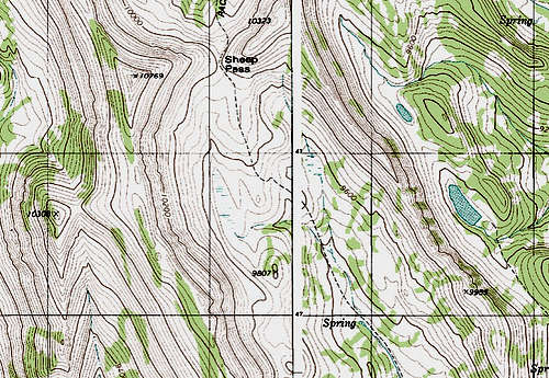
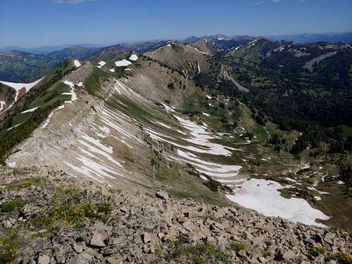
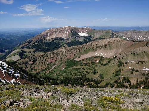
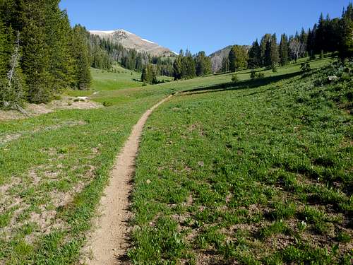
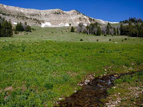
Today, Greysalt remains an obscure, seldom-climbed peak just west of Sheep Pass. A short, moderately steep hike gets you to the pass, and then a short, steep hike gets you to the summit. On clear days, summit views take in the Tetons and the Winds.
Getting There
You'll need to get to the trailhead for Sheep Pass. Any way you take means a long trip on dusty unpaved roads, but these roads are usually passable to most vehicles.
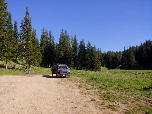
The way I know best, and easily the most scenic, is from the north. From Alpine, drive out of town on the Greys River Road. For about 60 miles, this road winds up the valley of the Greys River between the Wyoming Range to the east and the Salt River Range to the west. Views of the river, the mountains, and wildflower-filled meadows are frequent and spectacular. The road officially ends at Tri-Basin Divide, where you will head right (east) on another road. This road passes the La Barge Guard Station. Eventually, it turns north and reaches the first of what will be two very prominent switchbacks. At the second is a parking area and the trailhead, which is unsigned.
From the east, there are a couple options. One: Three miles south of Daniel Junction, leave U.S. 191 and turn onto Cottonwood-Ryegrass Road (#117), heading west. After about 14 miles and passing several minor roads, turn right at Ryegrass Junction. The road soon crosses into Bridger-Teton National Forest. Follow it up and over McDougal Gap and then to the Greys River Road (see above). Two: From either Big Piney or La Barge, take a road heading toward the Wyoming Range. They should be signed for National Forest access. These roads converge eventually, and then the road reaches the Tri-Basin Divide (see above).
From the west, find a large dirt parking area off WY 89 not far south of Smoot. This road will go to the Tri-Basin Divide (go left at a fork not far from 89). This road will trend east-northeast but eventually turns sharply north. At a prominent switchback, find the parking area and trailhead described above.
From the south, a road leads out of Cokeville and joins the road mentioned in the western approach. I have never driven this road and do not know its condition.
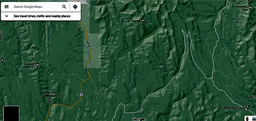
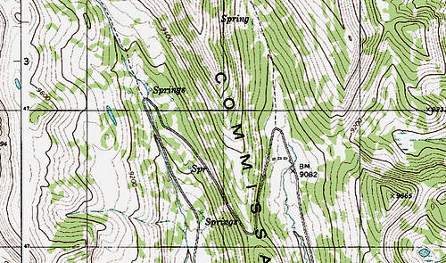
I hope the map images I have added below will help. Please click on them to view important details.
Route
It's 2-2.5 miles to Sheep Pass, with about 1000' of elevation gain. Then it's about half a mile and 800' to the summit. Class 2. There's chossy limestone if you really want to make it Class 3.
From the summit, you can follow the ridgeline south to a false summit that from the parking area looks higher than Greysalt, and from there you can descend straight down to the trailhead. I haven't done this myself, but a reliable source (Turiano) has told me about it and it looked very doable when I was there.
Red Tape
None except posted regulations. The peak and trail are in a roadles area, yet it was obvious some jackass had been riding the trail on a motorized bike the day before.
When to Climb
Late spring through early fall. Snowmobile access in winter might be possible.
Camping
There are several campgrounds off the Greys River Road, and dispersed camping is available all over the place. In fact, there is a nice site at the TH.