
|
|
Mountain/Rock |
|---|---|
|
|
33.56692°N / 111.9917°W |
|
|
Maricopa |
|
|
Hiking |
|
|
Spring, Fall, Winter |
|
|
1987 ft / 606 m |
|
|
Overview
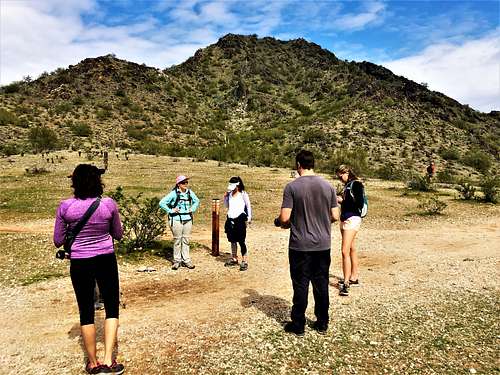
Situated 2.2 miles northeast of Piestewa Peak is Peak 1987, which rises to the east of the 40th Street Trailhead. It is unnamed and underappreciated, despite having a nice trail system and offering a fun little hike.
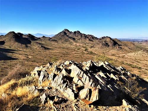
While it only has a prominence of 437', the peak is very attractive because it is an easy hike that can be done in an hour; ideal for trail runners; and it has unimpeded views to the east and the north. There are a few other summits in the area that can be combined with Peak 1987 including Two Bit Peak, Peak 1955, and Peak 2100 (which requires some scrambling).
Because it is overshadowed by Two Bit Peak, hiking to the summit is a good way to avoid the crowds even in a crowded hiking area.
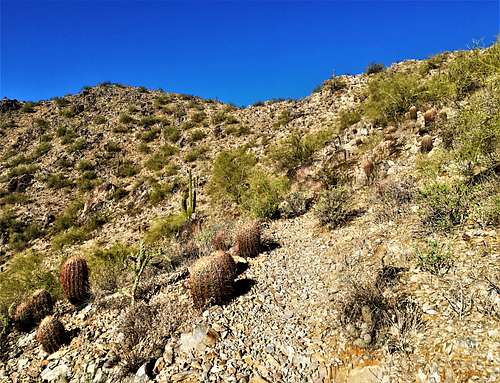
If taking the trail from 40th Street to the summit, it is about 1.5 miles to the top. The shortest maintained trail route to the summit is a little over half a mile; although you cannot park at the start of the trail, so it is 3/4 of a mile from the parking area.
Hiking Peak 1987 can be done year-round, although it is recommended to hike it very early in the morning in the summer. The best time to hike in this area is between November and March.
Getting There
There are options from neighborhoods and options to approach from any side. However, the three options explained below are the most straight-forward.
The primary starting point is the 40th Street Trailhead at 9200 N 40th St, Phoenix, AZ 85028. When the parking lot is full, cars can park on the side of the road just north of the trailhead. Peak 1987 is located to the east of the trailhead.
While there are multiple ways to approach, the best way to do this hike is to just take the primary trail route. After 0.4 miles, the trail reaches a large junction. If taking a left (heading east), the trail passes to the south of Peak 1987. If taking a right (heading west), the trail heads towards Peak 1955.
Once on the trail running south of Peak 1987, continue for a little over a half a mile. Take a left on a side trail heading up towards the saddle. If you start seeing houses, you’ve gone too far (houses start to appear 250 feet east of the junction with the trail to the saddle). The trail reaches the saddle in a little over a third of a mile. The summit is less than a quarter of a mile away. Pass the rock shelter and the summit is just a tiny bit further and easy to spot. It is 600’ from the trailhead to the summit.
A second option is to take 44th Street south from Shea Blvd. Park on the street and start walking the road as it turns to the right and becomes E. Fanfol Drive. In 350 feet turn left on N. 43rd Place. At the end of the road is a trail to the saddle. It reaches the saddle in a quarter mile. This is about ¾ miles to the summit, which is really short, with an elevation gain of 560’. But, if wanting to knock this summit off, this is a way to do it quickly.
You can also park at this spot and hike up, and then hike down the other side. Loop around the south side of Peak 1987 to the 40th Street Trailhead, then just walk along the north side of Peak 1987 back to the parking area. There isn’t a trail on the north side, but generally open land. That is only recommended in winter months when it is still cold. That is about a three-mile loop.
Finally, there are a few parking spots at the Tatum Blvd Trailhead. It is located on the west side of Tatum Blvd a quarter mile south of Doubletree Ranch Road. Take the trail that runs between neighborhoods for a little over a half a mile, and then take the trail to the saddle mentioned in the primary route. The trail isn't totally obvious, but there are a couple options. Just look for any trail on the right past the houses. It is about 1 1/4 miles to the summit gaining about 600’.
If combining Two Bit Peak with route #1 and route #3, add 1.8 miles round trip and about 900’ of elevation gain. For the 2nd route (the shortest route), you'd have to go back up and over the ridge on Peak 1987.
If parking at the 40th Street Trailhead, Peak 1955 can be added by taking a right (heading west) at the junction with the trail running south of Peak 1987. You can add a 2 ¼ miles to 3 miles loop back to the trailhead.
Red Tape
There is no red tape in particular. The trailhead is open during daylight hours and may be closed after dark. But you can park outside the parking lot and still hike after hours. Avoid hiking in the heat of summer. Watch out for snakes if weather conditions are right. Generally, they aren’t a huge problem in this area if staying on the trail.