
|
|
Mountain/Rock |
|---|---|
|
|
34.23870°N / 112.7954°W |
|
|
Yavapai |
|
|
Hiking, Bouldering |
|
|
Spring, Fall, Winter |
|
|
6100 ft / 1859 m |
|
|
Overview
Yarnell Hill is part of the southern Weaver Mountains. It is the site of one of the deadliest fire-fighting incidents in American history. On June 30, 2013, 19 firefighters died fighting the Yarnell Hill Fire.
Just over three years after the incident, a trailhead and a trail were built to commemorate these 19 firefighters who were part of the Granite Mountain Hotshots – named for Granite Mountain north of Prescott, AZ.
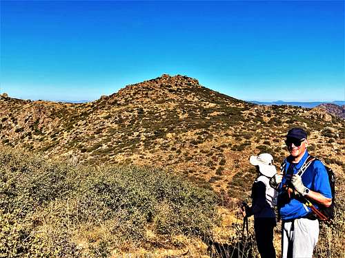
The Hotshots Trail leads up to the ridge in the southern Weaver Mountains and descends to the memorial site at a turnoff. This is where most people leave the trail. However, for those wanting to reach the summit of Yarnell Hill, they can continue straight past the turnoff and stay along the ridge until the trail connects to an old jeep track that leads to just below the summit of Yarnell Hill at 6,100’.
Yarnell Hill has a north summit at 6,018’ which is about 1 ½ hike miles further up the ridge. There isn’t a trail leading to it, but the openness of the terrain makes it a fairly easy summit to reach without too much bushwhacking.
Because the trailhead was opened to the public on November 30, 2016, the main summit of Yarnell Hill has largely been unknown and its north summit almost never visited. It wasn’t until the trailhead and the new trail was completed that these once obscure summits became easily accessible.
Located only about an hour west of the north Phoenix suburbs, the Hot Shots Trail has become a very popular destination. Its higher elevation makes is palatable for hiking from early fall to late spring. The trail is pretty open, without much tree cover, so summer hiking is discouraged.
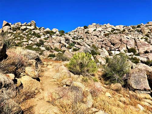
For extra adventure, there are plenty of opportunities to climb up the boulders along the trail and the ridge.
Getting There
The Granite Mountain Hotshots Memorial Trailhead is located 2.8 miles southwest of the small town of Yarnell. The trailhead is on 89 South, so if coming up from 89 North, you can turn around a little past it, and then swing back ¾ miles or so to the trailhead.
The issue with the trailhead is that there aren’t that many parking spots, and the parking lot is usually full during busy weekends. So, the town of Yarnell has generously made available a shuttle to take people to the trailhead every half hour from 8am to 5pm every Friday, Saturday, and Sunday between October and May. See the park website for more details: https://azstateparks.com/hotshots/explore/shuttle
Route
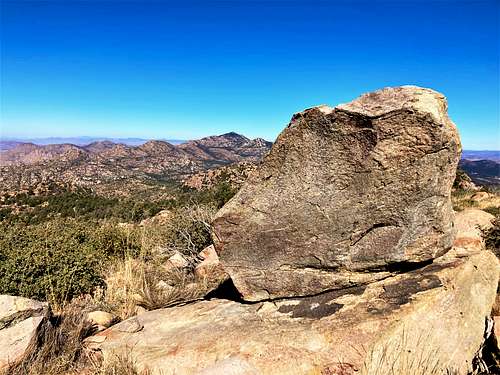
From the trailhead it is a steep hike to the top of the ridge, gaining about 1,200’ in less than two miles. At about 2 ¾ miles from the trailhead you reach a trail junction that leads to the memorial. To reach the summit of Yarnell Hill, pass the junction and continue on a trail that hugs the side of the ridgetop. In about a third of a mile, the trail descends to an overgrown jeep track. Continue along the jeep track and after about a mile the jeep track reaches the base of Yarnell Hill. The summit is less than 200 yards from, and a little over 100’ above, the jeep track. It is pretty simple to hike off-trail to the summit.
The one-way elevation gain to the summit is almost 2,100’ (considering the ups and downs) in about 4 ¼ miles. On the way back, another 340’ or so will be re-gained.
To reach the north summit of Yarnell Hill, head down the north side of the summit back down to the jeep track and cross the wash to a ridge on the right. Continue up to the ridge top and then down to the base of the north summit. Once at the base of the north summit, it is 358’ up to the summit. There is no trail, but it’s pretty straight-forward. Along the way, you will have to cross over a fence a few times back and forth.
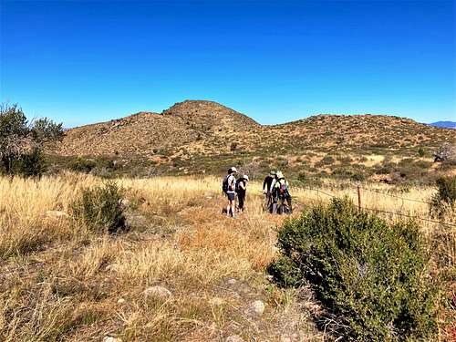
The north summit adds another 850’ and roughly 3 miles round-trip to the hike.
Red Tape
There is no red tape of note. Parking is limited during weekends, so plan accordingly.
External Links
https://azstateparks.com/hotshots/explore/park-history
https://azstateparks.com/hotshots/explore/trail-map