
|
|
Mountain/Rock |
|---|---|
|
|
34.55920°N / 112.0251°W |
|
|
Yavapai |
|
|
Spring, Fall, Winter |
|
|
5725 ft / 1745 m |
|
|
Overview
Onion Mountain is an easily accessible summit west of the I-17 between Prescott Valley and Camp Verde. It is centrally located on the way to Prescott, Jerome, Sedona, and Flagstaff, and makes for an easy mountain to grab if you have extra time when visiting those locations. It is located within the Black Hills of Prescott National Forest.
There are a couple options for starting points, depending on how far you’d like to hike and if you want to reach other nearby summits.
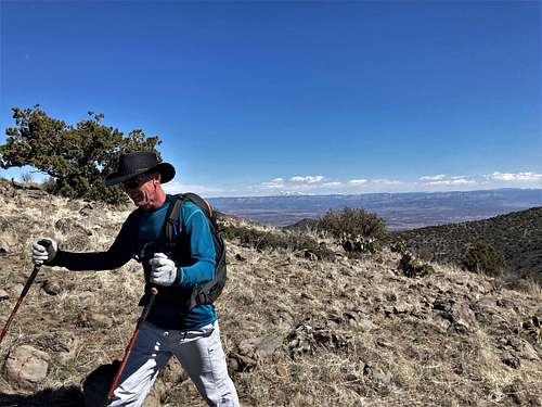
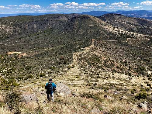
There is no trail to the summit, but the summit is easily reached off-trail without too much brush in the way.
Onion Mountain is an excellent destination if wanting to get away from the crowds. It is a little cooler than Phoenix, which means the window for hiking is longer. Because some off-trail is involved, hiking is recommended to begin in late October and go through early April to avoid the snakes.
Summit views are include Humphreys Peak and surrounding peaks in the vicinity.
Getting There
If coming from I-17, take the exit for AZ State Route 169. Head west for 5.5 miles and turn right on W. Cherry Creek Road. The easiest access to Onion Mountain is FR 96.
You can either start from the parking area next to the pavement or drive further to get closer to Onion Mountain. FR 96 goes for 2.3 miles until the road splits. Take a left and continue for another mile until a smaller road on the right runs right below Onion Mountain. From there, just hike up to the summit off-trail.
If hiking from the edge of the pavement, Onion Mountain is about 4 miles one-way, gaining about 1,040’ – nearly all of that in the last mile.
Onion Mountain can be combined with nearby Peak 5709, which is a little brushier, but not too bad. It can also be combined with Crater Mountain 6,020'. If doing so, drive the 2.3 miles up FR 96 to where the road splits. High Clearance is recommended.
Red Tape
There are no permits needed to hike up to Onion Mountain and no red tape. It is located within Prescott National Forest.