
|
|
Mountain/Rock |
|---|---|
|
|
45.92212°N / 7.83550°E |
|
|
14852 ft / 4527 m |
|
|
Dedication
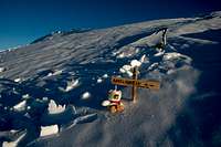
The last maintainer of this page and early SummitPost member Rahel Maria Liu) died for hypothermia 24/25 August 2004 after being caught in a freak snowstorm while attempting to climb the Innominata Spur on the southern (Italian) face of Mont Blanc. Edward Allen, her climbing companion (a british climber known some days early), was saved by an helicopter of Italian Rescue team.
Rahel was a charter member during SP's early days, and her work here remains among the best of SP's collected contributions. Her knowledge and experience has made an impact on the world mountaineering community, and her warmth and friendship will be long remembered among her many friends and fellow members here at SummitPost. She will be greatly missed by us all. She was only 34 years old. Continued maintenance of this page is in her memory.
Overview
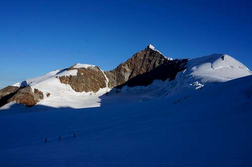
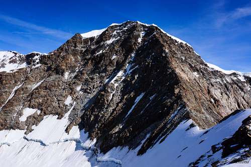
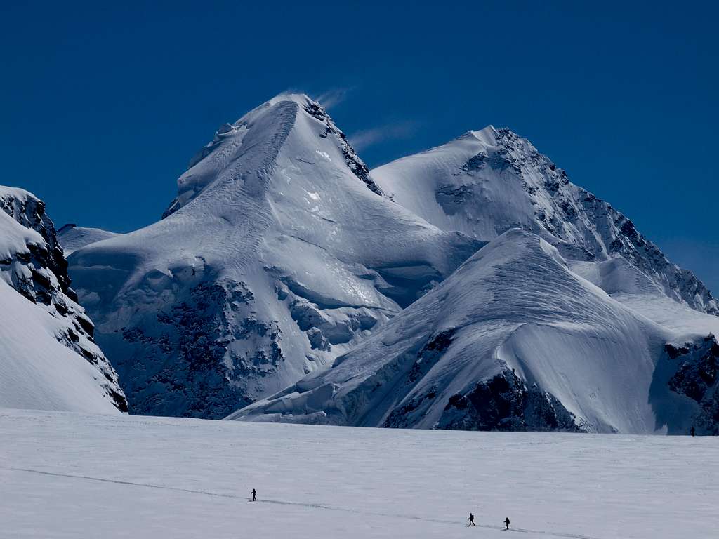 W-Face of Lyskamm West & East by Nikman
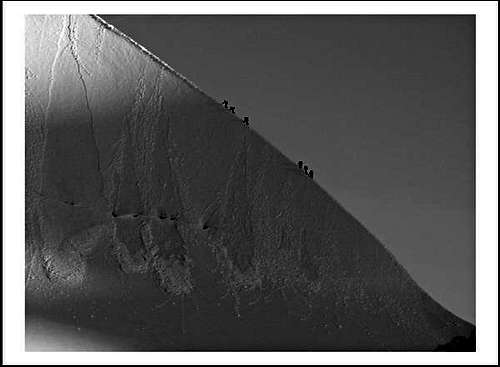
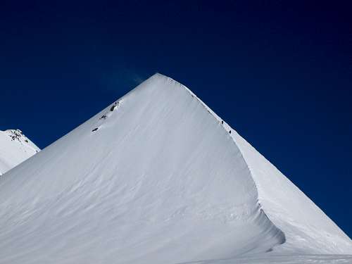
Lyskamm (German: Liskamm) is the 8th highest mountain in the Alps. It consists of 2 summits, the Western and Eastern Lyskamm, separated by a long and sharp ridge. The Eastern summit (4527 m) is the highest point of the ridge, which is about a 1000m long and crowns the ice covered north-east face, which is over a 1000 meters high. The western summit is sowmewhat lower, 4479 m, but is considered a stand-alone summit according to the UIAA-list of Alpine 4000-meter peaks. The mountain is nicknamed the "Menschenfresser" (Man-eater) because in former days many climbers fell to their deaths from the snow cornices along the ridge: On the 6th of September 1877, 2 english alpinist fell down to their death (William Arnold Lewis and Noel Paterson), and in 1896, Dr. Max Günther with his guides Roman Imboden and Peter Ruppen died as well because of the dangeroud cornices. Locals attributed the numerous accidents to the forces of darkness.
The eastern and higher of the two peaks was first ascended in 1861 from the Lisjoch up the east ridge by a 14-man team (seven Englishmen, one Scotsman, and six Swiss guides) led by J. F. Hardy and including William Edward Hall. The normal route starts from the Lisjoch, which can be accessed from either the Gnifetti/Mantova Hut or the Monte Rosa Hut. The route follows the route taken by the first ascenders. The mountain is often climbed as a traverse from the Feliksjoch (West), to the Lisjoch (East) or vice versa, a true classic. The first ascent of the W-summit took place on the 16th of August 1864 by Sir Leslie Stephen and Edward N. Buxton with the guides Jakob Anderegg and Franz Biner.
 NNW-Face NNW-Face |
 NE-Face NE-Face |
 S-Face S-Face |
Until the 1940s, the Liskamm still bore names such as Monte Rosa, Monte Rosa summit, small Monte Rosa and Rosenhorn. Another name that the mountain still carries today is “Silberbast”. “Silber” means “silver”, and “Bast” designates the wooden pack-saddle that pack-mules carried when transporting goods. This saddle has raised parts at the front and back, rather like the Lyskamm with its two summits. This name derives from the imagination of Canon Berchtold and was readily adopted by the Zermatt guides. Nevertheless, the name “Liskamm” suggested by Freiherr (Baron) Ludwig von Welden became established. The Lys is a river, 40 km long, which rises from the Italian side of the glacial arms of the Lyskamm.
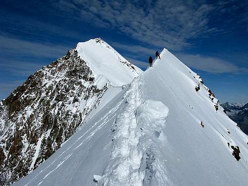
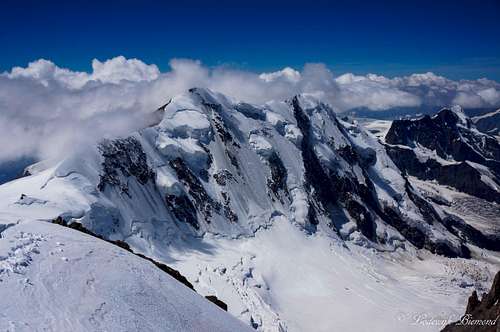
The Lyskamm forms a colossal massif with an impressive 1100m (3600ft) ice covered wall rising up from the Grenz glacier: the NE-face. The summit ridge has a length of over 1000 m between the West-summit (4479m) and the higher Eastern summit (4527m). The NE-Face falls down from this ridge. The Lyskamm ridge is situated on the border between the Swiss canton of Valais (north) and the Italian region of the Aosta Valley (south). The South side is built up by a 500 m high rockflank, which is interrupted by a small hanging glacier. This rockflank stands on the Lys glacier with its two broken tongues. It goes down to the Gressoney valley.
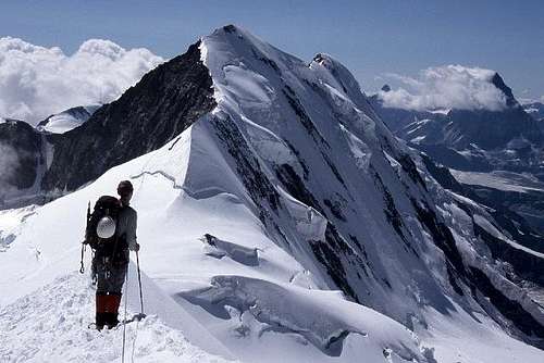
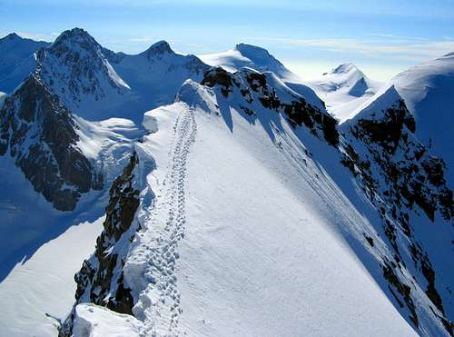
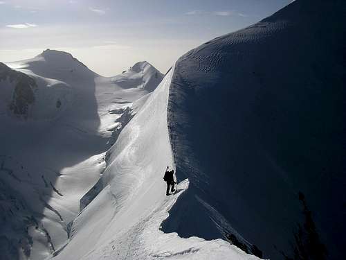 Lyskamm Ridge Lyskamm Ridge |
 Lykamm Ridge Lykamm Ridge |
 Lyskamm Ridge Lyskamm Ridge |
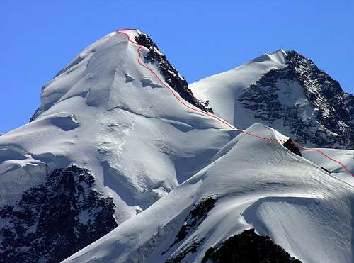
Especially the traverse from the Lysjoch to the Felikjoch is a great classic tour, which is technically not very difficult, but dangerous because of the cornices. It takes 4 to 5 hours, if the conditions are good. Because of the cornices you often have to traverse in the steep NE-flank. Sometimes the E-summit is reached via the WSW-ridge or the S-ridge. The different ascents through the NE-face are all very difficult and objectively dangerous because of icefall.
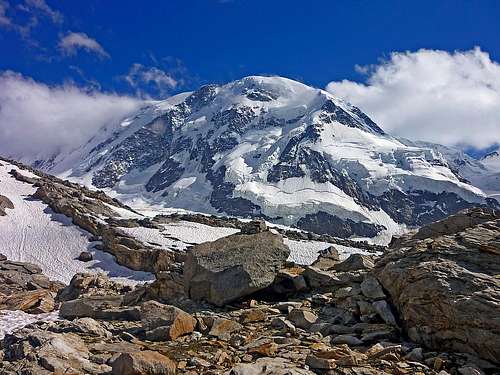
The alpine history of the Monte Rosa began in 1778, when seven Italian climbers from Gressoney went up from south side of Monte Rosa to discover the mythical lost valley: they believed that behind the snowcapped mountains and ridges existed a paradise, full of animals and fruit trees, the ancient home of their ancestors. The highest point reached by the group (at about 4000 meters) was called "stone of the discovery". The first ascent off a Monte rosa peak was in 1801 when the preast Giordani conquered the peak now carrying his name: Punta Giordani. Other peaks were also named after their conquerors: Zumsteinspitze (Joseph Zumstein, 1820) and Pyramide Vincent (Johann Niklaus Vincent, 1819).
Lyskamm (West) is the 8th highest mountain in the Alps (UIAA-list) after Mont Blanc (4810m /15.774 ft), Mont Blanc de Courmajeur (4748m /15.577 ft) , Dufourspitze (4634m /15.203 ft), Nordend (4606m /15.121 ft), Zumsteinspitze (4563m/ 14.970 ft), Signalkuppe / P.Gnifetti (4554m /14.941 ft) and Dom (4545m /14.911 ft).
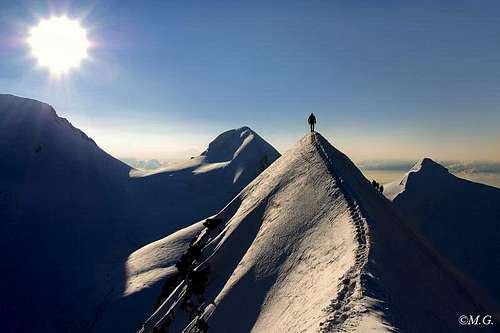
 Lyskamm ridge by Besucher01
Routes
There are several routes up to the summit of Lyskamm East and/or West. This section gives a short description of the main routes on Lyskamm. All sections provide a link to the route pages on SP (when available). All difficulties are based on regular conditions (experienced mountaineer, good weather, no ice/ icy snow!) as given in the guide. Note that when conditions are sub-optimal the difficulties can increase substantially.
I East ridge (Normal route)
- -G 4, snow till 45°, 1 1/2 - 2 h, 380 hm (
- )
- - ZS, 2 h from Lysjoch (Biner)
- - AD, II, till 45 °, 4-5 h from Gnifettihütte, 890 hm, firn and ice, as skitour possible, skidepot at Lysjoch (
- )
II Traverse from West to East
- - II, G 7, 1 - 2 h, 1 km (
- )
- - ZS (AD), II-III, 6 h from the Cap. Quintino Sella to Lysjoch (Biner)
- - ZS, 4-6 h, (Vaucher)
- For
- about this route see the
- by member
- .
III SW-ridge (Western summit)
- - G 4, 420 hm, 2 h (
- )
- - WS, 3, 5 h (Biner)
- - PD, II (passages), till 40°, 2-3 h from Felikjoch, 390 hm,mixed, as skitour possible, depot at Felikjoch (
- )
- For
- about this route see the
- by member
- .
IV S-ridge (Eastern summit)
- - III (passages), G 5, 960 hm, 4-5 h (
- )
- - PD, II-III, mixed, 5 h from Gnifettihütte, 890 hm (
- )
- For
- about this route see the
- by member
- .
V NE-Face Welzenbach route
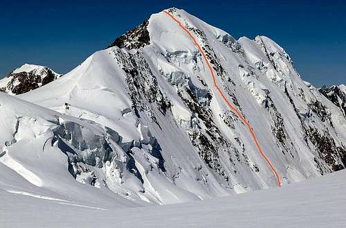
- - very difficult (
- )
- - D, till 55°, 7 h from the foot, 750 hm, very difficult and dangerous (
- )
- For
- about this route see the
- by member
- .
VI NE-Face Neruda-Klucker
- Neruda-Klucker-route to the E-summit (the most secure route through the face):
- - SS, IV+, 4 h for the face, 1- 3 h to the foot (Biner)
- - D, 50°-55°, 700 hm, 5-6 h, 3 h from the Monte-Rosa-Hütte (Vanis)
- - SS, 6-8 h, 727 hm (Vaucher)
- For
more information
- about this route see the
- by member
kletterwebbi
- .
VII Other routes

Nessi-Andreani-route to the W-summit (ojectively dangerous):
- SS, 8-10 h (Vaucher)
W-flank:
- - very difficult, big bergschrund, seldom climbed (
- )
NW-flank:
- - very difficult, big bergschrund, seldom climbed (
- )
SE-face:
- - AD+, III+, mixed, 7 h from Gnifettihütte 890 hm (
- )
Approach Routes
There are several ways to get to the different mountain huts from the valley. The different approach routes are described below.
I to the Mantova / Gnifetti Hut

Approach routes from Gressoney/Alagna
From Gressoney, Staffal, take the cableway to the Indren glacier. The first cableway brings you to the middle station of Alpe Gabiet (there is a bar- restaurant called Rifugio Lys) a few minutes from the Gabiet Lake. The second cableway brings you to direct to Passo Salati, where you can find the new lift to Punta Indren (3250m).
From here you have to walk: you have to cross the glacier, therefore crampons are advised.
From the lift, follow the track that crosses the glacier, and in about 20 minutes you reach the place where the track splits in two, a low and a high track. F
ollow the low one until the end of the glacier. Go beyond a rock with fixed ropes (15 meters), than climb up again and and shortly the Mantova hut is reached. It takes about an hour from the lift to the hut.
If you choose the high track (you have to consider the season and the snow conditions), climb up slightly. When the snow ends, you go on a mixed path (earth, rocks and snow) and after a few bends you reach an equiped path. The fixed ropes and steps made with wooden trunks make your ascent of this steep section easier. When you reach the top of this path you see on the left, below, the Mantova hut. The duration is about 1 hour.
To reach the Gnifetti Hut from the Mantova Hut you have to cross the Garstelet glacier. This will take up to 30 minutes longer.
Fore information about the cableway to Indren from Gressoney (including prices, timetable) see this link
Coming from Alagna
From Alagna take the cableway system to Passo Salati (it consists of two sections: the cableway (1st part) to Pianalunga and then the cableway that bring you to the Passo Salati (2nd part).
From here it is a 100m walk to the new Punta Indren cableway. Once reached Indren (3250m) you follow the same path as described above.
Otherwise, from Gabiet, follow the old path 6a to reach the hut on a very safe and well-marked path. The last part of the path is on stony ground.
The way from Gabiet to Mantova hut takes about 4-5 hours. To reach the Gnifetti Hut you have to cross the Garstelet glacier. This will take up to 45 minutes longer.
Fore information about the cableway to Indren from Alagna (including prices, timetable) see this link
II to the Quintino Sella Hut
Starting from Gressoney-La-Trinité, continue for about 4 km to reach Stafal, where the paved road ends. The lift to Colle Bettafora, at an altitude of 2680m, departs here. At the ending of the lifts path number 9, indicated by a yellow marker, starts. The first section of the trail, until Colle Bettolina at 3100m, is easy. From the beginning of the season until the end of July this path is usually covered with snow, but due to the amount of hikers, the path is usually well visible. The last section consists of an open ridge (30-40 minutes), there are fixed ropes present though, making this section relatively asy as well. Total time to reach the refuge is about 3 to 4 hours in total.
III to the Monte Rosa Hut

Approach route: Rotenboden - Monte Rosa Hut
Take the Gornergratbahn (Mountain Railway) from Zermatt station to Rotenboden (2819m).
From here a marked trail heads ESE following the flowpath of the Gorner Glacier. The final descent to the glacier involves down-climbing steep slabs using ladders and chains and finally crossing a small metal bridge to reach the ice at about 2500m. The trail on the glacier is well marked with flags and poles. Roping up is advisable. The glacier (ice!) is covered with a fine layer of grit so crampons are not obligated, but still, I would recommend using them.
The route crosses the junction of the Gorner and Grenz Glaciers, before following the eastern flank of the Grenz Glacier. The route leaves the ice and goes over into a marked trail, which goes straight up to the Monte Rosa hut. Total time is about 3 hours from Rotenboden.
How to get there
Zermatt
When you plan on climbing the mountain from the Italian side the Mantova or Gnifetti Huts are used as a base. Both huts can be reached from either Alagna or Gressoney.
The links below provide a detailed description about how to get to these villages. For more information about getting to the mountain huts from the villages mentioned here, see the section "mountain huts" below. Both the link to the official internet page as well as to the SP-page provide information about getting to the hut.
How to get to Zermatt: Click Here
How to get to Alagna: Click Here
How to get to Gressoney: Click Here
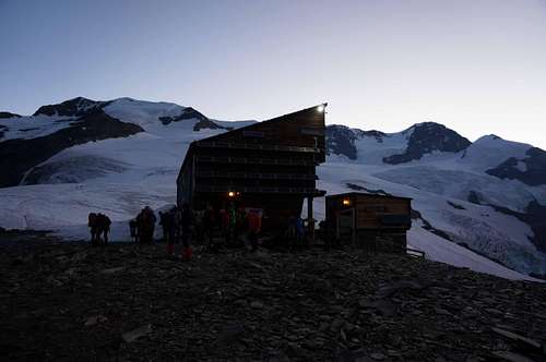
Mountain Huts
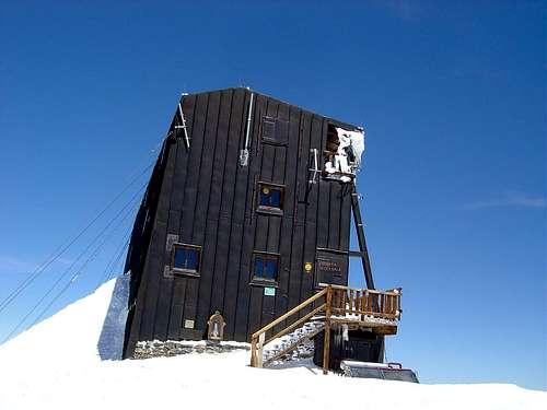
There are several mountain huts surrounding Lyskamm. The Monte Rosa hut is the only Hut located on Swiss terrain. It is possible to climb Lyskamm from the Monte Rosa Hut via the Grenz glacier.
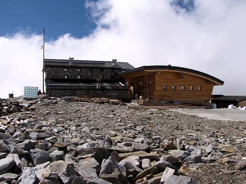
From the Italian side of the mountain the Gnifetti , Mantova or Quintino Sella Huts are often used as a base for climbing Lyskamm. The advantage of the Gnifetti Hut over Mantova is the higher altitude and better location (closer to the mountain). These 2 huts are the base for climbing Lyskamm East or make a traverse from East to West.
The Quintino Sella hut is a good base for climbing Lyskamm West or traverse Lyskamm from West to East.
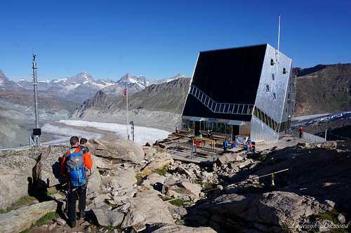
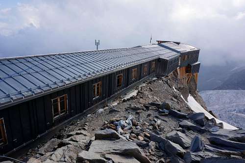
The last hut is the famous Capanna Regina Margherita, the highest mountain hut in Europe at 4554 meters, situated on top of Punta Gnifetti / Signalkuppe. Many climbers choose to spend the night here and traverse Zumsteinspitze & Dufourspitze, traverse Lyskamm, or descend back down to either the Italian or Swiss side of the mountain. If you plan on spending the night in the Margherita Hut, be sure to have the proper acclimatization.
Clicking on the name of the Hut in the table below directs you to the official internet page. Also the SP-link is given when available.
| Hut | Elevation | Telephone | SP_Link | Photo |
| Monte Rosa Hut | 2883m | +41 (0)27 967 21 15 | Here |
 |
| Gnifetti Hut | 3647m | +39 348 141 5490 | Here |
 |
| Rif. Mantova | 3470m | +39 016 37 8150 | Here |
 |
| Cap. Regina Margherita | 4554m | +39 348 141 5490 | Here |
 |
| Rif. Quintino Sella | 3585m | +39 0125 366113 | Here |
 |
27 967 21 15")
Books
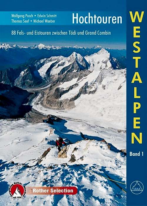
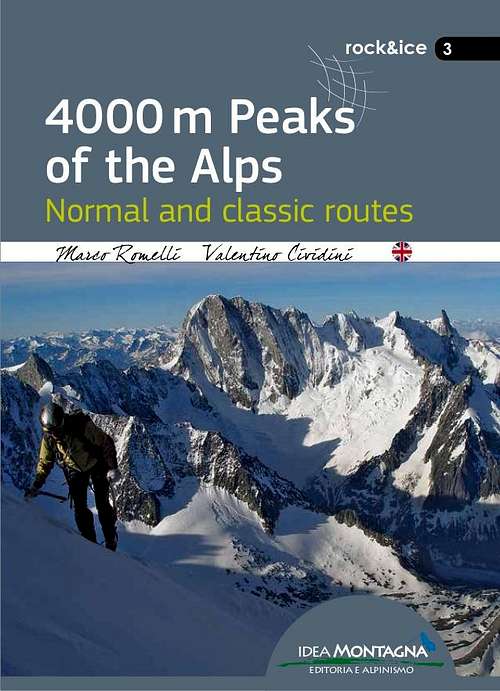
There are several books describing one or more climbing routes on Lyskamm. The ''Hochtouren Westalpen'' by Rother Verlag is a very popular choice. This guidebook includes photos, route descriptions and detailed route maps for many climbs in the Western Alps, including Lyskamm. For me this is the best guidebook at this moment. The ''Viertausender der Alpen'' by Dumler is a true classic. It is a 2014 reprint of one of the truly classic mountain books. The English version is still accessible as ''The high mountains of the Alps''. If you are looking for a smaller format the 4000er tourenfuhrer by Goedeke is a good choice as well. This guidebook has a description on every normal route on a 4000 meter peak in the Alps. If you are planning a ski-touring ascent of Lyskamm-West the guidebook ''Walliser Alpen'' by Rother Verlag is the guide to go with. Other recent publications like ''the 4000m peaks of the Alps'' and ''Topo Verlag Walliser Alpen'' are shown below.
 |
 |
 |
 |
 |
 |
| Publisher | Name | Author | Year (last Print) | ISBN / EAN |
| Rother Verlag | Hochtouren Westalpen Band I | Wolfgang Pusch | 2015 | 9783763330287 |
| Rother Verlag | Viertausender der Alpen | Helmut Dumler | 2014 | 9783763374311 |
| Rother Verlag | The High mountains of the Alps | Helmut Dumler | 1994 | 9780898863789 |
| Idea Montagna | 4000m peaks of the Alps | Marco Romelli | 2015 | 9788897299585 |
| Rother Verlag | Walliser Alpen Skitourenfuhrer | Daniel Haussinger | 2012 | 9783763359301 |
| Topo Verlag | Walliser Alpen | Daniel Silbernagel | 2016 | 9783033024311 |
| Bruckmann Verlag | 4000er Tourenfuhrer | Richard Goedeke | 2015 | 9783765457616 |
Maps
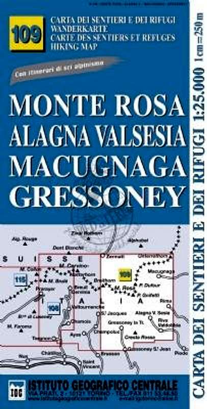
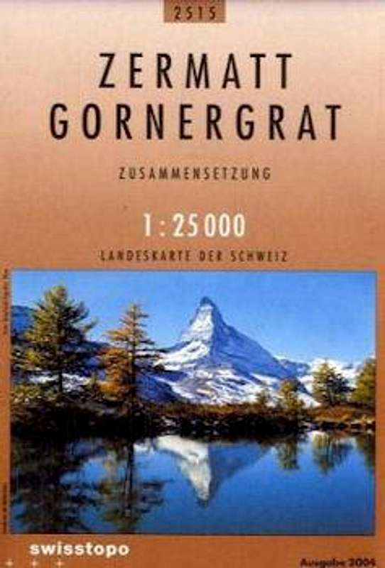
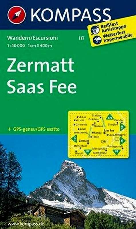
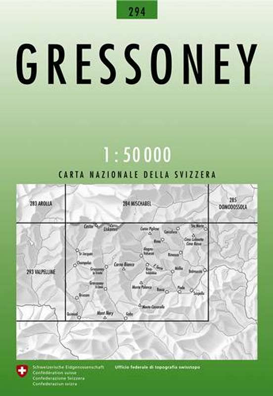
There are several maps for climbing Lyskamm. However, the only map on a 1:25.000 scale that covers all routes on Lyskamm is the Italian Instituto Geografico Centrale (IGC) "109 Monte Rosa Alagna Valsesia Macugnaga Gressoney" map. For climbing Lyskamm (and a Monte Rosa 4000ers tour) I would recommend this map. It is the only map that covers the entire Monte Rosa Group (the Swiss and Italian part). Other maps on a 1:25.000 scale are the Schweizer Landeskarte "1345 Zermatt" and the "2515 Zermatt Gornergrat" maps. Both are excellent, but only include the Swiss part of the Monte Rosa Group. These maps can be combined with the SLK "294 Gressoney" map, which covers the Italian part of Monte Rosa. Other options are the Kompass "Zermatt Saas Fee" and the SLK "5006 Matterhorn Mischabel" maps. Both are on a 1:50.000 scale and do not include the Italian side of Monte Rosa.
 |
 |
 |
 |
 |
 |
| Type | Name | Scale | ISBN / EAN | Additional Info. |
| Schweizer Landeskarte | 5006 Matterhorn Michabel | 1:50.000 | 9783302050065 |
Covers_the_Swiss_side
|
| Instituto Geografico Centrale | 109 Monte Rosa Alagna | 1:25.000 | 9788896455395 | Covers the entire area |
| Schweizer Landeskarte | 1348 Zermatt | 1:25.000 | 9783302013480 | Covers the Swiss side |
| Schweizer Landeskarte | 2515 Zermatt Gornergrat | 1:25.000 | 9783302025155 | Covers the Swiss side |
| Kompass Map | 117 Zermatt Saas Fee | 1:50.000 | 9783850269261 | Covers the Swiss side |
| Schweizer Landeskarte | 294 Gressoney | 1:50.000 | 9783302002941 | Covers the Italian side |
When to climb
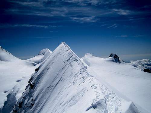
On the Lyskamm traverse
External Links
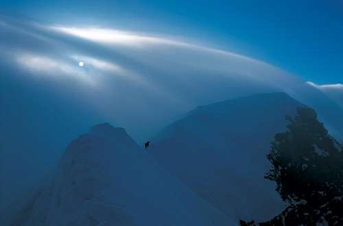
Steep ascent to Lyskamm East
Lyskamm at Camptocamp Description of all major routes on Zumsteinspitze; Partly in English, mostly French
Official Website Zermatt (CH) and Alagna Valsesia (I)
Photos of all the Monte Rosa peaks: Monte Rosa 4000
Mountain Guides for climbing Lyskamm: Guide Alpina Alagna in Alagna, Alpincenter Zermatt in Zermatt
Weather Forecast by mountain-forecast.com
Weather
Thanks
I want to thank SP-member mulidivarese for letting me adopt this important mountain page. Some of the text on this page is written by him. Thank you!
Hegyibarom - Oct 13, 2016 8:53 am - Hasn't voted
Lyskamm Orientale normal route (and Piramide Vincent)Video from the Lyskamm Orientale standard route (and Piramide Vincent): https://www.youtube.com/watch?v=DV0Ryc0_iDw