

|
|
Mountain/Rock |
|---|---|
|
|
19.02240°N / 98.6279°W |
|
|
Mountaineering |
|
|
Winter |
|
|
17887 ft / 5452 m |
|
|
Overview
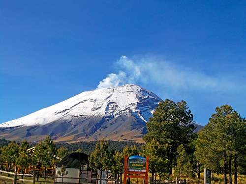
Popocatepetl is currently a very active volcano with forested slopes and a large crater. It is the second highest peak in Mexico, behind Pico de Orizaba (5636 meters/18,491 feet) and is generally considered to be the fifth highest mountain in North American.
The name Popocatepetl is Aztec for Smoking Mountain; it is often shortened to Popo. Popo and its neighboring volcano Iztaccihuatl (17,343 ft) dominate the sky east of Amecameca. They are located less than 80 kms from the Mexico City and are separated from each other by ten miles of high grounds referred to as Paso de Cortes.
I had the pleasure of climbing the mountain on December 18 1992, when the volcano was still considered dormant. This is no longer the case!
In the 20th century, Popo had an eruption in 1947, but on December 21, 1994, it awakened from dormancy, spewing gas and ash, which was carried by the wind as far as Puebla, 25 miles east. Surrounding towns were evacuated, and scientists have since been closely monitoring Popo for signs of a possible eruption. Ever since then the mountain has been closed to climbing.
In December 2000, the mountain really came alive with the biggest eruption in 1200 years and with the biggest display of "fireworks" (lava shot ~400 meters/1300 feet into the air) that has been . 30,000 people were evacuated.
The first documented ascent of Popocatepetl was by the Tecuanipas tribe in 1289, but this ascent has been disputed by historians. The first Spanish ascent of the mountain was an expedition led by Diego de Ordaz in 1519. Emperor Montezuma sent ten warriors to climb the mountain sometime between 1502 and 1519. Only two of these warriors survived the climb.
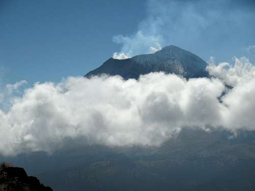 My photo of Popocatépetl as seen from the slopes of Iztaccihuatl on December 19 2016.
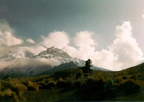 My photo of Popocatépetl on December 17 1992. The glaciers have since been blown away, melted, or have been covered in ash.
Dedication of This Page
On Saturday, November 20, 2010, Chris Pruchnic (Haliku) lost his life in an ice-climbing accident in Colorado's Rocky Mountain National Park.
Haliku, the previous maintainer of this page, was a valued contributor to SP, but his worth went well beyond the pages he created and is missed very much both from friends who have climbed with him, and by anyone who asked him for advice about climbing.
Written below is a beautiful tribute from one of his long time friends.
He always was willing to give a hand or advice to anyone in anyway that he could, and he always wanted to share his joy of climbing and exploring other cultures with his friends and fellow climbers. The climbing community and the world needs more people like Chris, not less, which makes the tragedy of his early parting so much more difficult to accept. He will live on in our hearts and memories. He and I had been talking about climbing Kilimanjaro soon, and someday when I stand atop that peak I will call Chris' name to honor my friend. --chicagotransplant
 Haliku on top of Denali on 25 May 2009.
The National Park
The Iztaccihuatl-Popocatepetl National Park was created in 1935 with an area of 25 679 hectares. In 1937 the lands of the former hacienda of Zoquiapan were incorporated increasing the area under protection to more than 45 000 hectares. The sylvan flora and fauna of the park are of nearctic and neotropical origin. In its geographic location it forms a part of the trans-Mexican volcanic zone, enabling it to have a great diversity of habitats, such as mixed forests of pine, evergreen oak and alnus, as well as high mountain prairies. Alpine habitats can be found at the highest altitudes, a great rarity in Mexico as the country is located in the subtropical zone.
These forests house nearly a thousand species of plants, comprising 45% of the reported species in the Valley of Mexico and 5% of the phanerogamous flora in the country. For its part, the fauna is an extraordinary richness of species, including mammals such as the zacatuche or teporingo rabbit, the puma, the lynx, the coati and the white-tailed deer, which constitute 40% of registered mammals in the Sierra Nevada. Also, the volcanic corridor serves as a resting point for diverse species of birds on their migratory routes to the Gulf and the Pacific.
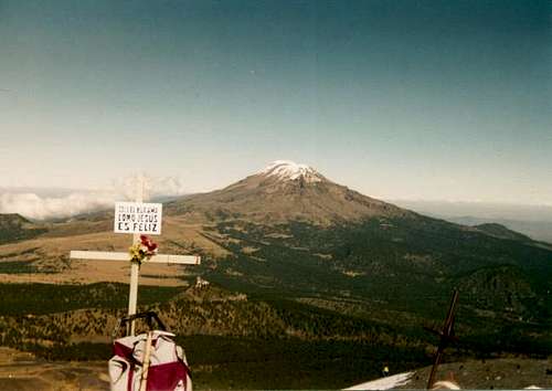
 Popocatepetl from the road to Iztaccihuatl.
Getting There
If the mountain is ever safe again, here's how to get there.
PUBLIC TRANSPORTATION (RECOMMENDED)
International flights can fly into either Mexico City (most convenient for Popo) or Puebla. From either of these locations take a taxi to the nearest bus station.
As of December 2016, here is the current information:
From the Mexico City airport, the closest bus station is TAPO. It's about a 5 to 10 minute ride depending on traffic. Make sure to get the authorized taxis from the airport stands as taxis on the street will likely quote gringos at least a 5 to 6 times mark-up on official rates.
From TAPO there are buses traveling in every direction at pretty much anytime.
Amecameca is your first destination. From TAPO, Servicio Volcánes buses run every 20 minutes between 5AM to 9PM.
In Amecameca you can find accommodations right off the main square at the Hotel San Carlos, or the quieter El Marques at the north end of town (be aware that the TV channels have a more playboy theme!).
From Amecameca, you destination is our destination is Paso de Cortés, which is most easily reached by taxi. The actual lodge and trailhead for Popocatépetl is at Tlamacas, but since December 1994, you are not allowed to go beyond Paso de Cortés.
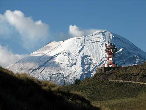
 Popocatépetl from the Paso de Cortés.
DRIVING DIRECTIONS:
From México City take the toll road towards Puebla (190D) and exit to the south (right) after the first toll booth. Drive past Chalco and Tlalmanalco on highway 115 to Amecameca.
About half a mile south of town, take the road on the left leading to the Popo-Izta National Park, from here drive 15 miles up the steep road to Paso de Cortés. At this point take the paved road to the right which will take you to Tlamacas two miles away where the two lodges are located.
Red Tape
Popocatépetl has been closed to climbing (and for good reason!) since December 1994!
 Iztaccihuatl as viewed from Las Cruces on route to the summit of Popo. December 1992. The mountain was open to climbing at that time!
 When To Climb
When it is again safe to climb the best months are November through March, which November and December being the best months. November is much less crowded than December.
The last two weeks of December are very busy due to the Christmas holiday.
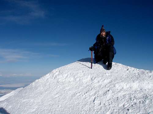
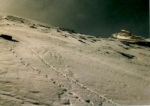 Climbing Popo in December 1992.
Mountain Conditions & Additional Information
Since conditions on Popo can change quickly I am including several links that allow the reader to access up to date information in addition to more history on Popo.
This site has information on all active volcanoes showing their Ash Advisory status.
A good source of historical data and current information can be found through the USGS.
For the weather forecast, check Mountain Forecast
A Spanish language site with information on the mountain and the surrounding park can be read here.
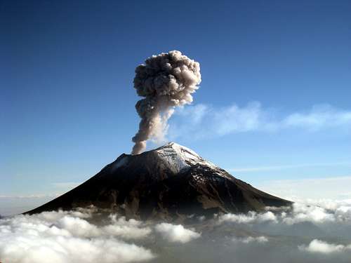 Popocatépetl eruption.
Lodging
Since the mountain is off limits camping on it is not an option. See the information above for local accommodations.
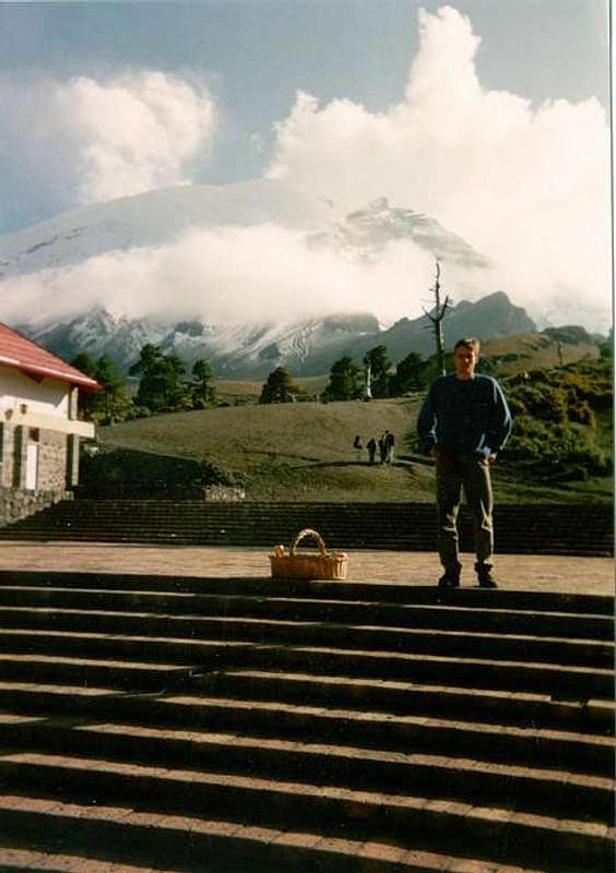 A "historic photo" of Popocatepetl and me at the lodge at Tlamacas taken in December 1992.
Guidebook
RJ Secor's guidebook for Mexico's Volcanoes: A Climbing Guide is one source of information on climbing Popo and some of the other higher mountains in Mexico. The book is quite outdated though and the Summitpost pages are often better than the guidebook.
For complete information on getting to Mexico and traveling around I highly recommend the Lonely Planet guidebook on Mexico.
Mountain Conditions
CLICK FOR POPO WEATHER FORECAST
Weather averages for Nevado Toluca at elevation 14,052 feet/4283 meters are below. Popo should have a similar climate, but the temperature on top should be 10-20 degrees colder °F or 5 to 10 degrees colder °C.
| Month | High (° F ) | High (° C) | Low (° F ) | Low (° C) | in. Rain | mm Rain | Rain/Snow Days |
| JaN | 45 | 7 | 27 | -3 | 0.60 | 15.3 | 2.7 |
| Feb | 46 | 8 | 28 | -2 | 0.52 | 13.2 | 2.6 |
| Mar | 49 | 10 | 31 | 0 | 0.49 | 12.4 | 2.5 |
| Apr | 50 | 10 | 32 | 0 | 2.22 | 56.4 | 6.6 |
| May | 50 | 10 | 32 | 1 | 4.58 | 116.4 | 13.4 |
| Jun | 49 | 9 | 33 | 0 | 8.06 | 204.6 | 19.9 |
| Jul | 47 | 8 | 33 | 0 | 9.59 | 243.5 | 24.5 |
| Aug | 47 | 8 | 33 | 0 | 8.98 | 228.1 | 23.0 |
| Sep | 47 | 8 | 33 | 0 | 8.21 | 208.4 | 21.2 |
| Oct | 46 | 8 | 31 | 0 | 3.46 | 87.8 | 12.6 |
| Nov | 45 | 7 | 29 | -1 | 1.07 | 27.1 | 4.5 |
| Dec | 45 | 7 | 28 | -2 | 0.59 | 15.1 | 3.0 |