
-
 136718 Hits
-
 95.81% Score
-
 56 Votes
|
|
Mountain/Rock |
|---|---|
|
|
47.56520°N / 121.1798°W |
|
|
Download GPX » View Route on Map |
|
|
King / Kittitas |
|
|
7960 ft / 2426 m |
|
|
Overview
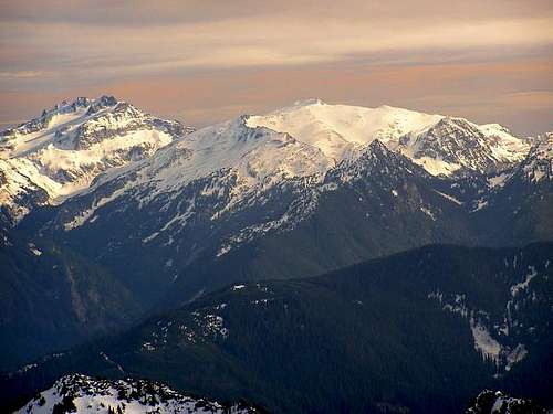
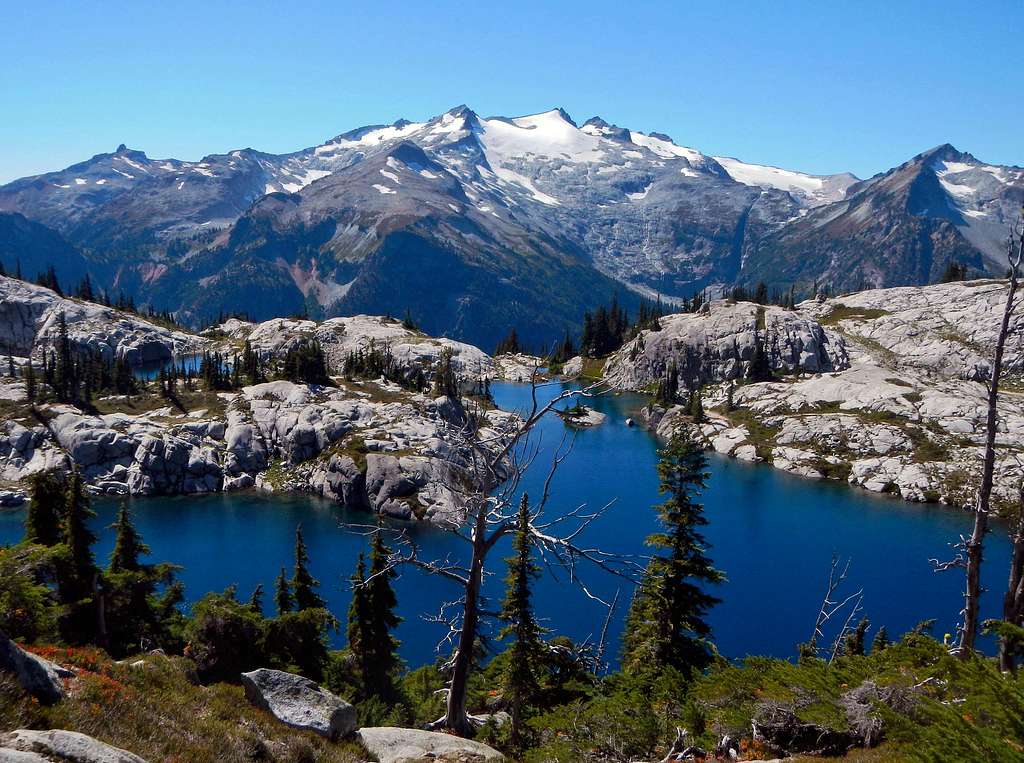 Mount Daniel Seen From Robin Lakes
At 7960 feet, Mount Daniel is the highest point in both King County, the county of Seattle, and Kittitas County. It is situated in the heart of the Alpine Lakes Wilderness on the Cascade crest, it's waters draining to the Cle Elum River on the east side and the Skykomish River to the west. Daniel is a complex glaciated massif with five main summits along its east-west trending spine. They are known as East Peak (7,899 feet), Middle Summit (7,959 feet), West Summit (7960+ feet, true summit), West Pyramid (7880+ feet), and Northwest Peak (7,686 feet).
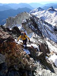
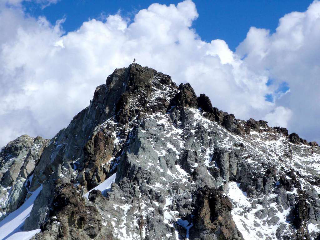 A Soloist On The East Summit
The Lynch Glacier flanks the mountain on the north and drains into the East Fork Foss River. It is the largest glacier on the mountain, but has experienced rapid melt in recent years draining into Pea Soup Lake. The Daniel Glacier is located on the northeast side between Middle Summit and East Peak and its runoff drains into the Cle Elum River. Hyas Creek Glacier, which may be turning into more of a permanent snowfield, is east of East Peak and also drains into the Cle Elum River. The first recorded ascent took place in 1925 but this is not believed to be the first ascent.
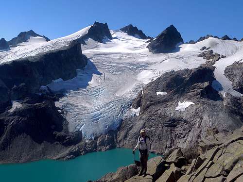
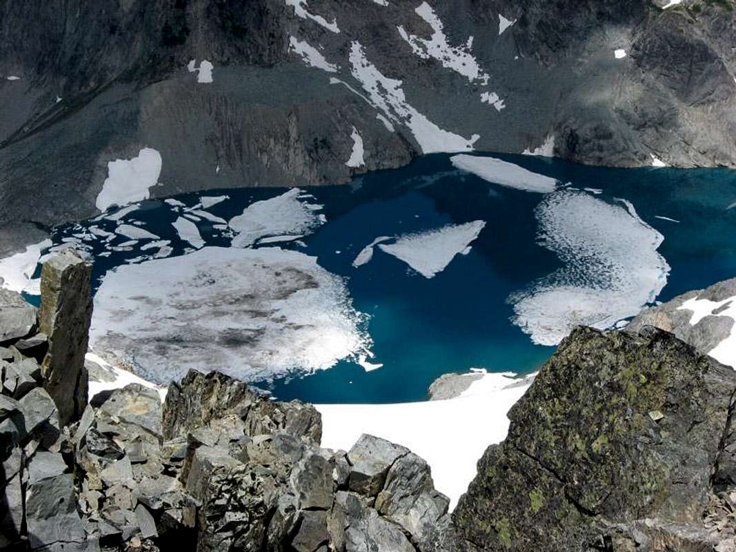 Pea Soup Lake
For many years the topo maps have been mislabeled in regards to the location of the summit. The highest point of Mount Daniel is the west peak, whereas the map implies that the east peak is the summit, at 7,859 feet. The "Daniels" benchmark showing on the map is NOT the summit of Mount Daniel, rather it's the summit of the East Peak. If you look at the topo map, both the center and west peaks are above the 7,960-foot contour, and field observations have proven that the west peak is the higher of the two. Why this error has never been corrected is a true mystery. If you wish to summit Mount Daniel, better go all the way to the West Summit, but the East Peak and Middle Peak are also worth the visit. The West Pyramid, and Northwest Peak are accessible from the Lynch Glacier but rarely visited.
![Lynch Glacier]() Climbing The Lynch Glacier
Climbing The Lynch Glacier
Please see the Standard Route Page. Route overview coming soon...
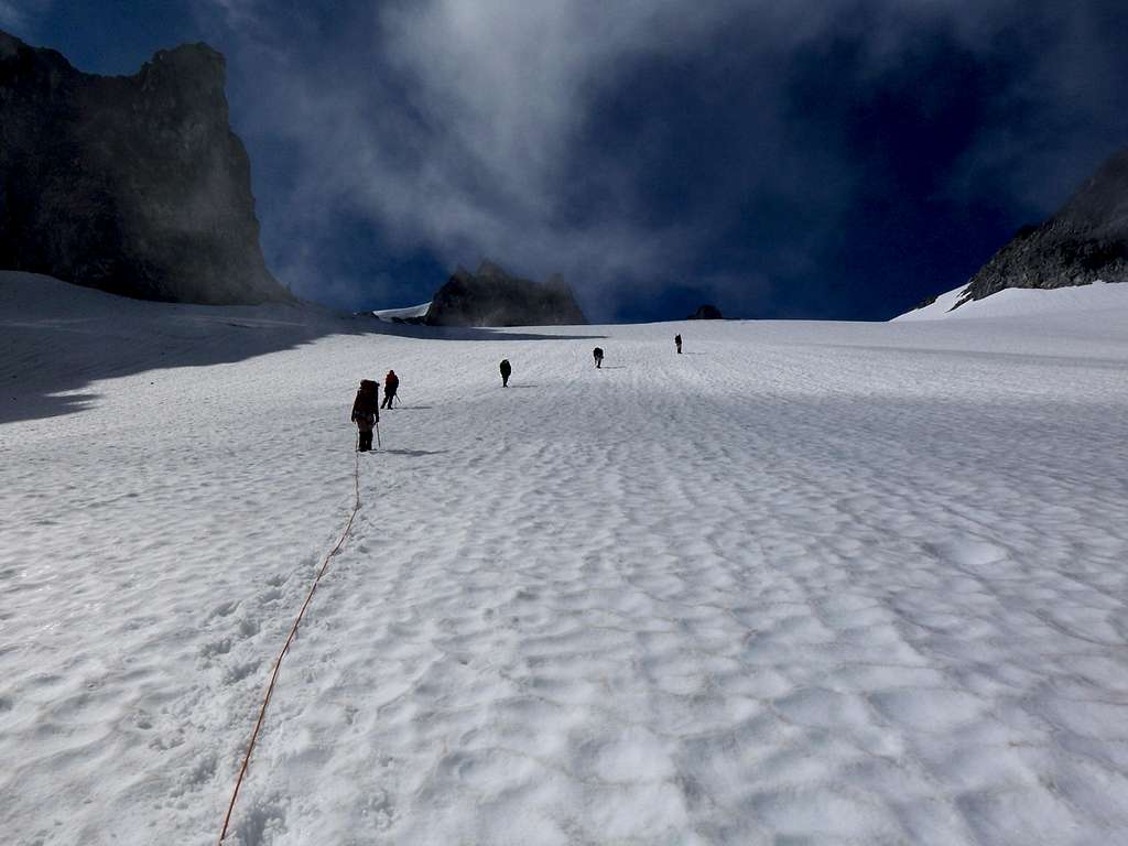 Climbing The Lynch Glacier
With 3500 feet of prominence, Mount Daniel is highly visible from the north, distinctly broad and white in appearance. It could be considered an icon of the Alpine Lakes Wilderness, a white beacon visible from hundreds of other summits. Daniel is often the first visual clue to establish directional bearings and a dead give away in the peak naming game. It has two neighboring peaks which are mention worthy. East of Daniel is Cathedral Rock a prominent craggy spire situated on the far side of Peggys Pond. Ambitious peakbaggers will wish to summit this peak along with Daniel since it is located adjacent to the standard approach. In fact, the first jaw-dropping view during a climb of Daniel is that of Cathedral rock. The other peak mention-worthy is Mount Hinman, located west of Mount Daniel but joined by a 6200 foot col. Hinman is strikingly similar to Daniel in that it is a massive hulk of a mountain with glaciers on the northern aspects, but it's somewhat smaller than Daniel and much more remote.
 Mount Daniel and Mount Hinman Mount Daniel and Mount Hinman |
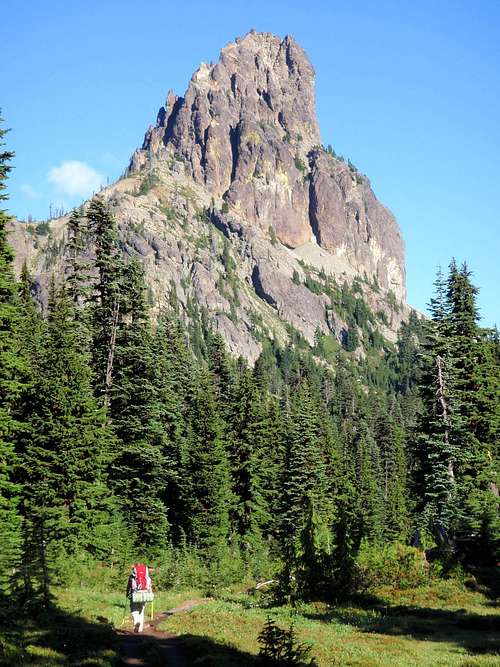 Cathedral Rock Cathedral Rock |
They don't call it the Alpine Lake Wilderness for nothing. Daniel is surrounded by lakes. The largest of these are Marmot and Jade Lakes, to the north, Hyas Lake to the east and Spade, Circle, Venus, and Deep Lakes to the south. The standard route follows a system of trails from the Cle Elum River to Peggys Pond and then ascends the southeast ridge. A variation of this approach ascends the Hyas Creek Glacier and headwall. Both of these routes are too long to do as a single day ascent unless you are a serious athlete. Most parties on the mountain camp at Peggys Pond which is an excellent, if not buggy camping area. A third route ascends the Lynch Glacier on the north side just as the 1925 ascent party did. This route is much longer. See the route section for more details.
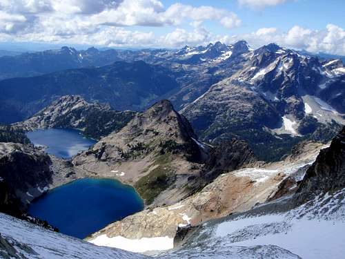 Venus And Spade Lakes Venus And Spade Lakes |
 Peggys Pond Peggys Pond |
Route Summary
Please see the Standard Route Page. Route overview coming soon...
Getting There
Drive I-90 east from Snoqualmie Pass or west from Ellensburg and take Exit 80.Proceed north through Roslyn and Ronald and toward Salmon la Sac, 16 miles from Roslyn.
Just before entering this little community, turn right on Forest Road 4330 and drive another 12.3 miles to near the end of the road.
Just before the end of the road and the Hyas Lake-Deception Pass trailhead is the parking area on the left for the Cathedral Pass trailhead, trail no. 1345.
![Fun On Mount Daniel]()
All trails and some picnic areas and campsites in the Wenatchee National Forest require a regional pass costing $5/day or $30/year. Golden Age and Golden Access Passport holders may purchase the above pass at a 50% discount. The Golden Eagle Passport will not apply to the Regional Northwest Forest Pass.
You can get them at these ranger stations, or it can be purchased online from the Washington Trails Association. A free wilderness permit is available at the trailhead.
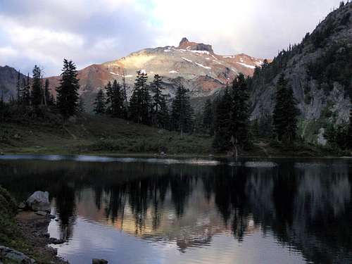
![Reaching 2 Million]() Mount Daniel Seen From Dip Top Peak
Many forest campgrounds can be found along the Cle Elum River road. Camping is permitted on and near the mountain.
Mount Daniel Seen From Dip Top Peak
Many forest campgrounds can be found along the Cle Elum River road. Camping is permitted on and near the mountain.
Red Tape
All trails and some picnic areas and campsites in the Wenatchee National Forest require a regional pass costing $5/day or $30/year. Golden Age and Golden Access Passport holders may purchase the above pass at a 50% discount. The Golden Eagle Passport will not apply to the Regional Northwest Forest Pass.
You can get them at these ranger stations, or it can be purchased online from the Washington Trails Association. A free wilderness permit is available at the trailhead.
When To Climb
Optimal conditions exist from June through September, depending on weather and snow conditions.Camping
 Mount Daniel Seen From Dip Top Peak