
|
|
Mountain/Rock |
|---|---|
|
|
47.40687°N / 121.62218°W |
|
|
King |
|
|
Hiking, Mountaineering |
|
|
Spring, Summer, Fall, Winter |
|
|
5162 ft / 1573 m |
|
|
Overview
McClellan Butte is a prominent pyramidal horn-shaped summit rising above the South Fork Snoqualmie River valley of the Mount Baker-Snoqualmie National Forest. Located approximately eight miles southeast of North Bend, on the south side of I-90, the standard route for the mountain is only a short drive from urban areas yet close enough to the Central Cascades to enjoy views of many nearby mountains. With an elevation of 5162' and clean prominence of 1442', McClellan Butte is neither the tallest nor the most prominent peak of the I-90 corridor between North Bend and Snoqualmie Pass. However, McClellan Butte offers a decent combination of an easy YDS Class 1 hiking trail and a final YDS Class 3-4 (depending on conditions) summit scramble, with an outstanding view overlooking much of the South Fork Snoqualmie River valley. These aspects help make McClellan Butte one of the most popular mountain hiking and climbing destinations in the region.
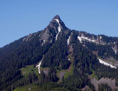 McClellan Butte
McClellan Butte was named after George B. McClellan, a Civil War general and a surveyor during the mid-19th Century. McClellan surveyed the Cascade Mountains during 1853, in search of the most viable mountain pass that could be used for the proposed trancontinental railroad system. Although McClellan's survey basically ignored nearby Snoqualmie Pass, which would be the actual mountain pass eventually used by the Pacific Railroad, his efforts and dedication did not go unnoticed and "McClellan Butte" was named in his honor.
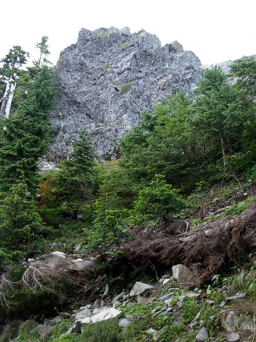 McClellan Butte Summit Block
The McClellan Butte Trail (#1015) has approximately 3300' elevation gain in 4.6 miles of maintained/easy-to-follow YDS Class I trail from the trailhead to the summit block, then with a short distance and elevation gain (~100') of scrambling to the summit. The first half of the standard route travels through a mixture of old-growth and second-growth forest, and some of the largest-diameter evergreen trees in Washington State can be found on the mountain slopes. The second-half of the standard route travels past at least five avalanche gulleys, all of which require extra caution when traversing during snow-covered periods. The final 0.6 miles of the McClellan Butte Trail circles around the southwest side of the mountain ridge to the rocky summit block.
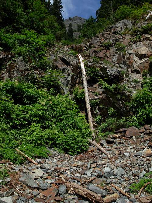 Looking Up A Steep Avalanche Gulley
The final rocky summit slope has plenty of natural handholds and footholds available for climbing/scrambling. However, this section has a lot of exposure and a fall might likely be fatal. Traversing the final summit slope is not recommended when the rocks are wet. Roping and belaying is not typically necessary, but common sense and extra caution are always needed for traversing this section of the mountain.
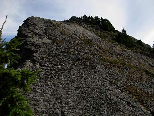 Final Summit Slope (Scramble Section)
Animals are commonly found on the mountain slopes. Mammals include mountain goats, cougars, black bears, squirrels, and pikas. Birds include eagles and pileated woodpeckers. Amphibians include frogs and salamanders (in the meadowy sections of the mountain).
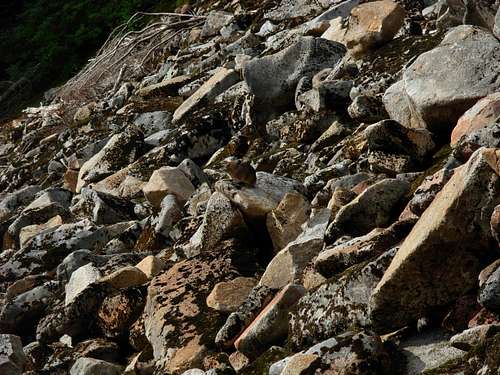 A Pika Nearly Camouflaged On Talus Slope...
Getting There
FROM NORTH BEND, WA:
1) Drive east along I-90 until Exit 42 (Tinkham exit).
2) Drive south along Forest Road 55 for 0.3 miles, until an unmarked road on the rightside (southside) of the road.
3) Turn on the unmarked road and drive uphill for 0.2 miles to the McClellan Butte Trailhead (Trail #1015, ~1800' elevation).
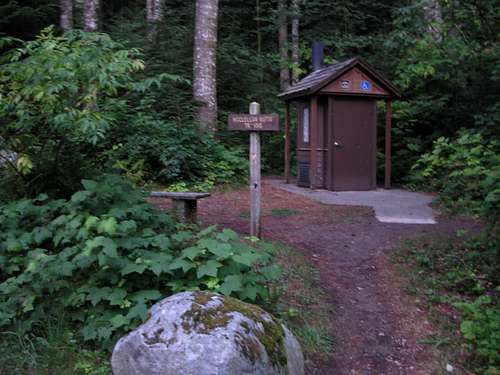 Official Trailhead
4) Begin hiking. After 0.6 miles, the McClellan Butte Trail intersects wtih an abandoned forest road-trail. There is a sign instructing to turn right (north) for the McClellan Butte Trail.
5) After 0.4 miles further, the abandoned forest road-trail (the McClellan Butte Trail during this section) intersects with the very wide Iron Horse State Park/John Wayne Trail. Cross over the John Wayne Trail to continue on the McClellan Butte Trail. There is a sign showing this trail junction.
6) After 0.5 miles further, the McClellan Butte Trail intersects with Forest Road 9020 (~2200' elevation). Cross over the road to continue on the McClellan Butte Trail. This is a sign showing this trail junction.
7) Hike 3.1 miles further to the end of the McClellan Butte Trail, at the southwestern side of the summit block of McClellan Butte.
8) Scramble for a short distance up the steep rocky slope (use extreme caution!) to the summit (5162' elevation) of McClellan Butte.
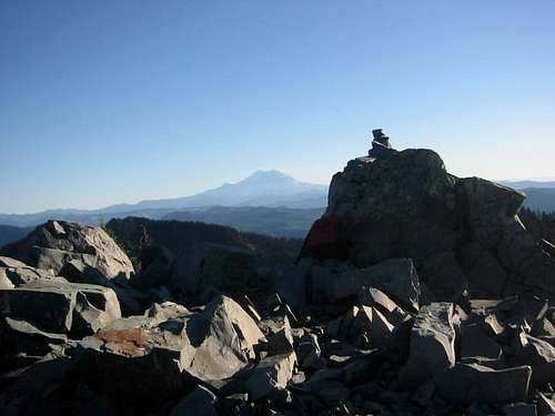 Summit Of McClellan Butte
Total hiking distance: 9.3 miles, roundtrip.
Some hikers have been known to eliminate 1.5 miles hiking distance (each direction) by taking Exit 38 off I-90 and following Forest Road 9020 south until its intersection with the McClellan Butte Trail. However, the Mount Baker-Snoqualmie National Forest greatly advises against using this method and only wants hikers to use the official parking area for McClellan Butte Trail #1015. The Mount Baker-Snoqualmie National Forest emphasizes that Forest Road 9020 might be gated and locked at any time, at drivers' own risk. Plus, parking space is limited and unobstructed Forest Service access to the road is required at all times.
McClellan Butte Trail #1015 and McClellan Butte are both shown on Green Trails Map #206.
Red Tape
A Northwest Forest Pass is required to access this area.
Campfires are not permitted. Caution should be implemented when using cooking stoves, especially during Summer months and dry periods when fire danger increases.
The McClellan Butte Trail is typically not recommended during months of snow-cover, due to extremely high avalanche dangers. For current trail conditions, contact the the North Bend Ranger Station at 425-888-1421 (Seattle 206-622-8378).
The City of Seattle/Cedar River Watershed Ecological Reserve is located southwest of McClellan Butte Trail. The Cedar River Watershed is a "closed" watershed; public access is prohibited. Those entering the watershed area unauthorized might be prosecuted. Stay on the McClellan Butte Trail, especially if the exact boundary of the watershed is unknown.
When To Climb
The prime timeframe to climb McClellan Butte is between mid-July and mid-Autumn, while snow is not present on the mountain and/or avalanche dangers have passed. During snow-covered months (usually between mid-Autumn to mid-Spring/early Summer), extremely high avalanche dangers exist on the mountain and especially where the McClellan Butte Trail crosses several steep avalanche gulleys. The use of an ice axe and crampons is highly recommended on the mountain during periods when snow is present. As previously mentioned, it is not recommended to climb the final summit scramble during wet conditions, as the rocky slope can be slick, mossy, and unstable in places. Roping and belaying is not typically necessary for the upper summit slope, but common sense and extra caution is required during the final ascent and descent.
 Downclimbing The Summit Block...
With that mentioned, McClellan Butte is still a semi-popular climbing destination for experienced climbers during snow-cover in Winter and Spring months as both a training climb and a conditioning climb.
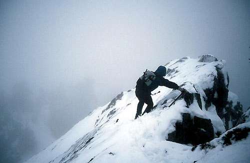 Winter Descent Of Summit Slope...
Camping
Camping is not permitted on McClellan Butte or at the trailhead.
However, Tinkham Campground is an official established campground located only a short distance (less than one mile) along Forest Road 55, from the turnoff for McClellan Butte Trailhead.
In addition, a backcountry campground ("Carter Creek Camp") is located along the John Wayne Trail approximately 2.8 miles east along that trail from its intersection with the McClellan Butte Trail.
Campfires are not permitted. Caution should be implemented when using cooking stoves, especially during Summer months and dry periods when fire danger increases.