
-
 192704 Hits
-
 99.54% Score
-
 117 Votes
|
|
Mountain/Rock |
|---|---|
|
|
39.46650°N / 106.481°W |
|
|
Eagle |
|
|
Hiking, Mountaineering, Skiing |
|
|
Summer, Fall |
|
|
14005 ft / 4269 m |
|
|
Overview
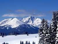
Mount of The Holy Cross may not be the tallest of Colorado's Fourteeners, in fact at 14,005' it barely cracks the list at all is the third shortest of the group. However, what it may lack in height compared to its brethren, it more than makes up for in its power.
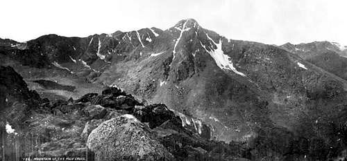
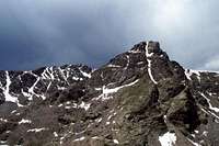
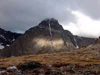
Rumors abounded about a "snowy cross" for years, but the reclusive nature of the peak kept it hidden. It was not until 1869 when it was spied from Grays Peak by William Brewer was it confirmed that indeed a cross of snow was stamped on the face of a mountain in Colorado. Discovery of where the peak actually was took several more years, and it was not until the 1873 Hayden Survey that the peak was finally located. Climbing up Notch Mountain across the valley to the east, the cross was famously photographed by William Henry Jackson on August 23, 1873. Since then it has inspired people from all walks of life with its rugged beauty, and cross of snow. Long before climbing fourteeners became popular, people came from far and wide to view the cross of snow and to pray before it.
In 1922 a shrine was built on Shrine Pass east of Vail (near present day Vail Pass) and in 1924 a shelter was constructed for pilgrims atop Notch Mountain. The stone shelter cost $120,000 dollars and is still open today, you at one time were even allowed sleep in it free of charge on a first come first served basis (see Red Tape below for camping information). From 1929 to 1950, Holy Cross was even designated as a National Monument.
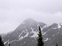
Notch Mountain is perhaps the best location from which to view the famous cross of snow, however, it is also visible from the top of Vail Ski Area, the Shrine Pass shelter, and numerous neighboring high peaks. Mount of the Holy Cross is a shy peak, despite being only about 15 miles from Vail, it is difficult to see from roads. You can briefly see the peak from I-70 when exiting the west side of Eisenhower Tunnel, from CO-91 while passing near the Climax Mine, and from CO-131 just north of the small community of Wolcott. The best views are reserved for those who dig deep to find them, and that perhaps is part of its storied beauty.
Statistically, Mount of the Holy Cross is the 51st highest peak in Colorado at a height of 14,005' (4269 meters). The peak boasts 2,111' of prominence from its parent, Mount Massive. It is the highest peak in Eagle County and Holy Cross Wilderness, and is the farthest north fourteener in the Sawatch Range. Holy Cross Wilderness is out of character with the majority of the Sawatch range, it is more remote, lush, and far more rugged than the rolling talus of the central and southern parts of the range. The Northern Sawatch has its own dedicated page here on Summitpost.
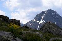
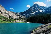
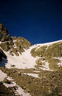
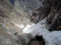
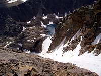
The famous cross of snow, is approximately 1400' high with a shelf cutting across about 2/3 of the way up and about 750' across. This deep inset couloir and shelf fill with snow to create the famous cross, which in snowy years remains strongly visible well into late July. As it melts, it fills a gorgeous sapphire blue lake called the Bowl of Tears.
 Mount of the Holy Cross Mount of the Holy Cross |
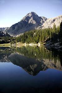
 Mount Jackson Mount Jackson |
 Aspen Splendor Aspen Splendor |
 Patricia Lake Patricia Lake |
 Winter Majesty Winter Majesty |
|---|---|---|---|---|
 Above the Cross Above the Cross |
 Cross Couloir Cross Couloir |
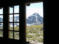 Notch Mountain Shelter Notch Mountain Shelter |
 The Cross The Cross |
 Angelica Couloir Angelica Couloir |
Getting There
Holy Cross may be elusive to the eye, but access during most of the year is fairly straight forward from US 24 about 3 miles south of the town of Minturn. Minturn can be accessed from I-70, via exit 171 which is 5 miles west of Vail. Minturn, Vail or Avon to the east have plenty of restaurants and grocery stores, Avon has a great mountaineering shop called The Bag and Pack Shop.
Follow US 24 south of Minturn for about 3 miles - on the right side of the road you'll spot a forest access sign for the Tigiwon Road (FS 707). Tigiwon is a Ute word meaning "Friends". The Tigiwon Road is generally passable by passenger cars, but can be rough in places and if you have lower clearance, you may wish to carpool with someone who has better clearance. After six miles you will come to the Tigiwon Community House, built in the 1930's to shelter Christian pilgrims on their journey to see the cross. There is also a campground at this location. Generally the road is good to this point, with the occasional pothole or washboard. The road continues an additional 2.5 miles to the parking area, trailhead, bathroom, and Halfmoon Campground. The parking fills up on summer weekends and you may find yourself parking along the road.
NOTE:
The Tigiwon road is closed in the winter, but accessibly by snowmobile. There is also an annual closure to all motorized vehicles for Elk Calving from May 1 to June 20. In heavy snow years that opening may be delayed due to snow conditions. You can walk or mountain bike the road during the elk closure.
Route Options Overview
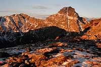
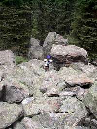
Mount of the Holy Cross offers a variety of routes including long ridge runs and several classic snow climbs in the spring. Below is a summary of the 5 "main" routes used to climb the peak, along with links to their summitpost route pages. The majority of people will descent the North Ridge (standard route) from any of the other options. The North Ridge is known to cause some confusion on the upper 300, see the picture below to help avoid the mistake many have made that has resulted in numerous calls to Search and Rescue:
Common mistake that gets folks into trouble when descending the standard route on Holy Cross.
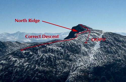
North Ridge
Click Here
11.5 miles round trip and 5600 vertical feet round trip (nearly 1000 of which is on the descent)
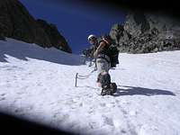
Mostly class 1 trail hiking, but some class 2 boulder hopping required, especially near the summit. This the "standard route" on the peak, but it is a long day hike with nearly 1000' of climbing on the descent. Make sure to save some gas in the tank for the exit!
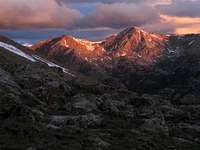
 Going Over Notch Mountain Going Over Notch Mountain |
 East Cross Creek View East Cross Creek View |
 Ascending North Ridge Ascending North Ridge |
 Stay High on North Ridge Stay High on North Ridge |
 Summit From North Ridge Summit From North Ridge |
|---|
Photos from the approach to the snow routes below, leave the trail just past the East Cross Creek crossing and stay on the west side of the creek on a climbers trail to Lake Patricia. I haven't gone beyond this point, but believe the trail continues to the Bowl of Tears. See the individual couloir route descriptions below for additional information.


Angelica Couloir
Click Here
12 miles round trip 5625 vertical feet (round trip stats include descent of North Ridge route)
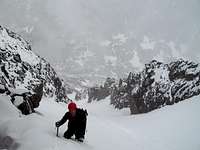
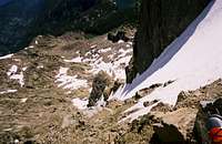
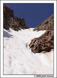
Class 1 trail to Lake Patricia followed by off trail hiking to the base of the couloir, snow steepness of appx 45 degrees at steepest. Angelica is the couloir most visible to hikers on the standard route and finishes 300 feet below the summit. Helmet, ice axe and crampons recommended. Some may want a rope and snow protection. Not recommended dry as it is loose, steep and occasionally icy.


Teardrop Couloir
Click Here
Class 1 trail to Bowl of Tears followed by off trail hiking to the base of the couloir, snow steepness of appx 40-45 degrees at steepest. Teardrop is the couloir that comes up between Holy Cross and Holy Cross Ridge. Helmet, ice axe and crampons recommended. Some may want a rope and snow protection. Not recommended dry due to steep loose rock.


Holy Cross Couloir
Click Here
Class 1 trail to Bowl of Tears followed by off trail hiking/scrambling to the entrance for the couloir, snow steepness of appx 45 degrees at steepest. Due to a lower cliff band, the couloir is not entered from the base but rather from the side. The Holy Cross Couloir is the famous snow feature that gives the peak its name and its fame. It finishes withing a few feet of the summit. Helmet, ice axe and crampons recommended. Some may want a rope and snow protection. Not recommended dry due to steep loose rock.


Halo Ridge
Click Here
13 miles round trip and 5420' elevation gain if route is done as an ascent of Halo Ridge with a descent of the North Ridge.
Class 1 hike to Notch Mountain Shelter, then consistent Class 2/2+ off trail talus hopping the entire way to the summit from there. Long and committing with no water and limited safe bailouts, but a very rewarding "tour de Holy Cross". You get to the see the Cross on this route as well as collect the summits of 2 additional peaks (PT 13248 and Holy Cross Ridge - one of Colorado's highest 100 peaks). For the fittest hikers, this the way to experience this peak.


The Sawatch Range
Mount of the Holy Cross is a part of the Sawatch Range, a linear range that runs north to south from I-70 west of Vail, to well south of Monarch Pass on US 50. US 50 and CO-82 (Independence Pass) are the only paved roads that cross the range, and Monarch is the only one of those that is open year round. The range roughly follows the Continental Divide to Tennessee Pass where it takes a sharp right and heads off towards the east.
There are 15 fourteeners in the Sawatch Range that have 300' or more of prominence, the most of any range in Colorado. Additionally 4 of the highest 5 peaks in the state reside in this range. 27 of the states highest 100 peaks reside in the Sawatch Range, second only to the San Juans which host 28. Holy Cross is one of the 14ers, and its neighboring ridge point at the crest of Holy Cross Ridge (PT 13831) is one of the states Highest 100 peaks.
The Northern Sawatch Range is the area between I-70 and CO-82 and includes Mount of The Holy Cross and its rugged namesake wilderness. While most of the Sawatch are large gentle talus mountains, the rocky peaks of the northern Sawatch offer more opportunities for scrambling and mountaineering including three classic couloir routes on Mount of The Holy Cross. This area also gets much more snow than the rest of the range, which leads to lush basins, with beautiful mountain streams and lakes(and unfortunately mosquitos). Holy Cross is but a taste of what this wonderful area has to offer, and I encourage you to spend some time exploring this sub-range of the Sawatch, it will not disappoint...
Red Tape & Wilderness Regulations
Mount of the Holy Cross is the monarch of its namesake Wilderness area. This area of the Sawatch is much different that the areas to the south, more rugged and more lush. Wilderness designation is the most restrictive form of protection from the Forest Service. Limitations include no motorized or mechanized travel (including bikes), limitations to group sizes, stock feed, and where you can camp.
NOTE: The Forest Service revised the management plan for Holy Cross Wilderness in 2013 and some of the regulations have changed as a result. See the link below for a complete list of regulation, highlights are as follows:
- No campfires allowed in the East Cross Creek drainage, or Missouri/Fancy Lakes area.
- Camping in East Cross Creek is in designated sites only, see map below. This is a change from before! The sites are supposed to be large enough to share, please share if you are in a larger site with available tent locations. Thanks!
- Mandatory self-issuing (free) permits required for overnight use only, it used to be for all visitors.
- You are NOT allowed to camp in Notch Mountain Shelter any longer. Mainly due to concerns about human waste at the above treeline site.
- Dogs are no longer required to be on leash, however, they are required to be under control and not harassing wildlife. You could be asked to put your dog on leash or fined if you cannot demonstrate you dog is under voice control.
Check out the full Holy Cross Wilderness regulations here.
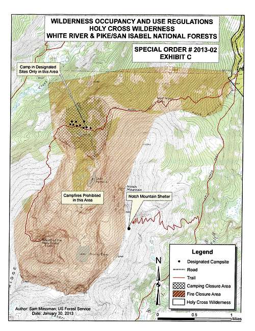 Holy Cross Camping Map
When To Climb
Generally the peak is best climbed in Summer and Fall due to access on the Tigiwon Road. The road is not plowed, and is gated closed for Elk Calving until June 20th. By mid to late fall, the new snows on the road can make it dangerous and risk vehicles getting stuck in the snow several miles from town. Winter climbs generally require three days, cross avalanche prone terrain, and are reserved for only the most experienced winter climbers.
Climbers should start early, Colorado is famous for late afternoon summer thunderstorms, and due to the nature of the route, you could be exposed to lightning on the return trip over Halfmoon Pass. Early fall can be a wonderful time to climb as generally the thunderstorms have stopped and the snows have yet to arrive, however early season snow storms are not out of the question.
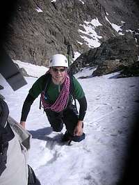
For snow climbs, generally the first 2 or 3 weeks after the road opens are best. By mid July they can turn to ice and they are a mess of loose rock when dry and should generally only be attempted when snow conditions are good, however accomplished alpine ice climbers may enjoy the late season ice. Ice axes and crampons are essential, and some parties may chose to use a rope and snow pickets to protect the climbs as they are steep and a fall could be fatal.
The peak is a wonderful and rewarding climb, however, like all alpine peaks in Colorado, should not be taken lightly. Compared to other fourteener routes, it is among the longer climbs in mileage and elevation gain by its standard route, and is a tough day. Remember there is nearly 1000' of elevation gain on the descent!

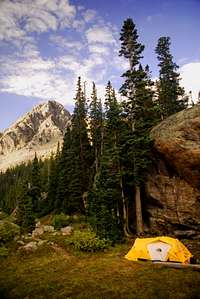
Camping
Two campgrounds, Tigiwon (6 miles up the road) and Halfmoon (at the trailhead) provide organized camping. There are also a few dispersed "pullouts" along the last 2 miles of the road that are available.
Many people hike into the East Cross Creek where there are several designated spaces as well, you MUST camp in a designated site ONLY. East Cross Creek drainage is also a NO FIRE ZONE, due to popularity and resource damage, all fires are banned. See the wilderness regulations above for more information about camping in Holy Cross Wilderness.
If climbing one of the couloir routes, there are some nice spots near Angelica Lake too, these are still available on a dispersed basis if you are outside of the closed zone indicated on the map above. No fires are allowed here either as indicated in the map.
You CANNNOT spend the night in the Notch Mountain Shelter any longer, it has been closed to overnight use effective 2013 due to concerns over human waste burial at the above treeline site. If you do camp near the shelter, you are encourage to (ahem) pack it out.
As always, no matter where you camp be sure to practice "Leave No Trace"!


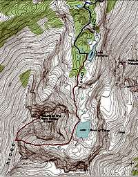
Topographic Map
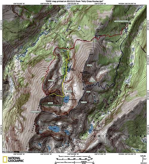
Click to Enlarge
Congratulations Summiters!
 James C James C |
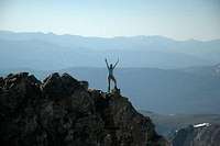 Foxy Long Bottoms Foxy Long Bottoms |
 Larry V Larry V |
 JHansen JHansen |
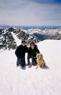 Maynardbc Maynardbc |
|---|---|---|---|---|
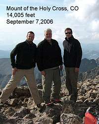 mcdonnellms mcdonnellms |
 Kiefer Thomas Kiefer Thomas |
 Kessler Kessler |
 Rocky Alps Rocky Alps |
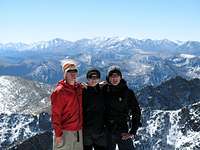 Haytraci Haytraci |
External Links
- Colorado Fourteener Initiative
Reducing Impacts on the Holy Cross Wilderness - Colorado Springs Exploits Resources
Short article on growing trends against exploitation of Pikes Peak and Holy Cross Wilderness - Holy Cross Wilderness Area
Quick overview of facts about Colorado's controversial wilderness. - Angelica couloir
- Mount of the Holy Cross, Holy Cross Ridge, Halo Ridge
- Mount of the Holy Cross and Holy Cross Ridge
- Cross Couloir (07/02/2004)
- A tough one, but worth it
- 14ers.com - The Home of Colorado's Highest Peaks
Fourteener Photos, Route Descriptions, Forum, and more... - Holy Cross National Monument
Historic information about Mount of The Holy Cross and its status as a National Monument
Acknowledgements
Special thanks to the original page author Aaron Johnson for the photo tables and some of the text. Additional thanks to the book "The Vail Hiker" by Mary Ellen Gilliland for background information, as well as the book "Colorado's Fourteeners from Hikes to Climbs" by Gerry Roach. Statistical information is from the website Lists of John. Also, thanks to all of YOU for your great photographs, routes, and trip reports! Keep them coming!