
-
 43013 Hits
-
 92.45% Score
-
 39 Votes
|
|
Mountain/Rock |
|---|---|
|
|
46.96430°N / 11.15380°E |
|
|
11505 ft / 3507 m |
|
|
Overview

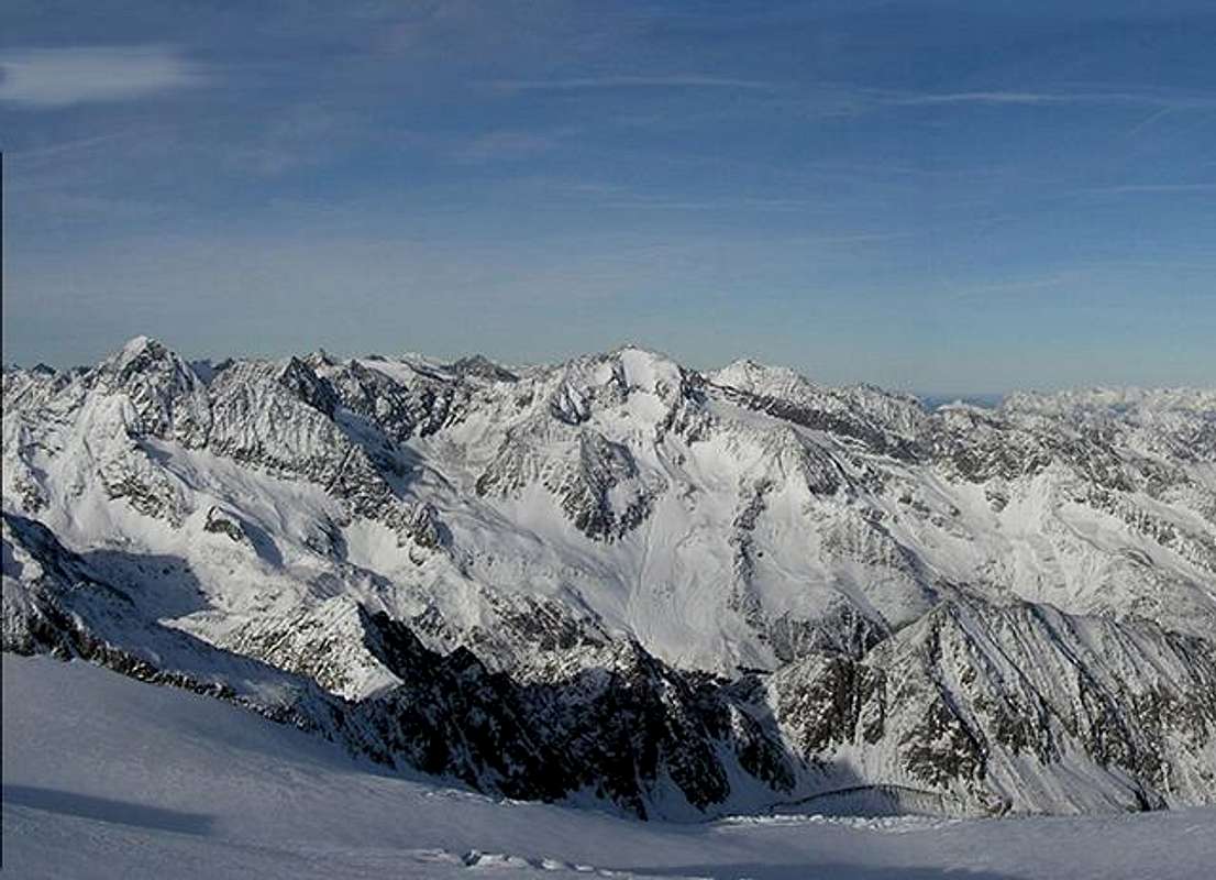
Zuckerhütl is the highest mountain of the Stubai Alps. To the north there Sulzenauferner creates a phantastic high alpine glacier landscape. The Sulzenauferner is magnificent, falling fully 1000 metres from the Zuckerhutl's icy summit. The lower part of the glacier is a huge icefall that looks unclimbable without ladders. This great glacier views from the valley gave Zuckerhütl its name. Translating Zuckerhütl into english it means "sugar cap". Zuckerhütls south face drops about 500m / 1640ft drop to Triebenkarlasferner.
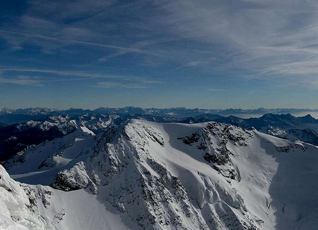
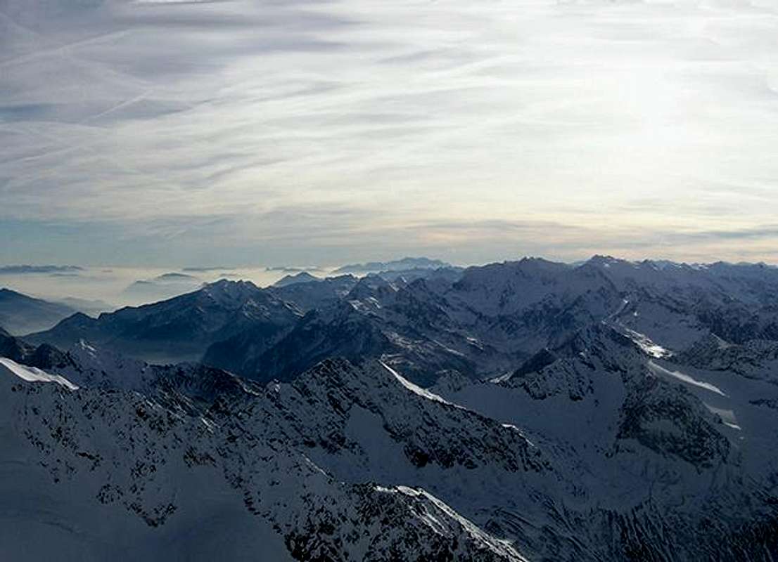
Because of beeing the highest summit of the Stubai Alps and its breath taking views to the surrounding mountain ranges (Ötztal Alps, Stubai Alps, Zillertal Alps and in the distance Ortles-Cevedale group), Zuckerhütl is visited very often. The easiest ascent goes along the east ridge via Sulzenauferner.
First ascent of Zuckerhütl was made in 1863 via Pfaffenschneide by J. A. Specht and A. Tanzer.
Summit panorama
 |
 |
 |
 |
 |


Maps and routes overview

Ascending Zuckerhütl.
Maps:
|
KOMPASS #83 - Stubaier Alpen - Good overview map of the hole Stubai Alps. |
|
Alpenvereinskarte 31/1 - Hochstubai - A very good map of the area. |
Routes:
|
|
Normalroute (east ridge) To get to the east ridge, you have to go to Pfaffensattel (3344m / 10970ft). There are several ways of getting there. The most popular ones might be from Hildesheimer hut (2900m / 9514ft) and Dresdner hut (2308m / 7572ft) or Sulzenau hut (2191m / 7188ft). The east ridge itself is an snow/ice ridge with gets quite steep to the end. Some cravasses may force you into the north face of Zuckerhütl. |
|
|
Pfaffenschneide (west ridge) First of all you have to get to Hildesheimer hut (2900m / 9514ft). From there a marked trail leads to Pfaffenferner (glacier). Cross the glacier to get to Pfaffenschneide. Difficulties should not be more that UIAA II. |
Getting There
By car:
From Innsbruck take the 182 south towards Italy (Brenner pass). The motorway is heavily tolled so it' s better not to use it. After about 20km a road turns right into the Stubai valley. From now on it is easy to reach the trailhead. Because you have to drive as far as you can get on the road.
Red Tape
There are no permits, fees or seasonal closures.
I don' t know if parking is free there, but in the city of Sölden there should be some free-parking areas. The parking lot of the Stubai glacier lift is free, too.
When To Climb
Summer months , June to September offer the safest ascent (big crevasses however !). Late in the season the steep ascent to the summit can be very icy.
A ski ascent during the winter is an obvious possibility with the use of the upper cable way to the "icegrat " station at over 3000 metres.
Anyway glacier equipment (ice axe, crampons, rope, ...) is needed.
If you atempt to climb Zuckerhütl in winter please check the current avalanche report (unfortunately in german only) for snow conditions on the mountains.
Accomodation
The city of Sölden in the Ötztal valley is a very trouristic area. For more information about hotels and stuff visit the multilangual homepage of the area.
On the mountain there are three huts, which are interresting:
|
|
Sulzenauhut (2192m / 7191ft) This hut is about 7km from the summit. Access to the hut via the city of Ranalt (1303m / 4275ft) at the end of the Stubai valley. Soon after leaving this city there is a parking lot (free parking) and trail #135 leads to a crossing with trail #136 which goes up to the hut. |
|
|
Dresdner hut (2308m / 7572ft) This hut is about 7km from the summit. Access to the hut via the city of Ranalt (1303m / 4275ft) at the end of the Stubai valley. Soon after leaving this city there is a parking lot (free parking) and trail #135 leads up to the hut. |
|
|
Hildesheimer hut (2308m / 7572ft) This hut is about 3km from the summit. Access to the hut via the city of Sölden (1368m / 4488ft) in the Ötztal valley. After parking in this city trail #26 or "Aschenbrenner Weg" leads up to the hut (NOTE: very long, about 15km). |
Mountain Conditions
Weather:
| Weather forecast for the city of Sölden (1368m / 4488ft) - about 5km from Zuckerhütl | |
| Weather forecast of the OEAV (austrian club of the alps). Unfortunately this excellent high-alpine weather forecast is only available in german. |
Webcam:
| This webcam at Eisgrat (2900m / 9514ft) doesn' t show Zuckerhütl, but is about 4 km from the summit and shows conditions higher on the mountains. |
Route Description
The best "tourist" route is from the Dresdner Hutte, 5:30 a.m. is a good time to start. This will reduce the impact of the sun which drenches the Sulzenau glacier from about 7:30 a.m. in high summer.
From the refuge cross the river to the south east and follow the steep and rocky trail to the "Beiljoch", descend from this col to the perfectly formed ancient moraine of the Sulzenauferner ( " ferner " = glacier ) on its ( true ) left bank. Follow the moraine and gain access to the glacier at around 2600 metres.
Climb the glacier keeping close to its ( true ) left bank (stonefall danger from the right) for about 2 km ( 500 m ascent) before reaching the upper flat area of the glacier. There are numerous crevasses so a rope is adviseable ( I climbed the mountain alone - not recommended). Bear south east toward the Pfaffensattel (col) between the Zuckerhutl and the Wilder Pfaff.
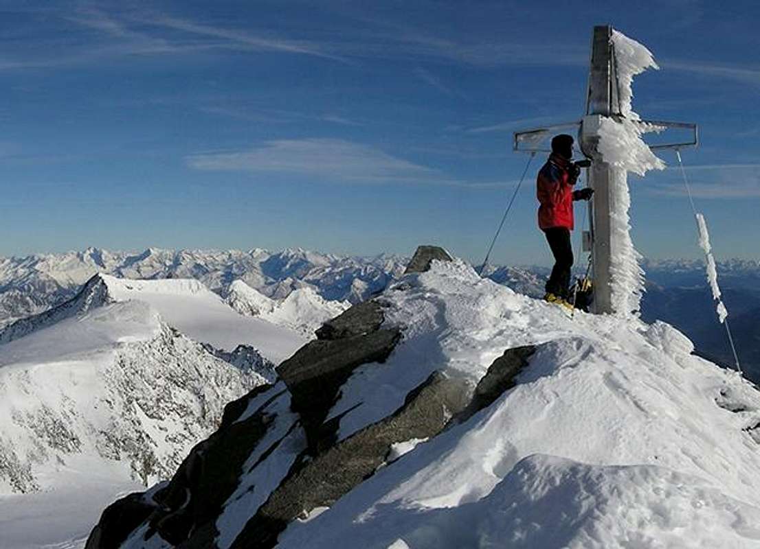
Climb the east ridge which steepens alarmingly (huge drops to the left). To avoid the steepest icy section the upper rocks of the south face can be taken (grade I / II ), this leads quickly to the tiny and airy summit ( about 5 hours from the refuge).
Return by the same route or over the Pfaffeneider col followed by an easy rock scramble down to the easy Fernauferner. Keeping to the glaciers right bank will bring you to the trail back to the refuge where if you have planned properly a beer will be waiting.
External Links
- Austrian Map online
Online digital maps of Austria (OEK 50, OEK 200 and OEK 500) by the BEV (Bundesamt für Eich- und Vermessungswesen) - in German - Vom Eisjoch auf das Zuckerhuetl
Description of the ski route
JoPo - Dec 22, 2001 4:24 am - Voted 10/10
Untitled CommentThe lat 50-100 vertical meters are usually aper (without snow), consequently one keeps southward in the rocks. The path is very exposed and seems to be secured with fixed ropes. Almost ALL of the ropes are loose and should NOT be used. In fact one does not really need them, but in case you do, it might be very dangerous.
r_ten_kate - Aug 9, 2002 2:58 pm - Hasn't voted
Untitled Commentanother great way to approach the zuckerhutl, is via the hildesheimerhutte ( 2899 m ). It takes about 4 hours to get to the summit, and 3 hours to descend. the route starts with rocks, followed by a great snow field, which is pretty easy to walk. from 3100 meter, you follow the same route as from the dresdner hutte, and it's a nice ascent
Troll - Feb 5, 2008 9:04 am - Voted 8/10
ParkingFree parking is possible close to Grawaa Alm (about 300m behind the restaurant), at the start of route 136. There is a small bridge and parking places (even in winter).