
|
|
Mountain/Rock |
|---|---|
|
|
28.26910°N / 16.6338°W |
|
|
Hiking, Mountaineering |
|
|
Spring, Summer, Fall |
|
|
12198 ft / 3718 m |
|
|
Overview
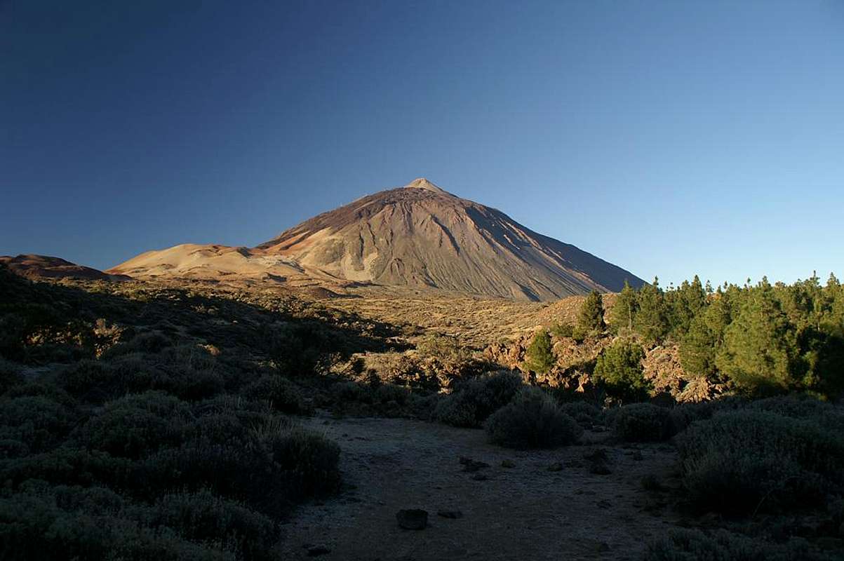
Teide 3715 m
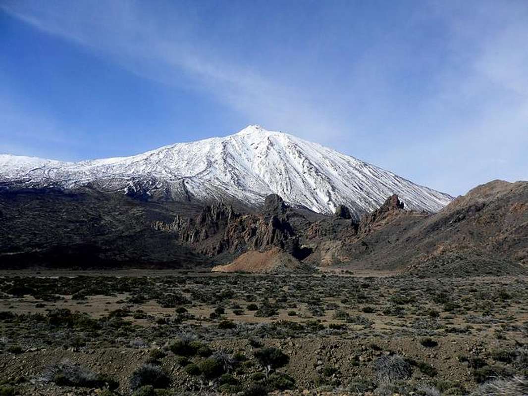
Spain's highest mountain is a volcano on the island of Tenerife (Canary Islands). The last eruption occurred in 1909. The mountain is protected as the Parque Nacional del Teide. The huge extinct crater has a diameter of about 10 kilometers, is filled with lava at an altitude of ca. 2000 - 2300 m a.s.l. This flat region looks like a scenery on the moon, although some flowers bloom there and make the foot of the rising cone a place of extraordinary beauty. This flat part is called Las Cañadas and can be reached by car.
In order to study that region and prepare the climb we took the mountain-bike from sea level. Las Cañadas does not have any shops, but a hotel (Parador), an information center, an astronomical and meteorological observatory, a cable car to the Teide. The next shops are at the town of Vilaflor 1460 m. The cable car starts at an altitude of 2350 m and reaches La Rambleta at 3550 m. It runs between 9 a.m. and 16 p.m. The climb from the Cañadas is an easy hike of about 5 hours. There is absolutely no water to be found! The weather is not extreme, although snow is common in winter and makes a climb probably awkward.
Getting There
Many roads lead to las Canadas where the itineraries to climb the summit start. From Puerto de la Cruz, from Santiago del Teide, from Vilaflor. The best choice is renting a car, but you can also use public transport. Info by Henning Lege: Bus No. 348 leaves Puerto de la Cruz at 9:15 am every day, arriving at the Parador around 11:00 am. 'Montana Blanca', where the trail starts, is an official bus stop. The return trip leaves the Parador at 16:00 in the afternoon. Although it is possible to climb the summit between 11:00 and 6:00, obviously it would be more convenient to either sleep in the refuge or hitchhike back later in the evening (there are many cars).
We stayed at the Parador hotel. Early in the morning we drove past the cable car station. We parked the car 3 km East of the cable car station. Maps and signs show you the route to the top. We followed a bad mountain road and went around a hill (Montaña Blanca). Soon the road disappeared and we followed a path that cannot be missed. At 3300 m we came across the Altavista hut, not inhabited. At 3550 m we went past the upper cable car station. From there the climb is restricted to persons with a permit. A comfortable garden path leads to the top at 3718 m. Some sulphurous gases could be seen and smelled, but they were not nauseating. The view is extraordinary, we could see most of the Canary Islands. We used gym boots. They were OK for the climb, but for gliding down on the stone avalanches, we would have preferred mountain boots. It may be pleasant to take the cable car for going down, but the 3 km walk on the hot pavement back to the car must also be considered.
 |
 |
 |
 |
 |
Red Tape
Since there goes a cable car (3550 m) almost to the top of the Teide (3718 m) it is inviting for a huge mass of people to climb the summit. The park authority wants to prevent that and all the climbers need a permit, which you can get without cost at the Park Office at: Ministerio del Medio Ambiente Calle Emilio Calzadilla 5, Sante Cruz de Tenerife Phone: ++34 922 290 129 Email: teide@oapn.mma.es www.mma.es. You need to go there personally with your passport (also needed on the mountain!). We found that awkward and intended to leave the path below the station and leave the control at our left. Fortunately this was not necessary since we read in the local newspaper that the cable car did not operate beginning of May due to maintenance work. We took the chance and were all by our own on the summit.
 |
 |
 |
 |
When To Climb
From spring to autumn. If you rise early in the morning, the heat should not be a problem. The starting point is rather high and there is much wind. Generally I would not recommend winter time, when the Teide is covered with snow. Too little for skiing, too much for hiking.
Info by Henning Lege: winter has the advantage, that the cable car does not go for sure. Thus, no crowds, no rangers, no one preventing you from climbing the very top, and no reason not do do, because you cause zero erosion and your footsteps will vanish when the snow melts. Because of the wind, the snow typically is hard pressed (icy). So you don't sink to your knees. To the contrary, even crampons can be of use, although it is more funny without. Very windy, indeed. Gloves recommended, warm clothing and windprotection are essential.
Accommodation
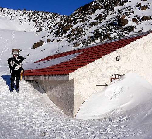
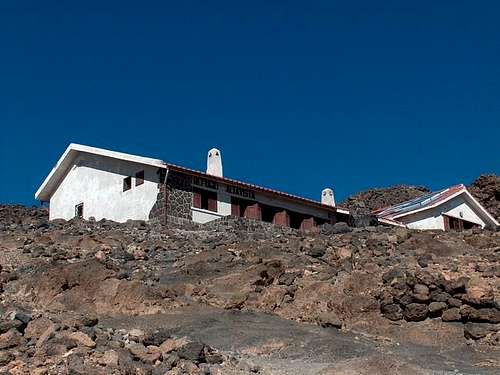
None. National Park. Forbidden. Instead of staying at the Parador, you can leave your home at the coast after midnight. But I prefer to get accustomed to the height. By the way Parador: if you are over 60 you get a rebate! H.L.:When the refuge is closed, the annexe apparently is always open. There are 8 beds, a few blankets (bringing a sleeping bag is recommended) and even an electric light (I checked it). There is no water (either carry water or melt snow) and no stove.
External Links
- Sendas Sendas is a site where you can find this webcam from Tenerife to Teide.
- Photo journal of my ascent of Teide on Jan 31 2005
- www.teideascension.tk - Climb of mount Teide from Sea. How to's, GPS points, maps, usufull info and other
- Photos from Canary Island, including Teide ascent
stucki - Jul 3, 2003 7:49 am - Hasn't voted
Untitled CommentI would strictly recommend to use mountain boots !. The trail is easy, but the volcanic rocks are sharp-edged, and the risc of a hurt is high!
stucki - Jul 3, 2003 8:02 am - Hasn't voted
Untitled CommentMany mountaineers hike up to the Refugio Altavista, take the night there, and hike up in the early morning to see the sunrise from the top of Teide. That must be great and an exceptional experience! As far as I know, you do need a permit or resevation for the Refugio Altavista.
An other possibility to see the sunrise is to start about 1.5 or 2 hours before sunrise from the parking lot, and see the sunrise from the "Huevos del Teide": Huge black balls in a yellowish pumice-stone (Bimsstein) landscape, the view over the partly with red clouds covered ocean, created by the early sunlight - I'll never forget that!
Rafa Bartolome - Nov 28, 2004 6:45 am - Voted 10/10
Untitled CommentActually (november of 2004) the permission can be obtained coming the leader of the group to refill the information of the persons contributing photocopy of the DNI or passport of all of the members of the expedition. The schedule of the office of the National Park is 9 to 14h and it is necessary to choose among the groups of hours to access to the summit: 9-11h, 11-13h, 13-15h and 15-16h of 2 following days. According to the rapidity with which we come fewer hours will stay to choose.
Generally the inspectors descent in the last cable car at 16:30 and you can accede without permission to the path that leads to the top (as well before the 9am).
Out of the summer (as october, november, december...) with few people in the top after 14h or 15 h. the inspectors leave generally to climb to the mountaineers that have realized the effort to walk the 4 hours or more necessary to come up to the checkpoint (but it's a risk, it's better to obtain the permit).
teideascension - Dec 11, 2004 7:08 pm - Hasn't voted
Untitled CommentHi Everyone!
This year we have done a climb to Mt Teide 3718 m from sealevel. The route is 29 km long and took us 6h and 5 min (we did it running). The route and the possibility of a climb from sealevel is not very well known and the loads of requests of information have given birth to www.teideascension.tk where everything is explained, from the route with maps and GPS points to the preparations, summit permit application etc.
If you visit it, better with ADSL, as documents are heavy and waitings may be long
Have fun,
Santiago Arnalich
__
WWW.TEIDEASCENSION.TK
La güeb de los que sube"n el Teide desde el nivel del mar
Playa del Socorro 0m - Pico del Teide 3718m
fjallakella - Jan 3, 2006 7:07 am - Hasn't voted
Untitled Commentjust back from a very nice time on teide. the refugio was open, not too warm but very welcoming. the warden said that they were aiming at keeping it open the whole year so if that proofs to be right everyone can look forward to a stay in that beautiful hut. i was surprised by the fact that not only were there beds but real bedcovers and pillows as well, so i need not have brought my sleeping bag. a headlamp however is handy!
Diego Sahagún - Jun 30, 2007 7:28 pm - Hasn't voted
El Teide, Patrimonio de la Humanidadhttp://www.desnivel.com/object.php?o=15937
tuan walter - Feb 13, 2010 1:31 pm - Voted 9/10
Permit By EmailOnce you have a scanned in copy of your passport (which might also come in handy in case you should lose your passport) the easiest way of getting the permit is by email - teide@oapn.es. You don't need to fill in the application form. You just have to give your name, passport number, the date you want to ascend, and the time span, and to attach the copy of your passport. You do have to submit your application AT LEAST 7 DAYS IN ADVANCE. You'll then get the permit within a couple of days, perhaps even the very next day, and can also print it out when you are on the road already. PUNTOinfo
damgaard - Mar 22, 2014 3:58 am - Hasn't voted
Teide, updateI climbed Teide times last week (early March 2014). Reservations for summit climbs are now booked online. Google Teide and reservation and you should find it. There are present four official (allowed) routes to the summit: 1. Via Montana Blanca 2. From Roques de Garcia via Pico Viejo 3+4. From the western road via Pico Viejo. I tried both 1 and 2 and found number 2 to be the most interesting. It is longer and there is 200 m additional climb, but the route is more varied and the views are in my oppinon nicer. When I hiked up both routes were not officially open due to ice and snow. This was not written anywhere except at the lower Teleferique station, but the routes were blocked from entry at the upper cable car station, so it might be a good idea to check at the lower cable car station before setting out.