
-
 54656 Hits
-
 91.38% Score
-
 35 Votes
|
|
Mountain/Rock |
|---|---|
|
|
46.02373°N / 7.88286°E |
|
|
Valais |
|
|
Mountaineering, Ice Climbing |
|
|
Spring, Summer |
|
|
13776 ft / 4199 m |
|
|
Overview
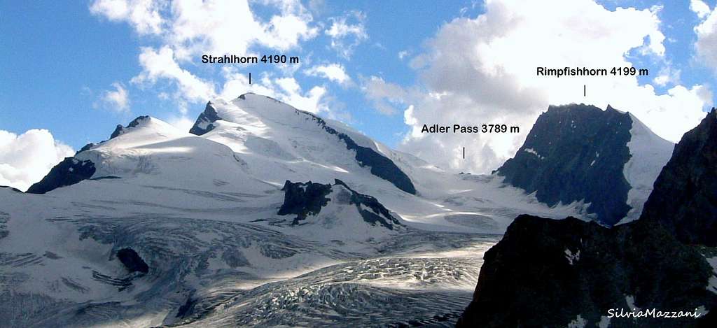
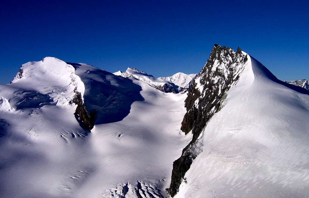
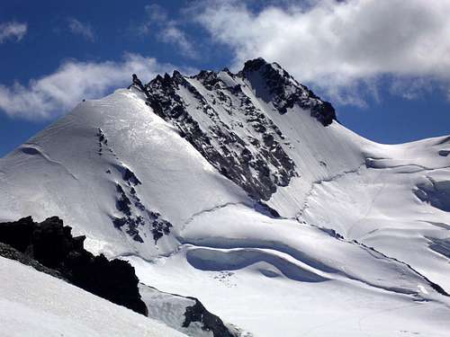
Rimpfischhorn 4199 m
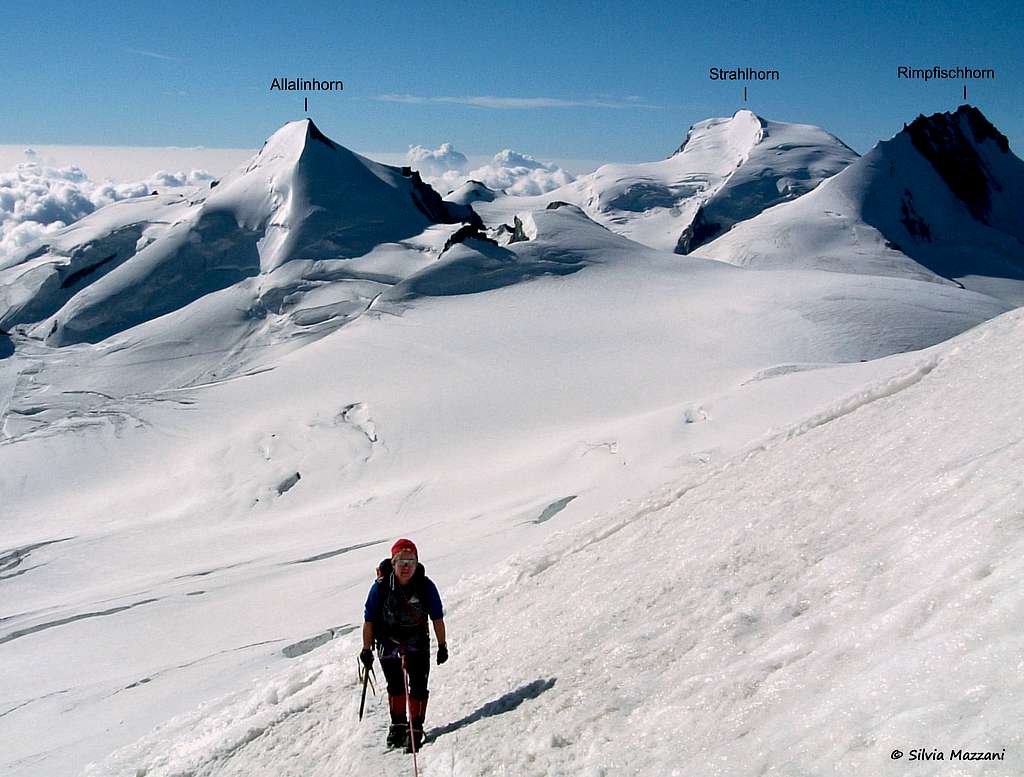
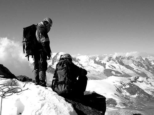
Rimpfischhorn is a beautiful 4000 located amidst of the mountain chain that links the Monte Rosa group with the Mischabel peaks and belongs to the Pennine Alps. The mountain is located South of Allalinhorn and separated from it by the Allalinpass. To the South of the mountain the Adlerpass separates it from the Strahlhorn and the Adlerhorn. The Rimpfischhorn is part of those mountains that fascinate with their spectacular profile. To the West and to the North there are large icy spaces, to the East and to the South a spectacular wall at least 600 m high falls on the Allalingletscher and gives to the mountain a severe appearance. The exposed ridge of Rimpfischhorn is enlivened by a series of gendarmes and looks like the back of a dinosaur.
It is not an extremely popular mountain, the reason could be that it is too easy for the experienced climber and too demanding for the novice. In fact the Rimpfischhorn is the hardest Four-thousandth of the Allalin massif. Check here the complete list of the 82 alpine Fourthousanders and the 46 minor summits: Club4000. However, the fact that the mountain is not a popular destination is enough surprising, since it can be climbed from both the mountaineer Mecca's: Saas Fee and Zermatt. And the view from this mountain is extraordinary. Most climbers use - of course and by definition - the Normal route from the Saas Fee side and sleep at the Britannia hut. If you stay in Zermatt, the Hotel Fluhalp (2616 m, only half an hour from the Blauherd chairlift station) or the Täsch hut would be your choice (see Täschhorn).
Even the Haute Route skiers and hikers who cross the nearby Adler pass on their long way from Saas Fee to Chamonix do not honor the Rimpfischhorn with a visit, since the climb from the Adlerpass takes 3 hours and offers bad rocks. The opposing ridge from the Allalinpass is occupied by a grim gendarme and it is - understandingly - not much appreciated by the public either. So most alpinists concentrate on the 5-6 hour walk from the Brittania hut on the Normal route in ice and snow. If you think of the many crevasses that have been opened for you in fall, it is not surprising that most mountaineers prefer deep spring snow for excellent skiing. Bring with you a rope, axe and crampons.
Getting There
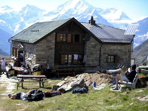
In Sass Fee take the Felskinn cable car (this is the first cable car to the left of the village). From the arrival of the cable-car, cross the Chessjengletscher (at the beginning of the season it is a comfortable track marked by the snowcat) towards the Britanniahutte 3030 m. About an hour (100 m difference in altitude on the ascent route, 50 m on the way back because of the path with various ups and downs). The refuge is an excellent vantage point on our peak.
Normal route from Britannia Hut
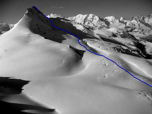
Normal route
Difficulty: Alpine PD+
Vertical gain: 1170 m from the Britannia Hut
First on the summit: Leslie Stephen and Robert Liveing with the guides Melchior Anderegg and Johann Zumtaugwald 1859, September 9th
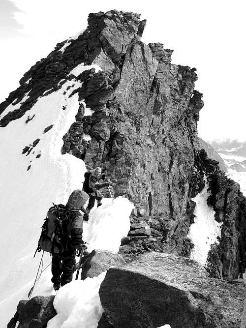
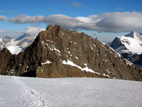
From the Britannia Hut 3030 m go down to get the start of the Allalinglacier. Walk along the South face of the Allalinhorn and climb the Allalinpass (3789 m). Then go left (south-west) for one mile and keep your altitude. Cross below point 3662 located at the lower end of a ridge that ends at the first big gendarme of Rimpfischhorn's North ridge. Now climb straight up the Rimpfischhorn. At about 4000 m, the slope of the glacier becomes steeper and skiers will leave their gear there. The rest is a steep couloir. Leave it after a 70 m ascent and go to the left until you reach a ridge. This ridge offers exposed climbing (one passage II+) to a minor summit. From here easily to the main summit. 5 hours.
Summer climbers who don't like to do the same way twice and love rock climbing can reach the Allalinpass directly via the North ridge. One problem is the Grand Gendarme (4108 m) a 50 m high tower that can be omitted by keeping on its right-hand side (east), sometimes icy. The dry west side is also possible, but the rock is of poor quality. However, excellent rock and holds allows you to climb this almost perpendicular gendarme on the west side (IV). 3 hours from the summit to the Allalinpass, gendarme included.
If you come from the Täsch hut (2701 m) you will turn right to the point below 3662 m before you reach the Allalinpass. 6 hours.
Red Tape
No fees no permits required.
Parking fee in Saas Fee.
When To Climb
Mountaineering: June to September
Ski: March to May
Huts

1. Britannia Hut 3030 m
There are 3 usual ways to reach the hut.
a. Felskinn 2989 m. Two cable cars reach this place, both starting in Saas Fee (1800m). This is the usual ascent with skis. In summer follow the dirty road to Egginerjoch (2989 m). Do not trust the yellow signals on the Joch. From the Joch you can see the hut. Ugly approach to the hut. Ca. 1 hour. Of course, you can walk from Saas Fee. Nice walk to "Maste 4" (2572 m). Afterwards ugly ski roads. But interesting insight how short-sighted tourism can ruin the nature. Car park in Saas Fee per day: sfr. 9.50 (2005)
b. Plattjen 2570m. A cable car connects Plattjen with Saas Fee. A wonderful path leads from Plattjen to the hut along the east side of the Egginer. Excellent view. Not suited with skis. 2-3 hours. Recommended.
c. Zer Meiggeru (1740 m). Longest but most beautiful ascent to the Britannia hut. Not suited for skiing. Excellent path and wonderful view all the way up. This is my favorite. Good for acclimatization. Free car park. Bus from Saas Fee every hour. 3-4 hours.
2.Täsch hut 2701 m from Taesch (1450 m) in 3-4 hours
3. Hotel Fluhalp 2616 m in 1 hour from the cable car station Blauherd (2590 m) above Zermatt
Meteo
Guidebooks and maps
Link for books and maps:
Literature and Maps
Walliser Führer, Vol. IV edited by the Swiss Alpine Club,
French: Guide des Alpes Valaisannes, Vol. IV
Map Nr. 506 Matterhorn - Mischabel 1:50'000
Map Nr. 284 Ski 1:50'000
See the Swisstopo Map with many interesting features.
External Links
- Rimpfischhorn at www.4000er.de
Images, routes, coordinates and more information about the highest peaks of the Alps