
|
|
Mountain/Rock |
|---|---|
|
|
38.43940°N / 109.2594°W |
|
|
12482 ft / 3805 m |
|
|
La Sal Mountains Overview
Click to see an Overview Photo of the La Sal Mountains.
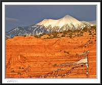
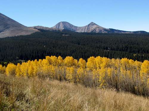
The La Sals are a small mountain range in eastern Utah covering an area 25 miles long (north-south) by 15 miles wide (east-west). They are, however, Utah's second highest range (after the Uintas) and contain twelve peaks higher than 12000 ft (highest point: Mt. Peale 12721 ft). With their lush forests and cool summer temperatures, they are in sharp contrast to the hot, arid canyonlands of eastern Utah and provide an excellent background for the dramatic scenes of Arches and Canyonlands National Parks. Two high passes, La Sal Pass (10125 ft) and Geyser Pass (10538 ft) divide the mountains into three distinct groups: north, middle and south.
North has seven 12ers:
Rank....................Peak
4...........................Mt. Waas (12331 ft)
5...........................Manns Peak (12272 ft)
7...........................Mt. Tomasaki (12239 ft)
8...........................Pilot Mountain (12200 ft)
9...........................Green Mountain (12163 ft)
11.........................Castle Mountain (12044 ft)
12.........................La Sal Peak (12001 ft)
Middle has five 12ers:
Rank....................Peak
1...........................Mt. Peale (12721 ft)
2...........................Mt. Mellenthin (12645 ft)
3...........................Mt. Tukuhnikivatz (12482 ft)
6...........................Mt. Laurel (12271 ft)
10.........................Little Tuk (12048 ft)
South has no 12ers:
Rank....................Peak
17.........................South Mountain (11817 ft)
Canyon Country's "La Sal Mountains, Hiking and Nature Handbook" by Jose Knighton, with its accompanying map, provide an excellent guide. Make sure you buy the map. Without it, the book becomes confusing.
 |
 |
 |
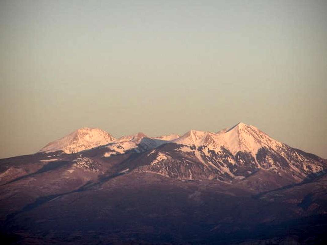
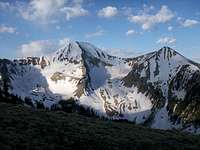
 North face, (L) Tukuhnikivatz, (R) little Tuk
Mount Tukuhnikivatz Overview
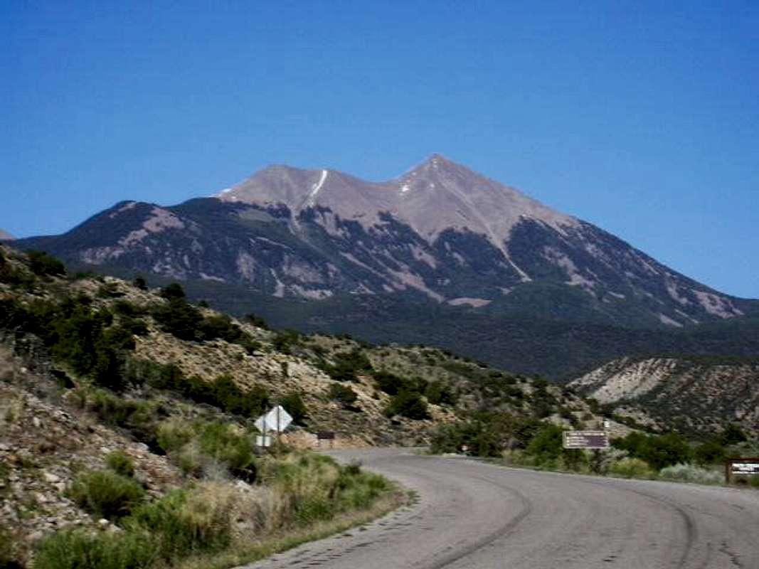
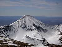
 West Face of Mt. Tukuhnikivatz


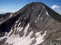
The word "Tukuhnikivatz" is supposedly a combination of native words meaning "where the sun sets last". This name probably stems from the fact that Tukuhnikivatz rises very abruptly on the western margin of the La Sal Mountains. From the town of Moab, Mt. Tukuhnikivatz appears as a steep triangular peak that seems to rise above the rest of the mountains.
Mt. Tukuhnikivatz has been traditionally climbed from La Sal Pass to the south. This route will take you up steep slopes (and loose scree just below the summit). An approach from the north, via Gold Basin, is also possible (see Routes). To the east, a 1.75 mile long ridgeline that drops to a minimum elevation of 11700 ft, connects Mt. Tukuhnikivatz to Mt. Peale. A traverse of this ridgline will take you past the "Razor Fang" which has been rated as the most difficult route in the La Sal Mountains. To the northwest, the slopes of Tukuhnikivatz create a 12048 ft sub-peak that is known as Little Tuk or Tukuhnikivatz North.
From the summit, you will have great views of the red arid canyonlands of Utah to the west. The rest of the La Sal mountains can be seen to the north, east and south. The Abajo Mountains (highest point 11360 ft) appear as broad ridges rising above the canyonlands 40 miles to the southwest. You will even get a glimpse of the Henry Mountains 75 mile away.
Getting There
Tukuhnikivatz (R), Mellenthin (L)
The mountains are easily accessible from the town of Moab (elevation 4000 ft). La Sal Pass can be reached from the west via a high clearance four wheel drive road. The easier route, however, is from the east as follows:
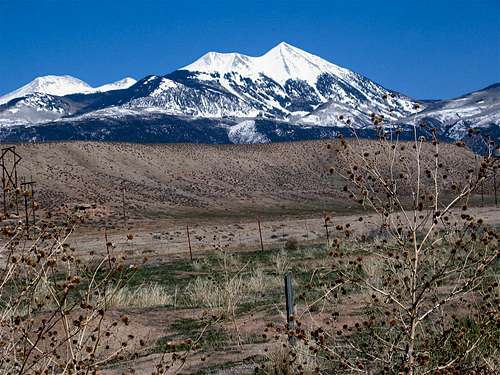
From downtown Moab drive 22 miles south on Route 191 to State Route 46. Turn east on Route 46. The road skirts the southern tip of the mountains and goes to their east side. At 35 miles from Moab, turn left/north onto Canopy Gap Road (a good dirt road). After two miles turn left onto La Sal Creek Road (passable by most any car). Drive the road 8 miles climbing the eastern slopes of the mountains through forests of Aspen to La Sal Pass (10125 ft).(The only obstacle is a creek crossing at 2 miles into La Sal Creek Rd which may present a problem for low clearance vehicles during high run-off). Don't be surprised to find cows roaming freely and blocking the road. At the pass, you can look north to see Mt. Peale and Tukuhnikivatz. To the south, you will find South Mountain (11817 ft). La Sal Pass is the trailhead for both Peale and Tukuhnikivatz. Hiking distance is 2.2 miles to the summit of Tukuhnikivatz.
 L to R: Mt. Tukuhnikivatz, South Mountain & Mt. Peale, SW Face
Red Tape
No fees or permits required.
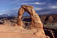
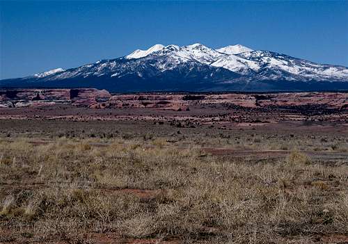
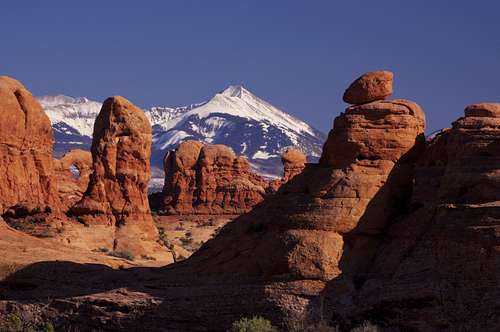 From Arches National Park
 |
 |
 |
 |
 |
 |
 |
 |
 |
Other Pictures
 |
 |
 |
 |
 |
 |
 |
 |
 |
 |
nikweb - Apr 16, 2002 4:21 pm - Hasn't voted
Untitled Commentcheck out the chapter in edward abbey's classic desert solitaire for a hilarious description of a day on this mountain