

-
 38104 Hits
-
 93.36% Score
-
 43 Votes
|
|
Mountain/Rock |
|---|---|
|
|
45.89216°N / 6.90649°E |
|
|
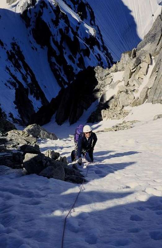
Mountaineering, Ice Climbing, Mixed |
|
|
Summer |
|
|
12050 ft / 3673 m |
|
|
Overview
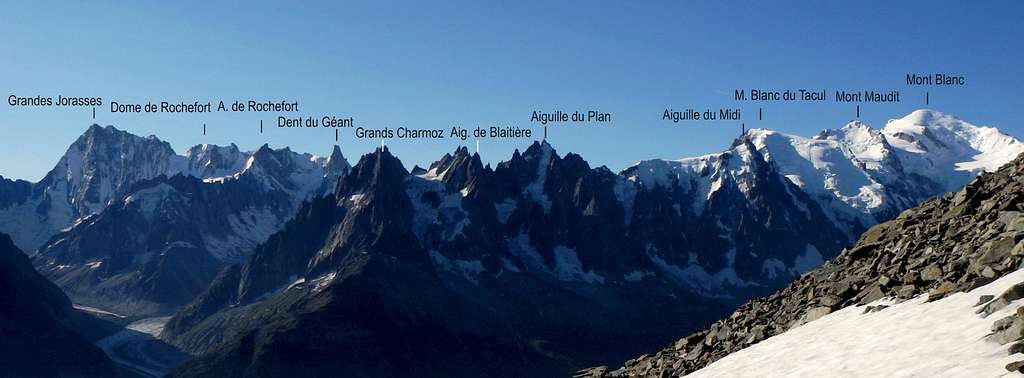
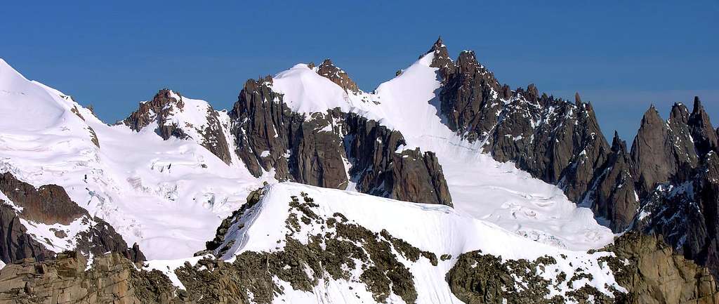
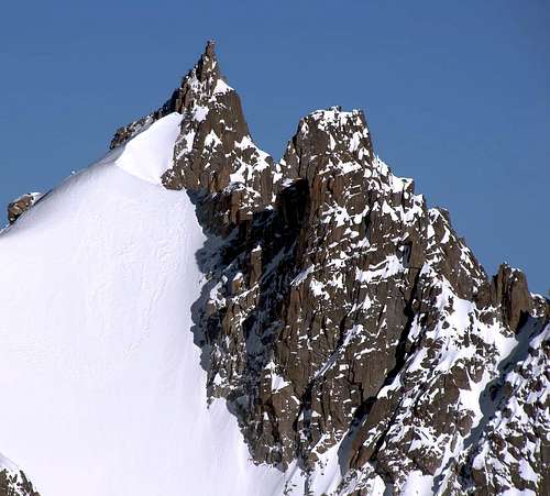
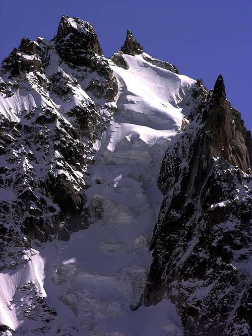
Aiguille du Plan 3673 m
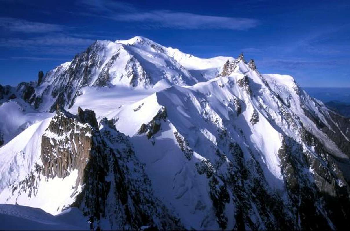
The Aiguille du Plan is a summit belonging to the Mont Blanc group and situated in the French side of the massif. When standing in Chamonix town and looking up towards Mont Blanc, one of the most striking features is the line of jagged needles that make up the skyline to the left of Mont Blanc main summit. It's called the Aiguilles de Chamonix, including the peaks lined up on the ridge overlooking the valley of Chamonix, between Montenvers and Aiguille du Midi. Right in the center, and bracketed by the Aiguille de L’M on the far left and the Aiguille du Midi on the far right, it stands the Aiguille du Plan.
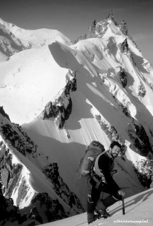
The Aiguille du Plan is probably well known above all as the destination of the classic Midi-Plan traverse. The route and the summit of the Aiguille du Plan offer spectacular views over the surrounding mountains, the Vallée Blanche and the Chamonix valley itself.
Getting There
The Aiguille du Plan is part of the Mont Blanc Massif.
From France:
1. You reach the Chamonix Valley by train:
a. From Martigny (Switzerland) via Vallorcine
b. From Geneva (airport) via Anncey (TGV till here) and St. Gervais
2. You reach the Chamonix Valley by bus:
From/via Annecy, Geneva, Grenoble, Courmayeur, Aoste and Turin
3. You reach the Chamonix Valley by car:
a. From Geneva (from the NW) on the A40 till St. Gervais and from here on the N205.
b. From Martigny (from the NE, Switzerland) via Vallorcine and the Col des Montets on the road no. N506.
From Italy:
7. You reach Courmayeur by bus or car:
a. From Chamonix through the Mont Blanc Tunnel from the NW.
b. From Torino (from the SE) on the A5 via Villeneuve.
Routes
Some of the more well known routes on/to the Aiguille du Plan are:
1. Midi-Plan traverse, PD/PD+.
2. Ryan-Lochmatter Ridge D/D+
Alternatively, some North face routes for the hard men and women:
1. North Face Direct, ED2
2. North-West Ridge Integral,TD+
3. Lagarde-Segogne Couloir, TD+
Red Tape
No fees no permits required
When To Climb
Climbing is possible all year round – weather permitting – but the main summer climbing season runs from June to middle September
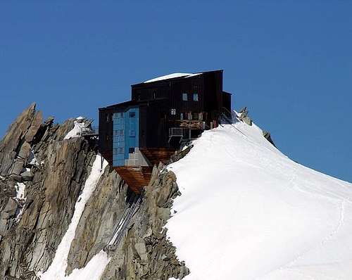
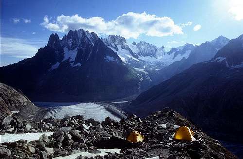
Huts
The most obvious refuges relevant to the Aiguille du Plan are:
- Refuge du Requin
- Refuge des Cosmiques
3. Not really Refuge status, but close to the Cosmiques, is the Abri Simond Bivouac.
Other accomodation
In addition to the mountain huts there is plenty of accomodations in Chamonix Mont Blanc, a primary destination offering several possibilities (hotels, huts, gites, renting rooms). Numberless campsites are situated both in the Northern and Southern ends of the town.
Main campsites:
- Camping Glacier d'Argentière
- Argentière (8 km. North to Chamonix) +33(0)450541736
- Camping la Mer de Glace
- Les Praz (3 km. North to Chamonix) +33(0)450534403
- Camping les Deux Glaciers
- Les Bossons (3 km. South to Chamonix) +33(0)450531584
- Camping les Arolles - close to the centre of Chamonix - +33(0)450531430
- Camping les Cimes
- Les Bossons (3 km. South to Chamonix) +33(0)450535893
- Camping les Marmottes - +33(0)450536124
Meteo and Mountain Conditions
Chamonix Meteo
Meteoswitzerland
Office de Tourisme, Chamonix:
(phone) +33 4 50 53 00 24
(web) www.chamonix.com
Webcams:
http://www.webcam-montblanc.com/
http://www.chamonix.net/francais/webcam/chamcam.htm
Guidebooks and Maps
Institut Géographique National (IGN), map number: 3630 OT Chamonix (1:25000)
External Links
- Office de la Haute Montagne de Chamonix Phone +33 0450 532208 - - Office de la Haute Montagne de Chamonix
- Cable-car informations Phone +33 0450 532275 Compagnie du MontBlanc
- Office du Tourisme de Chamonix Phone +33 0450 530024 Chamonix Mont-Blanc