
-
 51302 Hits
-
 86.37% Score
-
 22 Votes
|
|
Mountain/Rock |
|---|---|
|
|
47.45606°N / 121.38917°W |
|
|
Download GPX » View Route on Map |
|
|
King |
|
|
5890 ft / 1795 m |
|
|
Overview
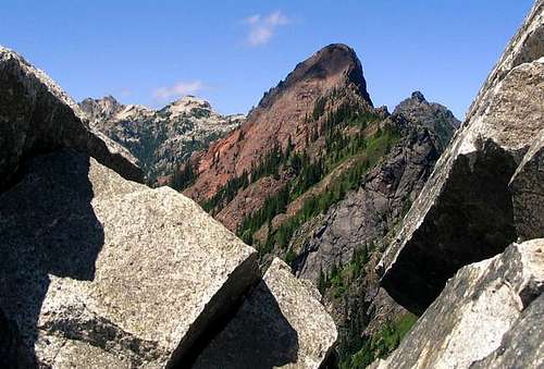
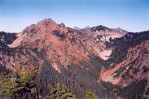 Red Mountain Above Commonwealth Basin
This mountain gets its name from the obvious red color of the rock that it is composed of. As you may already know, red rock in the cascades is usually an indicator of poor quality with multiple intersecting fracture lines. Fortunately the standard route is not steep enough for this to matter. Also enough folks scramble up to the summit each year that most of the loose stuff has been knocked out of the way. In any case, if there are climbers above you, beware of tumbling rocks.
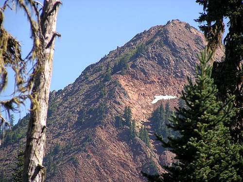 The Southwest Ridge and West Slope (left)
Red Mountain is one of many in the 5500 to 6500 foot level in the Snoqualmie area. To climb Red Mountain only requires 2900 feet of elevation gain. This makes it possible to do multiple ascents in one day. If you are feeling ambitious, Lundin Peak (technical) and Kendall Peak are the most obvious choices but combining with Snoqualmie Mountain is another possibility.
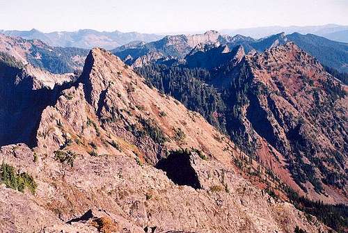 Red Mountain And Kendal Peak Seen From Lundin Peak
The first 4.5 miles or so of the route has a gradual 2000 foot elevation gain, but the last half mile on the west slope contains 900 feet or elevation gain and is a very enjoyable rock scramble at an inclination between 30-40 degrees nearly all the way to the summit. This scramble alternates between Class 2 and Class 3. The use of hands is only needed some of the time. There's no real exposure to worry about either.
Driving Directions
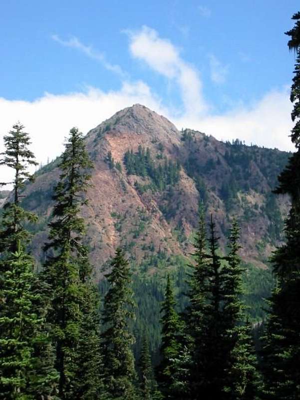 Red Mountain Seen From Commonwealth Basin
From Seattle, take I-90 E to Exit 52. Turn left at the stop sign and cross under the freeway. Take the spur road immediately on your right and shortly thereafter, another right will lead to the parking lot for the PCT. This is a big parking lot with one public toilet. Free back country access permits are provided at the trail head. An alternative parking location would be the Summit West parking lot on the south side of the freeway. Parking there does not require a Northwest Forest Pass. Another benefit of parking at the Summit West lot is that your car will be out in the open and less likely to be broken into. If you park there, follow the PCT a short distance to the official trail head.
Standard Route
Getting to the base of the mountain takes most of the time and effort. There are two ways to go from the same parking lot. Most people ride the Pacific Crest trail all the way but there is a nice shortcut option on the old Cascade Crest trail.
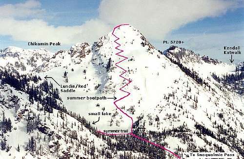 The Upper Route
Cascade Crest Shortcut (7 miles round-trip)
From the parking lot follow the broad PCT east for a hundred yards or so. Watch for a sign on a tree in the path that says something about livestock. I think there is a symbol for a horse on the sign. Just past this sign on the left is the first junction. Turn left onto this unmaintained section of the old Cascade Crest trail. This will cut off an extra mile each way and save some elevation gain.
Follow the rocky path to where it crosses Commonwealth Creek. There are two crossings. Just before the first crossing, a small offshoot path leads down to the left where you can view a small waterfall and pool. A quarter mile beyond the second creek crossing, you reach the Commonwealth Basin trail. Turn left towards Red Pass and Red Mountain. Continue up to a small basin at the base of the mountain.
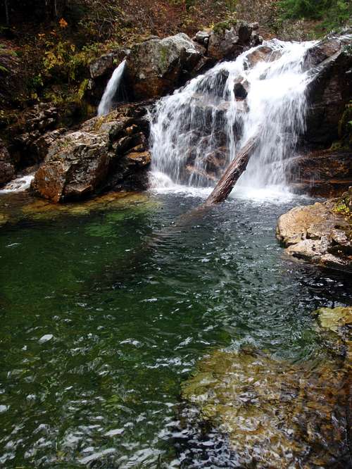 Commonwealth Creek Falls And Pool
If you come to the small pond, you've probably gone 300 yards too far. Before the pond, where the trail levels out a bit, look for a cairn right in the middle of the path. Even if the cairn has been removed, there should still be a large rock right in the middle of the path (this may also have been removed recently). This is where the scramble route begins. Turn off the trail and ascend a boot path for as long as possible. At some point the rough boot track will become difficult to see and follow. When this happens, just scramble up to the summit. The boot track is easier to follow on the way down.
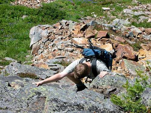 Easy Scrambling
Pacific Crest Trail (9 miles round-trip)
I'm not sure why anyone would want to go this way since it is unnecessarily longer but here you go. From the parking lot, follow the newer rerouted Pacific Crest Trail (PCT) 2 miles to a junction. Turn left onto trail 1033, Commonwealth Creek Trail, towards Red Pass and Red Mountain. If you end up going downhill, you are going the wrong way. Follow this trail up to a small basin at the base of the mountain.
If you come to the small pond, you've probably gone 300 yards too far. Before the pond, where the trail levels out a bit, look for a cairn right in the middle of the path. Even if the cairn has been removed, there should still be a large rock right in the middle of the path (this may also have been removed recently). This is where the scramble route begins. Turn off the trail and ascend a boot path for as long as possible. At some point the rough boot track will become difficult to see and follow. When this happens, just scramble up to the summit. The boot track is easier to follow on the way down.
When To Climb
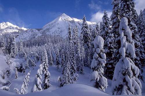 Red Mountain In Winter
The best climbing season is June through October just like most other mountains in the Washington cascades. A winter ascent is possible but with the slope of the mountain being 30-40 degrees avalanche danger can be high at times.
mvs adds: "Winter is actually a very good time to climb the mountain, but be certain that avalanche danger is low. You want cold and clear conditions, and you should get a pre-dawn start. It is not steep enough to require a second tool, but knowledge of crampons and ice axe are important."
Also beware of cornice danger on or around the summit. A tragic accident happened on February 1st of 2011. Ski-mountaineer Monika Johnson was killed when she walked out onto the cornice and it broke off. She fell 800 feet to her death.
Camping / Red Tape
 Red Mountain Seen From The Kendall Katwalk
There are some nice camping options in the surrounding area but really Red Mountain is only a day trip. If you plan to combine it with some of the other peaks in the area, camping might be a reasonable option.
A Northwest Forest Pass is required to park at the trail head. Also, a free, self-serve permit is needed to enter the Alpine Lakes Wilderness (located in the wooden box).
External Links
- December 2001 Trip Reprot by Alex Krawarik
- July 2006 Trip Report by Sadie's Driver
- August 2008 Trip Report by Foist
- August 2008 Trip Report by The Angry Hiker
- July 2010 Trip Report by Bryan K
- August 2010 Trip Report by Karen P
- December 2010 Trip Report by Rainie Too!
- July 2011 Trip Report by woutervw