|
|
Mountain/Rock |
|---|---|
|
|
47.89745°N / 90.56057°W |
|
|
Cook |
|
|
Hiking |
|
|
Spring, Summer, Fall, Winter |
|
|
2301 ft / 701 m |
|
|
Overview
Eagle Mountain is the highest natural point in Minnesota. Although a State Highpoint and only having a modest elevation of 2301', the mountain has multiple other interesting attributes for peakbaggers. Despite its short elevation, the peak has a surprising 1321' of clean prominence as well as 437 miles of isolation from the nearest higher ground (found west of the peak, in the central region of North Dakota). In fact, the peak is the 9th-most isolated peak in the entire United States.
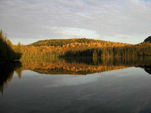 Eagle Mountain, Seen From East Of Whale Lake
Of the 82 USA county highpoints bordering the Great Lakes, Eagle Mountain is the highest peak. The mountain is also the highest point of Superior National Forest and Boundary Waters Canoe Area Wilderness. Despite being the highest point in Minnesota, the peak is located only 15 miles from the state's lowest point (Lake Superior, 600').
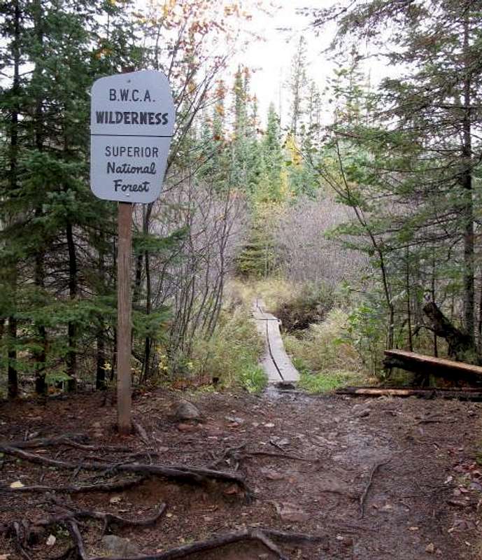 Entering Wilderness Area
To reach the summit of Eagle Mountain only requires a modest hike with no special gear required. Although the route is fairly straightforward, the sometimes rocky and rough terrain makes some people consider this to be a moderately strenuous hike for which sturdy footwear is highly recommended. The mountain has been summited during all seasons but snowpack during Winter months can make access more restrictive. During the other seasons of the year, the summit approach is a boggy area full of flying (and many times biting) insects.
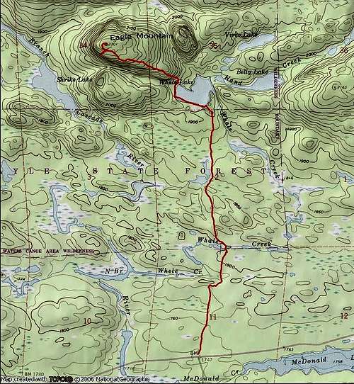
Getting There
STARTING AT HIGHWAY 61 IN LUTSEN, MINNESOTA:
1) Just east of town, turn left (north) onto County Road 4, also known as Caribou Trail. The road junction is well-signed, such as "Caribou Trail" or "State Trail Access."
2) Drive Caribou Trail for 17.7 miles, until its end at a "T" intersection with Forest Road 170 (a.k.a. "The Grade").
NOTE: Only the first 3.7 miles of Caribou Trail are paved but the remaining 14.0 miles is good gravel that should be accessible by most street legal vehicles.
3) Turn right at the "T" intersection onto Forest Road 170 ("The Grade").
4) After 3.8 miles along Forest Road 170, turn left at a road junction (with Bally Creek Road), with signage leading towards the Eagle Mountain Trailhead parking area.
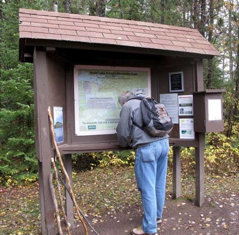 Eagle Mountain Trailhead Kiosk
Hiking Directions
As mentioned earlier, permits are required for all visitors and a permit kiosk is located at Eagle Mountain Trailhead (1747' elevation).
1) During the first two miles of Eagle Mountain Trail, the trail has little elevation gain and begins in thick forest. Soon, the area becomes full of lowland bogs, and wooden plank walkways are present for the major bog crossings. The trail is very rocky and rugged in multiple areas.
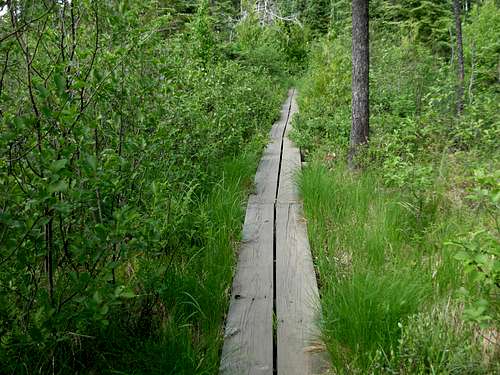 Wooden Walkway Over Bog
2) After the first two miles, Eagle Mountain Trail passes along the southern and then western shore of Whale Lake. A minor forested hilltop can be seen north of the lake, which many people confuse with Eagle Mountain but is actually a hill located east of Eagle Mountain.
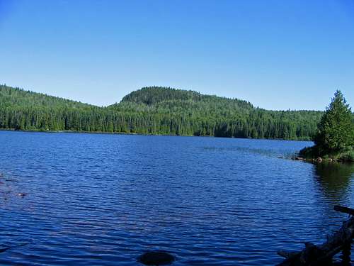 Unnamed Hill North Of Whale Lake
3) Near the northwest corner of Whale Lake, only several minutes after passing a campsite sign, a trail junction is encountered. Turn left at the trail junction to remain on Eagle Mountain Trail.
NOTE: Turning right marks the beginning of Brule Lake Trail.
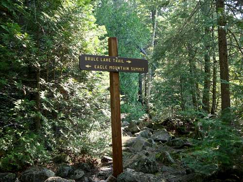 Trail Junction NW Of Whale Lake
4) From Whale Lake (1900' elevation), the trail briefly steepens for the first few hundred feet of gain. Two fantastic viewpoints are passed while en route to the summit.
HELPFUL HINT: Some ascending hikers have been known to lose sight of the summit trail while crossing the rocky fields near the top of the peak. If a person loses track of the official trail at the first rock field, cross the first rock field "horizontally" and the trail should soon be found again. The trail starts to circle upward. If the trail is lost again at the second open rock field, the general route goes right up the hill. Some tree blazes and rock cairns might be present, helping lead the way. Near the top of the rocky slope, the summit trail is reached and becomes more identifiable, and the summit is only a short distance further. The descent route tends to be much easier for hikers to follow the trail than during the ascent.
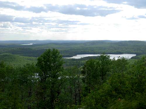 Great Viewpoint!
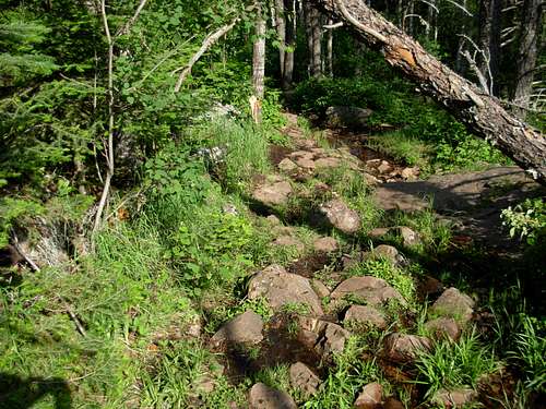 Rocky Trail Section
5) The summit (2301' elevation) is reached in a semi-wooded area. A large commemorative plaque is located at the summit on a rock that geologists presume to be over one billion years old.
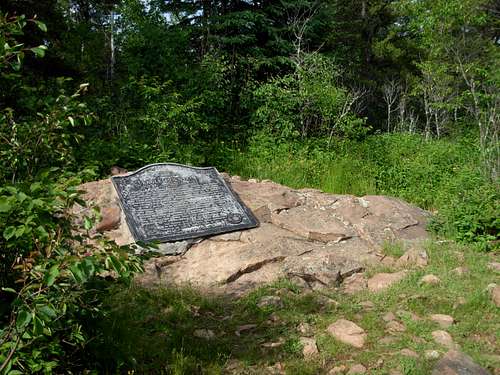 Summit Rock
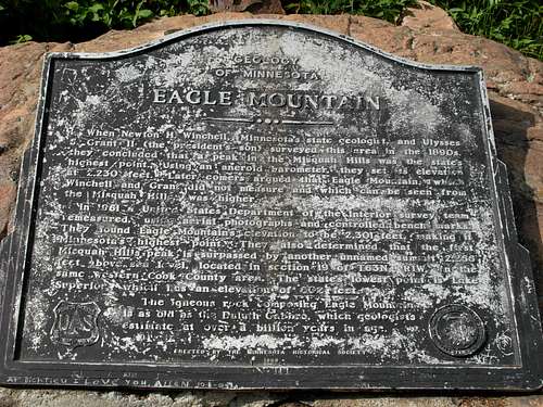 Summit Plaque
HIKING STATISTICS (ONE-WAY): 3.5 Miles with 550'+ elevation gain
 Eagle Mountain Trail
Red Tape
All visitors are required to have a permit when hiking within Boundary Waters Canoe Area Wilderness. A self-issued permit kiosk is located at the Eagle Mountain Trailhead. The permit is free to day hikers but everyone is required to keep permits with them at all times when hiking in the wilderness area.
Wear bug spray during Spring, Summer, and Autumn. That cannot be emphasized enough for this peak and region.
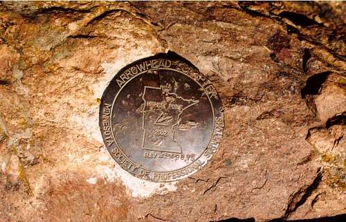 Benchmark Disk Near Summit
When To Climb
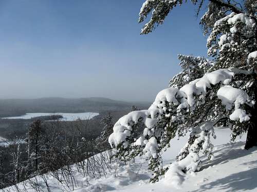
The peak can be climbed during any season. However, considerations should be made in Winter months for long ascents via snowshoeing or cross-country skiing. During other seasons, especially during late Spring through Summer, be prepared for plenty exposure to flying insects.
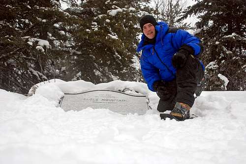 Successful Winter Ascent
Camping
The only designated camping location in the area is a short walk west of Whale Lake. Two campsites are at that location. However, potential campers must obtain a proper overnight permit from the Forest Service office in the town of Tofte.
Mountain Conditions
If planning a visit during Winter season, it is recommended to contact in advance the Grand Marais Visitor Center: 888-922-5000