
|
|
Mountain/Rock |
|---|---|
|
|
38.52729°N / 109.23369°W |
|
|
12200 ft / 3719 m |
|
|
La Sal Mountains Overview
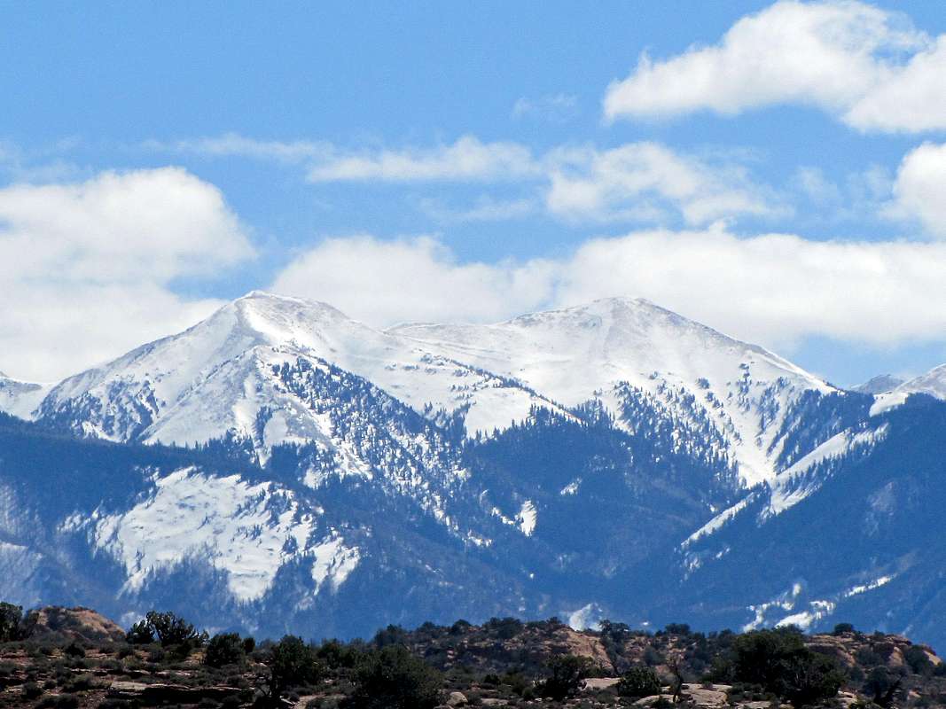
Right to left: Pilot Mountain, Green Mountain & Mt. Waas
Click to see an Overview Photo of the La Sal Mountains.
The La Sals are a small mountain range in eastern Utah covering an area 25 miles long (north-south) by 15 miles wide (east-west). They are, however, Utah's second highest range (after the Uintas) and contain twelve peaks higher than 12000 ft (highest point: Mt. Peale 12721 ft). With their lush forests and cool summer temperatures, they are in sharp contrast to the hot, arid canyonlands of eastern Utah and provide an excellent background for the dramatic scenes of Arches and Canyonlands National Parks. Two high passes, La Sal Pass (10125 ft) and Geyser Pass (10538 ft) divide the mountains into three distinct groups: north, middle and south.
North has seven 12ers:
Rank....................Peak
4...........................Mt. Waas (12331 ft)
5...........................Manns Peak (12272 ft)
7...........................Mt. Tomasaki (12239 ft)
8...........................Pilot Mountain (12200 ft)
9...........................Green Mountain (12163 ft)
11.........................Castle Mountain (12044 ft)
12.........................La Sal Peak (12001 ft)
Middle has five 12ers:
Rank....................Peak
1...........................Mt. Peale (12721 ft)
2...........................Mt. Mellenthin (12645 ft)
3...........................Mt. Tukuhnikivatz (12482 ft)
6...........................Mt. Laurel (12271 ft)
10.........................Little Tuk (12048 ft)
South has no 12ers:
Rank....................Peak
17.........................South Mountain (11817 ft)
(R) Pilot Mountain, (L) Green Mountain, northwest face as seen from Porcupine Rim Trail
Canyon Country's "La Sal Mountains, Hiking and Nature Handbook" by Jose Knighton, with its accompanying map, provide an excellent guide. Make sure you buy the map. Without it, the book becomes confusing.
 |  |  |  |  |
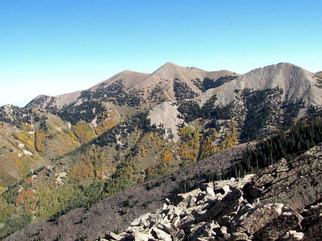
Pilot Mountain in the middle of the picture, Green Mountain to the left of it, south face
Pilot Mountain Overview

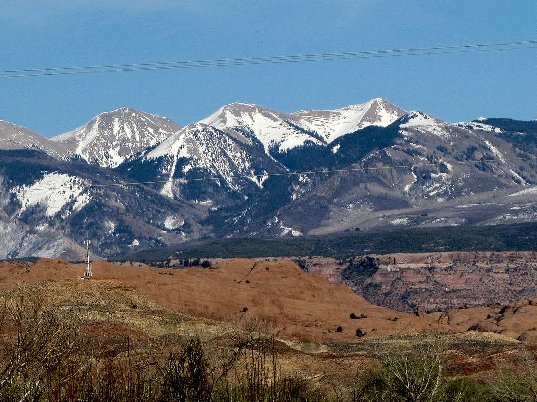
Colorado River & Pilot Mountain (3rd peak from right)


Click to see a picture of PILOT MOUNTAIN from the summit of Manns Peak.
Pilot Mountain, along with Green Mountain (12163 ft) and Dry Peak (11849 ft), create a ridgeline that connects Manns Peak to Mt. Waas. The very tops of Pilot and Green Mountains are rounded hill-tops that are easy to climb (depending on the route, the lower slopes may be more difficult). Pilot Mountain can be easily combined with Green Mountain. Extending the hike to Manns Peak or Mt. Waas will involve steep scree and is more difficult to do.
From the town of Moab, the shortest way to reach the summit of Pilot Mountain is via its western slopes. To the east, a high valley known as Beaver Basin provides an attractive alternative. This basin is drained by Beaver Creek to the northeast. A Four Wheel Drive road that follows Beaver Creek provides access into the heart of the mountains. The basin sits at an elevation of more than 10300 ft and is surrounded by the following mountains: The Red Wedge (11641 ft), White Knob (11601 ft), Manns Peak (12272 ft), Dry Peak (11849 ft), Pilot Mountain (12200 ft), Green Mountain (12163 ft) and Mt. Waas (12331 ft). A lush pine forest interspersed with occasional meadows covers the basin.
From the summit of Pilot Mountain one could see 11 of the 12 highest peaks of the range. Arid lowlands/canyonlands are well visible on all sides beyond the adjacent peaks.

From Shafer Canyon Overlook
Getting There


To reach Beaver Basin, take Route 128 eighteen miles from downtown Moab to Castle Valley Road. Turn south on Castle Valley Road, travel it 11 miles and then turn east on Castleton-Gateway Road. Take this road 9 miles to Beaver Basin Spur Road (pavement ends after a few miles on Castleton-Gateway Road).
Beaver Basin Spur Road heads southwest and follows the Beaver Creek to Beaver Basin. After 1.5 miles, the road becomes 4 wheel drive. I chose to park there (8760 ft) although the road was not too bad by 4WD standards. The summit of Pilot Mountain is 5 miles from the beginning of the 4WD road.
 |  |  |  |  |
Red Tape
No fees or permits required for day hikes. For all other rules and regulations, see the site for |  |
MoabPeakBagger - Oct 28, 2003 11:21 pm - Voted 5/10
Untitled CommentMost people do not approach the La Sals from Beaver Basin-- it is quite remote and also 4WD-- a limiting factor. A popular approach to Pilot Mtn is from the Oowah Lake/Warner Lake Areas. Many folks take the trail up to the Gold Knob Divide, and then ascend Pilot Mountain along the long southwestern ridge. The last part of the hike is a bit of a scramble over some VERY steep talus, but the summit is quite rewarding.