
|
|
Mountain/Rock |
|---|---|
|
|
37.88921°N / 107.53357°W |
|
|
Mountaineering |
|
|
13807 ft / 4208 m |
|
|
Overview
Niagara on the left
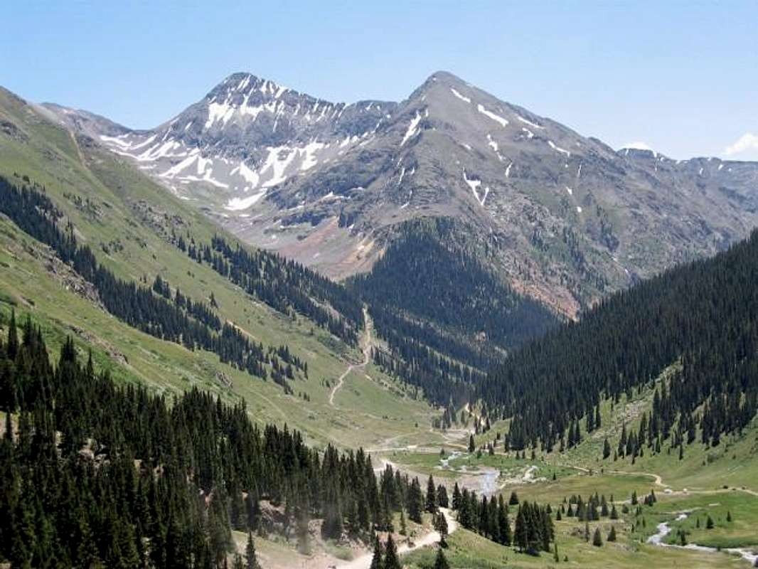
Niagara Peak and Jones Mountain (13860 ft) are two high 13ers that rise on opposite sides of Burns Gulch, a minor branch of the Animas River in the San Juan Mountains of southwestern Colorado. A 13200 ft saddle at the southeastern end of Burns Gulch separates Jones from Niagara.
Niagara is a triangular summit with a very impressive wall/steep rocky slope that dominates the view from Burns Gulch. The main route, however, is non-technical. The summit provides a bird's eye view of the Weminuche Wilderness and the heart of the San Juan Mountains.
Jones and Niagara are both easily accessible from the town of Silverton. I did not see anyone while I was on this mountain. The summit registry, however, seemed to indicate that during summer, the mountain is usually climbed a few times a week.
 |  |  |  |  |
Getting There
Directions to Burns Gulch Road:From Durango drive 50 miles north on Route 550 (or 60 miles south from Montrose) to the town of Silverton (elevation 9318 ft). Take Route 110 through Silverton. At the end of town make sure you turn right or the road will take you to the ghost town of Gladstone. Follow Route 110 eleven miles past the ghost towns of Howardsville and Eureka to the well-marked turn off for Burns Gulch on the right side of the road (Route 110 is a well-graded dirt road that is passable by most/any car. Beyond Burns Gulch, Route 110 becomes 4 Wheel Drive and goes to Lake City via Engineer Pass).
 |  |  |  |  |
Burns Gulch Route
Trailhead elevation: 10740 ft (3273 m)One way distance per my GPS: 2.9 miles (4.66 Km)
Follow a rough 4 Wheel Drive road up Burns Gulch through stands of pine trees into a basin above timberline between Niagara on the right and Jones on the left. The road gradually fades away at around 11800 ft.
You may not find a well-marked trail at the end of the road but the route to the saddle is obvious. To avoid trampling the delicate alpine tundra on the left side of the drainage, hike over the scree slopes on the right side. Near the saddle, go to the left where you will find a well-established trail. Follow this trail in order to avoid the loose crumbly bands of cliff below the saddle. Once on the saddle, a faint trail will lead you to the summit. You will encounter more rocky crumbly areas after the saddle but these are not difficult to pass.
Red Tape
No fees or permits required.
Camping
Available in Silverton 11 miles away.

When To Climb
Click to see the forecast for the nearby town of Silverton.Easiest in summer.
 |  |