
-
 16518 Hits
-
 83.1% Score
-
 16 Votes
|
|
Mountain/Rock |
|---|---|
|
|
37.22890°N / 118.7215°W |
|
|
12488 ft / 3806 m |
|
|
Overview
Wahoo Peak (Peak 12,498') is the high point of a northerly spur of the Glacier Divide on the border of Kings Canyon National Park, in the Sierra Nevada of California.
This oblong pyramid of a mountain is a striking sight from most locations in the Humphreys Basin. Rising above Lower Golden Trout Lake, it's north face is banded and heavily fractured. The northeast and northwest ridges drop gracefully from either side of the north face, terminating on a bench above Lower Golden Trout Lake. The peak's location, just north of the Glacier Divide, affords wonderful views of the Humphreys Basin and close-up views of the Glacier Divide peaks. A few dozen parties climb this peak every year.
The easiest route, the Northwest Ridge, leads quite directly to an impressive, pointy summit. The summit register contained comments to the effect that the Northeast Ridge is also an excellent Class 3+ route.
The first recorded ascent of this peak was made by Glen Dawson and Neil Ruge, July 11, 1933 ("Peaks, Passes, and Trails" P 298).
Approach to the Northwest Ridge route from Muriel Lake
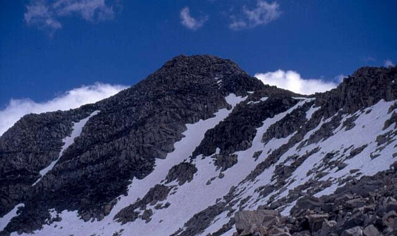
The north face and Northwest Ridge (right)
Getting There
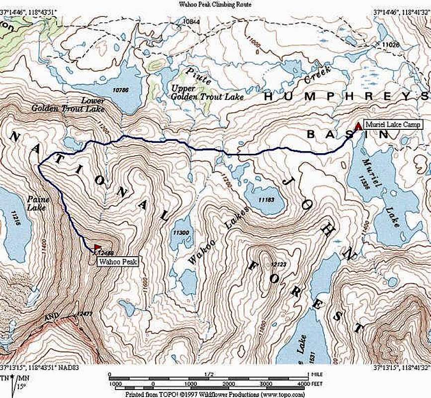
From Highway US-395 in Bishop, drive up Highway CA-168 to the North Lake turn-off, just before Lake Sabrina. Park in the hiker parking area, about 1/2 mile below the campground. Hike through the campground and up the Piute Pass Trail and over Piute Pass. Continue down the Piute Pass Trail to a faint use-trail going left (south) past Lost Lakes and on to Muriel Lake. From the outlet of Muriel Lake, hike cross-country, heading west, toward a bench beneath the north face of the peak. Pass a small lake on the west end of the bench and gain the obvious northwest ridge.
 |  |  |  |
Red Tape
For day hikes, no permit required. For overnight stays, obtain a free wilderness permit at the White Mountain Ranger Station, 798 North Main Street, Bishop, CA 93514, phone number is 760-873-2500.
For more info, visit the Eastern Sierra Nevada Logistics Page.
When To Climb
Best season is early June to mid October. Earlier than June, use skis or snowshoes to approach. November to January may have some snow, but not enough to ski.
 |  |  |  |  |
Camping
Best camping is between Muriel Lake and the bench below the peak, especially on the bench near the small lake. Fair camping is available at Muriel Lake, but can be crowded. Fair camping is also available in the vicinity of Lower Golden Trout Lake.
Further Reading
Eastern Sierra Nevada Logistics Page (highly recommended)
The High Sierra: Peaks, Passes, and Trails 2nd ed. (R. J. Secor) - P 298 - Listed as "Peak 12,488ft"
The Climber's Guide to the High Sierra (Steve Roper) - P 157 - Listed as "Peak 12,498"