
|
|
Mountain/Rock |
|---|---|
|
|
45.03710°N / 111.4591°W |
|
|
11293 ft / 3442 m |
|
|
Overview
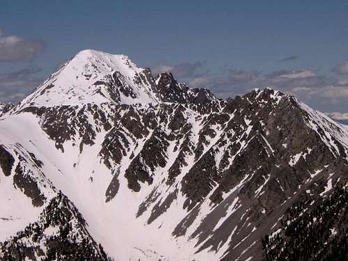
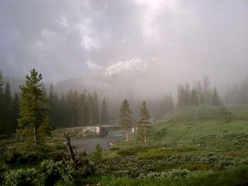
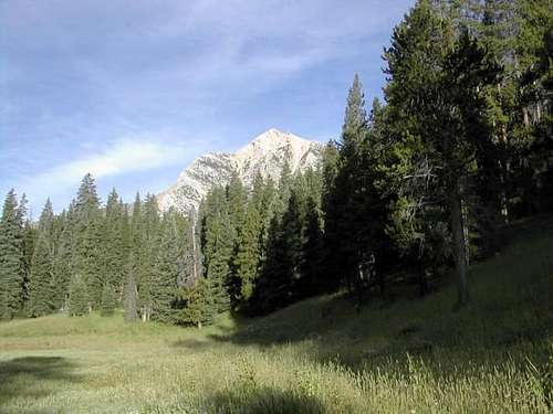
Koch Peak is a beautiful, rocky mountain peak located in a very isolated area in southwestern Montana. It is within Gallatin National Forest and is part of the Taylor Peaks (& is the highest of the Taylor Peaks) located in the Madison Mountain Range. This area has the highest concentration of Grizzley Bears in the lower (48) states. There is plenty of other wildlife as well. The beginning of the climb goes through densely forested areas with beautiful creeks and waterfalls. As you ascend up the mountain, it opens up, and becomes scree slopes.
Anyone attempting Koch Peak should bring USGS topo maps. The roads and trails are poorly marked and without the maps, we would have been lost.
You will need the following USGS maps:
Lincoln Mountain, Montana
Koch Peak, Montana
The total elevation gain starting from Taylor Fork parking is 3,993 feet. Allow approximately (3) to (5) hours for ascent time. Climbing along the southeast ridge is a class 2 climb.
Getting There

Red Tape
Permits, parking passes, etc. are not required to climb Koch Peak.Go to links for additional information on Gallatin National Forest or try this web-site:
www.fs.fed.us/r1/gallatin/
When To Climb
June, July, August, & September is the normal season for climbing in Southwestern Montana.
Camping
There are numerous campsites along the gravel road located between highway 191 and Koch Peak. Be extremely careful with grizzly bears. Remember that this area has the highest concentration of Grizzly Bears in the lower (48) states.Mountain Conditions
Grizzly Outfitters were very helpful and knowledgable about the mountain and conditions. They can reached at:406-995-2939
888-807-9452
www.grizzlyoutfitters.com (or go to the links on this page)
info@grizzlyoutfitters.com
Need Gear ?
If you are in need of climbing gear, there are (2) climbing shops located in Bozeman, Montana (about 1/2 hour north of the Taylor Road turn-off). I have posted links for both in the links section. They are Barrel Mountaineering and Northern Lights Trading Company. Both shops have an excelllent selection of gear as well as local knowledge.Weather Forecasts
External Links
- Gallatin National Forest
- Grizzly Outfitters
Local supply shop for mountaineering gear.
- Barrel Mountaineering
Climbing gear and local information.
- Northern Lights Trading Company
Climbing gear and local information.
Alcas24 - Aug 22, 2009 12:34 am - Hasn't voted
Road ConditionsJust wanted to update the road conditions. There has been alot of work done on the road and I would not hesitate to drive a standard passenger car up there. There is also a new, public bridge so the trailhead has moved to the other side of the creek. To get to the trailhead, drive past the "9" something or other ranch, take a left at the signed junction for Lightning Creek, in 2 miles the road forks and you go left and quickly cross the Taylors Fork and park at the signed trailhead, "Upper Taylor Fork Trail" I believe.