
|
|
Mountain/Rock |
|---|---|
|
|
43.96720°N / 71.5586°W |
|
|
4003 ft / 1220 m |
|
|
Overview
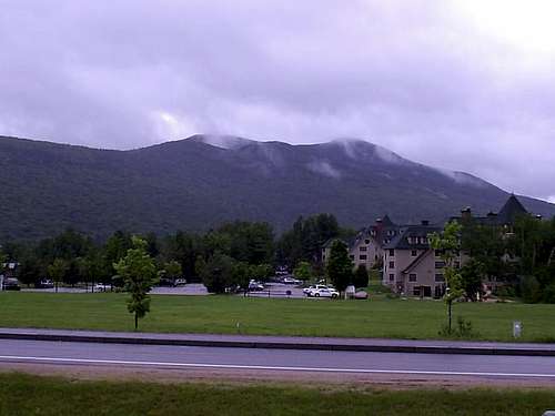 Mount Tecumsah from Waterville Valley
Mount Tecumseh is the smallest of the official New Hampshire 4000 footers, and is an easy hike. The mountain is a nice place to introduce your skeptical friends and family members to the high peaks of New Hampshire, and is a fairly easy hike from either approach. The eastern approach is hardly rustic; Waterville Valley is a developed ski area, with its facilities on Mount Tecumseh. However, the approach from Tripoli Road is unfettered by civilization.
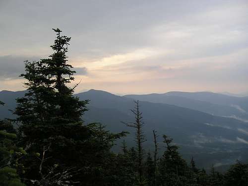
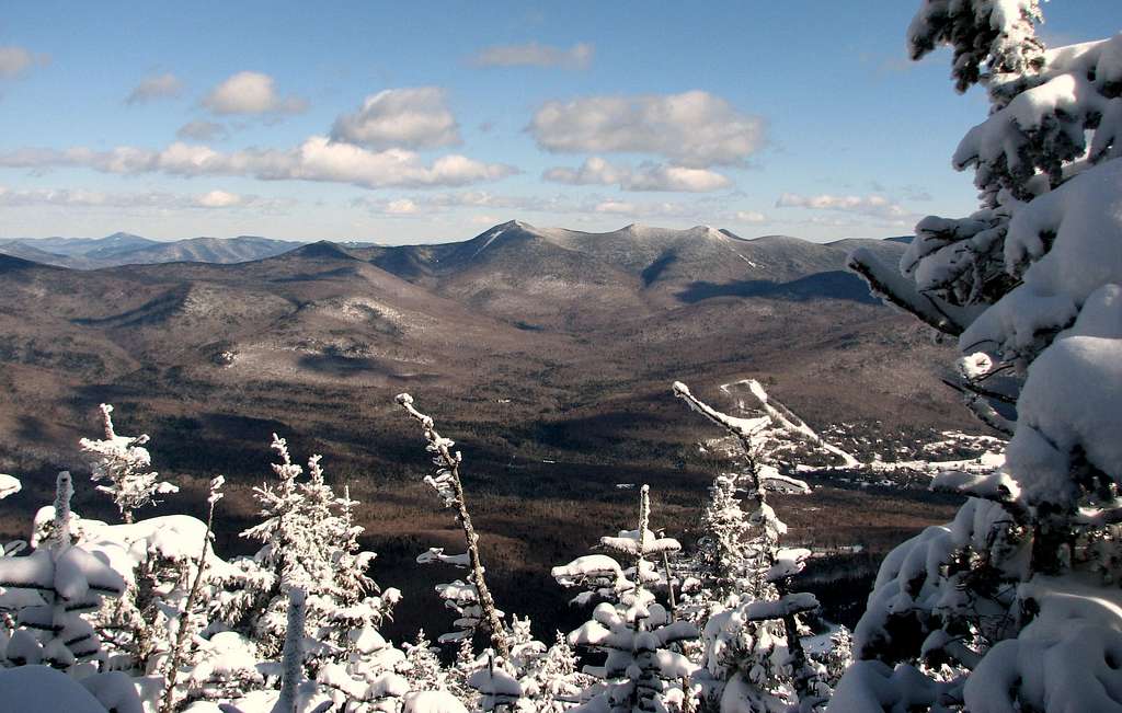 View from the summit area
The views from the summit are limited, but peek-a-boo views give glimpses of the Tripyramids, Osceola, the Franconia Range with Mt. Lafayette, Moosilauke, and the Kinsmans, as well as the lesser peaks in the area. The views have been rapidly expanding due to the fact that someone has been cutting down some of the trees on the summit. As the hike is a short one; ambitious peakbaggers can add Mt. Tecumseh to a day of climbing the Osceolas or the Tripyramids.
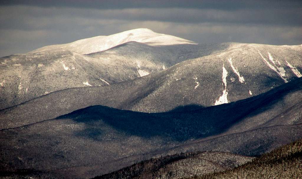 Winter view of Mount Washington
Mount Tecumseh is named for the great Shawnee native American leader, who tried to unite native American tribes in the early 1800s to resist the colonialists. Tecumseh fought alongside the British during the War of 1812, successfully raiding in Ontario and Michigan. He was killed in the Battle of the Thames, near Thamesville, Ontario, on October 5, 1813.
Getting There
Depending what you are in the mood for, there are two approaches to this peak. From the south Take I-93 North to the Campton exit, Route 49 / Waterville Valley. Follow Route 49 through the town of Campton, and take a left at the sign for the Waterville Valley Ski Lodge; follow this around to the right hand side, you will see the trail head sign, about 120 yd. from the main lodge. This leads you to the more populated, shorter approach, near the ski area.
For a more rustic approach, take I-93 to Exit 31, Tripoli Road. Follow Tipoli Road to the trailhead on the right hand side, just before the parking for Osceola. NOTE: Tripoli Road is closed in the winter.
The Trails
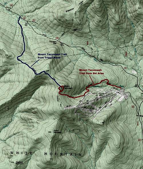 Mount Tecumseh Map
The Mount Tecumseh Trail runs from the Waterville Valley Ski Area, over Tecumseh, and on to Tripoli Road. Parking is available at both ends. The trail does not afford much of a loop, since the trail runs parallel to Tripoli Road; the return would be a lengthy walk along this dirt road. From the ski area to the summit, the distance is 2.5 miles, and the trail ascends 2200 feet. From the Tripoli Road parking lot, the distance to the summit is 3.1 miles, and the trail ascends 2400 feet. As mentioned above, the latter route is the more rustic, as it is away from the ski area. There are ledges along this route with views to the west and north.
The Sosman Trail connects the summit with the ski trails. The trail is easier to follow down than up; finding the trail on the way up the slopes can be tricky. The distance from the summit to the top of the trails is .8 miles, and to the base, a total of 2.6 miles.
Red Tape
Parking on the ski area side should be free, but off Tripoli Road expect to pay $3.00 per day for parking, or to display your U.S. Forest Service pass. Click here for more information on U.S.F.S. parking regulations.
Camping in the White Mountain National Forest is governed by National Forest Service rules. Forest Protection Areas, near trailheads and accommodations, which are clearly marked, are heavily restricted. Check the rules for other restrictions.
In general: No camping above treeline, except in winter and then only when there is two feet of snow on the ground. No camping within 1/4 mile of established huts, campsites, trailhead, or certain roads. Bring a camp stove and avoid open fires. Camp away from water.
When To Climb
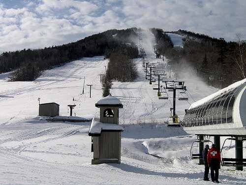 Mount Tecumseh is a four season mountain complete with a popular ski area on its eastern side
As with the other White Mountains, Mount Tecumseh is a four season experience. Spring brings mud and high water, though there are no major stream crossings; early summer means bugs; winter means bring snow shoes and crampons and the rest of your usual winter gear. The entire hike is below treeline. Nevertheless, always be prepared for changing weather.
 Summertime views
Camping
The U.S. Forest Service maintains several campgrounds on Tripoli Road and in the Waterville Valley area. Details on the camping and reservations are available through Pro Sports Inc., the campground concessionaire for the White Mountain National Forest.
Additional camping is not far away at the Lafayette Campground in the Franconia Notch State Park off of Route 3.
Back country camping in the White Mountain National Forest is governed by U.S. Forest Service Regulations. Forest Protection Areas are most heavily regulated and are clearly marked. For more information, check here.
Mountain Conditions
Current conditions are available from the Mt. Washington Observatory. Check the Higher Summits Forecast.
Current New Hampshire Trail Conditions: Views From The Top.
Numerous White Mountain resources: Appalachian Mountain Club