
-
 83947 Hits
-
 84.1% Score
-
 18 Votes
|
|
Mountain/Rock |
|---|---|
|
|
48.71547°N / 121.99839°W |
|
|
Whatcom |
|
|
Hiking, Mountaineering, Trad Climbing, Sport Climbing, Scrambling |
|
|
6640 ft / 2024 m |
|
|
Overview
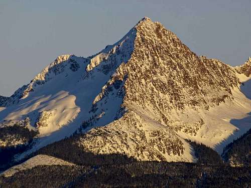 Photo Courtesy Of Grant Meyers
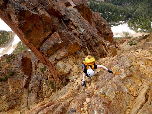
The North Twin is the second highest point in the strikingly jagged ridge known as the Twin Sisters Range, 10 miles southwest of Mount Baker. Pyramid shaped, the North Twin has three ridges which connect directly to the summit area. One to the northeast, one to the southeast which is joined by a saddle to the South Twin, and finally the west ridge. The highly popular west ridge makes the North Twin a major peakbagger destination. This narrow ridge is craggy and enveloped with cracks and features which beg you to place your hands on them. It truly is some of the finest scrambling to be found anywhere in the state of Washington.
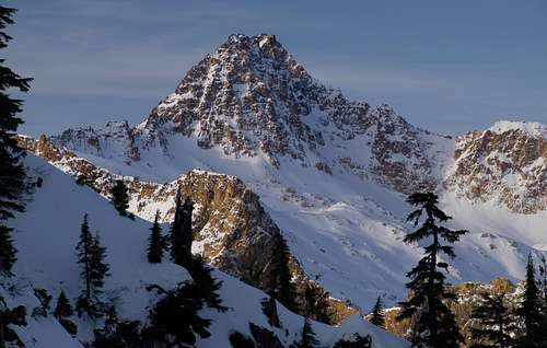 Photo Courtesy Of Grant Meyers
The orange-yellow rock in the Twin Sisters Range is primarily composed of Olivine and is extremely solid. Good holds are frequent and everywhere you place your hands it feels like 50-grit sand paper. The north ridge is snow covered on the average year until late in the season and this is the second most popular route on the mountain. Near the summit it's steep enough that a fall could become serious if a climber failed to arrest. Most climbers prefer to ascend the west ridge and make a quicker descent of the north ridge, glissading in the spots where it is safe to do so.
 |
 |
 |
 |
 |
Getting There
Most climbing routes are approached via Dailey Prairie. Because of the long distance covered on logging roads it is recommended that you take a bicycle so that on the way out you can roll down to your car. Also many stretches of the logging roads can be ridden uphill. There are several different ways to access Dailey Prairie but the best is without a doubt the Middle Fork Road that has access to a bridge which crosses the Middle Fork Nooksack River. This access has considerable less distance and less elevation gain than the other options.
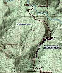 Map 1 |
 Map 2 |
North Access, Middle Fork Road:
- Take Exit 255 off of I-5 (Sunset Drive-Baker Hwy)
- Head East on Hwy 542 for 16.7 miles until you pass milepost 16
- Turn Right on Mosquito Lake Rd
- Follow Mosquito Lake Road for 4.8 miles until just South of Porter Creek
- Turn Left on Road 38 (Middle Fork Road)
- Follow Middle Fork Road for another 4.8 miles turning right at a junction that leads down to the gated bridge
- Call the Olivine Corp. (360) 733-3332 to see if the gate is open. This is unlikely.
 South Twin And North Twin From The East
West Access, Blue Mountain Road via Mosquito Lake (limited access due to frequent road work. Call ahead)
- From Acme on Highway 9 take Mosquito Lake Road 4 miles
- Take Road 4000
- call the Campbell Group at (360) 336-9733
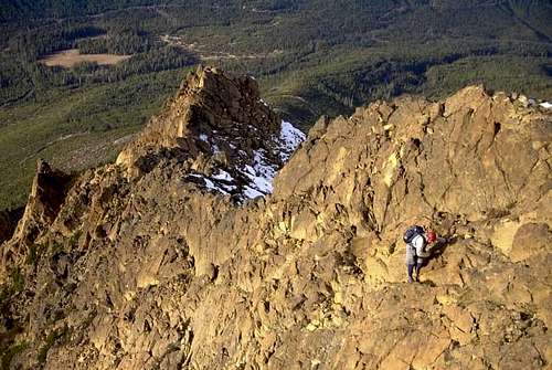 Photo Courtesy Of Lee Jams
South Access, Highway 20:
- At Ensley Road (overpass bridge) in Hamilton Turn North
- In 0.5 miles reach the Crown Pacific Company entrance gate
- Crown Pacific (360) 826-3951
- For more information call (206) 339-5548
No parking passes are required to park at the gate. If the gate is open, enter at your own risk, it may not be open when you leave. Certainly do not block the road anywhere you park or expect to be towed and heavily fined. Relations between climbers, the logging companies that own the roads, and Olivine Corporation who owns the land have traditionally been turbulent, Please do not give them reason to restrict all access to climbers. Keys are no longer given out for the North access (Dailey Prarie) due to concerns of illegal garbage dumping and traffic during mining and logging operations.
The South gate (accessed from Hwy 20) is manned, and they may grant access if you are polite and courteous.
Red Tape
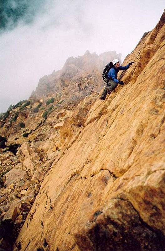
 An exposed section
No permits, parking passes, or other legal oddities are required for climbing in the Sisters Range. Although the logging Roads are gated, and locked they are open to the public for non motor vehicle use. For further road information call the Campbell Group at 360.336.9733
External Links / When To Climb
All year long! North Twin is a wonderful climb any time of the year. It is typically climbed between late may and early October when the road is (mostly) free of snow. In the winter, when snow hasn't been eradicated by typical cascade winter rain, the logging road provides a nice ski approach and descent. As far as weather and seasonal conditions apply: prepare for climbing North Twin Sister as you would prepare for any other 6500ft peak in the north cascades. Be cautious of avalanche conditions in winter.
 Optional 5th Class Moves Optional 5th Class Moves |
Northwest Hikers
Cascade Climbers
Other Websites
Videos
|
bfoggdc - Aug 29, 2005 1:36 am - Hasn't voted
Untitled CommentThis was my first climb ever, and it was nothing short of amasing. Took about 12 hours at a normal pace. Great view from top. I recomend "Trundling" some rocks on the NE slope. The rock slide will be very visible, just give a rock a push and watch it go!
tehovind - Oct 21, 2018 3:29 pm - Hasn't voted
Re: Untitled CommentPlease remove your head from the Fogg, bfoggdc! You never know if climbers are below you! Any rockfall could be deadly. NEVER "trundle" rocks! PERIOD!!