
-
 30850 Hits
-
 88.49% Score
-
 29 Votes
|
|
Mountain/Rock |
|---|---|
|
|
48.55347°N / 120.59087°W |
|
|
Download GPX » View Route on Map |
|
|
Okanogan |
|
|
Hiking, Mountaineering, Trad Climbing, Scrambling |
|
|
Summer, Fall |
|
|
8400 ft / 2560 m |
|
|
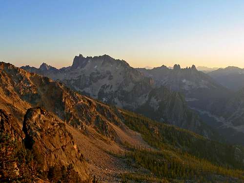
Overview

Burgundy Spire during Winter
Dallas Kloke ranked Burgundy Spire on the Top 10 hardest Peaks in Washington. This spire is located in the Okanogan National Forest, North Cascades near Washington Pass. It's attached to a series of other spires known as "The Wine Spires" along Silver Star's North Ridge. The easiest route up this peak is 5.8 (YDS), all of the routes on this peak are long and fairly committing.
 Steep North Face |  Scrambling Down |  Scrambling to the Col |  View of Highway 20 | 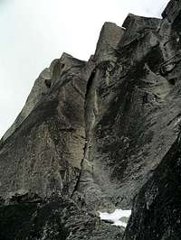 Chimney Variation |
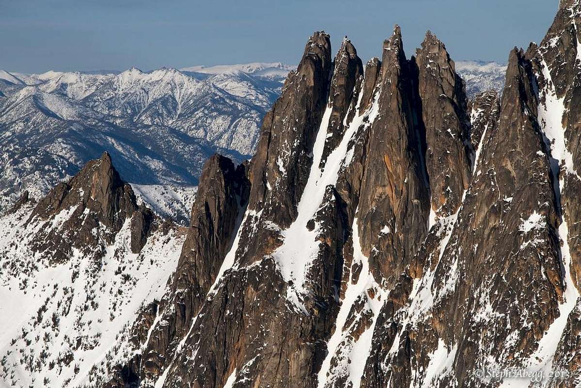
West Face of the Wine Spires: Burgundy Spire is the Spire in the Center of the Pic (Most Leftward Spire)
Routes

North Face

Action Potential
East Face Action Potential (5.10c): "One of the newer additions to the Wine Spires is this route put up by Mike Layton and Mark Allen in 2004, which follows much of the Cascades in offering a bit of adventure mixed with some excellent climbing. Despite some areas on the face that have subpar quality and cleanliness, the steepest and most challenging sections offer outstanding climbing in as usual, a fantastically scenic setting". -Z-Man
Northeast Buttress (UltraMega OK), Grade 5.10c/d (A0) or 5.11 III: There isn't much beta on this route. The first ascent was done in 2004 by Mark Allan and Tom Smith. The trip report can be seen on CascadeClimbers.
Getting There
From Seattle: Drive north along I-5 until you arrive at Arlington which you'll take exit 208. From here you take a right onto highway 530, in about 4 miles you take a left onto highway 9 for a few seconds and then take a right back onto highway 530. Then continue heading east for 27 miles until you get to Darrington. In Darrington you'll see a shell gas station where you take a left (north) which continues as highway 530. Eventually you'll end up in Rockport where you should take a right onto highway 20. From here you'll pass through Marblemount, Newhalem, and then Diablo. In about 35 miles you arrive at Washington Pass. After passing the Washington overlook road (left) keep driving for about 3.9 miles. The road now goes down hill, past a hair pin turn, and past multiple pull outs. The trailhead is a long pull out that is relatively obvious. If you see NF-400 on your left, you've gone too far (by 0.8 miles).From Winthrop: (East Side of the Cascades): Drive East on Highway 20 for about 26.6 miles. About 0.8 miles from the pull out you'll see NF-400 on your right side. From here the trailhead is the next major pullout on the left side of highway 20.
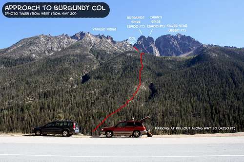 The Approach to Burgundy Col | 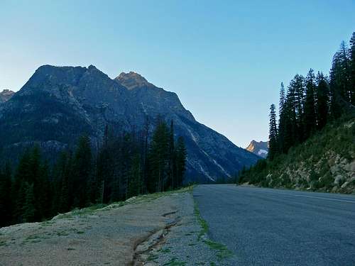 Le Petit Cheval from Highway 20 |
Red Tape and Camping

The First Camp Spot

Water Fill up near the Col
There are two main camping spots along the standard route. Half way up the approach is the first one at about 6,500 feet (very flat and could fit a dozen tents). The second one is at Burgundy Col. There is also camping at Rainy Pass (with amenities) which may require a Northwest Forest pass. More can be found in the Washington Pass area.
Water can be found in a few places even in late season. The first water source is at Early Winter Creek near the beginning of the trip. As you walk up the slope you could potentially walk off trail to the right to fill up water (although a bit out of the way). The next spot is a little bit before Burgundy Col, it's a small trickle on the trail. You might be able to find a trickle of water on the east side of Burgundy Col or break off a piece of hard snow. So in short, bring at least two liters of water.
When To Climb
Highway 20 usually closes around mid October until May. Some years have different variations of when the highway opens/closes due to snow pack and road damage. The best time to climb this peak is July through September. October might have fresh snow on the faces making climbing conditions less than ideal. The approach up to Burgundy Col is easier when snow covered, but could be potentially dangerous on the face.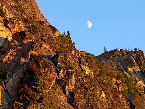
Evening Light with the Moon
Route Photos
Here's a few pictures to get you inspired to climb this peak.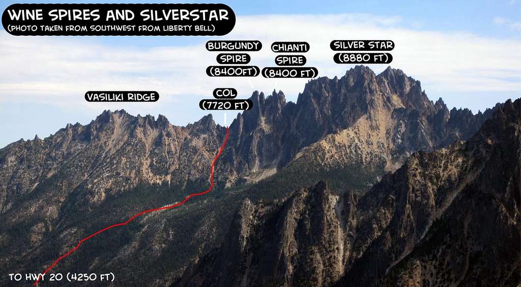
Wine Spires and Silver Star
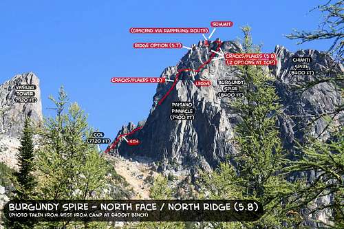 Photo overlay of North Face of Burgundy Spire | 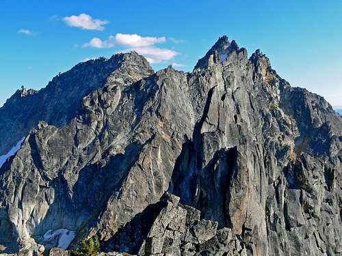 Silver Star Summits |
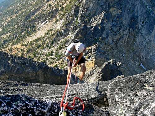 Rappelling Down the Standard Route | 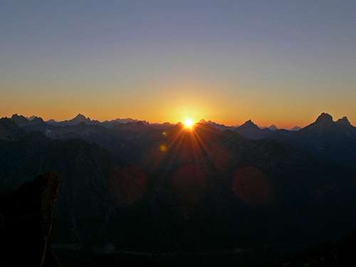 Sunset over the North Cascades |
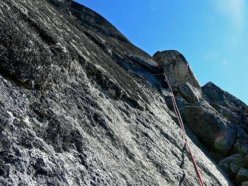 Looking up the 5th Pitch (I think) | 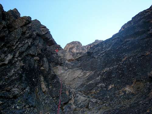 Climbing the First Pitch |
 Sunset with Kangaroo Ridge | 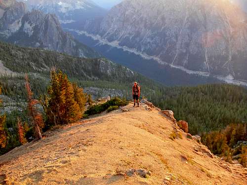 The Pathway during Sunset |
Mountain Conditions

Shadowed Light on Burgundy

Burgundy Covered in Snow
During November through April be sure to check in with the Northwest Avalanche Center. Very few people would even consider doing this peak during early season. But the link is for the hardy folks who go for it during Spring. Conditions are less than forgiving during the winter months on this peak.
For road Conditions check in with Washington State Department of Transportation for an up to date status on the road conditions.
Topographic Maps
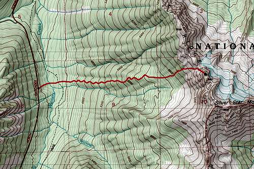
Burgundy Spire Topographic Map
External Links
- Day climb of Burgundy Spire N Face, with warm up on Paisano Pinnacle
- North Face 8/27/2005 - Married couples who climbed this as a team