
|
|
Mountain/Rock |
|---|---|
|
|
47.34920°N / 121.4549°W |
|
|
5395 ft / 1644 m |
|
|
Overview
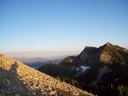 Tinkham Peak from Silver Peak
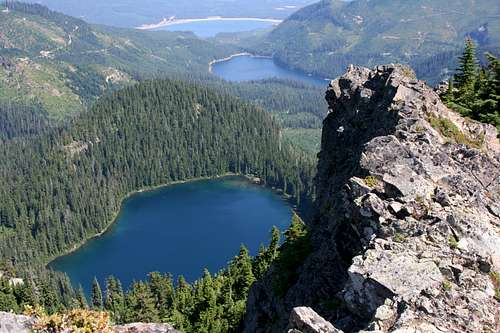 From the summit of Tinkham Peak
Tinkham Peak located just south of Snoqualmie Pass is a great summit destination located right off of the Pacific Crest Trail. With it's dramatic northern cliffs this mountain is very tempting to attempt. Keep in mind though that when you attempt this mountain you must make sure not to cross the watershed no trespassing signs or there are serious consequences for doing so. The summit is home to great views of the Snoqualmie Region as well as both distant Mount Stuart to the east and Mount Rainier to the south. It is also quiet incredible to be staring down the north cliff and lake below. Just one look down the cliff makes this summit well worthwhile. The mountain itself is a double summit peak with the western summit easily being the taller of the two. Both side should be visited though to truely enjoy this peak.
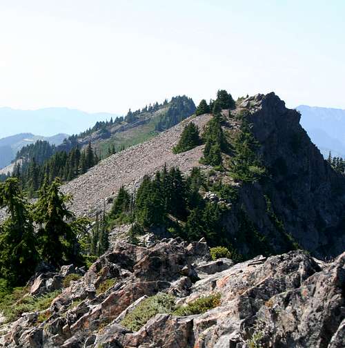 The west (true summit of Tinkham Peak from the false summit.
As mentioned, Tinkham Peak is located just off the PCT. It offers trailhead access from at least two different starting points. The Mirror Lake Trail is by far the quickest route to the peak (6 miles roundtrip). A start in Olallie Meadows at the PCT trailhead is another option (approx. 8 miles roundtrip). It should be noted that the northwestern approach has one small 20 foot section of a YDS Class 3 gully crossing and the rest of the final 250 feet is definitely Class 2. The summit itself is moderately exposed so caution should be used on it because it sits between the gully and the large northern cliff. The summit register is located here.
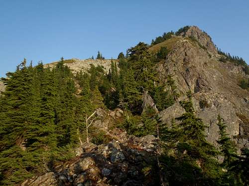 Looking up at Tinkham Peak
The peak can also be climbed from the southeast side as well. This side is stated as much easier and the bootpath coming up from the southeast side has some ribbon tape and is now a well used bootpath. The southeast side will avoid much of the issues with scramble and the Class 3 gully that the northwestern side has.
 |
 |
 |
 |
 |
Getting There
Shortest approach from trailhead:From Seattle, take I-90 E to exit 62 then take a right at the stop onto road 54. After 1 mile, take a right onto road 5480. It’s gravel from here on out and is typically in good shape. Follow this road for about 4.5 miles before reaching Lost Lake. Continue around the lake for another 2 miles and the Mirror Lake trailhead (3,600 feet) will be on the right.
From Redwic: " A short distance prior to Lost Lake, FR-5480 reaches a five-way intersection. DO NOT CONTINUE STRAIGHT. Instead, veer right to remain on FR-5480 and go around the East & North sides of the lake until reaching the desired Mirror Lake parking area(s). There is a "Trail 1302" sign (for Mirror Lake Trail) at the last left-bending road-turn just prior to its final uphill ascent to the trailhead. The trailhead, itself, is unmarked but obvious. Cars will need to park along the side of the road at the bottom of the hill, while high-clearance vehicles can find parking just beyond the trailhead."
Alternative starting point:
From Seattle, take I-90 East to Exit 54. Turn right at the stop. You immediately come to another stop, proceed straight onto Hyak Drive E. Continue past the ski area and then past the treatment plant to the gravel road. Road 9070 starts at this point. Follow it for 4.5 miles to the PCT trailhead in Olallie Meadows (elevation 3,800 ft) on the left-hand side of the road.
Red Tape
A Northwest Forest Pass is required to park at the trailhead.When To Climb
June through October. Do not attempt this peak when wet or icy form the northern approach.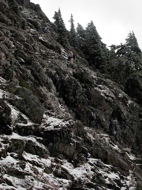 Not the ideal time for Tinkham Peak
Camping
Mirror Lake, Cottonwood Lake and the PCT all offer some campsites, however Tinkham Peak is easily climbed in one day. In fact Tinkham, Abiel and Silver can all be summited in under 8 hours in ideal conditions.Mountain Conditions
Washington Trails AssociationNational Weather Forecast for the Seattle area
 |
 |
 |
 |
Maps
Topozone MapExternal Links
- Washington Trails Association
User updated trip reports. - National Weather Service
Local weather forecast for the Seattle area.
NwHikers.net, the most up to date trip reports and photos of climbs in this region