

-
 52228 Hits
-
 93.1% Score
-
 41 Votes
|
|
Mountain/Rock |
|---|---|
|
|
45.94396°N / 6.96312°E |
|
|
Mountaineering |
|
|
Spring, Summer |
|
|
11522 ft / 3512 m |
|
|
Overview
Petite Aiguille Verte 3512 m
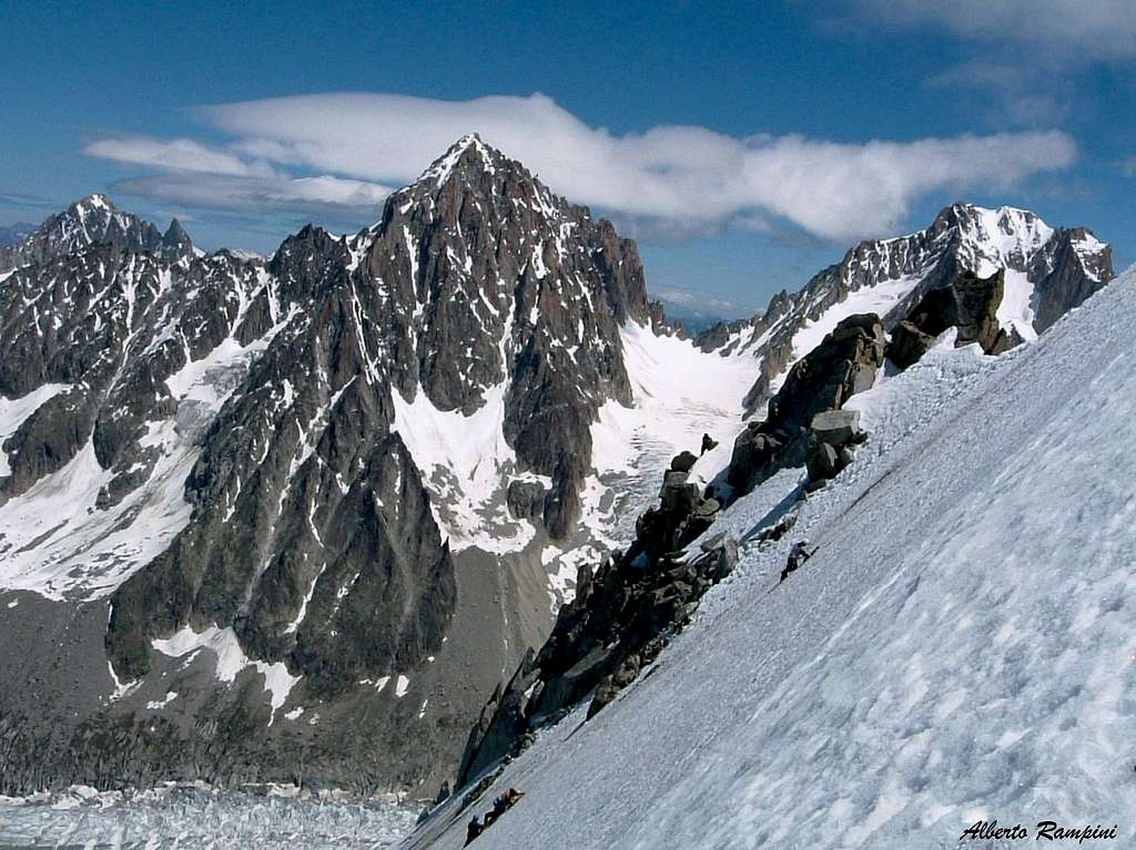
The Petite Aiguille Verte 3512 m is a mountain located on the French side of the Mont Blanc massif, more precisely between the Argentiere glacier and the Mer de Glace. The mountain is part of the Aiguille Verte group, also called Verte-Triolet chain, a subgroup originating from the main border watershed between Italy and France at the Aiguille de Triolet and developing in French territory in a North-West direction.
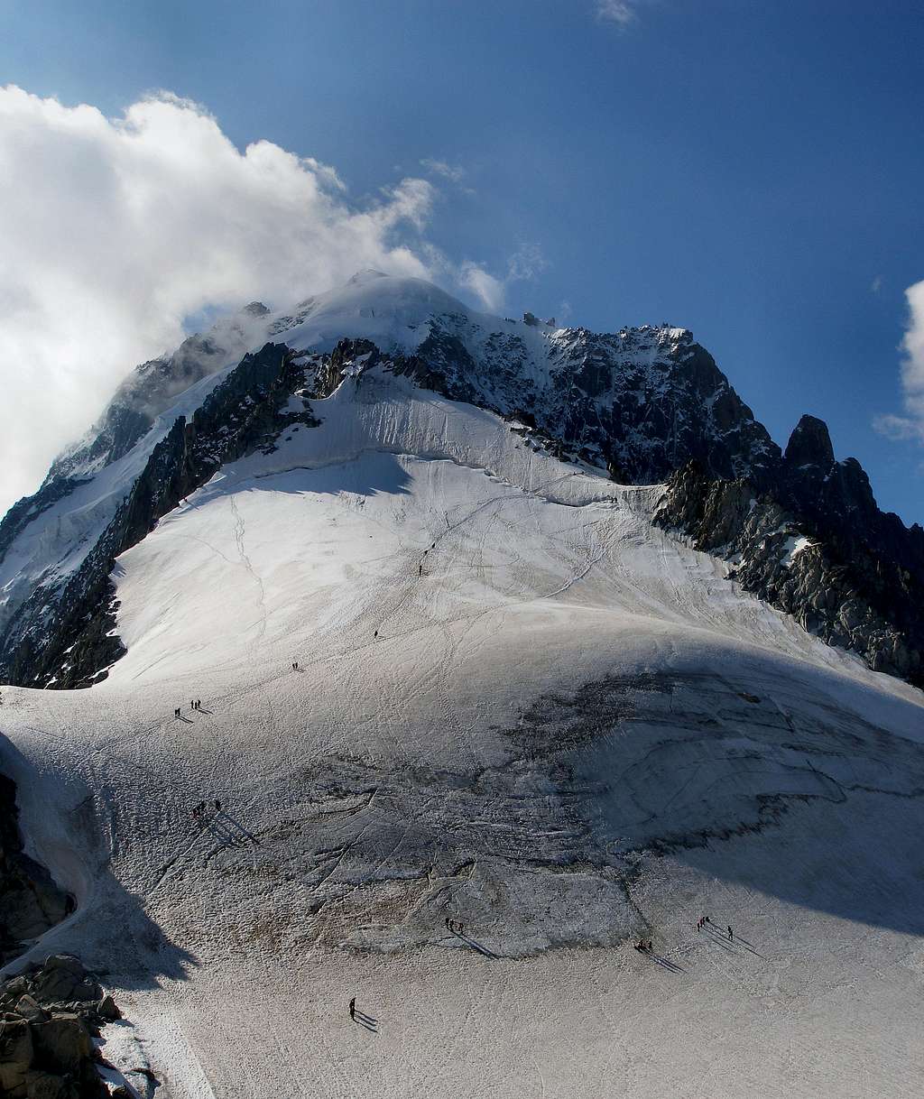
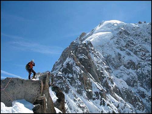
The Petite Aiguille Verte is undoubtedly a minor peak when compared with the giants that surround it, but surely is an excellent peak for training and acclimatizing with the advantage of being easily accessible from the village of Argentière via the Grands Montets cable car. All of the routes are quite short and can be climbed year-round. The itineraries overlook the Col dei Grands Montets and are very popular during the opening period of the cable car. The normal route along the NW Ridge is quite interesting and is ideally suited for beginning alpine climbers. It involves some moderately steep snow, crossing a rimaye/bergschrund, and a few easy rock moves (UIAA III) on an exposed ridge. It is featured in Rebuffat's 100 Finest Climbs of the Mont Blanc Massif.
The views from the summit ridge are quite nice, with the Aig du Chardonnet, Aig d'Argentiere, and Tour Noire visible to the east, and Les Drus and the Grands Montets Ridge of the Aiguille Verte to the south.
Getting There
All routes can be accessed from the Grands Montets cable car, which is located just outside the town of Argentière 1240 m
Road access
The main road approachs to Argentière are:
- From Chamonix follow the road towards NE in the direction of France-Switzerland border, quickly getting to the village of Argentière (8 km. from Chamonix)
From Switzerland
- Starting from Martigny: follow the road getting to the Switzerland – France border, pass the border, getting to the village of Argentière (37 km. from Martigny, 5 km. from the border).
- Starting from Geneve: follow the E25 Motorway to St. Gervais les Bains, then the RN 205 to Chamonix and Argentière
From Italy
- From Aosta follow the E25 Motorway to Courmayeur, then enter the Mont Blanc Tunnel getting to Chamonix, then Argentière (73 km. from Aosta)
There is frequent bus service to the base station from all of the major villages in the Chamonix valley (Le Tour, Chamonix, Les Houches, etc). The Chamonix valley can be reached easily by bus from the Geneva Airport in under 2 hours (service provided by SAT Bus Company), or by train from virtually anywhere in Europe.
Normal route on the NW ridge
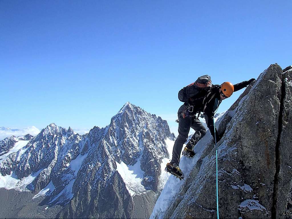
NW Ridge (AD-, UIAA III+, 100 m on the ridge, 3 hrs)
It is a fine and profitable climb along the NW ridge of the mountain and although it is not a climb without difficulty, it is considered the normal way to summit the mountain. A short but interesting route with some technical steps.
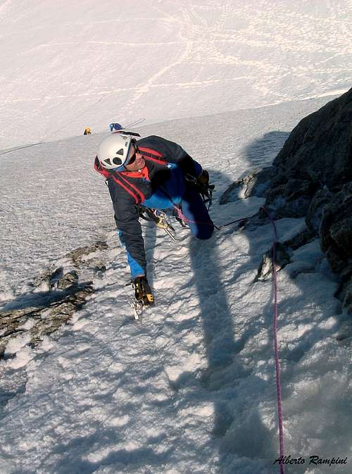
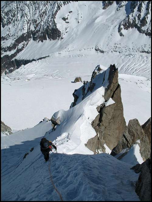
From the Grands Montets cable car station, go down the stairs to the small glacier and head directly across the Col des Grands Montets. Climb directly up the snow slopes ahead, straight up at first, then obliquely to the right towards the bergschrund. Cross the berghschrund and then climb e steep ice slope (up to 40°) reaching an obvious shoulder on the NW ridge. Turn left up the ridge, passing over moderately steep but easy mixed ground (45 degrees) and follow the ridge or eventually cross to the right side of the ridge and arrive to a second shoulder. Here follow the ridge to a rocky prominence, avoid it on the North side, then take again the ridge, following a sloping ledge. On the ridge to a narrow saddle facing North, before the summit tower. Climb the rocky wall following a short crack just above the saddle (UIAA III+). Continue to a fore-summit (fixed anchor), then follow the sharp and exposed ridge on the Argentiére side reaching a narrow saddle. Climb a second rocky wall (UIAA III) and then reach the summit. In winter, the ridge can be quite snowy and tricky in sections. The saddle just before the summit can be somewhat delicate under snowy conditions.
Descent: from the top downclimb to a fixed anchor to abseil down the last rocky wall, reaching the foresummit. On the fore summit abseil down to reach the notch on the NW ridge from where you follow downclimbing the ascent route.
Other routes
NW Face - Via Contamine 1959 (PD, 45°, 100 m, 2-3 hrs)
It is a short North face located on the left of the ridge of the Normal route, excellent for starting the ice climbing technique.
The route climb directly the icy face directly opposite the Grands Montets. When looking at the face, the NW Ridge is on the right and NNE Ridge on the left. Follow the Normal route, when the track approaches the bergschrund and heads towards the right ridge (facing the slope), leave it and head left in the direction of the ice slope to find the best point to cross the bergschrund (which can often be high). Climb two pitches on the ice slope and then join the upper part of the Normal route. Follow it to the summit.
NNE Ridge (PD, 150m, 3 hrs)
An alternative to the NW Ridge. Start as for the Normal route, but cross the bergschrund at its left end to reach the NNE Ridge. Follow the ridge over or around several rock towers to reach the characteristic curving snow crest (the "Demi-Lune"). From here continue to the summit rocks.
ENE (Chevalier) Couloir (AD, 50°- 55°, 300 m, 3 hrs) From the Col des Grands Montets head down the Glacier du Rognon towards the Argentiere Glacier and countour right along the base of the Grands Montets Ridge descending from the Aiguille Verte to reach the start of the wide couloir. Pass the bergschrund (often difficult) and climb the steep snow and ice slope (50-55 degrees). Higher, the slope slightly increases. The couloir becomes deeper and recessed with some rocky prominence until it comes out at the hill before the Demi-lune snow crest on the NNE Ridge, just before the summit rocks.
Note: The Alpine Club guide rates the Chevalier Couloir PD+. However, one French guidebook rates it AD to D, depending on the condition of the bergschrund. I found it a bit difficult for PD+ and believe AD is a more accurate rating.
Red Tape
There are no permits or fees required to climb. A round-trip ticket to the top of the Grands Montets costs about 20 Euro. Keep in mind though that the cable car is closed briefly in the spring and fall (between the peak seasons for climbing and skiing).
When To Climb
The Petit Aiguille Verte can be climbed year-round and is an excellent climb in winter (highly recommended). Crossing the rimaye may be more difficult in summer and there may be a substantial amount of snow on the ridge in winter, both of which may add to the overall difficulty. There are far fewer people in winter, however, which improves the overall experience.
Where to stay
Chamonix is a primary destination, offering various kinds of accommodation (hotels, huts, gites, renting rooms). There are many campsites in the town of Chamonix (both in the Northern and Southern ends of the town) and in the villages of Les Praz, Argentiere, and Les Houches. They are often very crowded during the high season. Camping is allowed in the mountains, near the Index station for example, but technically only permitted from dusk to dawn. Some people camp here for a few days in order to climb several routes in the Aiguilles Rouges.
Main campsites:
- Camping la Mer de Glace, Les Praz (3 km. North to Chamonix) +33(0)450534403
- Camping les Deux Glaciers, Les Bossons (3 km. South to Chamonix) +33(0)450531584
- Camping les Arolles, close to the centre of Chamonix - +33(0)450531430
- Camping les Cimes, Les Bossons (3 km. South to Chamonix) +33(0)450535893
- Camping les Marmottes, +33(0)450536124
- Camping Glacier d'Argentière, Argentière (8 km. North to Chamonix) +33(0)450541736
Meteo
Guidebooks and maps
- The Mont Blanc Massif: The 100 Finest Routes (Gaston Rébuffat) (several editions)
- Mont Blanc Massif: Selected Climbs (Lindsay Griffin) (Volumes I and II, ISBN 0900523573 and 0900523581)