
|
|
Mountain/Rock |
|---|---|
|
|
28.60000°N / 61.60000°E |
|
|
13287 ft / 4050 m |
|
|
Overview
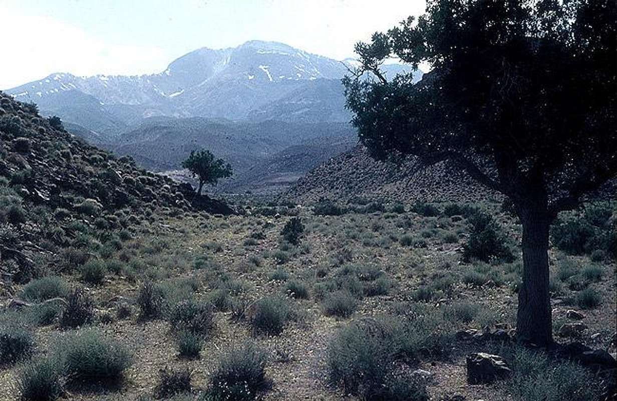 | ||||||||||||||
| Taftan and heights around it, are known as heights of Khash area located at Iran's Sistan and Beluchistan province. The province of Sistan and Baluchistan is located in the south-eastern part of the Iran and has an area of 181, 578 sq.km. Though it is the third largest province of the country, it is sparsely populated. Anyway Taftan semi-active volcano is one of the attractions of the province.
"Taftan" means hot and molten, something that has got hot under the the sun or on the fire, well this is not a strange name for this semi-active volcano. The first climb was done in 1893. Existence of Khash heights including Taftan peak causes pleasant climate of Khash and nearby areas, higher altitude of Khash area helps to gain more downpour in comparison to other parts of the province and to be much more vegetated and less arid. | ||||||||||||||
| Geologic History | ||||||||||||||
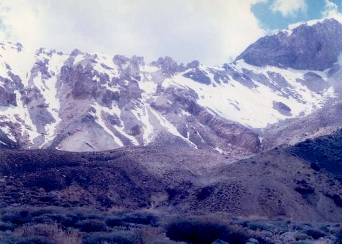
| Taftan is the tallest of several volcanoes in southeastern Iran, a group of moderately-large stratovolcanoes which stretches into neighboring Pakistan and Afghanistan. Taftan is located 99 km SSE of Zahedan and 45 km NNW of Khash, Beluchistan. Taftan is a complexly eroded stratovolcano with two prominent summits. The volcano was constructed along a volcanic zone in Beluchistan, SE Iran, that extends into northern Pakistan. The higher SE summit cone is well preserved and has been the source of very fresh-looking lava flows. Highly active, sulfur-encrusted fumaroles occur at the summit. The deeply dissected NW cone is of Pleistocene age.  Arial photo | ||||||||||||||
| The Active Volcano | ||||||||||||||
| Volcanic status of Taftan is active, fumarolic Last Reported Eruptions : An eruption that sent a lava flow about 60 m down slope was reported on April 25, 1993 Also exiting flow of lava has been reported from Taftan at 1970 and 1971. The big nozzle on top produces lots of gases that some of them are serious like sulfur. You can hear the explosion sound from this nozzle, the acidic gases may destroy the cotton wearings.  | ||||||||||||||
| Narkouh (3950m) summit | ||||||||||||||
| Few people climb this summit but climbing it is usually included in a Taftan attempt program, there is a windy east-west ridge line between Taftan and Narkouh which includes parts of the north route to Taftan. You can take nice photos of Taftan from Narkouh, there are some big rocky cliffs on the south face under the summit but the summit profile is plane, soft and soil. | ||||||||||||||
| Taftan: | ||||||||||||||
 [by] [by] | ||||||||||||||
Getting There
|
| Schematic map of Khash heights: |
 |
Red Tape
| To enter the Taftan mountain protected area you should grab a permission at Sistan and Balouchestan sports department ("Edare koll-e tarbiat-e-badani") in Zahedan. You need to show this kind of permissions to the booth which protect the area. (To protect the nature some pure mountain areas need this kind of permissions in Iran) |
| To use the shelters you must pay about 1$ to the Sistan and Balouchestan sports department ("Edare koll-e tarbiat-e-badani") in Zahedan and grab a permission. |
| No fees of permission is required for camping |
When To Climb
| Best | March and April |
| Summer | Dry and hot |
| Winter | Strong windy situation and crater surrounded by ice, would make the attempt so hard |
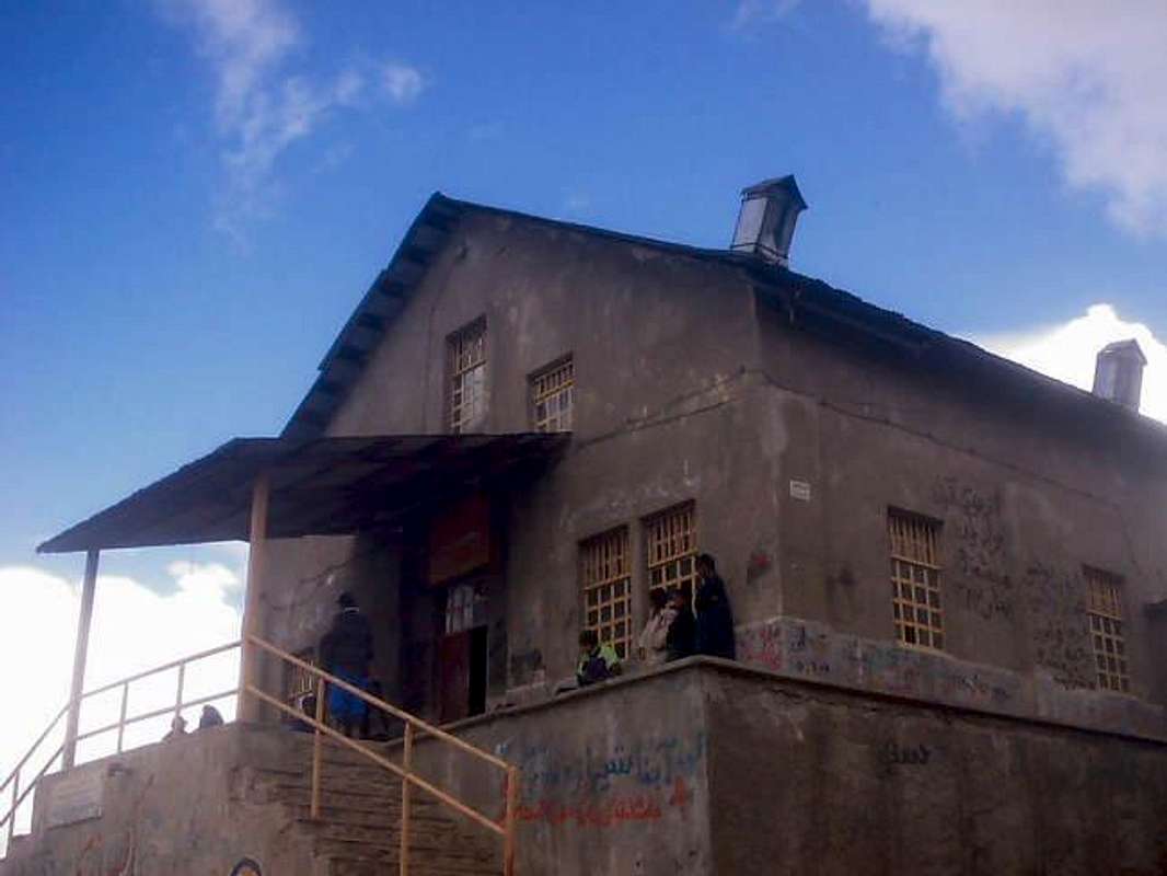
Camping
Sobah shelter:
 [by]
[by]
|
Mountain Conditions
| Summer | Pure sunlight. |
| Winter | The winter conditions are not as serious as Alborz and Zagros ranges but the struggle wind and ice can make it a hard climb. |
| Sulphuric acid | The acid steam rising up from the crater is toxic and burns the clothes. |