
|
|
Mountain/Rock |
|---|---|
|
|
39.30300°N / 105.439°W |
|
|
11970 ft / 3648 m |
|
|
Lost Creek Wilderness Overview
First, the mountains of the Lost Creek Wilderness submitted here on Summitpost are exclusive to this site. Locating information or any route beta for this area is difficult. Thanks to Jennifer and Gerry Roach's LCW book all of us can view photos and visit these remote summits here on SP.
The Lost Creek Wilderness Area protects nearly 120,000 acres in the Tarryall, Platte River and Kenosha mountain ranges in central Colorado. This relatively new wilderness (designated in 1980) is loaded with hiking, backpacking and climbing possibilities. Typical LCW landscape will consist of mixed and very dense forests, open meadows, and small streams. Upon first sight, it’s possible the casual climber or mountaineer may not be too impressed with the typical LCW mountain configuration. Dense, tree- laden slopes that frequently lead to tree-covered summits could easily rekindle a forgotten bad memory, a memory that includes your most frightening bushwhacking experience.
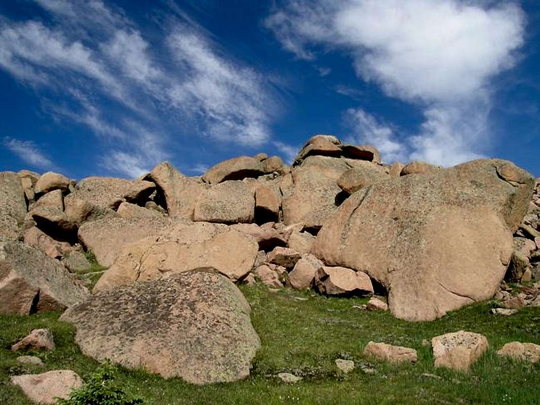
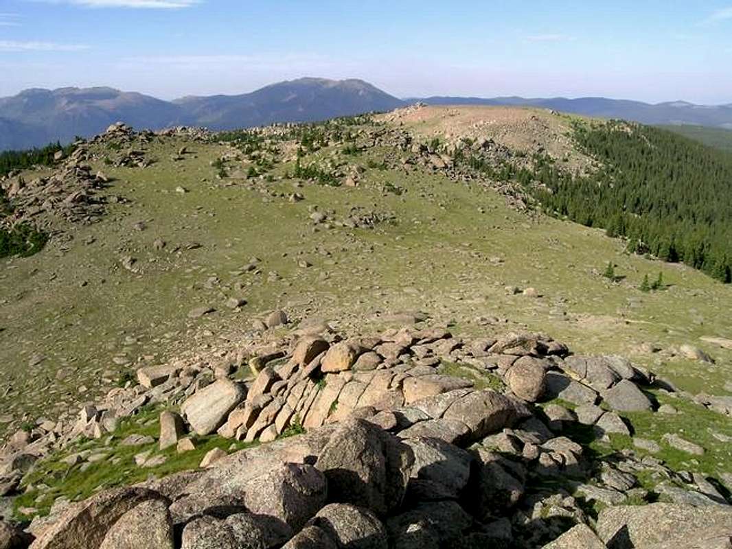
Despite lacking the high alpine scenery of other Colorado wilderness areas, one can argue that LCW is one of the most unique wilderness areas in Colorado. The Lost Creek Wilderness certainly has its own unique character that no other place in Colorado can match. Character that includes some of the most bizarre rock formations Colorado can offer. The heart of the LCW scenery is dominated by twisted rock, which includes massive granite domes and towering granite spires. The highest mountains even sport huge, wide-open plateaus providing easy hiking and excellent views. Getting to those plateaus is another story.
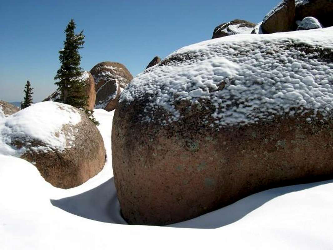
When you combine an arid climate with low elevations, you get hot summers, and the LCW has a reputation for staying hot from June through September. Any snow pack typically melts off fast, occasionally as early as March or April. With the arid climate, expect mild temperatures during the spring and winter, which provides an easy escape from the bitter cold of Colorado’s' alpine environment. When the high summits of Colorado are draped in snow, the Lost Creek Wilderness will welcome you with open arms.
The LCW has an extensive trail system and is known for long approaches. The best solitude and views require a 4-6 mile approach on good trails. Be assured, you will be rewarded with excellent scenery and solitude for the hard work. Hikers beware; the LCW can really put the hurt on someone who ventures too far off the beaten path. These forests are loaded with downfall so the bushwhacking can be gruesome, to say the least.
The last place you want to be is stuck in the dense tree cover without a GPS read. It’s easy to lose your sense of direction in these trees, so the potential for a navigational nightmare is real.
I call them “the big four.” If you spend anytime in the LCW, you need to spend your time attaining the summits of the big four. These peaks include Bison Peak, McCurdy Mountain, Windy Peak and Peak X. I would attempt them in that order as well. All four have expansive plateaus and offer huge scenery that will represent the area well. Next, get your tail up into McCurdy Park and Lake Park and visit the “Catamount” and “Tarryall Peak.”
Windy Peak Overview
Windy Peak (11,970-ft.) is a singular mountain, resting only 30 feet short of 12,000-ft. just outside of Bailey Colorado. The small town of Bailey is only a 45-minute drive from Denver on Hwy 285 and it only takes an hour and 15 minutes to get to the Rolling Creek Trailhead. Windy Peak can easily be viewed from the steep "Crow Hill" on hwy-285 that descends to Bailey.This large mountain is somewhat isolated from the continuous bulk of the Kenosha Range. Although separated by the vast Wigwam Creek Drainage, Windy Peak still holds true to the Lost Creek Wilderness form with its giant granite boulders and immense summit plateau.
West Ridge Route
As of August 1st, 2004 the West Ridge Route on Windy Peak falls into the “must do” category for the Lost Creek Wilderness. Having enough LCW experience to make such a bold statement, I place this route with the North Plateau Route “loop” Route on Bison Peak and a few different routes on McCurdy Mountain and McCurdy Park. This route is only available from middle May through mid November, because of a gate closure on RD 77 seven miles prior to the Lost Park TH.
Having completed two routes on Windy, i enjoyed the West Ridge Route more so than the standard North Ridge Route. I believe that most whom summit Windy Peak, do it from the Rolling Creek TH, so expect total solitude.
The West Ridge Route on Windy Peak is close to 9 miles RT with only 2,500-ft of vertical gain. You will not have access to a trail for the entire route. A good topo map is essential, without one; expect to get lost in a place where it may take a while to be found. A GPS unit would be a good idea. Expect 5.5 miles of tree laden, nondescript terrain. Locating landmarks will be a challenge as well. The first 2 miles does 1,500-ft and the last 2.5 miles will only do 800-ft. Because of the gentle incline of the last 2.5 miles it can be tough to tell where to go while in the trees, for you can’t ever see the summit plateau until the trees finally give way to open tundra for the last 1.2 miles. Once you reach the expansive summit plateau, the fun really picks up plus the route finding becomes easier.
 |  |  |  |  |
North Ridge (winter route)
Windy Peak does not really have a standard route, the Roach's note that the West Ridge Route is standard but this "classic" route is only accessible starting June 15th. If you want Windy Peak's elusive summit earlier in the season, the best option is the North Ridge Route starting at the Rolling Creek Trailhead. Keep in mind, this is a north-facing route. Couple that with May or early June snow and you get a day to remember. At any rate, Windy Peak's north ridge route will really test your route finding skills. Once off of the comforts of the Colorado Trail, the north ridge offers a very steep, tree-laden, giant boulder infested climb. Add some heavy wet spring snow and you get the picture. If you have a GPS or a compass, bring it or you can trust your instincts like I did.
 |  |  |  |  |
Lost Park-TH
From Denver Colorado travel Hwy 285 past Aspen Park, Conifer, Pine Junction and Bailey. Continue to Kenosha Pass where you will find the Kenosha Pass campground.From Kenosha Pass, descend the pass and when 285 levels out, look sharp for RD-77 on the left. Turn south on to RD 77 and follow this road 19 miles to the Lost Park Campground. RD-77 is a dirt road with plenty of “washboard” driving. Bring your SUV for this improved dirt road, but a passenger car would be sufficient if needed. This TH is closed starting early Nov and re-opens in late April or May.