
|
|
Mountain/Rock |
|---|---|
|
|
41.36100°N / 106.318°W |
|
|
12013 ft / 3662 m |
|
|
Overview
Medicine Bow Peak is in the Snowy Range of Wyoming, which itself is a part of the Medicine Bow Mountains of Wyoming and Colorado. This small, but very beautiful and well-named range is full of sparkling lakes and flowery meadows with scenic peaks rising above.
Medicine Bow Peak itself is probably the easiest and most popular mountain in Wyoming that is above 12,000 feet high. It is also the highest mountain in Southern Wyoming. Although the peak is easier than most high mountains in Wyoming, this doesn’t mean that it is somehow unworthy. The scenery around the peak is some of the best around and gives everyone (even motorist who never leave the road) a taste of alpine scenery that you usually have to work hard to see.
Partially because of the proximity to Laramie Wyoming, this peak gets a lot of attention. It is also not that far away from the Front Range cities of Colorado so you are just as likely to run into hikers from Colorado on the mountains as you are running into hikers from Wyoming.
Besides some relatively easy routes of the mountain, the mountain also is host to many technical routes and couloir climbs.
One of the area’s first fire lookouts used to adorn the peak, but little is left of it. The weather was deemed too harsh and too cloudy for the fire lookout to be maintained for long.
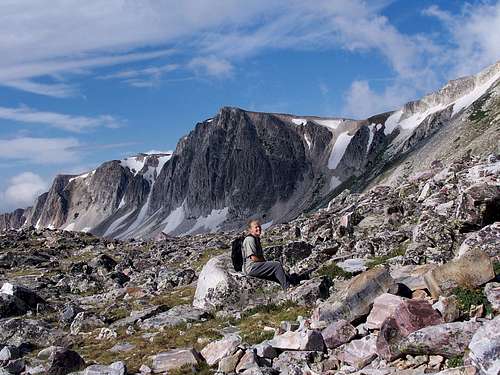 Medicine Bow Peak on August 9 2008.
Getting There
There are three main trailheads used for Medicine Bow Peak and one more one that is less used. Keep in mind that all of these roads are summer and fall roads only and are closed for much of the year. There is a $6 fee to park at all trailheads with the possible exception of Dipper Lake.
Lewis Lake Trailhead
From the east, leave I-80 at Exit 311 and drive Highway 130 west to Centennial. From Centennial, follow the highway another approximately 11.2 miles to the Lewis Lake Recreational Area and Sugarloaf Campground, which is on a side road which heads north from Highway 130. This same location can be reached by driving east from Saratoga Wyoming.
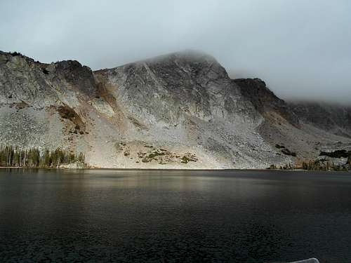
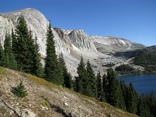
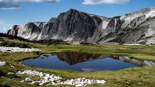
 Medicine Bow Peak as viewed from Lewis Lake.
Lake Marie Trailhead and Mirror Lake Trailhead
Since these two trailheads are closed together, the driving directions are nearly the same. Both roads are just off State Highway 130 between Laramie and Saratoga. From the east, leave I-80 at Exit 311 and drive highway 130 west for about 43 miles, passing Centennial along the way, to the Mirror Lake Trailhead, a short road off Highway 130. The Lake Marie Trailhead is located not far to the west. This same location can be reached by driving east from Saratoga Wyoming.
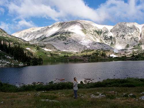
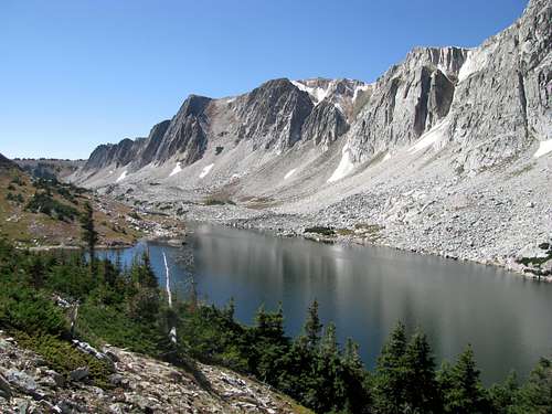
 Lake Marie.
Dipper Lake Trailhead
I have not been to this trailhead, but from Highway 130, FR 103 heads north to a parking lot two miles from the highway. The trailhead is another 1.5 miles along a 4wd road to Dipper Lake.
Routes Overview
There are several routes up Medicine Bow Peak. Some of the main routes are covered below.
Routes that are mostly on a trail:
Via Lewis Lake
This is the shortest and easiest route up Medicine Bow Peak. It is 1.6 miles each way and has just over 1200 feet elevation gain. From Lewis Lake, the trail heads west to the saddle between Sugarloaf and Medicine Bow and then climbs north to the ridge top. The route then heads west with some easy scrambling to the summit.
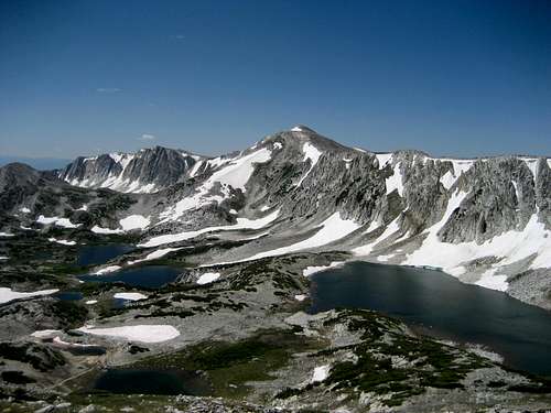 From Browns Peak, the Lewis Lake Route can be seen. Notice the prominent saddle between Sugarloaf and Medicine Bow Peaks.
Via Lake Marie
This route is 3.0 miles one way with about 1600 feet elevation gain. From Lake Marie (west side), the trail climbs to the south ridge of Medicine Bow Peak and then follows that ridge to the summit.
 Much of the Lake Marie Route can be seen here.
Via Mirror Lake
This route is 2.7 miles each way with about 1600 feet elevation gain. From Mirror Lake, the trail heads north and northeast past several lakes to the saddle between Sugarloaf and Medicine Bow Peak. The trail then climbs north to the ridge top. The route then heads west with some easy scrambling to the summit.
 Along the Mirror Lake Route.
Both the Mirror Lake and Lake Marie Routes can be combined into a nice 5.7 mile loop.
Via Dipper Lake
This is a less used route than the routes above. It is 2.6 miles each way with more than 1300 feet elevation gain, assuming you can get to the 4wd trailhead (add an extra 1.5 miles each way if you can't). I have not done this route, but a trail does exist.
Mountaineering and Couloir Routes:
Gap Ridges
 Gap Ridges.
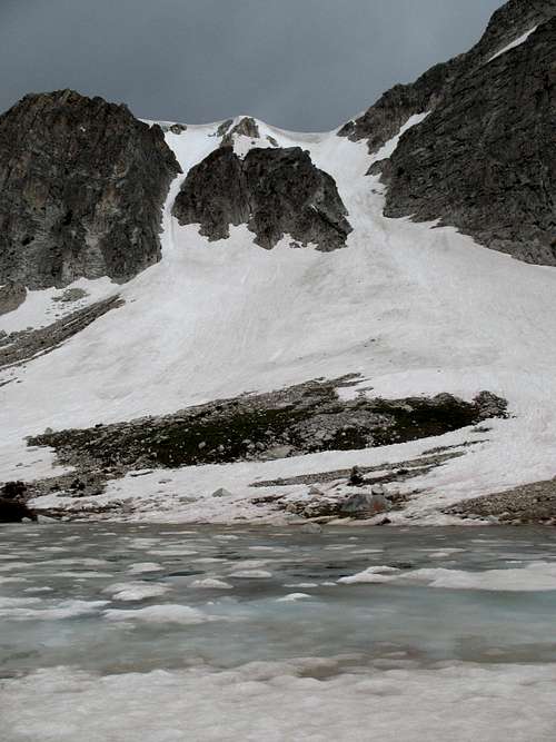 Lookout Couloirs.
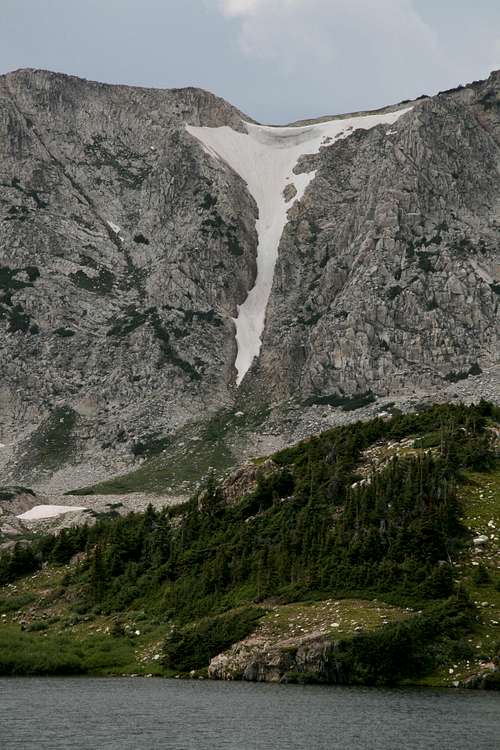 North Klondike Couloir.
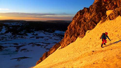 Marie Couloir.
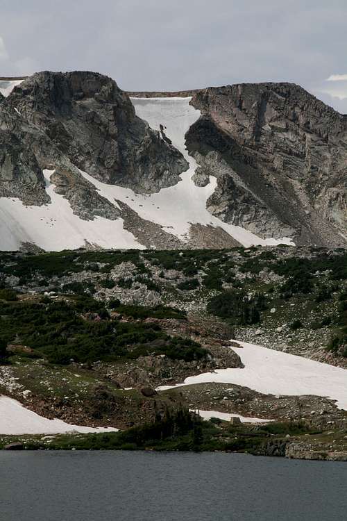 Island Couloir.
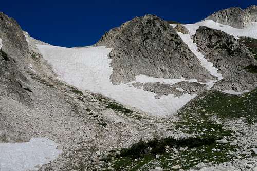 Old Main Couloir.
Red Tape
For of all of the Snowy Range, it is requested that all fires are at least 200 yards from lakes, streams, and trails, and no discharging firearms within vicinity of the lakes, streams, or trails.
Open fires are banned during the drier months (check with the ranger station), and for winter or low-danger months, it is recommended that campers and climbers use stoves instead of open fires. Cutting switchbacks on trails is prohibited.
Cutting down timber is strictly prohibited - even when it involves dead trees. Picking up dead timber off the ground is permitted, but even scraping dry twigs off tree branches is prohibited, and hefty fines accompany violation of this regulation.
 Please tread lightly in this beautiful area.
 When To Climb
The most popular and easiest season to climb here is mid or late July through mid September. Expect snow, wet or snowy trails, and wet campsites well into July and sometimes later.
Winter and spring would be a challenging, but beautiful time to climb in these mountains, but access can be difficult if you don't have a snowmobile to get to the trailhead.
Be aware of avalanches in winter and spring and lightning in summer.
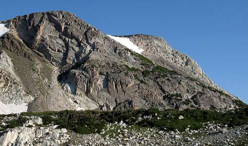
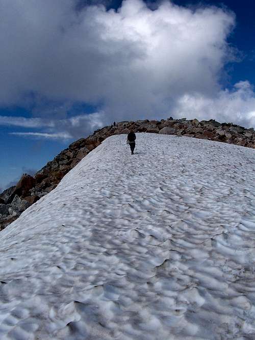 Approaching the summit in August.
Camping
There are many campgrounds in the area. They can fill up fast on summer weekends, but campsite should always be available somewhere.
Campground existing hear the trailhead are Lewis Lake, Libby Lake, and Sugarloaf, near the Lewis Lake Trailhead, and at Lake Marie and Mirror Lake Campgrounds near the two other respective trailheads.
There are other informal campsites in the less congested parts of the range.
For the most part, Medicine Bow is a day hike, but backcountry camping is allowed. There are good backcountry campsites around the lakes north of the area around Medicine Bow Peak.
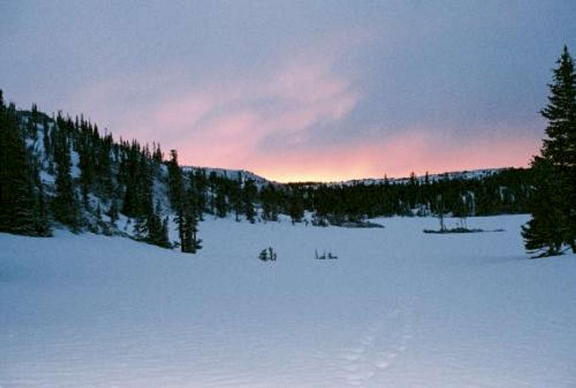 Mirror Lake Campground as seen in June!
Mountain Conditions
Contact the Brush Creek Ranger Station:
Brush Creek-Hayden
South Hwy. 130
P.O.B. 249
Saratoga, Wyoming 82331
307-326-5258
CLICK HERE FOR AREA WEATHER FORECAST
Below is the National Weather Service Climate Summary of Fox Park, which is located in the mountains to the south of Medicine Bow Peak. The data is from 1911-1979 Fox Park is at 9070 feet elevation, so expect the temperatures on the higher elevations of the range to be around degrees colder than in Fox Park (except for cold winter nights). Higher elevations will be much wetter as well. Medicine Peak or Sugarloaf might be three times wetter than Fox Park.
| MONTH | AVE HIGH | AVE LOW | REC HIGH | REC LOW | AVE PREC (in) |
| JAN | 26 | 4 | 50 | -52 | 1.36 |
| FEB | 29 | 6 | 54 | -37 | 1.23 |
| MAR | 34 | 9 | 56 | -41 | 1.49 |
| APR | 43 | 18 | 66 | -21 | 1.50 |
| MAY | 53 | 26 | 76 | -8 | 1.41 |
| JUN | 64 | 32 | 90 | 12 | 1.55 |
| JUL | 72 | 37 | 89 | 18 | 1.54 |
| AUG | 70 | 36 | 88 | 19 | 1.55 |
| SEP | 62 | 29 | 89 | 3 | 1.27 |
| OCT | 51 | 23 | 72 | -20 | 1.01 |
| NOV | 36 | 12 | 59 | -34 | 1.04 |
| DEC | 29 | 7 | 53 | -40 | 1.17 |