

|
|
Mountain/Rock |
|---|---|
|
|
40.65900°N / 105.955°W |
|
|
Spring, Summer, Fall |
|
|
12644 ft / 3854 m |
|
|
Overview
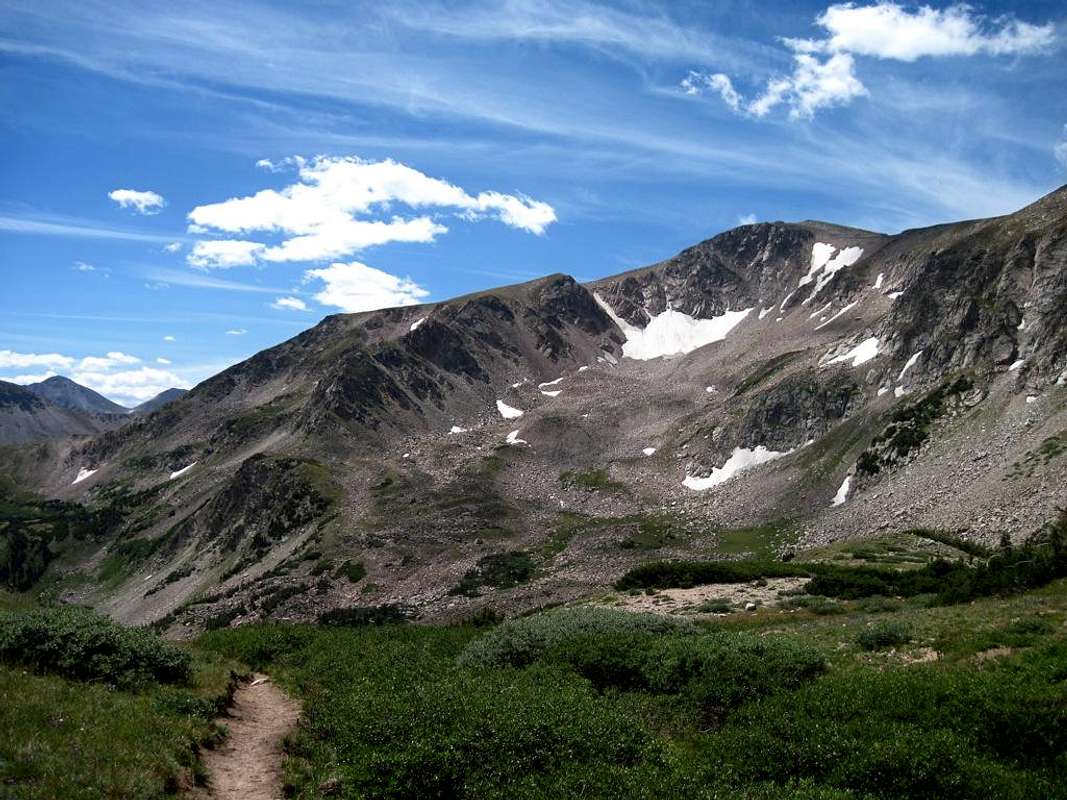
South Rawah Peak (12,644 ft) is the second highest named peak in the Medicine Bow Mountains (the highest being Clark Peak at 12,951 ft). The Medicine Bow Mountains stretch about 100 miles from Cameron Pass in the northern part of Colorado up into Wyoming and terminate near the town of Medicine Bow. In Colorado, the range consists of one long spine of peaks that makes up the boundary between Jackson County on the west and Larimer County on the east. The range also separates the Colorado State Forest on the west and Roosevelt National Forest on the east. The eastern slopes of South Rawah Peak, and many other peaks, are contained in Rawah Wilderness (administrated by Roosevelt National Forest).
The eastern slopes of South Rawah Peak make for a relatively easy ascent with their tundra slopes. However, the approach is very long—roughly eight miles. Fortunately, the area makes for an excellent backpacking destination. There are numerous, fantastic camping spots nestled up against the east side of the Medicine Bow Range. The meadow below Twin Crater Lakes, Twin Crater Lakes themselves, and Bench Lake offer great places to set up a base camp. From any of these places, a hike to the top of South Rawah Peak is relatively short and easy. While you’re up there you might be tempted to climb some of the other peaks in the area. The rugged, unnamed peaks that tower over Twin Crater Lakes look like a fun challenge. North Rawah Peak can also be reached from South Rawah Peak via a rugged ridge traverse.
 |  |  |  |  |
Views From The Summit
The views from the summit are spectacular. You can look south down the rugged spine of the Medicine Bow Range and pick out Clark Peak and Cameron Peak as well as numerous unnamed mountains. You can also see the northern part of the Never Summer Range. If you look to the southeast you can see parts of the Mummy Range and other peaks in Comanche Peak Wilderness. To the north you can see North Rawah Peak and on into Wyoming. To the west you look out across North Park to Mount Zirkel Wilderness on the horizon. |  |  |  |  |
Fishing
Fishing in Rawah Wilderness is spectacular. I’ve caught, or seen people catch, fish in Island Lake, Carey Lake, Twin Crater Lakes, Rockhole Lake, and Bench Lake. Bench Lake in particular is my favorite with its tons of 10” Brook Trout. Rockhole Lake has many large Greenback Cutthroat Trout. I watched my brother-in-law pull a 15” Greenback out of Rockhole using a lure, but I am yet to catch anything there. At the other lakes dry flies like Renegades and Adams seem to work well and little beadhead nymphs do well also. The numbered lakes on the north side of Grassy Pass are also reported to be good fishing, as is the Laramie River (however sections of the Laramie River are privately owned so be careful). |  |  |
Getting There
Via West Branch Trail in Rawah WildernessFrom Fort Collins, take hwy 287 north to hwy 14 (Poudre Canyon). Take hwy 14 west 52 miles to Laramie River Road (this road sneaks up on you so if you pass Chambers Lake you know you've gone too far). Go north on Laramie River Road for eight miles to the West Branch Trailhead (right after Tunnel Campground on your left). Hike up West Branch Trail until it intersects with Rawah Trail. Take Rawah Trail until it intersects with North Fork Trail. Take North Fork Trail up into the Twin Crater Lakes area. Fantastic camping spots can be found in the meadow below Twin Crater Lakes, Twin Crater Lakes themselves, and the Bench Lake area.
Fore slightly more detailed route info and a map check out East Ridge route info.
When To Climb/Mountain Conditions
South Rawah Peak is best climbed during the summer and early fall (July through October). This area is all but inaccessible during the winter months because Laramie River Road closes during the winter. This would make for a very, very long approach from Blue Lake Trailhead (15 miles with lots of up and down).For up-to-date mountain conditions try contacting Canyon Lakes Ranger district or Colorado State Forest. The following weather forecast gives info for the town of Walden, Colorado which sits in North Park to the west of the Medicine Bow Mountains.
National Weather Service spot forecast
The Weather Channel forecast for Walden, CO
Camping
There is plenty of camping in the area. If you're backpacking, camping is allowed anywhere as long as your campsite is 200 ft from any major body of water. Also, fires are not allowed over 11,000 ft.For car camping, Tunnel Campground, Chambers Lake Campground, and Brown's Park Campground all sit on the eastern boundary of Rawah Wilderness. As of the summer of 2008, a campsite at the Tunnel Campground ran $15 a night. I'm less familiar with camping opportunities on the west side of South Rawah Peak in the Colorado State Forest. Contact Colorado State Forest for more info.
 |
Red Tape
There is no red tape to climb this mountain from the east side. If you climb from the west side you will have to pay to get into Colorado State Forest. For more information on Colorado State Forest regulations call them or visit their website.Contact Information
Canyon Lakes Ranger District (they administrate Rawah Wilderness):- Website: www.fs.fed.us/arnf/districts/clrd
- Address: 1311 South College, Fort Collins, Colorado 80524
- Phone: (970) 498-2770
- TTY: (970) 498-2727
- Fax: (970) 498-2769
- Website: www.parks.state.co.us/
- Address: 56750 Hwy 14, Walden, CO 80480
- Phone: (970) 723-8366
- Fax: (970) 723-8325
- Email: state.forest@state.co.us
Google Map
View Larger Map
External Links
- Colorado State Forest Map
- Colorful History of Colorado State Forest and North Park
- www.leachfam.com
My personal website contains lots of photos from all over the southern half of Rawah Wilderness (Blue Lake, Island Lake, Rockhole Lake, Bench Lake, etc).