

-
 67345 Hits
-
 78.27% Score
-
 9 Votes
|
|
Mountain/Rock |
|---|---|
|
|
30.63500°N / 104.173°W |
|
|
Jeff Davis |
|
|
Hiking, Scrambling |
|
|
Spring, Summer, Fall, Winter |
|
|
8378 ft / 2554 m |
|
|
Thanks to Scott!

Thanks to Scott Surgent for doing such a great job establishing and maintaining this page for such a long time! Thanks also for asking me to help out with it! :)
Overview
Mt. Livermore is the highest summit in the Davis Mountains, Texas second highest mountain range in Texas. Though the Guadalupes have four summits which are higher, this range is significantly larger than the raised reef up north. You may find some sources which claim that Baldy Peak is the highest point in the range, and there is some truth to that position; Baldy is the name of the protruding fin which makes up the summit block of Mt. Livermore. The highest peaks represent igneous rock intrusions within an ancient volcano (Buckhorn Caldera); many visitors to the area are surprised at the rugged nature of this mountain. Theoretically, rock-climbing would be quite good in the area, though it doesn't appear that many have tried the pursuit on this peak.
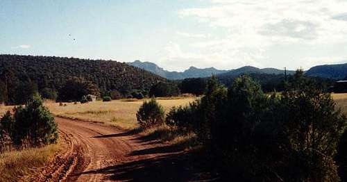
The summit is visible from the TNC complex
For more information on things to do in the area, please take a look at the main Davis Mountains page here on SP.
The northern half of the peak sits on land owned by The Nature Conservancy, and as such, access to this peak must be arranged through them. The group is doing a tremendous job preserving this West texas "Sky Island", so you should expect to work with their open access schedules in order to visit Mt. Livermore (don't expect to just show up and hike). For the latest event calendar, please refer to the Davis Mountains page.
The southern half of Mt. Livermore is owned by the Barnett family who runs the Livermore Ranch. Visit their website, www.livermoreranch.net, for information regarding access to the peak from their property.
Getting There

Getting to Mt. Livermore always entails a drive. El Paso, ELP, (195 mi away) hosts the closest international airport, though Midland / Odessa, MAF, (162 mi away) has a regional air-field serviced by most major carriers.
Most visitors will approach Mt. Livermore from IH-10 coming from the west (El Paso) or the east (DFW and/or San Antonio):
- Exit IH-10 in Kent, TX (Exit # 176)
- Drive south on TX-118 (roughly 32 mi) to the entrance of the Davis Mountains Preserve on the right (South). You will pass TX-166, a beautiful & scenic loop drive at ~20 mi. The entrance is barely noticeable when the Preserve is not open, and only marginally moreso on an open date. Look for a small sign low to the ground with some orange surveyor's tape tied to it. You'll drive over Beef Pasture Gap, a small saddle, just under a mile before the turn-off into the TNC property; if you reach the Madera Canyon Roadside Park (a few picnic tables), you've gone too far.
Others will approach the area from Fort Davis, TX:
- Drive approximately 20 mi west on TX-118 from Fort Davis, TX. You'll pass the Madera Canyon Roadside Park just before the entrance on the left (South). If you reach the TX-166 Scenic Loop turnoff, you've gone too far.
If all else fails, ask someone in Fort Davis for help / directions. Everyone I've met in the town is very friendly.
Red Tape
Mt. Livermore lies on the land owned by The Nature Conservancy of Texas. The Davis Mountain Preserve is only open to the public a few days / weekends per year, so please check the calendar on their website for details.
For information regarding the Davis Mountains Preserve, please contact Jason Wrinkle at jwrinkle@tnc.org or (432) 837-5954.
2009 Calendar:
(Last updated on 27 Jul 2009)
Please, no pets allowed at Preserve events.
2009 Davis Mountains Preserve Events
- October 24 (Day hiking): The Preserve is open for self-guided hiking, birding and picnicking from 8:00AM to 4:30PM. Reservations are not required. - Contact: Jason Wrinkle at jwrinkle@tnc.org or (432) 837-5954.
- December 5 (Christmas Tree Hunt): Contact Jason Wrinkle for more information; jwrinkle@tnc.org or (432) 837-5954.
- December 12 (Christmas Tree Hunt): Contact Jason Wrinkle for more information; jwrinkle@tnc.org or (432) 837-5954.
Camping and Hotels
They allow camping on the grounds on open dates. Otherwise, no camping. There is camping at a state park near Fort Davis, about 20 miles south.
Fort Davis has some basic, clean hotels and is a very interesting town to visit. It's Texas' highest town at just under 5,100 feet elevation.
Davis Mountains Preserve Information
The following is courtesy of Kevin Donovan:
Attached is the 2005 Calendar of Events for the Davis Mountains Preserve. The "Open Hiking" days you can day hike Mount Livermore and on the "Open Weekends" you can camp in the Preserve. It appears that reservations are necessary but there are no fees. These are the only days there is access to
the mountain.
Here is the updated contact info:
Crawford Marginot
Office Manager
West Texas Program
PO Box 2078
205 N. State Street
Fort Davis, TX 79734
432/426-2390, ext 1 (Tele)
432/426-2394 (Fax)
Website:
2006 Dates and Info
Fort Davis Calendar of Events (Thx to 'grunt' for the link information)
What Else Is There To Do?
The Fort Davis National Historical Monument is located just north of town. It is the original fort, decomissioned in the 1890s, in very good shape. There is even a short hiking trail to a small hill above the fort. Admission is $5 for adults.
The McDonald Observatory is located south along TX-118 about 17 miles north of Fort Davis and about 5 miles south of the TX-166/118 junction. Tours are available, with nightly star parties, too. Prices are reasonable ($5 for the basic walk-through, on up), and one gets a good view of Livermore from the summit of Locke Peak.
The loop drive around the Davis Mountains along TX118 and TX166 is spectacular. This is a very popular biking route, covering about 50+ miles.
Nearby, Balmorhea State Park features one of the largest natural springs in the world. It's about 20+ miles northeast of Fort Davis, near Interstate-10 along TX-17.
Gas and Grub Info
Van Horn: Full services.
Kent: a gas station and mercantile.
Fort Davis: Full services.
Valentine: Nothing.
Marfa and Alpine (both about 25 miles south): Full Services.
Visit also www.cohp.org
Further useful information can be found at the county highpointers website:
Texas County Highpoints
External Links
- Mt. Livermore - Jeff Davis County (TX) Highpoint
- The Nature Conservancy
Information on the Nature Conservancy's purchase and protection of Mt. Livermore. - Fort Davis Chamber of Commerce Home Page
A thorough page. Getting to Fort Davis is quite a trip; this site will help you make it worthwhile. Provides the standard Chamber of Commerce info - accomodations, restaurants, etc. Also provides a calendar for Davis Mountain Preserve open dates. Describes local attractions including Marfa Lights, McDonald Observatory, Fort Davis National Historic Site, Davis Mountains State Park, Balmorhea State Park.
grunt - Jan 22, 2006 1:04 pm - Hasn't voted
Untitled Commenthttp://www.fortdavis.com/calendar_of_events.html
This link gives open hiking dates for the Davis Mountains Preserve. It is updated regularly.
txmountaineer - Oct 2, 2006 5:00 pm - Hasn't voted
New Contact ComingCrawford Marginot is no longer working for the TNC, and they have yet to hire someone in her position. More to come!
hgrapid - Jun 7, 2021 9:12 am - Hasn't voted
Needs a lot of updatesNeeds updates on open days. Madera Canyon always open. Assume you can drive to trailhead?