
-
 15088 Hits
-
 73.06% Score
-
 3 Votes
|
|
Mountain/Rock |
|---|---|
|
|
31.91960°N / 104.8819°W |
|
|
8508 ft / 2593 m |
|
|
Overview
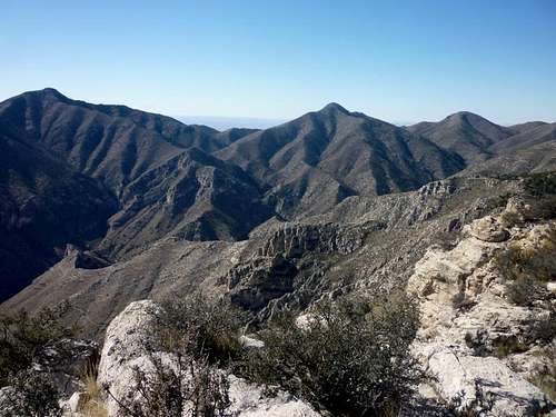
Guadalupe Peak, Shumard Peak and Bartlett Peak from the east
The in the southern end of Guadalupe Mountains National Park, a bold wall rises abruptly from the desert floor. Several peaks are lined up from El Capitan to the south, through the high point of Texas at Guadalupe Peak, onto Shumard Peak and then to Bartlett Peak, before marching northward to Bush Mountain, the second highest peak in Texas. Part of the dramatic, west-facing wall from the west, Bartlett Peak from the east rises from the upper Pine Canyon as a mild, humped mountain cut by drainages and defined by pronounced ridge lines.
With no trail to its summit, the majority of visitors to the National Park bypass this peak. A sheer wall forms a barrier to access from the west, while a rock-strewn scrub filled with Spanish Dagger and other poky plants prevents the casual visitor from strolling toward Bartlett Peak's lonesome summit.
Profile image by txmountaineer.
Rank: 4th highest peak in Texas
Prominence: 448 feet
USGS Quad: P X Flat
Planning Map: Trails Illustrated #203 | Guadalupe Mountains National Park
Rank & Prominence: Lists of John
Red Tape
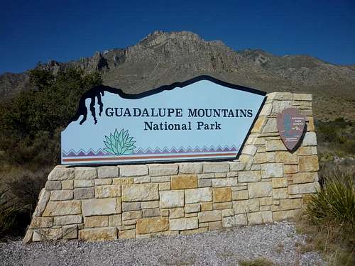
Welcome to Guadalupe Mountains National Park
The entrance fee to this national park is $5.00 per person for adults 16 years of age and older, and is good for 7 days.
Many use restrictions apply in national parks, most notably that dogs are not allowed on most trails and are restricted only to parking lots, campgrounds and interpretive trails or other trails designated as dog-friendly.
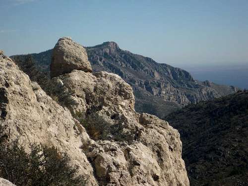
 Bartlett Peak from the south |  Century Plant Agave |
Getting There
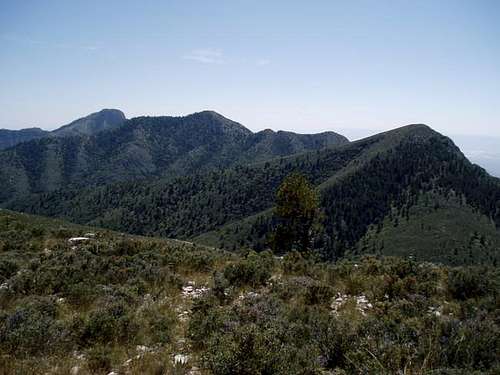
Hunter Peak from Bartlett-Shumard Saddle
The vast majority of visitors to Guadalupe Mountains National Park will arrive by vehicle. Bartlett Mountain is accessible via the primary park entrance. The park is located in far west Texas, about 110 miles east of El Paso, Texas. To reach the main entrance, out of El Paso, follow U.S. Highway 62/180 to the park entrance.
El Paso has the nearest major commercial airport, though Albuquerque, New Mexico, would be an option for air travelers, as well.
To to the sheer topography of the west-facing escarpment walls, Bartlett Peak is most frequently accessed by dropping off the Bush Mountain Trail, crossing the upper reaches of Pine Spring Canyong, and ascending the northeastern ridge of the peak.
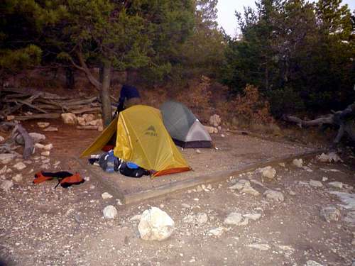
Camping & Lodging
Front Country Camping
Per the National Park Website:
Pine Springs (Elevation 5,822')
Located just off U.S. Highway 62/180 near the Headquarters Visitor Center, Pine Springs Campground is a simple, desert camping area situated at the base of the mountain.
•Campground conveniences include: potable water, accessible flush-toilet restrooms , utility sink, pay telephones, and a drink machine. There are no showers available in the campground.
•Tent campers have a choice of 20 leveled, gravel sites. Small junipers and oaks partially shade most of the sites and each site has a picnic table. Numbers are limited to 6 people or 2 tents per site.
•The RV camping area is a paved parking lot with 19 sites to choose from. RV sites are defined by painted lines and numbers on the pavement. There are no hook-ups and there is no dump station. RV water tanks can be filled from an outside water faucet near the registration board. RV campsite #21 is wheelchair accessible.
When you arrive, select a campsite, then pay at the self-registration board near the restrooms, or fees may be paid by credit card at the Headquarters Visitor Center. All sites are on a first come, first served basis. The fee is $8.00 per night per site, $4.00 for Golden Age (Senior) and Golden Access Passport holders.
Per SP Member Bark Eater:The Pine Springs tent camping area is small and can typically fill by Thursday evening for popular weekends. The good news is that the NPS folks are pretty cool and will let "tenters" sleep in their cars or pickups in the RV area if spaces are available and the tent area is full. This was the case for my group. Still nice picnic tables available around the RV space. You just cannot pitch a tent there. The park enforces quiet time after 8 PM so you don't have to worry about generators going all night long. The flexibility to stay in the RV lot is good because other drive-up camping options are a LONG drive away.
Weather & Seasons

On the summit of Bartlett Peak
•Summers are hot, though the desert nights cool down nicely at this elevation. Keep an eye out for afternoon monsoon storms in late summer.
•Autumn is generally cool and calm with pleasant fall colors.
•Winter can bring warm sunny days but bitter cold nights and even fog, snow and freezing rain.
•In a park notorious for high winds, spring brings some of the gustiest conditions. The park frequently posts high winds warnings in springtime.
External Links and Additional Information
•Guadalupe Mountains National Park Official Website•Park Map (PDF)