
-
 66038 Hits
-
 92.24% Score
-
 39 Votes
|
|
Mountain/Rock |
|---|---|
|
|
43.74700°N / 110.7966°W |
|
|
Hiking, Mountaineering, Trad Climbing, Ice Climbing, Aid Climbing, Mixed, Scrambling, Skiing |
|
|
Spring, Summer, Fall, Winter |
|
|
12928 ft / 3940 m |
|
|
Overview
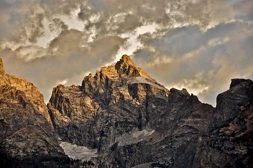
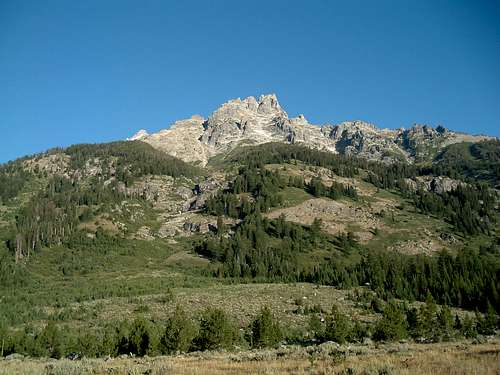
Located inside of the Grand Teton National Park, Mount Owen is one of the greatest of the Teton peaks in both elevation and climbing interest. All routes require knowledge in mountaineering and rock climbing and vary in degree of difficulty from 5.1 to 5.10 and very high quality of rock. The views are nothing short of spectacular which also makes Mount Owen one of the most appealing climbs in the Tetons. As the second highest peak in the Tetons, it rises dramatically above the plains around Jackson Lake but still sits nearly 1,000 feet lower than the Grand Teton. Approach this peak with lots of respect and know that this peak will probably kick your butt and requires more effort than an ascent of the Grand Teton due to the lack of trail and more remote setting.
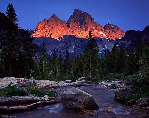
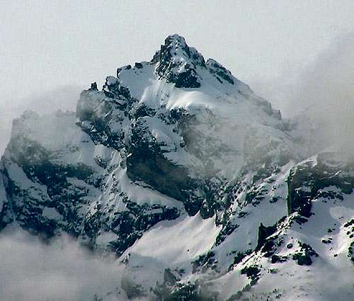
Mount Owen Alpenglow
Getting There - Lupine Meadows TH
Mount Owen is located in the northwest corner of Wyoming inside Grand Teton National Park. From the north entrance of the park, drive south 28.5 miles to Moran Junction on Highway 191. From Moran Junction, continue south on the highway for 18 miles to Moose Junction where you turn right (west). If you are coming from Jackson Wyoming, drive north on Highway 191 for 12 miles to Moose Junction and turn left (west). At Moose Junction, drive about seven miles to the sign for Lupine Meadow Trailhead. Drive just under a mile on the gravel road to the trailhead with a huge parking area and restrooms. Lupine Meadow trailhead is the jumping off point for most routes on Mount Owen as well as the Grand Teton. Expect a lot of cars at this trailhead.
 Mount Owen | 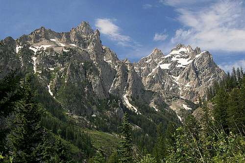 Mount Owen at the right | 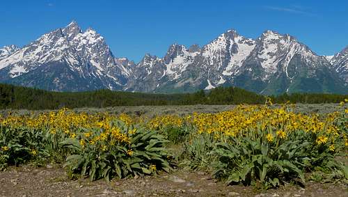 Grand Teton and flowers |
Standard Approach
From Lupine Meadow Trailhead (6732 ft) follow the trail south through the forest as it gains a small ridge and curves west. At 1.7 miles the trail forks and you want to right fork towards Garnet Canyon and Amphitheater Lake. Begin a series of long switchbacks ascending beautiful meadows for another 1.3 miles to the next junction. Continue to the right and follow the trail to Surprise and Amphitheater Lakes. In early season there will surely be snow on the trail and the lakes will be covered with ice and snow. It's a total of 5 miles on the trail to 9,714 foot Amphitheater Lake, however no camping is allowed at the lakes so you must continue north another 10 minutes or so, and gain the small 9,880 foot saddle between Disappointment Peak and Point 9,967. This saddle has a nice perch that offers fantastic views of Mount Owen, and into upper Glacier Gulch off to the northwest.
 Teewinot from Lupine Meadows | 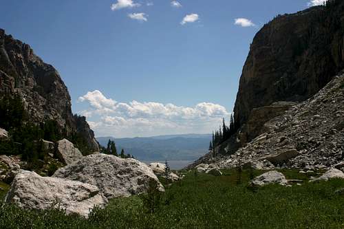 View of Jackson Hole from the trail |  Amphitheater Lake and Owen poking up |
Standard Route - Koven - Class 5.4
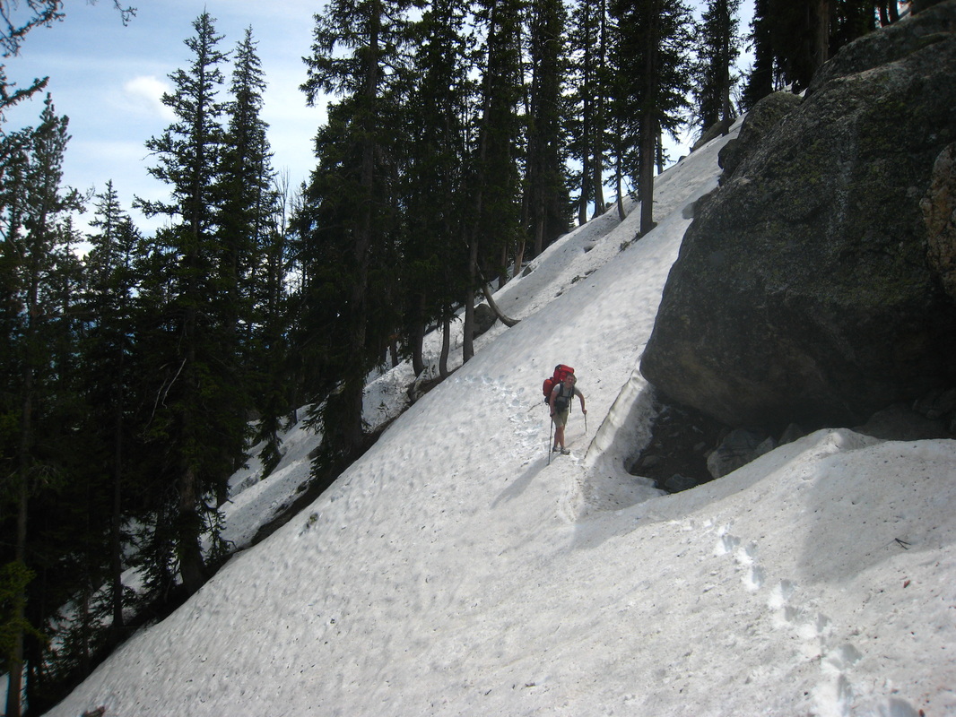
From the 9,880 foot saddle above Amphitheater Lake, Descend a short bit over the north side and cut left and make a traverse on an exposed ledge into the basin above Delta Lake, and below the huge north face of Disappointment Peak. When there isn't snow, this is a good trail but if snow covered it is a scary traverse on 45-50 degree snow where a fall would throw you over a 200 foot cliff if you fail to arrest. Use caution. Once in the basin, continue ascending northwest on the moraine along the base of Disappointment Peak, then at 9,900 feet, cut due north and ascend to the top of the terminal moraine for the Teton Glacier, and descend 30 feet into the large bowl. The glacier has receded quite a bit and in summer, this is a miserable talus romp. Continue ascending northwest on the talus (or snow if you go in early season) aiming for the deep couloir just to the west of East Prong. This is the Koven Couloir.
 Traversing below the 9,880 foot saddle to the moraine | 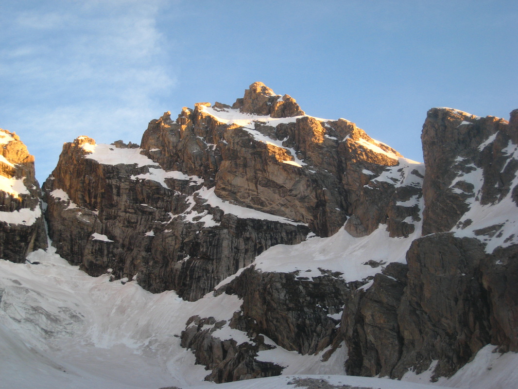 Sunrise on Mount Owen from the moraine | 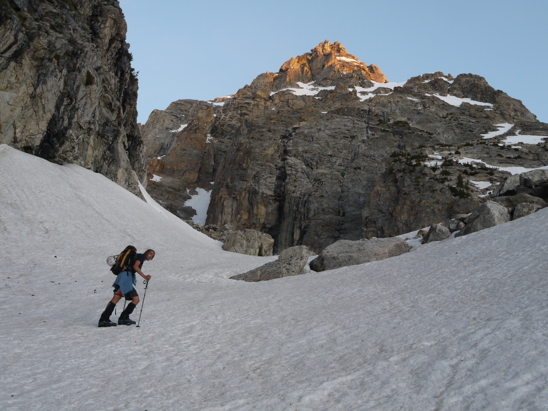 Hiking up the moraine |
Reach the base of the couloir at 10,690 feet and climb one long pitch of 5.4 rock to enter the couloir proper. This pitch is a full 70 meters and is usually wet, it's best to stay to the right of the small waterfall coming down the slabs. Once on the easier terrain above, begin climbing the moderately steep couloir, then as it narrows at around 11,350 feet, it becomes steeper and tops out on the east ridge of Mount Owen at 11,880 feet. The steepness exceeds 50 degrees at the top. Once at the saddle just west of the East Prong, turn left and continue up the ridge, and traverse slightly north aiming for an obvious gully/chimney. Climb this 140 foot chimney and emerge onto the massive upper bench at which point you can continue around the bench all the way to the west end and finish the climb via the south ridge (Class 5.4), or complete the east ridge directly (Class 5.6). See the corresponding route pages for more information.
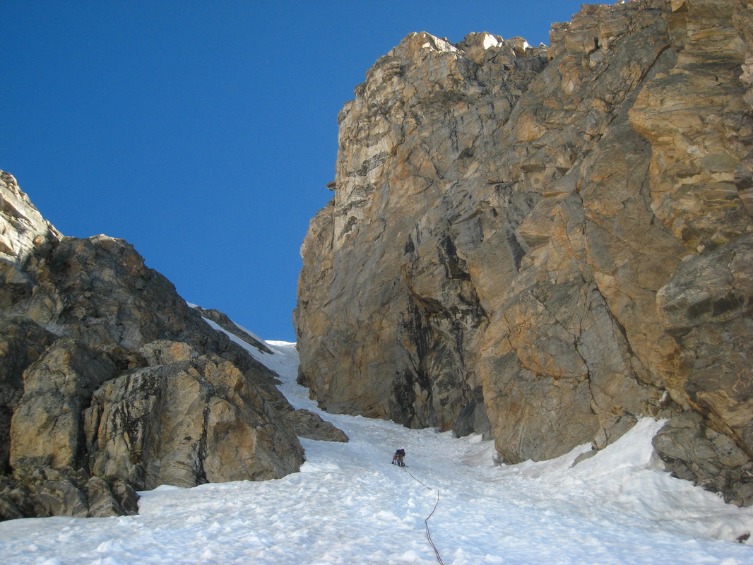 Climbing the Koven Couloir | 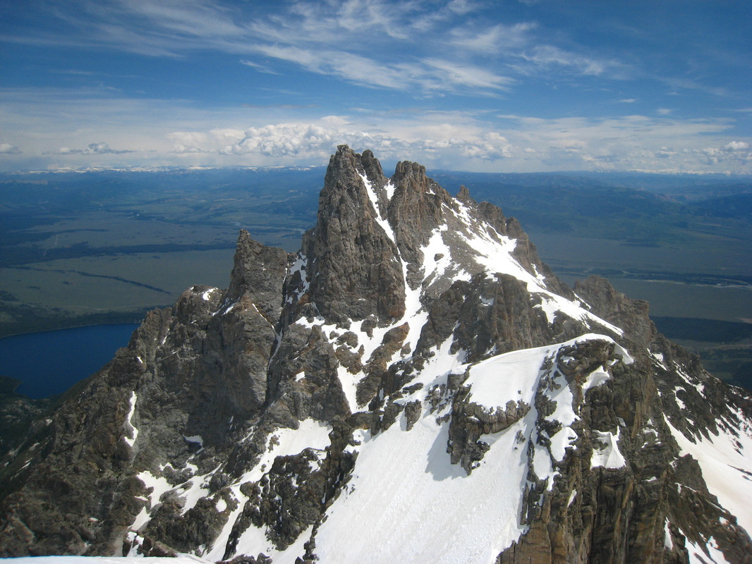 Teewinot Mountain from the top of the chimney | 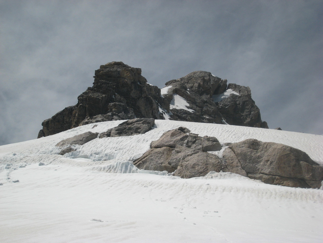 Mount Owen from the start of the upper bench |
Maps
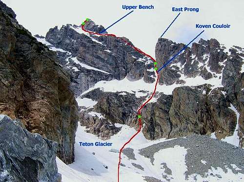 Koven Route Topo from the saddle just above Amphitheater Lake |
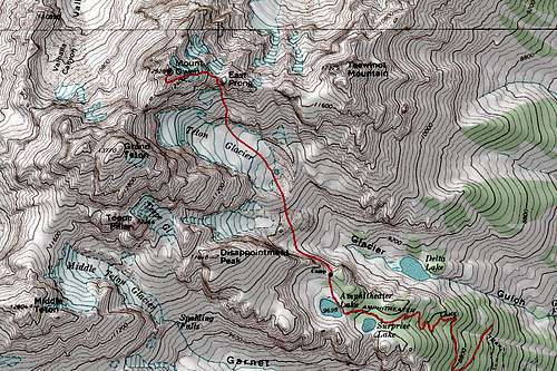 Mount Owen Topo Map |
When To Climb
June through September are the usual climbing months. Months outside of this range encounter unconsolidated snow, ice, and colder weather but don't necessarily make the mountain unattainable. In fact, the entire area is a haven for ski touring in spring. The standard route however is best done when snow fills both the couloir and the talus moraine, otherwise it's a long romp on loose, and dangerous rocks. Some years the couloir completely melts out making it a bowling alley of loose rocks, while other years it will turn into water ice in late summer inviting alpine ice climbers.
 Mount Owen in early season | 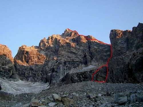 Mount Owen in late season (east ridge marked) |
Camping/Red Tape
Grand Teton/Yellowstone National Park Entrance Fees are required to enter/re-enter either park (the pass is good for both). Single entry pass is valid for 7 days and costs $20.00 per vehicle; $10.00 per person for single hiker or bicyclist; $15.00 per motorcycle. Permits are required for backcountry camping within the GTNP and can be obtained at the Jenny Lake ranger station. Arrive early and be prepared to stand in line during peak season. Camping is not necessarily prohibited at the trailhead (in your car), but I wouldn't go throwing up a tent. Many people camp at the 9,880 foot saddle above Amphitheater Lake however no camping is allowed at the lake, or Surprise Lake just below.
Cheap lodging can be found at the American Alpine Club's Climber’s Ranch which is located 7 miles past Moose Junction on Teton Park Road and offers shared cabins with bunks (bring your own sleeping bag) for $8 per night for AAC members or $16 for non-members. A cooking area and showers/restrooms are on site. Spots are available on a first come/first served basis but some reservations are taken. Call ahead for specifics at 307-733-7271.
Grand Teton National Park has five campgrounds all on a first come, first served basis. Jenny Lake campground has 49 sites for tents and fills very fast. Other campgrounds include Gros Ventre - 360 sites, Signal Mountain - 86 sites, Colter Bay - 350 sites, Flagg Ranch - 175 sites, and Lizard Creek - 60 sites. Colter Bay and Flagg Ranch each have over 100 full RV hookup sites. All other lodging (such as what's available in Jackson) is ridiculously over priced and will never be of interest to climbers.
Other Route Options
West Ledges - II, 5.1Southwest Ridge - III, 5.6
South Face - III, 5.6, A1
South Chimney - III, 5.6
Fryxell - II, 5.4
Bunton - II, 5.6
Koven - II, 5.4
East Ridge - II, 5.6
Northeast Snowfields - III, 5.6
Crescent Arete - III, 5.7
Run-Don't-Walk Couloir - IV, 5.9, A3, WI4
North Ridge - IV, 5.9
North Face - III, 5.6
Northwest Ridge - III, 5.7
Northwest Face - III, 5.6
Serendipity Arete - IV, 5.6, AI or IV, 5.7
Intrepedity Arete - III, 5.10-
North Ridge - IV, 5.9
Tetons Webcam

Tetons Webcam
External Links
Great Trip Report of the Koven Route
Mountain Project Description for the Koven Route
Reminder that accidents can always happen!