
-
 59046 Hits
-
 89.58% Score
-
 30 Votes
|
|
Mountain/Rock |
|---|---|
|
|
33.41100°N / 111.4°W |
|
|
5057 ft / 1541 m |
|
|
Overview
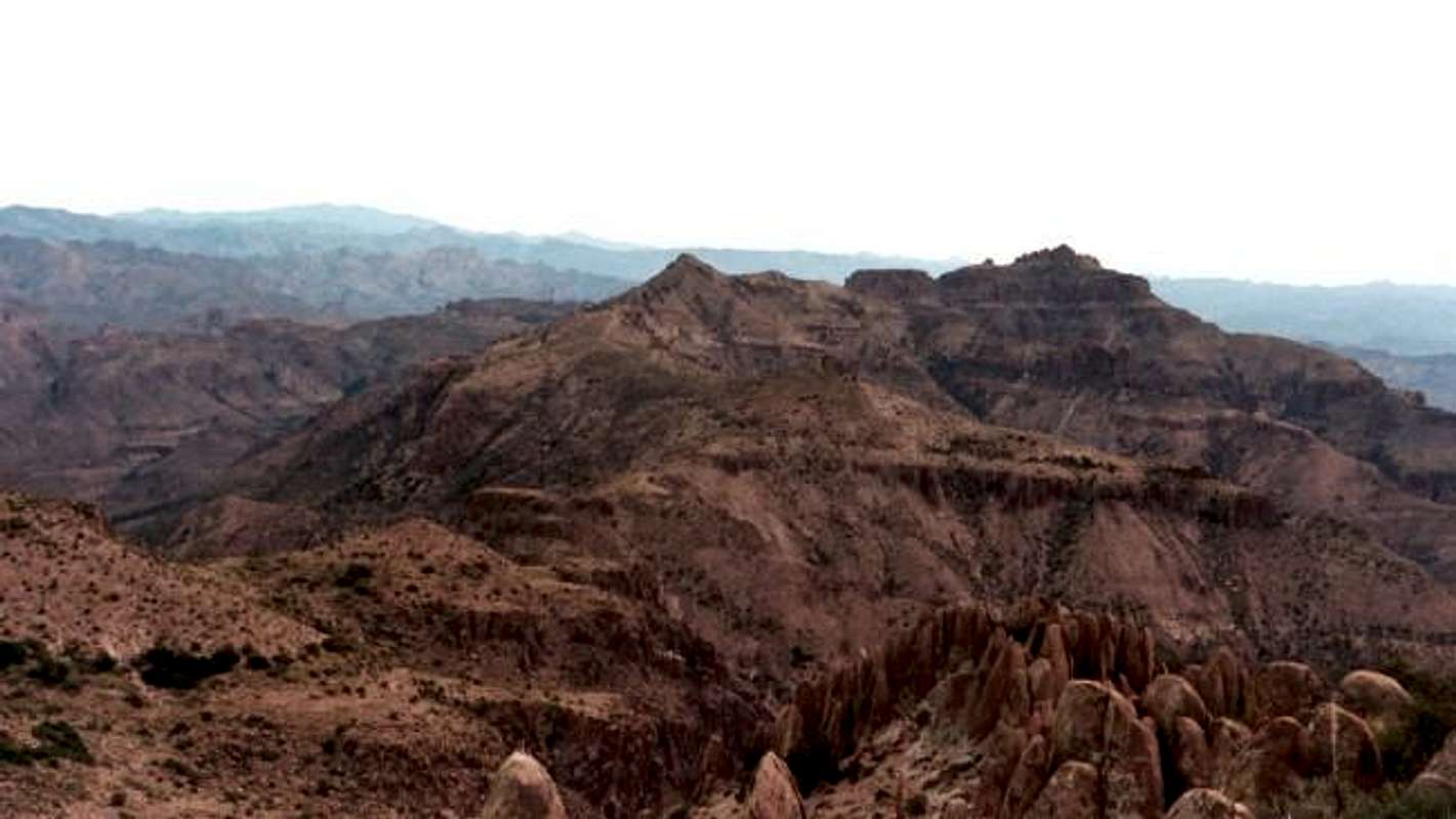
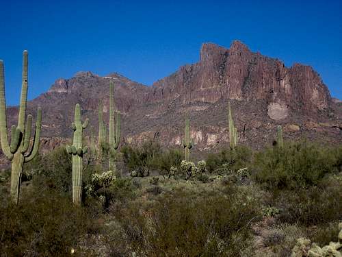
 The Superstition Mountains are a massive range of mountains east of Phoenix. They are Arizona’s premiere range of mountains and probably the most famous range in Arizona. They are a volcanic range that offers a lot. They probably are one of Arizona’s most beautiful and rugged ranges. There are all sorts of hiking you can do throughout the Superstitions. There are easy trails that head through canyons to multi-day backpacking trips. There are many mountains that you can climb with difficulties from easy trails to class 3 scrambling to rock climbs.
There are many superstitions about lost gold in the mountains, the Lost Dutchman Gold Mine being the most famous superstition out. There are other stories by the Native Americans. One being that in the area there was a giant flood. All the good people heard about it and all the bad people drowned. All the good people ran up the mountains and turned to stone. If you look at the hoodoos many of them look like people.
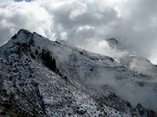
Superstition Mountain is the highest point along the Superstition Ridge line, which overlooks both Phoenix and the rest of the Superstitions. The view of Weavers Needle is spectacular from its peak. This peak even though it is the high point, is not heavily traveled like The Flatiron. This secluded peak really gives you a feel of what the “Supes” are all about. Everybody I talked to says that they like the view better than the Flatiron as well. In my opinion that is definitely true. The trail that leads to the top of it takes you through enchanted canyons with hoodoos hovering above you and other spires and pinnacles all around the canyons. The peak is covered in Hoodoos and looks impassable without ropes. But in actuality a simple short class 3 climb with an exposed class 4 maneuver get you right on the peak, no ropes required. The overall ascent is not technical but is very steep. The environment is harsh, brush, bushes, Cacti and agave plants growing right next to the trail ready to snag and scratch you. If you do not wear pants you WILL get cut and scratched up. This IS Arizona desert hiking at its best!
To read more about the Superstition Mountains go HERE
 |
 |
 |
 |
Getting There
Carney Springs/ Boulder Trailhead:
From Phoenix Take Hwy. 60 heading towards Globe to mile post 204. Turn left on Peralta Rd. Watch on the right hand side carefully for the Peralta Rd sign. From here go about 6.1 miles. You will see a sign that reads Peralta Trail. Shortly after the road turns to the right and there is an unmarked road heading left. Park here and hike .6 miles to the trailhead. This road has been closed off to vehicular traffic. From here there is no designated trailhead, just go through the opening in the fence and find the trail.
Red Tape
Carney Springs Trail head has no red tape. The road has been closed off to Vehicular traffic, so you must walk an additional .6 of a mile.
When To Climb
Best climbed in winter. Summer temps are way too hot. October-March is the best time. In march you can catch the wild flowers coming in bloom. There is nothing like the desert in bloom in Arizona. The winter may bring some snow to the mountains as well.

Camping
Peralta Trail head
Thanks to MoapaPk for adding this:
While I didn't see a sign specifically prohibiting camping at Peralta Springs, there are no campsites. There is a rough campsite (at least, a level spot off the road with a fire ring and one small shade tree) between Carney Springs and Peralta, on the N side of the road. The validity of this site is questionable; the property to the immediate N is marked "No Trespassing".
Carney Springs
The road has been closed off to vehicles. So to camp you have to backpack in .6 of a mile to the trail head and camp there. Don't let the name fool you. There is no springs and no water. You must bring your own.
Mountain Conditions
The Arizona desert is a harsh environment. The summers are scorching and there is no water in the Superstitions. BRING PLENTY OF WATER, especially if your heading across the Superstition Ridge line. I brought 4 1/2 liters and ran out within the last mile.
MoapaPk - Mar 20, 2008 11:48 pm - Voted 10/10
some changes"From what I understand you can camp at Peralta Trailhead (for a fee) or you can camp at Carney Springs Trailhead for no fee." While I didn't see a sign specifically prohibiting camping at Peralta Springs, there are no campsites. There is a rough campsite (at least, a level spot off the road with a fire ring and one small shade tree) between Carney Springs and Peralta, on the N side of the road. The validity of this site is questionable; the property to the immediate N is marked "No Trespassing". The Carney Springs Road is now closed to vehicular traffic. You can't camp at the springs unless you are willing to backpack. "If you go all the way to the Peralta Trail there is a parking fee which you can pay with your credit card. " I didn't see an obvious fee, and certainly didn't see any capacity for paying by credit card...
Steven Cross - Mar 23, 2008 10:19 pm - Hasn't voted
Re: some changesThanks for the heads up, changed the info.
Marmaduke - Apr 1, 2011 1:41 am - Hasn't voted
3 U.S. Geological MarkersDoes anyone know why there are 3 of them on this peak?
Vic Hanson - Feb 15, 2015 12:00 am - Hasn't voted
No CampingThere is now a sign along the road that say "No camping at any trailhead". There are 3 trailheads, all are free now. Most of the land leading up to them is State Trust Land, according to their website: An ‘Individual Permit’ allows the signatory limited privileges to use State Trust Land for some recreation. Recreation under this permit is limited to hiking, horseback riding, picnics, bicycling, photography, sightseeing, and bird watching. Camping is restricted to no more than 14 days per year. Individual permits are $15, family are $20, I think per year. They are available by mail, not sure about in person. https://land.az.gov/sites/default/files/documents/files/RecreationPermit.pdf