
|
|
Mountain/Rock |
|---|---|
|
|
45.98630°N / 113.4596°W |
|
|
Granite |
|
|
Hiking, Scrambling |
|
|
Summer, Fall |
|
|
10463 ft / 3189 m |
|
|
Overview
Big Sky Country is where you will find the true American wilderness!!!
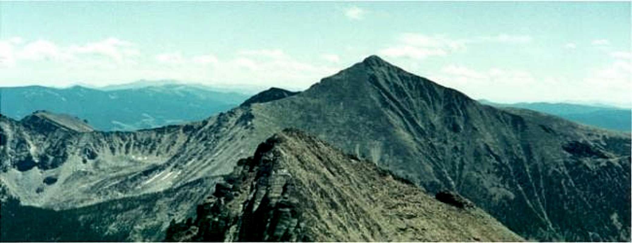
A mountain climber needs a good sense of direction to tackle this peak. There are several routes you can take to the mountain. The technically easiest, and most popular being a 13 mile round trip day hike/boulder hop. No matter what route you take, you will eventually reach the heart of the Anaconda-Pintler wilderness, where the trails disappear, and you must use your own cunning to survive!
Warren Peak resides in the Anaconda Range of southwestern Montana. There are no towns within 30 miles of the peak. Do not expect a good view of the Pintler Range from the road. These mountains are pretty isolated and only come into full view on rt. 38, and they are still pretty far away at that point. They are obscured on Moose Lake road because the road goes up nearly 1,000 feet and is surrounded by small forested mountains that dominate surrounding views.
The Anaconda Range is a little more than an hour away from Anaconda, Montana, which you can reach off of I-90 in between Butte and Missoula. The most prominent mountain you see from the road is Warren Peak, which is also the high point of Granite County, Montana. Although it is very close to a higher mountain, West Goat Peak, 10,793', Warren Peak is still the high point of Deer Lodge County.
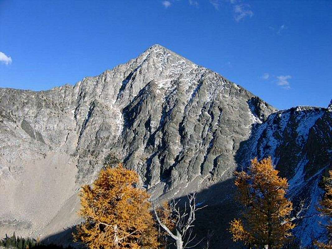
Warren Peak is a lovely mountain, not climbed too often, since most people use the Anaconda-Pintler Wilderness trails for fishing at the area's many lakes. The Edith Lake trail is a class 1 hike until you reach the lake. The entire last 2 miles to the summit is all Class 2. From the trailhead, it is 6.5 miles to the top with 4,400 feet of total elevation gain. If you camp out at Edith lake (roughly 5 miles in from the trailhead), you hike 3,200 feet to the top.
*Thanks to Saintgrizzy for his excellent photos submitted in November of 2004!
 |
 |
 |
 |
 |
Getting There
You can reach the Anaconda Range and Warren Peak by traveling down I-90 toward Missoula until you hit Route 1. Then take Route 1 to rt-38(AKA-skalkaho pass) Take rt-38 for 9 miles until you get to Moose Lake Road. Take a left on Moose Lake Road, (a dirt road) and drive 16 miles to the end of the road, where you will find the trailheads. Note that the dirt road is pretty smooth, but can get dangerous, and has sharp curves at certain points. I was driving 50mph on it once, and my car spun out of control. Luckily I didn't get even a scratch on my car, it just spun around and when I got control, I was facing the opposite direction! Lucky I was in Montana where there is no traffic!
After you park your car, you take the trailhead to the left, (back towards the road) which leads to a long gradual trail that goes up 1,000 feet to Edith Lake or Johnson Lake. The primary trail to Warren Peak is near Edith Lake. Most people hike 6 miles to Edith Lake and camp there for the night. The Edith Lake trail is a pretty direct way to get to Warren Peak. The upper portions of the trail have many viewing spots of the surrounding areas. It is a truly magnificent and beautiful scenic trail.
At Edith Lake:
On the same side of the lake that the trail comes in, you can take a left and go through the woods. Do not go around the lake. As soon as you get to the lake, walk left, and walk on that side of the lake for 100 yards, then go left, up through the woods. There is no trail at this point, but I suggest that you start up the mountain at this point and you will find that the only way to go is UP.
You climb a few hundred feet through woods, and then you'll be on class 2 rocks all the way up to 8500 feet. At this point you traverse a smaller peak, which leads to a false summit, to reach the saddle of Warren Peak. Then you go straight up to the summit.
 |
 |
 |
 |
 |
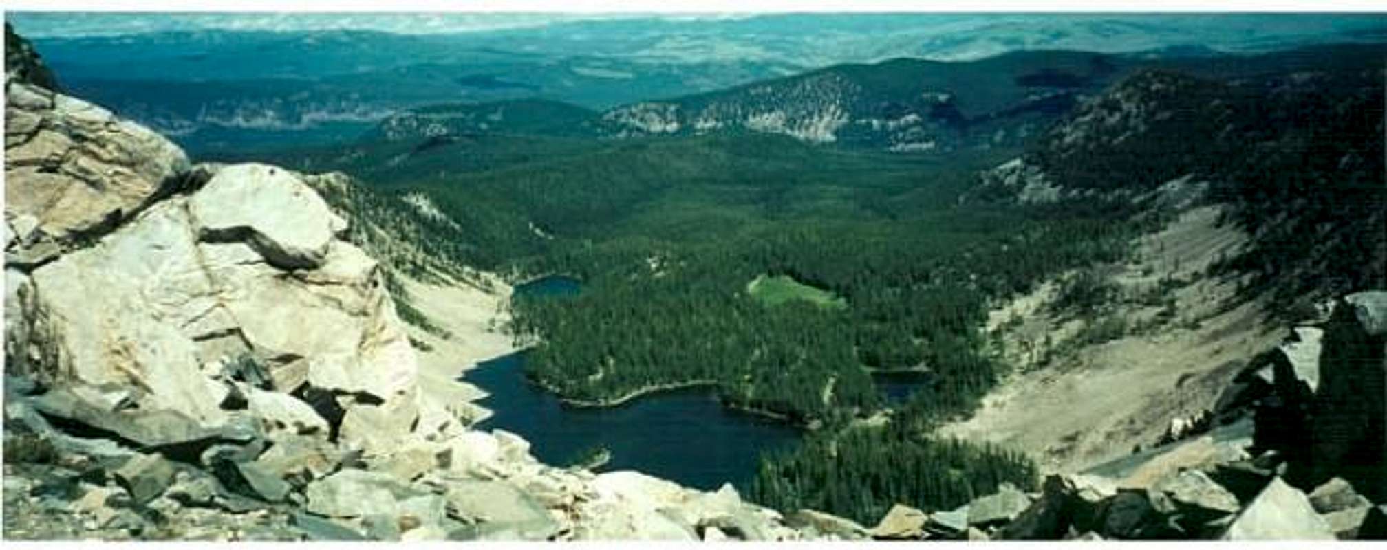
Views from the top
The surrounding mountains, valleys, lakes, and lush green forests, provide stunning views in all directions. Warren Peak and the Anaconda Range is quite isolated but offers a true and honest wilderness experience. The mountain is never crowded and always has opportunities to find new routes down the mountain. Check out the summit view photos below.
 |
 |
 |
 |
 |
Red Tape
Moose Lake road is frequently traveled, so road conditions are at least made tolerable for inhabitants of the area. Camping is permitted throughout the wilderness area, although regulations from time to time may limit camping around popular day hiking destinations. Additional camping is found at several designated campgrounds on the east and west sides of the mountains. Abundant informal campsites also exist all around the wilderness area. More information on camping access and restrictions
Crampons and an ice ax are essential tools for winter and spring ascents of Warren Peak and the surrounding Mountains.
Watch out for Bears, Cougars, and Moose. Always pack up your food, do not hike alone, and make noise.
When To Climb
Best to travel here during the summer because snowstorms make travel on Moose Lake road questionable during the winter and spring. We faced a serious snow storm just a few miles from the trailhead on June 1st, 2001. Warren Peak is generally free of snow by mid-to-late July through early September. Generally, the trails are well maintained and defined in the summer months.
 |
 |
 |
 |
Camping
Camping is allowed in the area, especially at the lakes. There are no fees. There are no huts. More information on camping access and restrictions
 |
 |
 |
 |
External Links
- Montana Mountains and state high points
links to Daniel Fleischmann's Montana webpage, as well as pages on other states and state high points. - Weather in Philipsburg, Montana
Weather report for the closest town to Warren Peak. - Camping info
General info on the area
montanaboy - Aug 8, 2005 2:08 am - Hasn't voted
Untitled CommentDistance from Edith Lake trailhead to Edith Lake was exactly 4 miles on the GPS. Distance to the summit from Edith Lake trailhead was 5.4 miles on the GPS. A longer route was taken on the descent, making the round trip mileage 11.8 miles on the GPS.