
-
 26798 Hits
-
 81.07% Score
-
 13 Votes
|
|
Mountain/Rock |
|---|---|
|
|
47.32105°N / 121.06462°W |
|
|
Download GPX » View Route on Map |
|
|
Hiking, Scrambling |
|
|
Spring, Fall, Winter |
|
|
5034 ft / 1534 m |
|
|
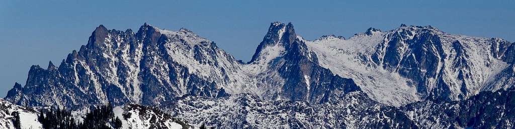
Overview
Hex Mountain is located in the Teanaway on the eastern crest of the Cascades. This peak is a decent choice during the fall or as a trainer hike during the snowy months. This mountain has a total elevation gain of about 2,600 feet and is about 8.25 miles of traveling round trip. Total round trip moving time is 4 to 6 hours depending on your party speed. From the summit one can enjoy good views of the Stuart Range (north) and Mount Rainier to the South. Though out the winter months the trail is completely covered by snow making route finding the biggest challenge (it's not that difficult). I would recommend snowshoes instead of skis due to the thick forests on the upper slopes. Finally, a good reason to choose this pre-season conditioning climb is when you finish you can stop off at Village Pizza in Roslyn.Getting There
For easy Google Maps directions click here.
From Seattle: Head east on I-90 for 77 miles (exact mileage depends on your starting point). Take exit 80 toward Salmon La Sac/Roslyn. In 0.2 miles turn left onto Bullfrog road. In 2.8 miles at the 2nd traffic circle, take the 2nd exit onto WA-903 N. After 1.5 miles turn left onto W. Nevada Ave. In 0.3 miles turn right onto WA-903 N/N 7th St. From here the trailhead is in 6.6 miles on the left side of the highway. The trailhead is a parking area just before FS 116. Either park there or drive pass the creek and turn right at the second road (about 200 feet passed the parking area).
From Seattle: Head east on I-90 for 77 miles (exact mileage depends on your starting point). Take exit 80 toward Salmon La Sac/Roslyn. In 0.2 miles turn left onto Bullfrog road. In 2.8 miles at the 2nd traffic circle, take the 2nd exit onto WA-903 N. After 1.5 miles turn left onto W. Nevada Ave. In 0.3 miles turn right onto WA-903 N/N 7th St. From here the trailhead is in 6.6 miles on the left side of the highway. The trailhead is a parking area just before FS 116. Either park there or drive pass the creek and turn right at the second road (about 200 feet passed the parking area).
  |
Standard Route
The hike starts out on the gavel covered Newport Creek road (also known as FS 116).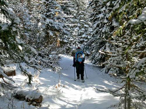
Hiking though snowy Woods
- You will see a yellow gate (GPS: 47.291198/121.09779 -- Elev.2518 feet).
- Continue up the road for about 10-15 minutes or so, and you will see a split in the road continue straight (right fork).
- After 200 feet or so you will see the road turn left, take this left. I saw tracks in the snow continue straight, do not continue straight.
- Follow the road for another 1.7 miles to the HEX mountain trail sign (GPS: 47.30478/121.08050 -- Elev.2650 feet)
- Follow the trail to summit. About 1/4 mile before the summit, the trail turns right along the ridge; another 10 minutes and you will reach the summit (GPS: 47.32104/121.06464 -- Elev. 5024 feet).
Red Tape and Camping
Northwest Forest Pass is recommended, not sure if it's required but it's always good to stay on the safe side. The start is not at a traditional trailhead making it questionable for the pass deal.
Camping is allowed which requires no permit. There are many places you could camp, although very few people ever camp on this mountain. I would mention camp spots but you could camp pretty much anywhere on the mountain. The best ones being near the beginning.
Camping is allowed which requires no permit. There are many places you could camp, although very few people ever camp on this mountain. I would mention camp spots but you could camp pretty much anywhere on the mountain. The best ones being near the beginning.
When To Climb
Most people climb this mountain December though March. However, this mountain can be climbed any time of the year due to its low elevation. Avalanche danger is rarely a concern here due to it's moderate slopes that are mostly tree covered.
![The final approach to the...]()
Hex Mountain during October
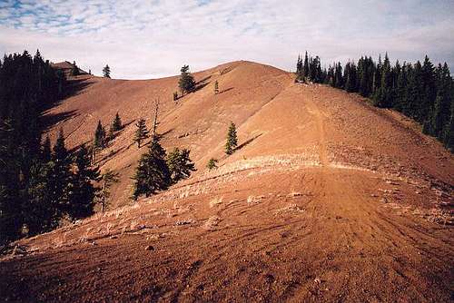
Hex Mountain during October
Mountain Conditions
For current weather information on Sherman Peak check in with the Noaa Forecast.
For Avalanche Conditions, check in with the Northwest Avalanche Center. (Limited based on the season)
Check in with WSDOT for info on Snoqualmie Pass road conditions.
![Frozen Leaf]()
Frozen Leaf during November
For Avalanche Conditions, check in with the Northwest Avalanche Center. (Limited based on the season)
Check in with WSDOT for info on Snoqualmie Pass road conditions.
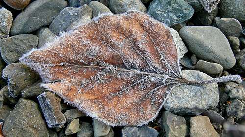
Frozen Leaf during November
Topographic Maps
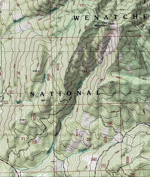
Hex Mountain Topographic Map
External Links
http://rgervin.com/photos2011/20110202HexMtn/thumb.html
http://www.nwhikers.net/forums/viewtopic.php?t=7980461&highlight=hex+mt+mtn+mountain
http://www.nwhikers.net/forums/viewtopic.php?t=7973910&highlight=hex+mt+mtn+mountain
http://www.nwhikers.net/forums/viewtopic.php?t=7995568&highlight=hex+mt+mtn+mountain
http://www.nwhikers.net/forums/viewtopic.php?t=7988423&highlight=hex+mt+mtn+mountain