
-
 67642 Hits
-
 88.48% Score
-
 28 Votes
|
|
Mountain/Rock |
|---|---|
|
|
39.95370°N / 105.299°W |
|
|
Hiking |
|
|
Spring, Summer, Fall, Winter |
|
|
8549 ft / 2606 m |
|
|
Overview
South Boulder Peak is the tallest of the peaks in the Boulder Group just west of Boulder, Colorado upon which the famous Flatirons lie. It is also the highest of the six major peaks in the Boulder Open Space and Mountain Parks. From south to north these are: 1. Eldorado Mountain, 2. South Boulder Peak, 3. Bear Peak, 4. Green Mountain, 5. Flagstaff Mountain, and 6. Mount Sanitas. For all this lofty altitude, however, it is visible from only a few places in town; from most angles, the nearly-as-tall and impressively pointy Bear Peak shields it from view. Although close to Boulder, South Boulder Peak will provide more solitude than nearby Bear Peak or Green Mountain. Also, with over 1,000 feet of topographical prominence, South Boulder Peak is the 343rd most prominent peak in the state of Colorado.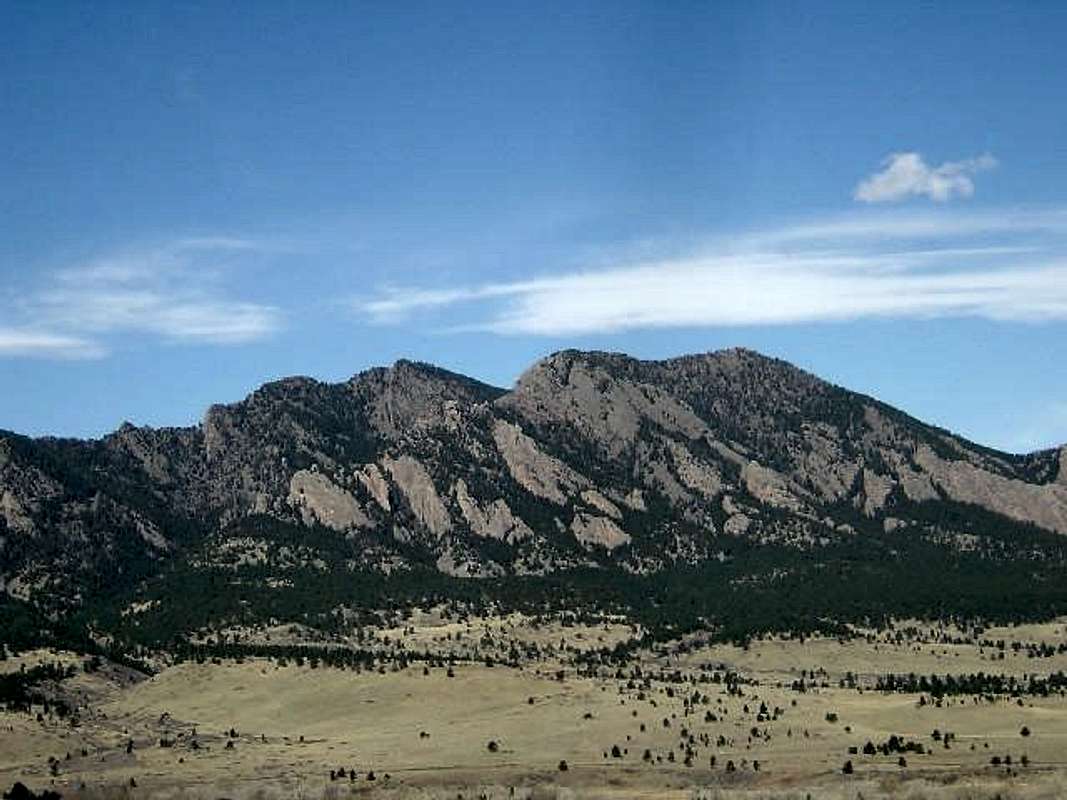
South Boulder Peak (left) & Bear Peak (right). Photo: Chris
Trailheads
In general, there are three main trailheads for South Boulder Peak. From the north, the most accessible trailhead is the NCAR trailhead located at NCAR at the western end of Table Mesa Drive in Boulder. There is no parking fee at the NCAR trailhead. From the east, the most accessible trailhead is the South Boulder Creek-West Trailhead. There is a $5 daily parking fee at the South Boulder Creek-West Trailhead. Finally, from the south, the South Mesa Trailhead is located on Eldorado Springs Drive 1.7 miles west of CO-93 a mile & ~1-2 miles east of the town of Eldorado Springs, Colorado. There is a $5 daily parking fee at the South Mesa Trailhead as well. The Mesa Trail runs along the base of the flatirons and connects all three trailheads (and many other places in the park) quite efficiently. It is possible to make a loop hike from any of these trailheads.
The Boulder OSMP map page has much more information and links to high-quality maps.
Route Options
Given the proximity of Bear Peak and South Boulder Peak, they are usually climbed together. Please refer to the Bear Peak page for more detailed information on Bear Peak.
Shadow Canyon Route
The southern approach starts at the South Mesa Trailhead and climbs the rugged Shadow Canyon. From the trailhead, hike 2 miles to the base of the canyon on the Mesa, Towhee, or Homestead Trails. Pass a small, ruined cabin along the creek. It is then a stiff 1.1 miles and 1800 vertical feet to the sandy saddle between Bear and South Boulder Peaks. From the saddle it is an easy 0.3 miles to the summit of South Boulder Peak (Class 2+ summit block) and the fantastic views to the west. Returning to the saddle, it is a slightly rougher 0.3 miles to the summit of Bear Peak (Class 3 summit block).
Fern Canyon Route
This is one of the standard northern approaches to South Boulder Peak but requires climbing up and over Bear Peak first. It is well covered in the Bear Peak section. Total mileage from NCAR to South Boulder Peak is about 3.5 miles one way with a very stiff but scenic climb up Fern Canyon and the north ridge of Bear Peak.
Southeast Ridge
Class 4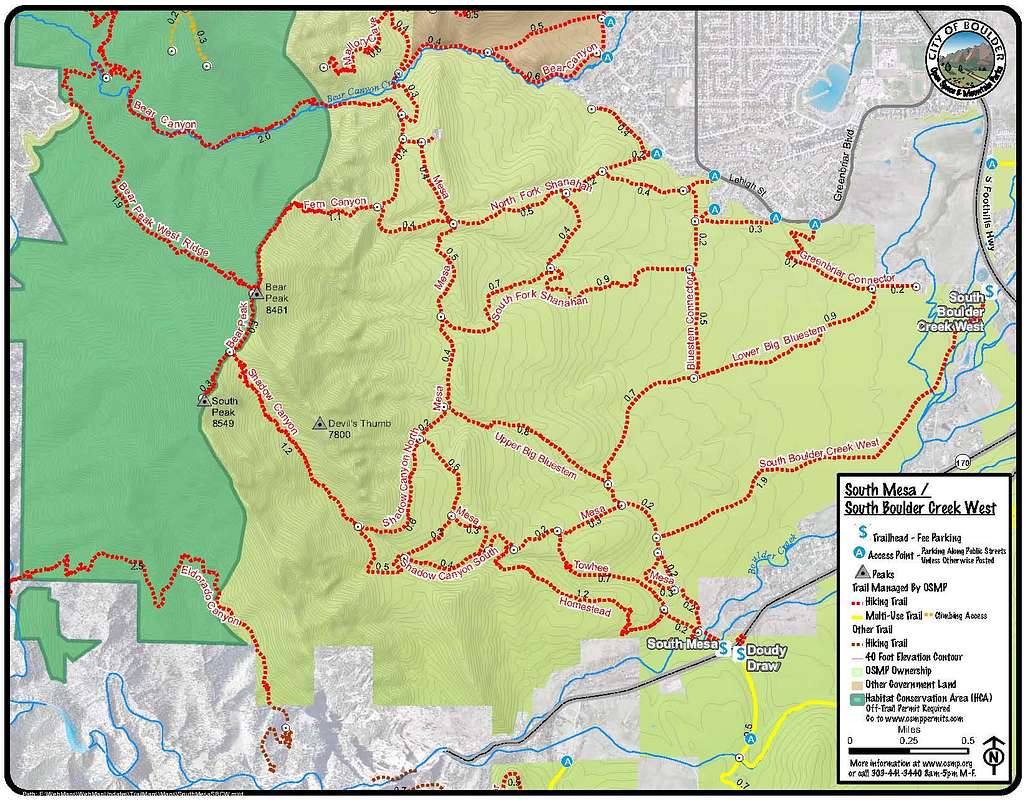
South Boulder Peak map showing the South Mesa & South Boulder Creek-West Trailheads. Click to enlarge.
Red Tape
There are no parking fees or permits necessary except for the South Mesa & South Boulder Creek West Trailheads which both require a $5 parking fee. Dogs are allowed in most areas but should be kept on leashes at all times. Bears and mountain lions frequent many areas of the park. Occasionally, trails will be closed for excessive bear or lion activity.
Boulder guards its raptor habitat and many areas in the park are closed between February 1 and July 31 for nesting peregrines and other hawks. The Boulder Open Space and Mountain Park website has a comprehensive closure list with maps.
When To Climb
These peaks are in essentially a glorified city park and are pretty manageable at any time of year. Snow on the trails in late winter may pose a problem and, in the shadowed depths of the canyons, may exist late into the season. Given the traffic that these peaks receive, it will likely be packed down hard. Yak Trax or microspikes might not be a bad idea during these conditions.
 |
 |
 |
Camping
Camping is not allowed in the Open Space and Mountain Parks. Since any conceivable hike up South Boulder Peak will be less than ten miles, camping shouldn't be required.
Mountain Conditions

External Links
Acknowledgements
I inherited this page from CharlesD on January 13th, 2014.