
-
 47626 Hits
-
 91.99% Score
-
 37 Votes
|
|
Mountain/Rock |
|---|---|
|
|
46.79500°N / 121.2558°W |
|
|
7766 ft / 2367 m |
|
|
Overview
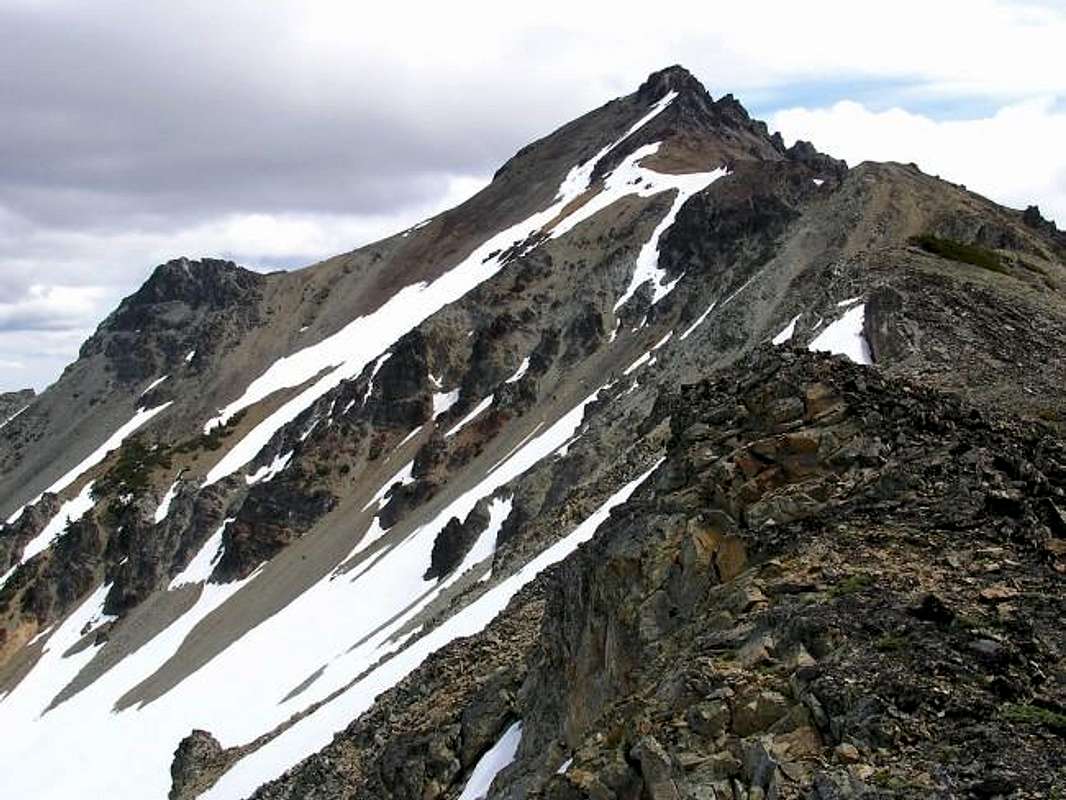
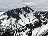
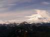
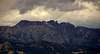
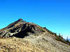
Mount Aix is the dominant peak in the Cacades east of Rainier. Situated in the William O. Douglas Wilderness adjacent to Mount Rainier National Park and about 22 miles due east of its twice-as-big brother, this mountain has the wonderful fortune of falling in Rainier's rainshadow. That combined with a large part of the trail having southwestern expsoure means it is a great early season peak when you can't get in to anything else. About a third of the route is on high ridges with excellent views of Rainier, Adams, Goat Rocks and the Stuart Range. Aix is also the 39th most prominent peak in Washington with 3,286 feet of prominence.
Beckey states that goats are frequently seen on the high slopes. There were plenty of goat tracks along the trail and on the ridges that I saw so it may also be a nice spot to seem them. This is a great peak for early season and for conditioning.
Questions arise as to the pronunciation of this one. Sources show it pronounced like "Aches", "Eye" and "Ikes". Beckey states in a previous edition of CAG 1 that an "1885 map of Washington Territory shows it as Mt. Aiks. The possibility exists it was transposed from Mt. Ikes."
The best route to the summit is a 12 mile round tripper (Mount Aix Trail #982) from the west with 4200 feet of elevation gain that hikes up onto Nelson Ridge and then out to Mount Aix proper. Late in the season, the trail is very dry so you either need to pack a lot of water in for anything after about July or hike this one in late May or June when there are abundant water sources. The peak can also be accessed from the east via a very long hike combining a few other trails. You can also join up to the Mount Aix Trail from the north via a hike up Nelson Ridge.
Great Trip Report with photos
Another good trip report with photos
 |
 |
 |
 |
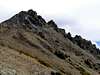 |
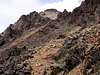
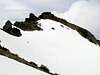
Summit views
 |
 |
 |
 |
 |
Getting There
From the west (Seattle) take 167 to SR 410. Follow SR 410 east through Cayuse Pass and the junction with Hwy 123. Stay on SR 410 through Chinook Pass. 21.9 miles east of Cayuse Pass turn right at the sign for Bumping Lake. Follow this 11 miles to where the pavement ends. The road becomes Road 1800 here and continue on it 2.5 miles to a junction. Stay left and go ahead on Road 1808 (some maps show this as No. 395) 1.5 miles to a sign for Mt. Aix Trail #982 on the left. Pull in here and park in the lot. Passenger cars can make the drive but go slow on the last few miles as it gets rocky and rutted in spots.
From the south (Portland) you have two options. I've taken both and there is not much difference either way.
Option 1-drive I-5 north to Highway 12 at exit #68. Take Highway 12 east past Packwood 7 miles to Highway 123. Take Highway 123 north 16 miles to Cayuse Pass (you'll go through a corner of MRNP but no fees or entrance booths) where you junction with SR 410. Follow from there as above.
Option 2-Take I-84 east to Biggs, OR and cross north over the Columbia on Highway 97. Take 97 to Toppenish, WA and follow signs for I-82. In Toppenish you will change to Highway 22 from Toppenish to I-82. Ignore signs to stay on Highway 97 (a left turn at an intersection with several gas stations) as this is a frontage road with many stoplights and it's going to be quicker to take Highway 22 to I-82. From I-82 go north to Yakima. Take Highway 12 west from Yakima to a junction with SR 410 5 miles west of Naches, WA. Take SR 410 approximately 15-20 miles to the same sign for Bumping Lake and turn left there. Follow as above.
From the east (Spokane)-Take I-90 west to I-82 south to Yakima and catch Highway 12 west and follow as above.
Red Tape
Northwest Forest Pass is required to park at the trailhead.
Additionally, a Wilderness Permit is required to be carried and filled out at the trailhead. They are available at the trailhead and are free.
When To Climb
mid or late May through October
Early season has fewer crowds, more water. Some snow to deal with but nothing bad (May, June). Late season can be very hot and dry.
 |
 |
Camping
Camping is readily available at various spots along SR 410. There are also great spots at the trailhead. There is a flat spot dug into the hillside at about 6050 feet at switchback to the right with great views of Rainier near an all-summer spring. Above this there are spots in grassy areas at about 6400 feet. Also, on the backside (NE side) of the summit pinnacle is a flat spot sheltered from the wind that would be an excellent campsite. No fees to camp.
Mountain Conditions
Naches Ranger District
(509) 653-2205
Credits
Thanks to Paul Klenke and Bob Bolton for their information on this peak. I appreciate the teamwork in helping me with this page.
mandrake - Jun 9, 2009 12:47 pm - Voted 10/10
Mt. AixApparently this area is a major hotspot for Bigfoot sightings. The Bigfoot Field Research Organization (BFRO) was camped out just down the way from us.
Brian Jenkins - Jun 10, 2009 12:19 am - Hasn't voted
Re: Mt. AixHa. Did not know that about this area. Weird.