
|
|
Mountain/Rock |
|---|---|
|
|
39.66140°N / 106.2181°W |
|
|
13180 ft / 4017 m |
|
|
Gore Range Overview
”In my opinion, the two most rugged mountain ranges in Colorado are the Gore Range northwest of Dillon Reservoir and the Needles Range in the remote San Juan Mountains.” -John Fielder-famous Colorado Landscape photographer.
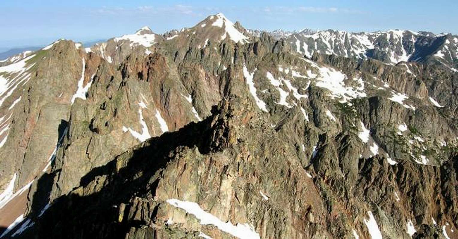
The Gores are more of a range consisting of 12-13,000-ft ridges, rather than separated peaks. A few of the more prominent ridges actually have names like, Zodiac Spires, Rockinghorse Ridge, Ripsaw Ridge and the Grand Traverse. With 50 peaks over 12,000-ft, none attain the magic 14,000-ft mark, which is the primary reason for the Gores obscurity. This is one of Colorado’ most rugged mountain ranges and the rock quality is generally good.
Only 60 miles from Denver, Colorado the Gore Range as a whole is relatively inaccessible due to the lack of mining roads that normally criss-cross other Colorado mountain ranges. The Gores also have a rep for a lot of trailhead access red tape, due in large part to private property. Hikers and climbers not interested in long approaches and heavy vertical might want to look elsewhere for their adventure. Overall, the west side of the Gore Range is more accessible than the east. Approaches that start from the east are few because of private property, in return, expect even longer approaches and expect a poor network of trail systems. Precise planning and execution are of paramount importance when selecting routes in this range. Armed with a loaded backpack and good maps, many of these quiet summits can be climbed without a rope. Major faces and long jagged ridges provide unlimited technical climbing opportunities as well. An ice axe is highly recommended on any early season climbs.
Officially named peaks in the Gore Range are hard to come by, only a few of the Gore highpoints have official names. Differentiating the highpoints on a map or while hiking has challenged all of us at some point. Thankfully we have the CMC to make sense of all of that rugged terrain. In 1932, CMC members Carl Erickson and Edmund Cooper used letters to assign summits in the obscure Black Creek Basin and the CMC subsequently tended and expanded the system (Jacobs & Ormes- Guide to Colorado Mountains.) The lettering system for naming peaks has frustrated many casual visitors over the years, however Gore Range enthusiasts seem embrace the system. It won’t be going away anytime soon.
Mount Valhalla Overview
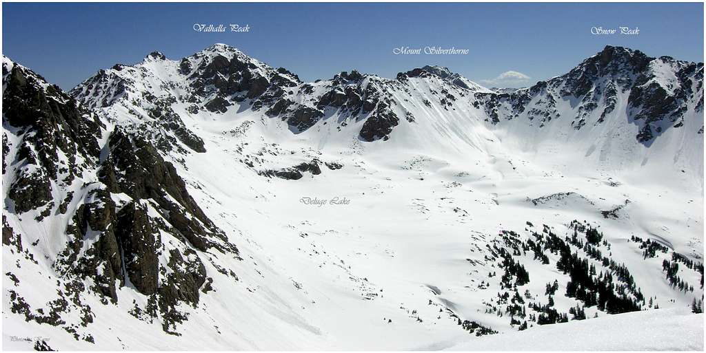
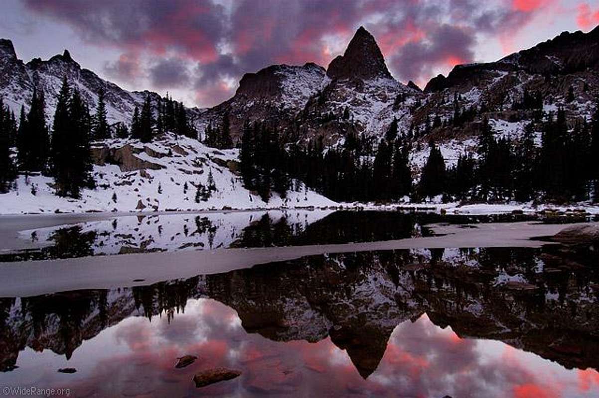
Mount Valhalla (13,180-ft) is the centerpiece of the beautiful Deluge Lake Basin. Flanked by the shapely Grand Traverse Peak (13,041-ft) and the elegant Snow Peak (13,024-ft,) Mount Valhalla stands guard overlooking its pretty neighbors with complexity and ruggedness. In the middle of all of this mountainous symmetry rests the picturesque Deluge Lake, resting comfortably under the huge southwest face of Mount Valhalla.
Mount Valhalla has a rough south, east, and northeast ridges. These typically beautiful Gore-like ridges belong to the Deluge Lake Basin, North Rock Creek Basin and the South Rock Creek Basin. The Deluge Lake Basin approach requires 3,000-ft of elevation gain in 3.54 miles, it is steep. The Rock Creek approaches fall under the “long, tedious, bushwhacking, type” approach that the east side of the Gore Range is known for. In fact, only a two-hour drive from Denver, the Rock Creek Drainages are as remote a place as you can find in Colorado!
In typical Gore, peak-bagging fashion, the high altitude Deluge Lake (11,700-ft) is a perfect place to camp and summit the three 13ers in the immediate area. Mount Valhalla is only 1,350-ft of vertical gain from the lake. The North Slopes Route consists of very steep grassy benches with plenty of loose rock balancing above; the perfect combination for flying rock missiles. Yes, you have heard those rocks go zipping by before, building up speed on those steep grassy slopes; please wear a helmet! Not really sure how much a helmet would actually protect your noggin on this dangerous slope but I’m sure something is better than nothing. Once on the northwest ridge the route to the summit is fun class 3 with some minor exposure.
"Hail Peak"
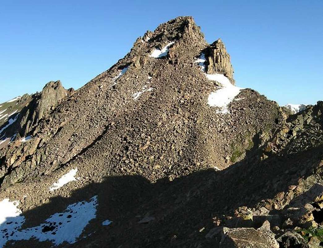
 Hail Peak topo
The officially ranked UN12,904 or “Hail Peak” resides about a half mile west of the Mount Silverthorne massif in the southern Gores. It is the highpoint of a long, and extremely rugged ridge that runs west to Mount Valhalla. The cone-shaped “Hail Peak” views well from other peaks that reside south, peaks like Demming Mountain, Red Peak.and Uneva Peak.
Unfortunately, many of the climbs in southern Gores consist of a lot loose and fractured rock, leading to more talus climbs than normal. “Hail Peak’s” standard Southeast Face Route certainly falls into the climbing category-dangerously loose, and tedious talus. Below the fine summit of “Hail Peak” the upper face consists of teetering car sized boulders, ready to move with just the weight of your hand. The last 300-ft requires your undivided attention to the details of scrambling in this loose environment.
“Hail Peak” easily redeems itself with its great approach (via the Gore Lake Trail) and excellent summit views. Also, “Hail Peak” can easily be combined with another nice unranked peak called Point 12,605 or “Zodiac View.” Named obviously for its unabated view of “Zodiac Ridge,” which connects the Silverthorne massif with beautiful Red Peak.
Topozone Coordinates for "Hail" Peak.
Deluge Lake Trailhead
From Vail Pass, descend down to the city of Vail, Colorado and take exit 180, your first Vail exit on the right. Turn left and go under I-70 and take an immediate left (southeast) onto a feeder road. Take this road past numerous condominiums 2.10 mile southeast where it will bend to the north and go back under I-70. From here it is only .19 mile to the Deluge Lake Trailhead; there is plenty of parking. This is also the Gore Creek Trailhead, another great trail that provides access to many scintillating hikes and climbsMount Valhalla Conditions/Regional Weather
Expect snow up in the Deluge Basin until early June. I wouldn't recommend the southwest slope for a snow or winter ascent. The slope has very poor run-out, often cliffed out. Plus there is too much loose rock balancing above that really doesn't need the melting snow around to help set it in motion towards your head.Click image to enlarge

Red Tape-Eagles Nest Wilderness
“Red Tape” per attmNo permits or fees are required. Like all wilderness areas no mechanized or motorized vehicles are permitted within the Eagles Nest boundaries.
Wilderness is land set aside as part of wild America, where man can be a visitor. The natural environment has not been disturbed. Travel is restricted to foot or horseback. No mechanized equipment is allowed.
For more information, contact the U.S. Forest Service at the # below:
Additional Resources:
Eastern Portion of the Wilderness:
Dillon Ranger District
680 River Parkway
Silverthorne, CO 80498
970-468-5400
or
Western Portion of the Wilderness:
Holy Cross Ranger District
P.O. Box 190, 24747 US HWY 24
Minturn, CO, 81645, Phone: 970-827-5715
volda2000 - Jul 8, 2004 4:00 pm - Hasn't voted
Untitled CommentFrom this trailhead you have the option of a great Gore Range loop. You can hike from Gore lake to Deluge lake via the Snow Lake valley then up and over Snow pass. This is an easy connection, but has no trail to follow, so bring a map.