
|
|
Mountain/Rock |
|---|---|
|
|
38.62690°N / 106.2856°W |
|
|
Chaffee |
|
|
Hiking, Skiing |
|
|
Spring, Summer, Fall, Winter |
|
|
13663 ft / 4164 m |
|
|
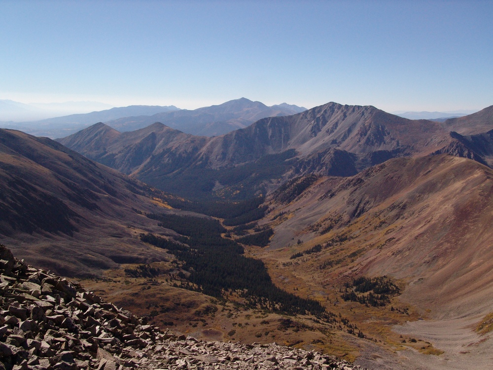
Overview

Sitting roughly two miles (3.2 km) west of the Fourteener, Tabeguache Peak in the San Isabel National Forest is a pair of thirteen-thousand foot peaks called Carbonate (13,663') & Cyclone (13,613') Mountains. While these two peaks are distinct enough to be named and officially ranked, they are usually hiked together hence, occupying the same page here on Summitpost.They barely meet the "official" USGS criteria of being ranked as they only lie .53 mile apart and the saddle between them drops a lowly 336'. Cyclone Mountain lies northwest of Carbonate and also has mining claims that occupy its summit and eastern flanks (Cyclone Mountain that is).
Both peaks are classified as class-2 hikes and lie on the bi-centennial list (highest 200). Other peaks in the Central Sawatch that are in proximity include: Boulder Mountain, Mt. Mama, Cronin Peak, Calico Mountain and Pomeroy Mountain.
In general, most of the nexus of peaks and mountains in this small region of the Sawatch are not difficult nor present any climbing routes. These are all rolling tundra hills seperated by class-2 tundra ridges. Although many of these slopes when stable, make great ski descents.
The closest towns are Maysville and the Monarch Ski Lodge. Other than that, Poncha Springs & Salida are the next closest. But those are some distance away (especially for supplies). It's not that these two mountains are isolated or remote, county road #240 is a fairly good road. But that there is really no infrastructure close by. So while it will take a hot minute to resupply, it won't be difficult.
There is the ghost town of Shavano (named for the famed Tabeguache Southern Ute chief, Shavano) located ~10 miles north of Maysville near the bottom of the southern ridge of Carbonate Mountain on county road 240, basically the North Fork of the South Arkansas River. At the time, this valley was a heavily-traveled toll road, much like from Garfield to the Tomichi Mining District in Gunnison over Monarch Pass. This mining encampment was founded in 1879 and actually boasted a single post office (dated back to 1880). It served more as a way station for the northern valleys (Jennings Creek, Cyclone Creek) where ore was off-loaded and prepped for the short journey to Maysville. However due to falling and wild silver prices, by 1885, Shavano was already in deline. By the time the silver crash of 1893 hit, Shavano was done.
And just a few more tidbits on mining in the area, some local mines of note are the: Irishwood Esther located at 10,655' SSW of Carbonate Mountain. The Irishwood produced mostly silver. There was the Little Charm also SSW of Carbonate which produced silver (Ag) and some gold, but not enough Au to keep it going through the silver crash. And lastly, the Tomcat Mine at a whopping 13,450' located on the west slope of Carbonate Mountain. It started in 1901 and had adits and shafts of about 1,000' into the mountain. The Tomcat produced mostly lead (Pb).
Both peaks are in the St. Elmo Quadrangle, Chaffee County.
Getting There
From Poncha Springs, travel west on hwy. 50 for seven miles to the small town of Maysville. Turn right (north) onto county road #240. There is a BIG Victorian house at this corner. Follow #240 north as it parallels the North Fork of the South Arkansas River. Drive for roughly eight miles. Park at the Jenning's Creek Trailhead* or continue .7 miles further to the Cyclone Creek Trailhead.
* If you utilize this approach, know that the Forest Service has in past years closed off access to this approach due to severe erosional damage caused by yearly runoff and hikers' feet. While upper Jenning's is very beautiful (personal testimony from doing Tabeguache Peak this way my first time), keep your time here short and your footprint light. Stay the trail to avoid furthering resource damage.
From Buena Vista, drive 11 miles south on highway 285 to the small town of Nathrop (more of a bedroom community than anything else). Drive over Chalk Creek and turn right onto Chalk Creek Drive/Cty. Road #162. Follow this west for 13.2 miles to Alpine Lake passing by the Mt. Princeton Hot Springs.
At Alpine Lake, look to the left (south) for Baldwin Gulch Jeep Road. It is signed. Some maps also have this marked as county road #277. Keep in mind, THIS IS A ROUGH ROAD. Unless you know how to drive off-road, think twice about taking a stock vehicle all the way up. Modified vehicles will have no problem. It seems every year, Baldwin Gulch Road gets a little more challenging due to all the spin-outs. There aren't too many places to turn around. So drive up early to avoid oncoming vehicles. It's a popular summer destination for Jeeps/trucks and OHV's.
Follow Baldwin Gulch Road for 2.8 miles. There is good parking at the confluence of West Baldwin Creek and East Baldwin Creek. The altitude here is about 10,880' and just past Baldwin Creek. The normal, North Ridge Route of Cronin Peak is accessed from here. Desend Cronin's South Ridge to an unranked point at the nexus of three ridges called, "Lo Carb". Continue south towards Cyclone and Carbonate Mountains.
Baldwin Gulch Road is NOT maintained in winter.
Red Tape
Carbonate & Cyclone Mountains lie within the Pike/San Isabel National Forest. Forest regulations are considerably more relaxed than wilderness. But in general, here are a few guidelines and rules for visits to national forests:
![]()
- Maximum stay of 14 days
- Follow current campfire restrictions
- No fireworks
- FIrearms (certain restrictions apply).
- Pets must be on a leash in developed areas
- Of course, leave no trace and pack out all trash.
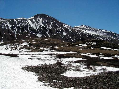
When To Climb/Safety
Carbonate & Cyclone Mountains are an alpine environment. So expect wild temperature swings, possible snow in any month, lightning, AMS, intense UV etc. could happen at any moment. Dress and plan accordingly. This is an easy mountain to hike in summer. But course, emergencies can happen. Expect an easy day but plan for contingencies. Cronin Peak does make for a great BC ski trip. Be avalanche aware.
Of course, being prepared when venturing into the backcountry will make for a safer and overall, more enjoyable trip for everyone. Many wilderness education courses and organizations preach the ten essentials. Consider the following selections when packing:
- Matches/lighter
- Knife
- Food & Water
- FIrst Aid Kit
- Emergency Shelter (poncho, ground cloth etc.)
- Sunglasses/Sunscreen
- Map & Compass
- Flashlight/torch + batteries
- Signling device(s)
Depending on what I'm doing, how far & how long I plan on being out and route choice, I will usually bring some combination of the aforementioned. It's always best to have contingencies already planned for. There's been a lot of SAR rescues in the Colorado backcountry as of late. I'm sure some of those instances could be categorized from poor route-finding and lack of experience, but other rescues could have been prevented by proper planning.
Camping
")
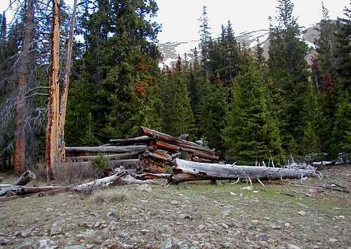
There are a good number of opportunities to camp in the area both in dispersed situations and more formal campgrounds. And with Salida being relitively close, even hotels aren't entirely out of the question. Here's a few options...
North Fork Campground: This small, nine-spot campground is located at a respective 11,480' next to the beautiful North Fork Reservoir. All spots are on a first-come, first-serve basis with fees paid on site (think those small, round brown tubes with a self-pay option). A high-clearance or 4WD vehicle is HIGHLY recommended in getting here. This is actually one of the nicer places I've spent an evening and the surrounding mountains are just gorgeous. The reservoir is stocked with fish and has a maximum depth of about 25'. The campsites have picnic tables.
Dispersed Camping: All along the middle and upper stretches of #240, there are small but frequent places to pullover and car camp or set up a small tent. This is a great alternative for those wanting more privacy or if it's a busy weekend.
Angel of Shavano Campground: This is a local favorite and classic campground in the area popularized by the Fourteener crowd. Located at 9,120', this formal campground has 20 campsites (tent) with tables and metal fire rings. There are also vaulted toilets available. Due to the Forest Service increasing rates of late, nightly camping fee's are $22/night with day use fee's being $8.00. The campground is open seasonally from May 20th to September 25th.
Historical Photographs
")
")
")
JohnGolob - Aug 8, 2016 6:23 pm - Hasn't voted
Route Finding HelpI was up there on July 26, 2016 and want to offer some notes on finding the route. First, the National Geographic "Trails Illustrated" map is mistaken regarding the trailhead. When driving up the road the trailhead is before the old townsite, not after. And, the trail is on the east side of the creek, not the west as shown on the map. Once you know where to look the trail is easy to spot, a gash through the woods headed by a signpost that says No Motor Vehicles. The Cyclone Creek trail is easy to follow at first, but gets a little sketchier as you go further upstream. When you leave this trail to head up toward the saddle between Carbonate and Cyclone, it helps a lot if you can find a climbers trail that allows you to avoid loose talus. I want to help you find this trail. You want to leave the Cyclone Creek trail soon after it crosses to the west side of the creek, about a mile from the TH. It crosses to the west side of the creek where a large boulder field appears as an obstacle to continuing on the east side of the creek. You want to leave the main trail after passing this boulder field. You have two ways to get by this obstacle, either boulder hopping on the east side of the creek, or following the trail on the west side of the creek. I went up on the west side of the creek and came back over the boulder field. Pick your poison. Two creek crossing vs. a little boulder hopping. The boulders have lots of lichen on them, which would be slippery when wet. After going by the boulder field, leave the main trail and head up toward the saddle. I couldn't find a trail in this area, but stayed near the trees as long as I could because the grass and dirt provided secure footing. When you get beyond the trees look to the north for a trail along the hillside that avoids the talus. Finding this trail will make your day much more relaxing. I wasn't aware of this trail, and my instinct to stay in the middle of the gully kept me a little south of the trail. But if you angle a little north of the center of the gully and keep your eyes open, you should be able to spot it. Good luck. An easy way to bag to bicentennials.
CO14erBagger - Aug 24, 2016 9:59 pm - Hasn't voted
Re: Route Finding HelpSubtitle: Don't sell Gerry Roach short! John, don't know if you're aware of this but Gerry Roach describes in detail the route up Cyclone/Carbonate from Cyclone Creek in his "Colorado's Thirteeners" book. (Under the section "North Carbonate" ["old" name for Cronin Peak]). I hiked Cyclone today (Aug 24, 2016) and tried your route up and Roach's down....I think your route is easier to find and perhaps hike providing you stay low in the trees. Specific thoughts: 1. I think the "sketchy" part of the trail you are referring to is soon after you start from the trailhead and encounter a number of downed trees crossing the trail. At this point the trail (old road) moves to the right (north) away from the creek. The downed trees can confuse one into thinking you need to stay close to the Creek. Bottom Line: Good trail until you cross Cyclone Creek. 2. It is unclear where the "Standard" (Viz Roach) trail goes after crossing to the west side of Cyclone Creek. We stayed close to the Creek and got soaked from the high-standing underbrush. (Storm in area, rained heavily the previous night). After crossing the Creek to the west side, the answer is to go up maybe 100-200 feet and you will find a high-quality trail paralleling the Creek and avoiding the willows and other undergrowth, far below. 3. The hiker's trail you found at treeline is the "Standard-Roach" that you take if following the west side of the Creek for about a mile after the crossing and then head NE towards the gully leading to the saddle between Cyclone & Carbonate. I put in a large cairn at about 12000 today, just below the highest tree clump to help guide hikers coming up your route or down the gully. My intention is that this cairn is at the junction of your route and Roach's.