
-
 60201 Hits
-
 86.37% Score
-
 22 Votes
|
|
Mountain/Rock |
|---|---|
|
|
38.79140°N / 104.9933°W |
|
|
12367 ft / 3769 m |
|
|
Special Note

In April of 2012, I adopted this page from mmoerk. mmoerk was critical in building the foundation of Colorado Springs area peaks on SummitPost, contributing many of the region's keystone peaks (such as this mountain). Thank you, mmoerk, for your pioneering hard work showcasing the beautiful summits in our metro area.
Overview
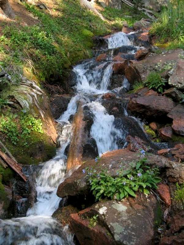
North Cheyenne Creek
Almagre Mountain is the 2nd highest peak on the Colorado Springs skyline, and one of only a handful of peaks in this vicinity rising above treeline. In spite of this, Almagre doesn't get much attention, and many locals are not even be able to identify it. This is probably due to the fact that only the highest part of the mountain is visible from town, and its summit is relatively flat and looks less dramatic than Pikes Peak or Cheyenne Mountain.
There is a 4WD road that climbs almost to the summit, so in that sense the mountain is quite accessible. For those that are more sporting, the summit can also be reached by trail without having to hike along the road. Due to the abundance of 4WD roads at the base of the mountain, there are surely even more routes that one might envision. If you've climbed any routes not listed here, please submit your route.
Except by those who drive up and climb the 500' or so to the summit, Almagre is not frequently climbed. Among other things, this could be due to the fact that the trail to Stratton Reservoir is not even on most maps (it is on the Pikes Peak Atlas, however). In spite of the road, don't expect a crowd at the summit. Pikes Peak this is not. Many people simply drive to the gate and turn around. A few will venture on to the reservoir, and fewer still take the time to climb to the summit. You might climb the whole way and not see another person.
Some people refer to Almagre as "Mount Baldy". In fact, Baldy is a sub-summit of Almagre. The true summit is to the north of Stratton Reservoir, while Baldy and the communication towers are to the south.
The views from Almagre are exceptional. In addition to an aerial view of Colorado Springs, you'll have an up-close view of many of the mountains that you may be used to seeing from town, including Pikes Peak, Mt. Rosa, Cameron Cone, Cheyenne Mountain, and many others.
- Almagre, or "red ochre" was the original name given to Pikes Peak and the surrounding area by Spanish explorers. In 1779, Governor Don Juan Bautista de Anza of New Mexico first mapped "La Sierra Del Almagre."
- Rampart Search and Rescue, Inc. operates a GMRS radio repeater on "Almagre Mountain South." About 45% of Colorado is covered by this repeater. This is part of the Metro Emergency Radio System (MERS) and is the highest such repeater in the US. See the LINKS section.
- North Cheyenne Creek, which forms Cheyenne Canyon, originates from Stratton Reservoir on Almagre.
- Almost all of the water used in Colorado Springs comes from snowmelt collected in reservoirs near the Continental Divide and Pikes Peak, such as Stratton Reservoir and the reservoirs visible from Almagre.
Getting There
Almagre is accessible via Gold Camp Road. From Colorado Springs, take Old Stage Road, which turns into Gold Camp. This is a dirt road but easily navigable by any passenger car. Take your time... there are lots of blind corners. It takes me about an hour to reach the trailhead from the Rockrimmon area.
Continue on Gold Camp Road to Forest Road 379. This is a 4WD road. If you are hiking up Cheyenne Canyon, proceed by foot or by SUV up this road 1.8 miles to the Captain Jacks Trailhead (specifically, you are looking for Trail 701), and continue with directions found on the Cheyenne Canyon route page. Or, simply follow the directions on the Forest Road 379 page if that is your planned route.
![]()
![]()
Red Tape
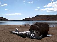
![Stratton Reservoir]()
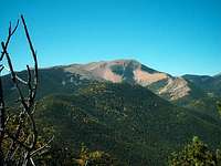
Stratton Reservoir | knotis23No permits or fees are required. Mountain bikers and motorized vehicles must stay on designated routes.![Pikes Peak from Almagre Summit]()
Pikes Peak from Almagre Mountain
Almagre Mountain is in the Pikes Peak National Forest. (719) 636-1602. Or visit the Pikes Peak Ranger District on the web.Weather & Seasons
![Almagre Mountain from the...]()
![Almagre Mountain from summit...]()

Click image for avalanche forecastAlmagre Mountain is certainly doable year round. In winter and spring, keep a sharp eye on snow conditions and choose your route carefully. The steep, west-facing slopes tend to be cross-loaded with pillows of snow and could be prone to sliding. Summer months bring heavy Jeep & ATV traffic to the dirt roads surrounding Almagre Mountain on three sides, and Old Stage Road is crawling with teens blaring obnoxious music, drunks shooting into thin air (no, I’m not making this up) and tourists nervous about damaging their rental car on the potholes and ruts. Spring access to the summit would depend on the year’s snowpack; a heavy snowpack would mean deep drifts of soft, late-season snow lodged in the trees and, as with winter, spooky cross-loading on the western slope. Fall is a nice, though likely cold and windy, time to be on this mountain. 
Click image for weather forecast
Contact the Pikes Peak Ranger District for current conditions.
Pikes Peak Ranger District (719) 636-1602Camping
Camping is permitted in the National Forest.
FS 376: Due to private property holdings in the area as well as relatively high travel (recreation and utilities use), camping in the western approach (Beaver Creek) drainage is limited.
FS 379: There are places to camp up in/near Frosty Park. Let it be written that this is a popular area for folks to unwisely combine drinking with target shooting. Personally, I would not bother camping in this vicinity.
Cheyennne Canyon approach: There aren't any good camping areas along the trail in Cheyenne Canyon, however, as it's too steep.
Almagre can also be approached from the Jones Park area starting in North Cheyenne Canon Park. As PurpleMountainNear adds:
- There is an ideal camping area for the hike to Almagre along the 667 trail called Jones Park. The park features an abundance of grass & aspen groves and flat camping sites for those who want to make a weekend out of the hike, or for locals who just want to take a short dayhike. It also has two different creek lines on both sides, as just west of the park is where North Cheyenne Creek branches north and turns into Bear Creek. The Seven Bridges Trail off Old Gold Camp Road will take you up to the Cheyenne Creek-side of the park (about 2.5 miles) while Captain Jacks Trail, taken either from the top of High Drive or from the Access Trail on Old Gold Camp, will take you to the north side of the park and on up to Almagre. I recommend camping here even if you're not going any farther up the trail-- it's a wonderful place to spend the day trekking around or to take as a loop hike from the Gold Camp parking lot. The only signs marking Jones Park, however, are along the Seven Bridges Trail.
Note: On my Trails Illustrated Map, Jones Park is not labeled. It is just northwest of Kineo Mountain, where Trails 667 and 622A intersect. From here, your topo map will show you how to reach the Cheyenne Canyon route (just find Trail 701 where it intersects with North Cheyenne Creek).
![]()
![]()
![]()
![]()
![]()


skorpeo - Sep 12, 2005 12:22 am - Hasn't voted
Untitled CommentI hiked the mountain on Saturday September 11 with my friend Paul. One mile from the gate on 379A(the last road) there was a rockslide my Ford Ranger 4X4 could not fit through. The trun around was very scary. Larger trucks would have even more difficulty. PLEASE park where 379 and 379A intersect until the slide is repaired.
skorpeo
Sarah Simon - Nov 26, 2012 5:39 pm - Hasn't voted
Re: Links...Brother, Could you be a bit more specific??? =) Sarah
Sarah Simon - Dec 9, 2012 11:05 pm - Hasn't voted
Re: Links...Thanks, Jer, I took care of the broken links section. Broken links, unfortuntely, are the reason I'm hesitant to ever link to other trip reports, etc., in my pages. Sarah