
-
 12159 Hits
-
 76.66% Score
-
 7 Votes
|
|
Mountain/Rock |
|---|---|
|
|
50.51990°N / 9.23950°E |
|
|
2536 ft / 773 m |
|
|
Overview
If anyone has the topo coordinates I would greatly appreciate it if you could send me a message with them! Thanks!
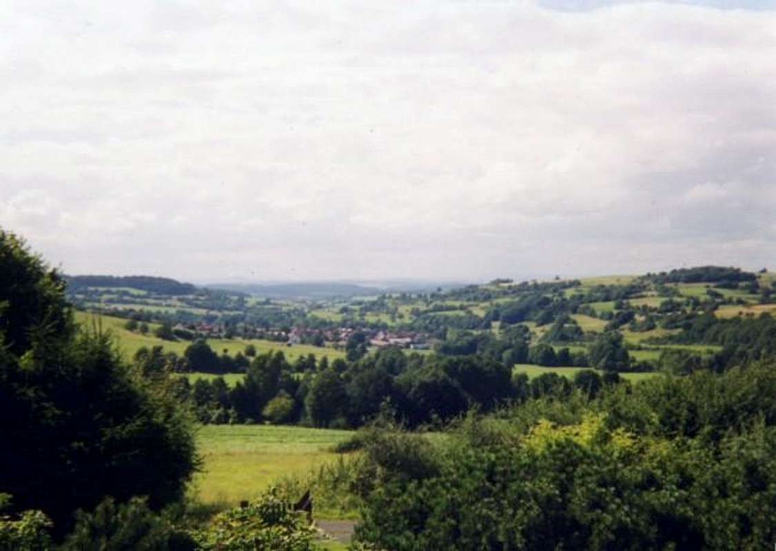
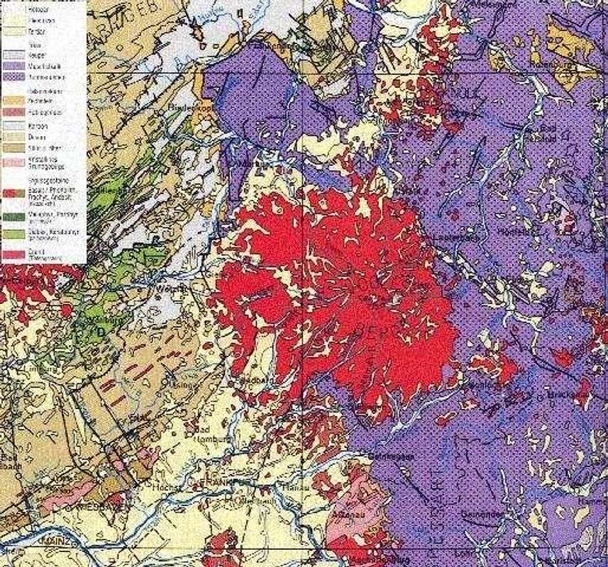
Vogelsberg is a massive volcanic outcropping in central Germany. The mountain also contains the largest outcropping of surface basalt in Europe. Huge chunks of the dark black rock can be found everywhere as well as many other types of volcanic rock. The mountain is comprised of a number of peaks, the highest being Taufstein at 773m. Hoherodskopf is the second highest peak on this mountain at 763m. Vogelsberg translated means "bird mountain". The entire Vogelsberg Massif is enshrouded in a national park and also in the area exists the Hoher Vogelsberg Nature Preserve, which contains many specimens of birds from the area. One of the most noticeable features of this area is the large number of windmills you'll see almost everywhere you travel in this region. They don't take up a lot of space and are very efficient. The wildlife in this part of the country is great as well.
Hoherodskopf probably receives more attention than Taufstein because of its' many summit attractions. On top there is a radio tower, a restaraunt, a store and in the winter, a skiing area. The most famous attraction on this mountain, is the sled track which heads down the mountain under the ski-lifts and propels riders at a high rate of speed down the mountainside.
The massif is divided on the east by the Fulda River, which forms a natural barrier between Vogelsberg and the Rhon Mountains. Vogelsberg abounds with hundreds of miles of hiking and climbing trails and there are trails for all levels as well. The peaks of this mountain are not steep, but fairly high for this part of Germany. Much of the land is forested, but there are still many open areas and meadows which afford wonderful views in all directions. The large number of rock outcroppings all along the mountain provide many fun opportunities for exploring and technical climbing.
The Vogelsberg region is one of the most beautiful areas in central Germany as there is much to see and do outside of the hiking experience. Many castles and fortresses abound throughout the valley along with medival towns, which along with the beautiful scenery make for a wonderful journey. Some of the more famous towns are Lauterbach, Ulrichstein and Alda.
ROUTE INFORMATION IS WELCOMED!
 |  |
Vogelsberg: Land of Volcanoes
The Vogelsberg Region is a total volcanic structure. It is home to the largest outcropping of basalt in Europe and the scars of ancient volcanoes are visible everywhere you go. Pumice, Basalt and Obsedian are among the volcanic jewels left behind throughout this mountain. They are found everywhere, even around the massif as far as Frankfurt.
 |
Hiking Routes
Other Hiking Route Information:
Niddaquelle
Geiselstein
Schalksbach
Trail Information:
http://www.naturpark-hoher-vogelsberg.de/steig_aus/index.html
 |  |  |
Getting There
From Frankfurt Am Main:
Head north on highway A5 until you reach the exit for highway number 49. Head east on highway 49 until you reach highway 276. Head south on highway 276 and you'll be in the midst of the entire Vogelsberg region within fifteen minutes. The entire trip is about 80 miles and takes about two hours.
From Munich:
In Munich get onto highway A3 and head north. Outside of Wurzburg get onto highway A7 and continue north. Once you reach Fulda get onto highway254 and head west to the intersection with highway 275. Highway 275 will take you into the heart of the Vogelsberg Region.
 |  |
Red Tape
The only fees required are for that of the attractions on top of Hoherodskopf. No permits are required for hiking/climbing in the area. In the national park area however, all of the country's rules apply for conservation. There should be no seasonal closures because the area is a fairly large ski resort in central Germany.
When To Climb
This mountain is climbable all times of the year.
Camping
For camping information go to:
http://camping-gross-eichen.de/index.php
Mountain Conditions
For weather conditions go to:
weather.com
Type in Fulda, Germany as your region.
External Links
- Taufstein
This web page is in German and gives plenty of information about the highest peak on Vogelsberg. There is also a live web cam from the top of Hoherodskopf.
- Hiking Routes
This page gives information on trail routes within the Nature Park of Vogelsberg. The page is in German so you will need to translate.
- Naturpark Hoher Vogelsberg
This page is for the nature park and gives all information for the park in Vogelsberg.