
|
|
Mountain/Rock |
|---|---|
|
|
35.16720°N / 93.6447°W |
|
|
Logan |
|
|
Hiking, Mixed |
|
|
Spring, Summer, Fall, Winter |
|
|
2753 ft / 839 m |
|
|
Overview
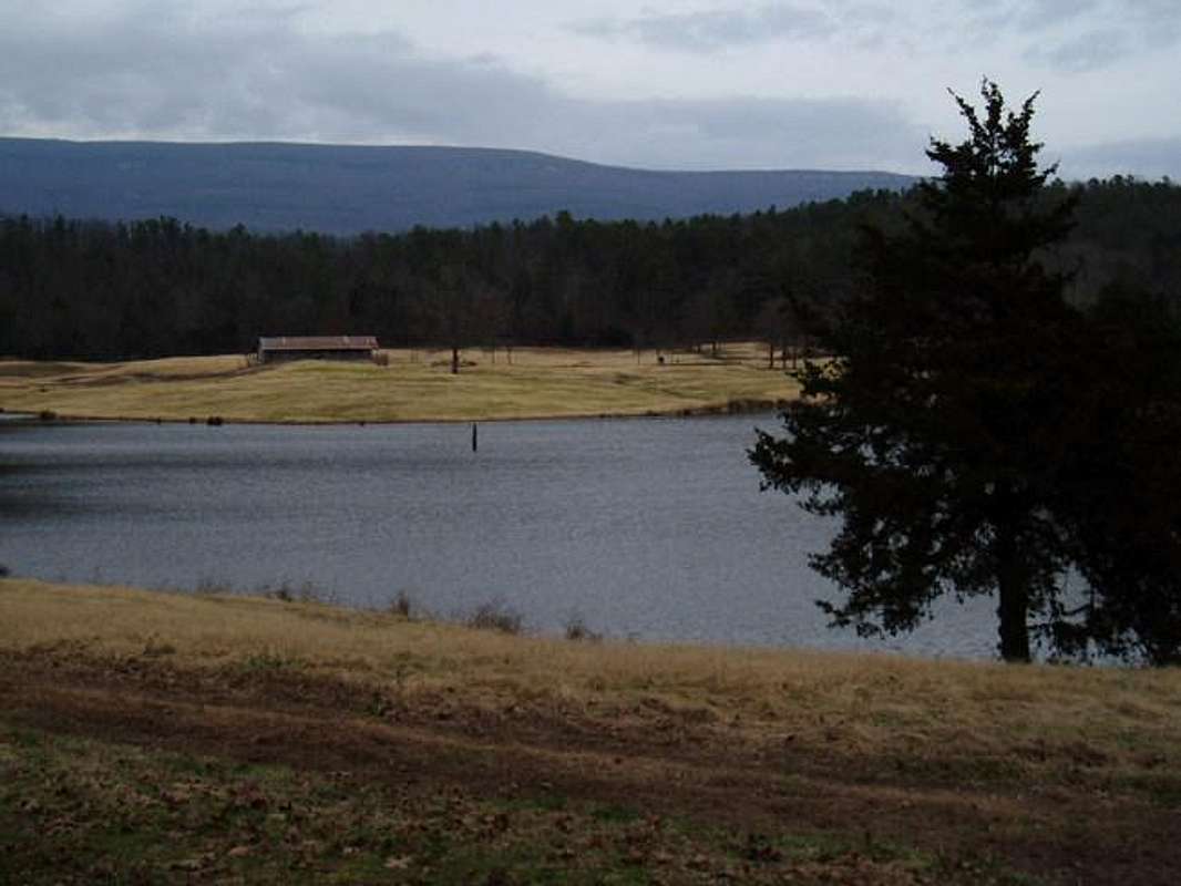
Mount Magazine from its base
Arkansas is a midwest state actually known for its mountains. The Ozark Mountains are unique, the result of tectonic activity below the surface of the region. Three main mountain ranges run through Arkansas, which are among the oldest in North America and are unique in that they run east-west rather than north-south. This contributes to Mt. Magazine's mesa like appearance. Mount Magazine is a flat-topped plateau with a sandstone cap rimmed by precipitous rock cliffs. Two peaks are situated atop the plateau, Signal Hill, which is the tallest point in Arkansas, and Mossback Ridge which reaches 2,700 feet.
Mount Magazine-Signal Hill is the highest peak in Arkansas and the Ozark plateau. The peak is in the Boston Mountains, 120 miles Northwest of Little Rock. It sits in the midst of the Ozark National Forest in the Arkansas River Valley approximately 17 miles south of Paris, Logan County, Arkansas. on Scenic Highway 309 (also known as the Mount Magazine Scenic Byway). The mountain range itself is considered part of the Northern Ouachitas, but it is considered part of the Ozarks because it is in the Ozark National Forest.
The mountain itself is in Mount Magazine State Park, and the highest point on the mountain is called Signal Hill. Mount Magazine State Park is a well-developed state park, complete with a full array of services, campground, and recreational activities. The park offers 18 campsites, hiking trails, pavilion and picnic area with restrooms, and assorted scenic overlooks. The visitor's center maintains an exhibit gallery and gift shop. Interpretive programs are presented by the park staff on a regular basis. Rock climbing, horseback riding, biking, ATV trail riding, and hang gliding are available activities. Mount Magazine is the site of the annual "Mount Magazine International Butterfly Festival". The mountain is also home to black bear, whitetail deer, bobcat, and coyote as well as other species.
 |
 |
 |
 |
 |
Rock Climbing
There are some technical climbing areas, where there is rappelling and rock climbing on 200-foot high bluffs. In terms of rock climbing, the tallest route at Mt. Magazine is 90 ft. (Right to Flight - 5.9)
Before you rock climb, get more information from the Visitors Center to find the best places to climb.
"Right to Flight" A.K.A. "The Nose" is a 5.9 on the south face of Mt. Magazine. It starts in a crack about 40 feet west of a route called "Cruise Control" (5.7.) There is a 3rd class from the trail that leads to the ledge above "Cruise Control" and you can rap down from the anchors there. Another way to find this route is to go past the 3rd class walkdown, continuing east along the trail, look for a prominent roof that helps to form a large chimney-like area. I will post another picture looking down from this point...
The route is typically done in two pitches to avoid rope drag on the upper pitch. There is a cave about 60 ft. up and the route continues another 30 ft. or so to the topout. The crux of the route is pulling the large roof in the upper section. Until that point, it climbs like a 5.6-5.7. Some people only do this easier pitch, but that is a true waste! The most beautiful part is the top. There is endless pro on this route, making it a great classic that can be well protected. This route can be easily done in about 45 minutes (both climbers at the top)
Thanks to cagedalpinist for information on "Right to Flight"
It should be noted that climbing is not allowed on the north face, due to poor rock quality and indigenous species.
Access issues are still a concern for rock climbers at the park, but increased interest in rock climbing in the area will keep access alive. For more information on rock climbing routes, the "Climber's Guide to Mt. Magazine" by Kerry Allen is available at most of the local outfitters. ($10)
See these links:
Rockclimber page
Specific Rock Climbing Routes
 |
 |
 |
 |
 |
Getting There
From Fort Smith (coming from the West), get off I-40 in Eastern Oklahoma and take route 22 to Paris, or just continue on I-40 East to exit 35, and take route 23 south to Paris. Mount Magazine is 17 miles south of Paris, Arkansas.
From Little Rock (coming from the East), take I-40 West to Russellville, and take Route 7 South to Route 27 South to Route 10 West to Route 309 North.
Mount Magazine State Park is clearly marked on route 309 going in either direction. At the visitor center, you follow the signs and take the park roads to the various trailheads. I recommend getting a park map from the Visitors Center.
Views of the Bluffs are about 2 miles down the road.

 |
 |
 |
Routes
Mount Magazine Hiking Trails (State Park)
(see map in the link section)
Several Trails lead to the highest summit in Arkansas
The trails very in length from 1.0 to 2.3 miles. The total trail system in the park is almost 9.0 miles
At 2,753 feet, Mount Magazine-Signal Hill is Arkansas's highest mountain. Signal Hill Trail from the Cameron Bluff Campground to the highpoint is under 1/2 mile in length (one way). Other trails include Greenfield, Benefield, Mossback Ridge, and the Will Apple's Road Trail. Two trails (Huckleberry Mountain Horse Trail and the Cove Lake Trail) connect to trails winding through the National Forest. Back country camping is allowed off the National Forest trails. This trail system is listed in both the day and overnight hiking sections due to the versatility offered by the varity of access points, distances, and terrain. This is truly a unique setting, offering some of the most expansive views in Arkansas.
(NOTE: Park operates under special use permit from the Ozark-St. Francis National Forest)
Here are the various trails:
Benefield Trail (West Loop)
LENGTH: 1 mile
DIFFICULTY: Easy
TRAILHEAD: Benefield Picnic Area
DESCRIPTION: In the 1870's Benjamin Benefield homesteaded 160 acres on the southeastern leg of Mount Magazine. It's hard to imagine orchards, vineyards, and row crops once occupied this area. In 1939 WPA/CCC crews built campgrounds and picnic facilities in this area. Some of their work was abandoned during World War II only to be recently rediscovered. Today this trail makes a one-mile loop through a mixed pine and hardwood forest. It crosses Highway 309 and leads to a wildlife pond. The eastern end of the Mossback Ridge Trail starts near the pond. From that pond, the Benefield Trail loops back to the highway at the entrance road to the picnic area. Enjoy wildflowers, butterflies, and birds. Watch for deer and bear. (Blue Blazes)
Mossback Ridge Trail
LENGTH: 2 miles
TRAILHEADS: Benefield Wildlife Pond, Greenfield Picnic Area, and House Gap
DIFFICULTY: Moderate
DESCRIPTION: Mossback Ridge was named after Albert Morsbach, a settler, farmer, and teacher. It connects the Benefield, Greenfield, and Signal Hill trails. Most of the walking is easy on top of the ridge. Watch for a variety of wildflowers and signs of bears moving rocks and logs. (Yellow Blazes)
Cove Lake Trail
LENGTH: 9.3 miles
TIME: 5 hours
TRAILHEADS: Cameron Bluff Drive, Corley and Cove Lake, Green Bench Road
DIFFICULTY: Moderate - Strenuous
DESCRIPTION: This trail is a total of 9.3 mile long but only 1/3 of a mile of it is in the park. It requires 1500 feet of elevation gain. Most of the trail is in the Ozark National Forest. It is a good trail for beginning backpackers. Enjoy stands of virgin hardwoods. Watch for deer and turkey. Hunting is allowed in the National Forest so be aware of the seasons and wear bright colored clothing. (White Diamond Blazes)
Greenfield Trail
LENGTH: 1 mile
TRAILHEAD: Greenfield Picnic area
DIFFICULTY: Moderate
DESCRIPTION: The Greenfield picnic area was a family farm before the Great Depression. This trail crosses the headwaters of Big Shoal Creek and connects to the Mossback Ridge Trail and is a good place to start a longer trek across the park. Some hikers continue all the way to Cove Lake for over night trips. (Green Blazes)
Signal Hill Trail
LENGTH: 1.5 miles
TRAILHEADS: Cameron Bluff campground, House Gap, and Old Lodge Site
DIFFICULTY: Moderate
DESCRIPTION: Signal Hill is the highest point in the state. No visit to Mount Magazine is complete without having hiked half a mile from the campground to the highpoint. At the top is a stone map of Arkansas approximately 400 square feet. A wide variety of plants make this a nice nature walk. Sign the register at the top. (Red Blazes)
Will Apple's Road Trail
LENGTH: 2.3 miles
TRAILHEADS: Horse Camp, Visitors Center
DIFFICULTY: Moderate
DESCRIPTION: Named after a farmer, who cultivated several acres of corn on the northeastern leg of the mountain, this was one of the first roads to the mountain. Features include: historic homesites, wildflowers, escaped domestic flowers, woodland songbirds, stone fences, and ruins of a swimming pool built in the 1920's. Mountain bikes are allowed on this trail.
This information can also be found at the Mount Magazine State Park Homepage
 |
 |
Red Tape
No permits required. The campground has fees if planning on staying the night. The rangers would like anyone climbing at Mt. Magazine to register at the visitor's center (no fee) This helps not only in an emergency, but also by showing that there is an interest in climbing on the mountain - this will help to keep access open!
When To Climb
Any time of the year
Camping
Mount Magazine State Park has 18 campsites. Campers must register at the Visitor Center before occupying a site. For more information on camping accessibility see the links page to go to the park website, or call the park headquarters at: Phone: (479) 963-8502
Mountain Conditions
Weather Conditions
For mountain conditions see the links page to go to the park website, or call the park headquarters at: Phone: (479) 963-8502
Miscellaneous Info
*The summit sign has been updated as this area has been well treated for a state highpoint outside the Rockies or Appalachian mountain states.
**I request that posters who add photos in the future provide shots of the mountain from a distance or of the pretty rock faces in the park, rather than shots of the summit signor the USGS marker. This mountain has a lot more to offer than just the sign at the top. Thank you.
 |
 |
 |
 |
External Links
- Mount Magazine State Park
Park Brochure, with map - Mount Magazine State Park Home Page
Park home page with links, maps, photos, and other information - Photo Gallery
Photo Gallery of mountains, flowers, and butterflies in Mount Magazine State Park. - Scott Staples Mount Magazine State Park site
Photos and information for the Ozarks, and the beautiful state of Arkansas, including Mount Magazine State Park.
cagedalpinist - Aug 19, 2004 9:52 am - Hasn't voted
Untitled CommentAlan -
You may be thinking of the "Classic Rock Climbs #22 (Sam's Throne Area,) by Clay Frisbee. I have one of those coveted copies, which have been out of print for over 5 years now.
Kerry Allen simply prints up copies whenever the local shops ask him to. I can probably get one for you (no finders fee :) )
A.W.
hgrapid - Apr 3, 2005 2:24 pm - Hasn't voted
Untitled CommentDon't sweat it, I will be there in mid-May and take some photos.
cagedalpinist - Apr 3, 2005 3:24 pm - Hasn't voted
Untitled CommentCool, look me up if you want to do some climbing.
A.W.
cagedalpinist - Aug 18, 2004 12:54 pm - Hasn't voted
Untitled CommentThe tallest route at Mt. Magazine is 90 ft. (Right to Flight - 5.9) It should be noted that climbing is not allowed on the north face, due to poor rock quality and indigenous species. Also, the "Climber's Guide to Mt. Magazine" by Kerry Allen is available at most of the local outfitters. ($10)
cagedalpinist - Aug 19, 2004 9:52 am - Hasn't voted
Untitled CommentAlan -
You may be thinking of the "Classic Rock Climbs #22 (Sam's Throne Area,) by Clay Frisbee. I have one of those coveted copies, which have been out of print for over 5 years now.
Kerry Allen simply prints up copies whenever the local shops ask him to. I can probably get one for you (no finders fee :) )
A.W.
cagedalpinist - Apr 3, 2005 12:38 am - Hasn't voted
Untitled CommentWhat was once the beautiful south-looking scenic overlook has been bulldozed, blasted, and reformed for the construction of the "New Lodge." This 60 room hotel will feature a restaurant, pool, etc. etc. etc. I'm sure it will be way better than the historic lodge site that once formed this overlook. Who needs natural beauty when you can build a hotel instead? They have built it right on top of the old climbing trail. Currently this entire area is fenced off. You can no longer park next to the lodge site and walk down, you have to park at one of the hang-glider launch pads and walk about 1/4 mile around the fence, or bushwack in front of it. What was once the "Waterfall Walkdown" is now a pile of rubble, filled with trash from the construction workers' lunches. Look for this wonderful new addition to open up Spring 2006. The cost? As of yet undisclosed...
cagedalpinist - Apr 3, 2005 1:02 am - Hasn't voted
Untitled CommentThe directions are not quite that straightforward for anyone who has not been to Mt. Magazine before.
From Fayetteville, take I-540 South to I-40. Take Exit 35 toward the town of Ozark on 23 south. You will see the recently installed brown State Park signs.
Turn left at the first stoplight in Ozark and continue on 23. At the second stoplight, turn right and go across the bridge (Arkansas River).
Shortly after you reach the other side of the river, you will go around a few curves. As you come to the crest of a hill just before a straight section, look for Hwy 309 on your left.
Stay on 309 through the town of Paris. As the road splits, stay left to go up the hill. (note: look at the street sign just before the road split, on the left -- "klan" street... Interesting.)
Follow this road into the park, where signs will direct you to the different areas.
hgrapid - Apr 3, 2005 2:24 pm - Hasn't voted
Untitled CommentDon't sweat it, I will be there in mid-May and take some photos.
cagedalpinist - Apr 3, 2005 3:24 pm - Hasn't voted
Untitled CommentCool, look me up if you want to do some climbing.
A.W.
osatrik - Jul 11, 2009 3:02 pm - Hasn't voted
Magazine Mountain - NOT Mount MagazineA check of the official geographic names index (GNIS) of the USGS reveals that the name of this feature is "Magazine Mountain", not "Mount Magazine". Although not a hard and fast rule, generally "Mount Xxxxx" is used for a peak, and "Xxxx Mountain" is more frequently used for ridges, which better describes this feature. Magazine Mountian appears in the GNIS as a ridge, and Signal Hill as a summit. "Mount Magazine" is the name used by the Arkansas State Park, but it not the officially accepted name. All four of the guidebooks published to date on state highpoints have used the correct nomenclature, and I believe entries in Summitpost.org should do the same.