

-
 17622 Hits
-
 89.39% Score
-
 29 Votes
|
|
Mountain/Rock |
|---|---|
|
|
45.85390°N / 6.90130°E |
|
|
Mountaineering, Trad Climbing, Sport Climbing |
|
|
Summer |
|
|
12116 ft / 3693 m |
|
|
Overview
Petit Capucin 3693 m
The fat brother of Gran Capucin, someone said it looks like Sancho Panza near Don Quixote ... Climbers here like better Tour Ronde, Grand Capucin, Pic Adolphe ...
I've spent many climbing days in this Cirque and have never seen climbers on it, when I climbed it we were all alone ... but in a different environment this summit would look as fine as it is: a smart and worth to be climbed mountain. In fact it is a very interesting peak, which offers numerous various routes of all kinds and difficulties on good rock. It also offers fantastic views over the Grand Capucin
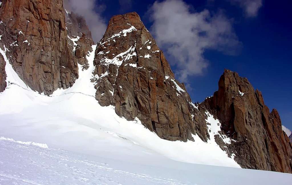
This is the only summit in the Tacul satellites that can be climbed with low difficulties and efforts.
And the close views from its summit are fantastic !!! 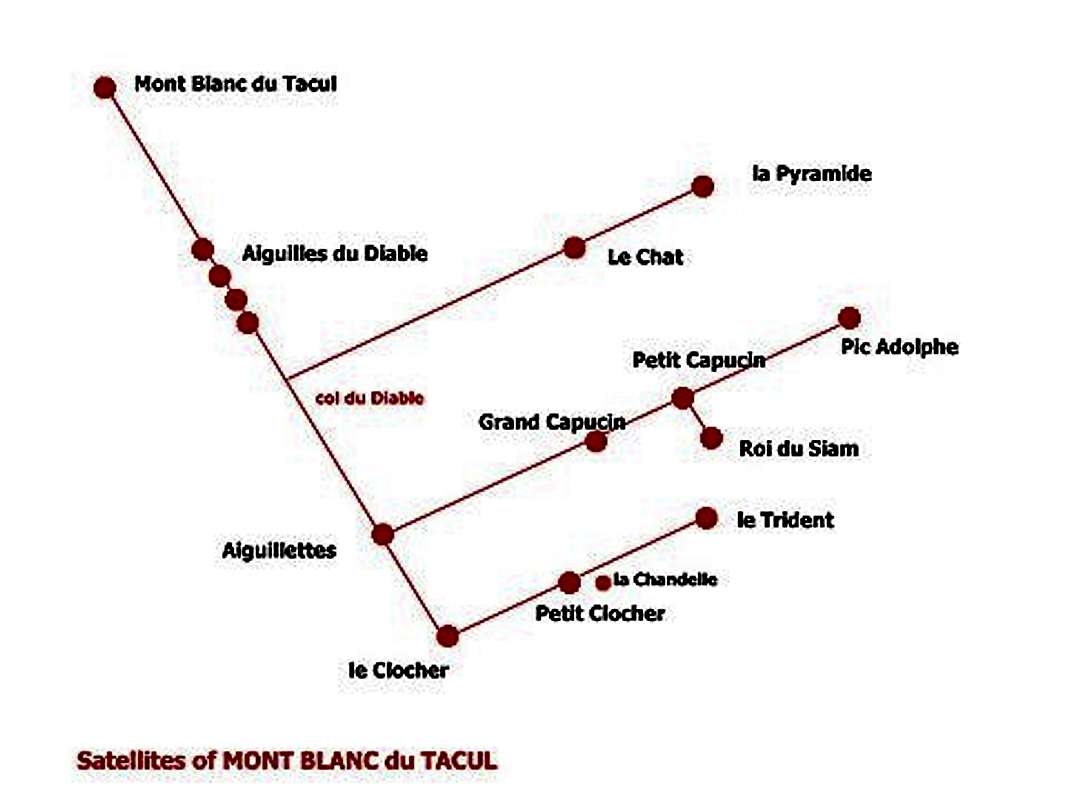
Getting There
| Can be done in one day starting directly - from Courmayeur (cable car to Punta Helbronner) - from Chamonix (cable car to Aiguille du Midi) All routes start from Glacier du Geant Starting point : Rif Torino - 1 hour using the route to Col du Gros Rognon - Col du Midi Rif Cosmiques - 1 hour passing the Col di Gros Rognon Rif du Requin - 2 hours through "la Bediere" and the Route to Col du Geant Montenvers ... it's a long way ... |
Routes overview
| On its SE side a big "gendarme" , le Roi du Siam looks like embedded on the wall till you are near but can be considered as a separate summit with 1 difficult route along the N side and east ridge. west ridge from the Brèche du Petit Capucin - PD - fine rock - amusing south wall (Boccalatte) - from west to the Brèche du Roi du Siam - then with not difficult climb (AD), in an amazing environment, to the summit south wall trom east to the Brèche du Roi du Siam - then to the summit using the previous route - the couloir can give some problems in the first section east wall (Gervasutti) - from the saddle between the Roi su Siam and the Pic Adolphe - classic - very amusing - D - (some passages of 5°) - 250 m  - -  north wall the most difficult wall/route on this summit - ED - serious and not inviting most amusing - Gervasutti to go on - Boccalatte to come down - as end of amusing day after the Salluard to Pic Adolphe
|


Logistics and Huts
| Rif. Torino directly with the cable car from Entrèves/Courmayeur (Italy). You can reach the hut directly also with the Helbronner cable car from the Aiguille du Midi (to Aiguille du Midi with the cable car from Chamonix). Pay attention: The Helbronner cable car, traversing the Géant glacier, is mostly closed. Or you go on foot from the Aiguille du Midi over the glacier du Géant (3 h): From the foot of the S-face of the Aig. du Midi you go on the almost even glacier to the Pointe Lachenal, turn left (E) to the glacier valley below the rugged E-face of the Mont Blanc du Tacul. You go along this E-face of the Tacul and the Pointe Adolphe Rey in order to loose only little height. Now you turn to the ESE to the Col des Flambeaux. From here in a few minutes to the Ref. Torino. It is a very beautiful glacier walk with 200 hm ascent. Difficulty: F. Courmayeur (Italy) by bus or car: - from Chamonix through the Mont Blanc Tunnel from the NW. - from Milano or Torino (from the SE) on the A5 via Aosta valley Ref. Cosmiques: In about 1/2 h from the Aig. du Midi (cable car from Chamonix). If you leave the cable car station via the bridge, you go to the Southsummit. On the firn ridge, you go down with SE-direction to an even ridgeplatform; then turn right to the S and SW-direction below the S-face of the Aig. du Midi. Pay attention to crevasses! Chamonix Valley by train - from Martigny (Switzerland) via Vallorcine - from Geneva (airport) via Anncey (TGV till here) and St. Gervais. Chamonix Valley by bus: - from/via Annecy, Geneva, Grenoble, Courmayeur, Aoste and Turin Chamonix Valley by car: - from Geneva (from the NW) on the A40 till St. Gervais and from here on the N205.b. From Martigny (from the NE, Switzerland) via Vallorcine and the Col des Montets on the road no. N506. |
When To Climb
| from June to September snow and ice can remain in its walls and ridges due to their low steepness |
Red Tape
No fees no permits required
Meteo
Guidebooks and maps
 |
 |
 |
- Guidebooks
“Le topo du Massif du Mont Blanc” Tome 2 by Michel Piola – Editions Equinoxe
"La chaine du Mont Blanc" Vol I - Lucien Devies, Pierre Henry - Guide Vallot “
"Mont Blanc Supercrack” by Lamberto Camurri and Giovanni Bassanini, 2012
“Monte Bianco” Vol. I by Gino Buscaini – Collana Guide dei Monti d’Italia CAI-TCI
- Maps
- Meridiani Montagne “ Monte Bianco” map 1:30.000
- Swiss Topo 292 Courmayeur
- IGN 3531ET St.Gervais Les Bains – Massif du Mont Blanc