
|
|
Mountain/Rock |
|---|---|
|
|
33.87890°N / 112.7949°W |
|
|
Maricopa |
|
|
Hiking, Scrambling |
|
|
Spring, Fall, Winter |
|
|
3663 ft / 1116 m |
|
|
Overview
UPDATING PAGE IN COMING DAYS
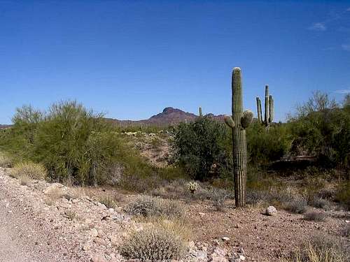
Vulture Peak tops the Vulture Mountains, a small but dramatic range in northwestern Maricopa County, south of Wickenburg. Its block-shaped summit mass is a well-known and familar landmark visible from miles in all directions and even from distant mountaintops, if you know where to look.
Despite its imposing appearance, a climb to the summit is well within most people's comfort level. A good trail gets you to a saddle below the summit, while the final 240+ vertical feet to the top is a combination of chutes, rock-scrambling and cactus-avoidance. It's not overly technical, and exposure is minimal, but there are a couple spots where care is needed. The views from the top are well worth the effort.
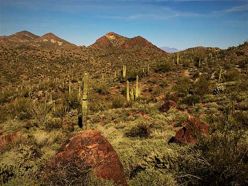
 Classic Sonoran Desert Flora (and 'rocka')
Getting There
Wickenburg is about 45 miles northwest of Phoenix via US-60/Grand Avenue. The best way to avoid the traffic is to access US-60 from the Loop-101 freeway in Glendale, the Loop-303 expressway near Sun City, or AZ-74 via Lake Pleasant. No matter what, though, you will hit traffic.
In Wickenburg stay west on US-60 past downtown for about 3 miles to Vulture Mine Road. Turn left and drive south about 7 miles to a well-marked turn-off toward the peak. There is parking along a good dirt road, with the main lower trailhead reached about 0.4 miles from the pavement. Passenger cars park at the lower trailhead while 4-wheel drive can proceed another 1.5 mile to a higher trailhead.
Wickenburg has full services, including hotels, restaurants and an interesting 'old-west' downtown. There's a major grocery store, discount store and pharmacy at the junction of US-60 and Vulture Mine Road.
For an interesting back way to this point from Phoenix, take I-10 west to 355th Avenue. Follow this fine paved highway about 17+ miles to a junction with Vulture Mine Road. Turn right and go north another 12+ miles to the Vulture Peak turn-off. These roads are paved but rarely traveled. They are not state highways. There is talk that these roads may be expanded as part of the Canamex/Nafta free-trade route, bypassing Phoenix. For now, they are lonely roads through desolate desert country.
Route information
The primary trail starts less than a quarter mile from the summit at the Upper Trailhead. To reach the upper trailhead, either take the Vulture Peak trail or the dirt road. The trail can be confusing at times. Both are about 1 1/2 miles from the main lower trailhead. Once at the upper trailhead, the trail goes uphill in earnest, getting steeper until the saddle is reached between the rocks. You gain over 700' in just over a half a mile. The summit is the main rocky plateau on the left.
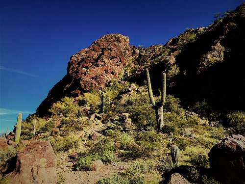
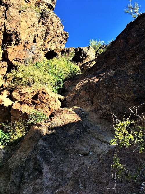
Take the use trail up from the saddle, which quickly becomes a scramble up rocks. Just below the summit, follow the gully through a narrow passage. This is the crux of the climb. It is pretty steep, but not exposed. Once at the top of this section, you are on the summit.
The total elevation gain from the main lower trailhead is about 1,300', and the hiking distance is a hair under 2.2 miles one way via the road or the trail.
Red Tape
No fees, passes or anything required.
When To Climb
Winter is best as summer is very hot. Snow is extremely rare and often doesn't last more than a few hours. November to April would be your best window for this peak.
Camping
The trailhead area seems to be open to RVs so I imagine you can car-camp here. It's pretty basic bush-camping. Wickenburg has hotels and is a neat place to visit. I do not know of any developed campgrounds in the immediate area other than near Lake Pleasant, which is kind of far off and with its own set of restrictions and hassles.
The Vulture Mine Ghost Town
The Vulture Mine Website
The Vulture Mine and townsite is a remarkably well-preserved gold mine dating from the 19th century, located about 5 miles south of the trailhead along Vulture Mine Road (about 12 miles south of Wickenburg proper). The land is privately owned but tours are available at a very reasonable price. This isn't some ghost town where all you see are foundations. Here, you see the actual buildings - falling apart, of course - but authentic. Well worth a visit!