
-
 50504 Hits
-
 85.36% Score
-
 20 Votes
|
|
Mountain/Rock |
|---|---|
|
|
32.37600°N / 110.879°W |
|
|
7258 ft / 2212 m |
|
|
Overview
Mt. Kimball is one of the highest peaks along the southern front of the Santa Catalina Mountains. The Catalinas rise just north of Tucson, Arizona, and their forested summits often carry winter snow while far below, Tucson is warm. Like many of its neighbors, Mt. Kimball is a "sky island" - its lower slopes are desert, but as you climb higher thicker vegetation and forests appear.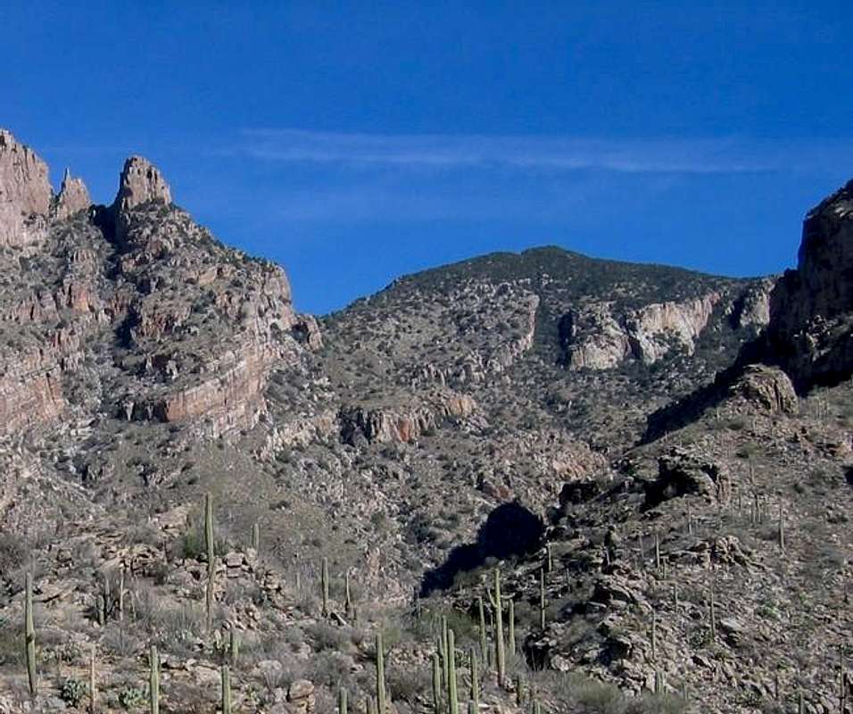
Mt. Kimball from Finger Rock Canyon. Finger Rock itself is at left; Kimball is behind at right.
Although it does not present a forbidding face from most directions, Kimball still towers almost a vertical mile above Tucson and is a steep, long day trip for many hikers. The summit of Mt. Kimball also provides spectacular views into the heart of the Catalinas and of the surrounding southern Arizona desert.
 |
 |
 |
 |
Getting There
The two main routes up Mt. Kimball are Finger Rock Canyon and Pima Canyon.
For Finger Rock Canyon, take Skyline Drive, a major road that parallels the Catalinas just south of the foothills. From the intersection of Skyline and Alvernon, take Alvernon north. The road dead ends at the Finger Rock Canyon trailhead which is a long parking lot; there are some turns that lead to gated communities, but this is your spot. There's a water fountain that works intermittently, but it's probably wiser to bring your own.
For Pima Canyon, the trailhead starts further west. Skyline turns into Ina road; the intersection of Ina and Christie is just west. At that intersection, go north on Christie. This street dead-ends at Magee. Turn right here, and park at the lot (it's called the Iris Dewhirst trailhead) straight ahead of you.
 |
 |
 |
Red Tape
No dogs are allowed on either the Pima Canyon or the Finger Rock Canyon trails. Off-trail hiking is sometimes subject to seasonal closure, but given what off-trail hiking is like in this area (wading through fields of shindaggers and other sharp plants) this isn't usually a problem. Other than that there's no red tape.
The Highest Catalina Summits
| Rank | Peak | Elevation | 7.5 minute Quadrangle | ||
| 1 | Mount Lemmon | 9,157 | Mt. Lemmon | 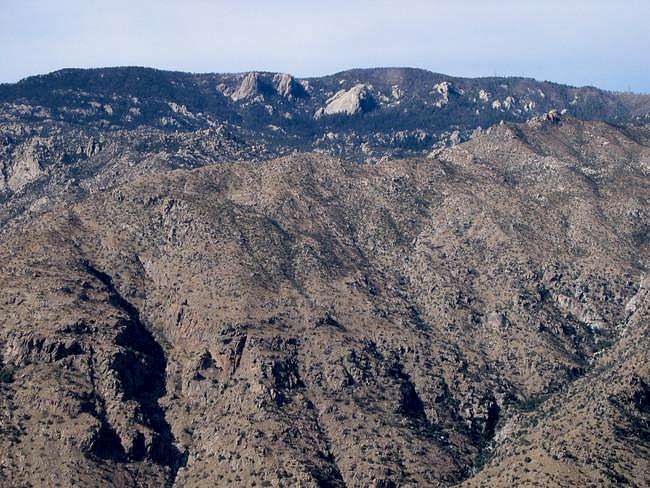 |
|
| 2 | Mount Bigelow | 8,540 | Mount Bigelow | ||
| 3 | Marshall Peak | 8,300 | Mount Lemmon | 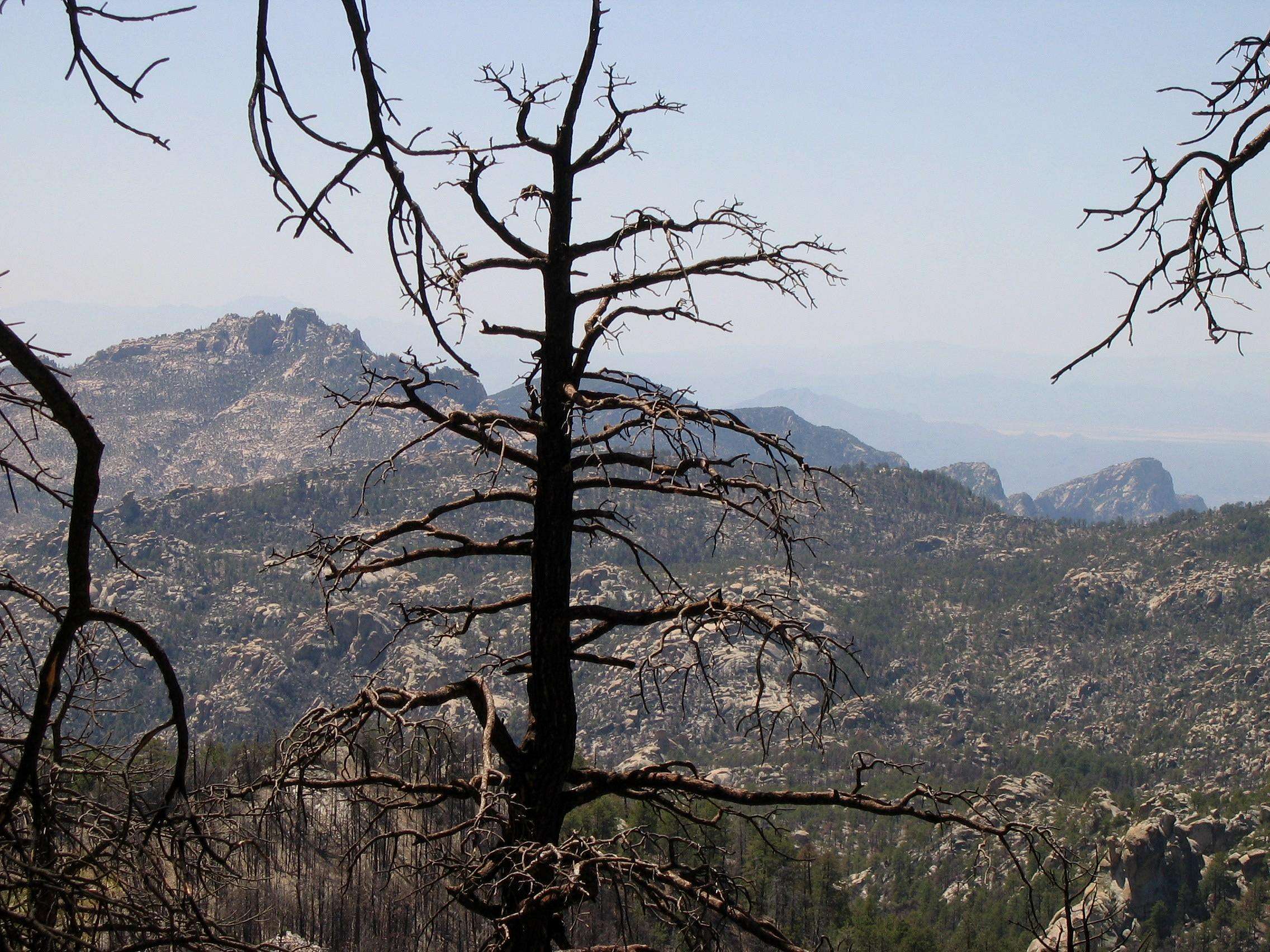 |
|
| 4 | Cathedral Rock | 7,957 | Mount Lemmon |  |
|
| 5 | Green Mountain | 7,904 | Mount Bigelow | 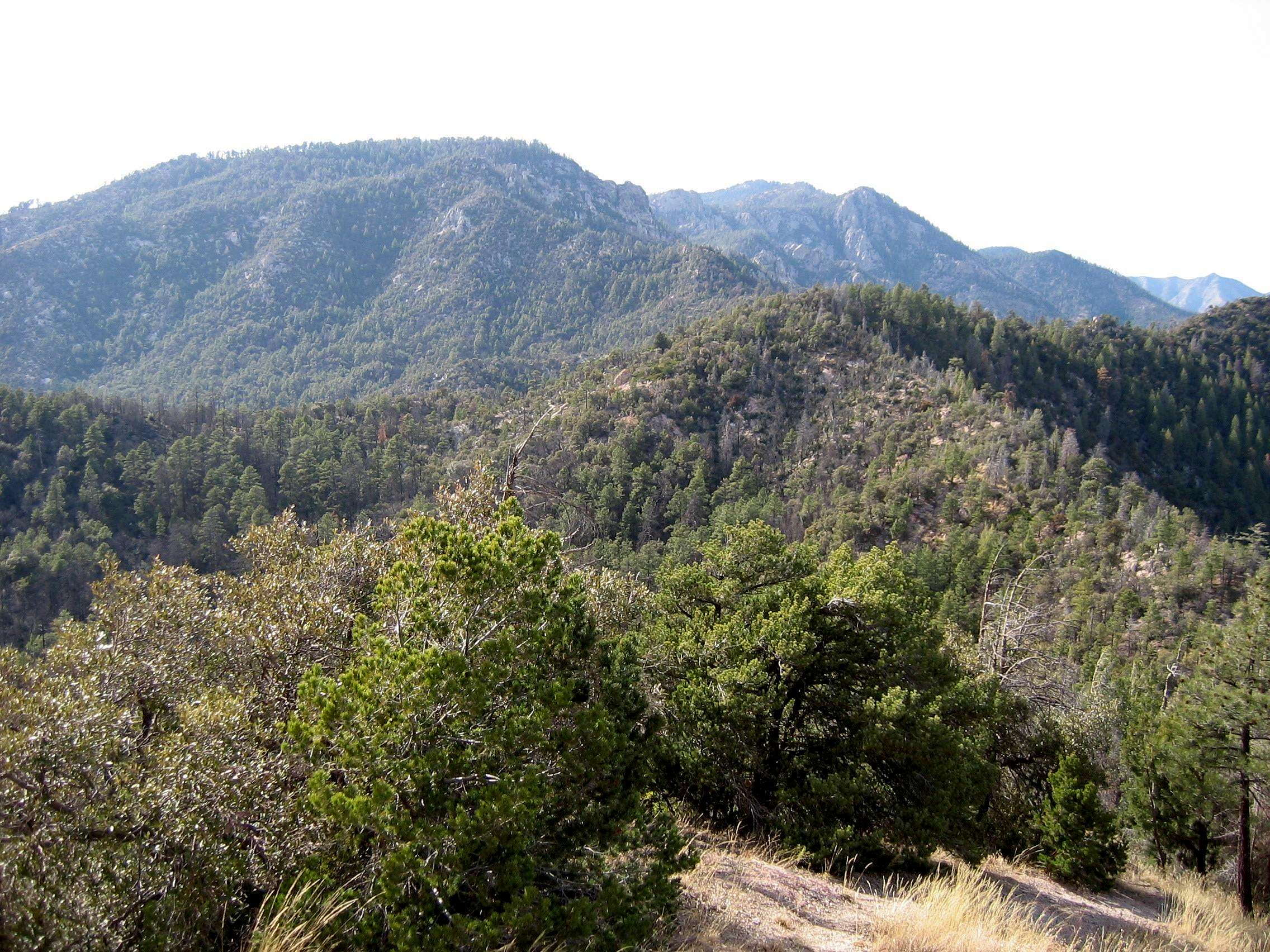 |
|
| 6 | Samaniego Peak | 7,700 | Mount Lemmon | 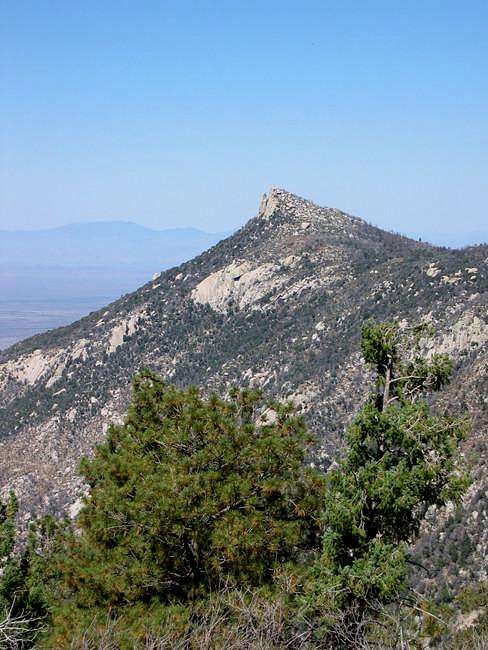 |
|
| 7 | UN 7693 | 7,693 | Mount Bigelow | ||
| 8 | Window Peak | 7,468 | Mount Lemmon |  |
|
| 9 | Rose Peak | 7,303 | Mount Bigelow | ||
| 10 | UN 7281 "Guthrie Mountain" | 7,281 | Mount Bigelow |  |
|
| 11 | Mt. Kimball | 7,258 | Oro Valley |  |
|
| Mule Ears | 7,060 | Mount Lemmon | |||
| 12 | Rattlesnake Peak | 6,653 | Sabino Canyon |  |
|
| 13 | Prominent Point | 6,628 | Tucson North | 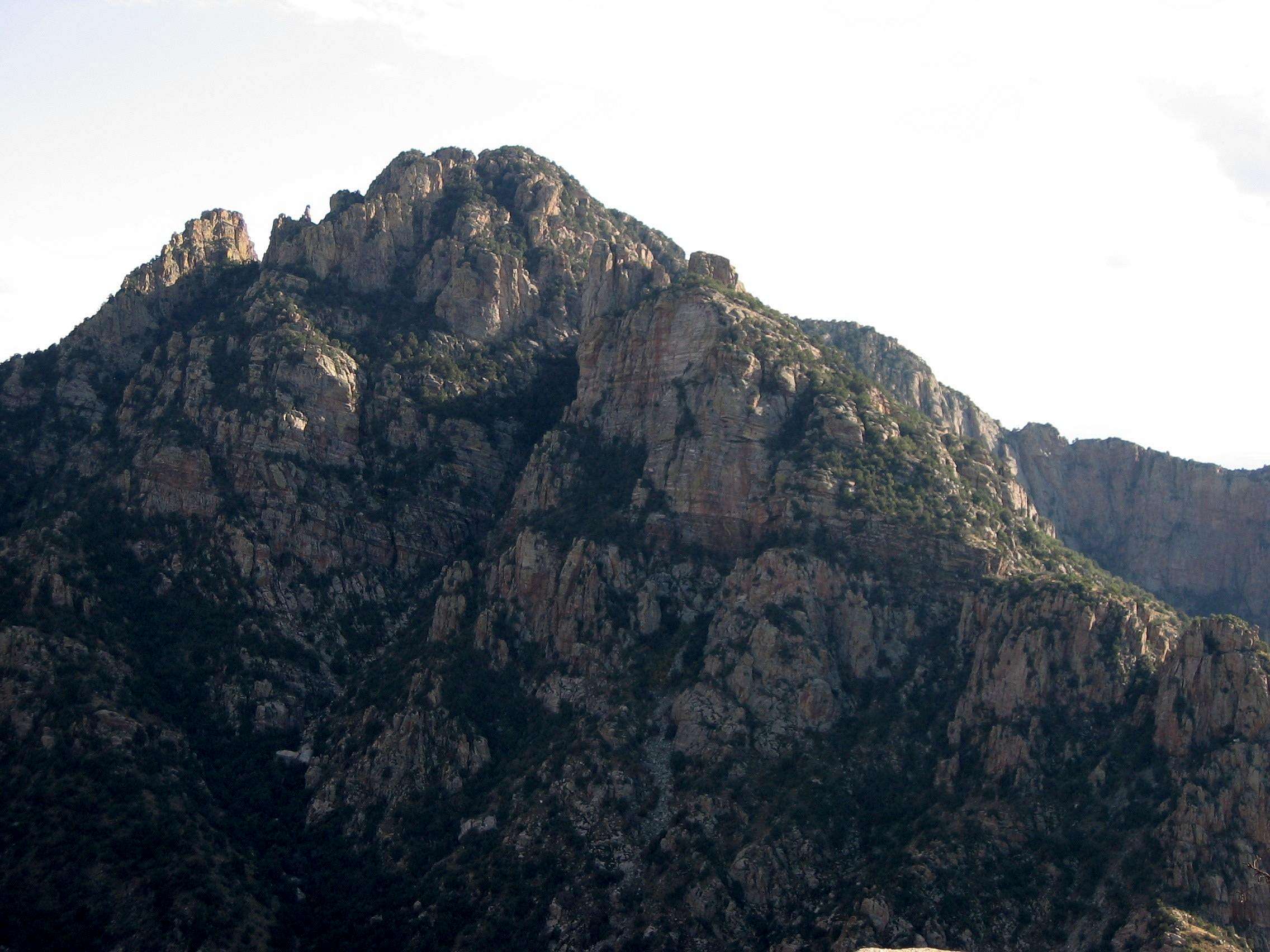 |
|
| 14 | UN 6512 | 6,512 | Agua Caliente Hill | ||
| 15 | Apache Peak | 6,441 | Oracle | ||
| Finger Rock | 6,420 | Tucson North |  |
||
| 16 | Table Mountain | 6,265 | Oro Valley |  |
|
| 17 | UN 6191 | 6,191 | Agua Caliente Hill | ||
| 18 | Airmen Peak | 6,100 | Agua Caliente Hill | 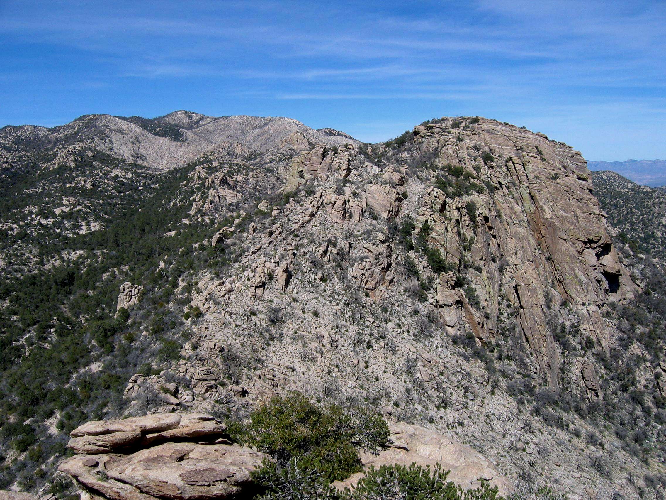 |
|
| 19 | UN 6060 | 6,060 | Mount Bigelow | ||
| 20 | UN 6053 | 6,053 | Mount Bigelow |
Clicking on the small picture by a peak will take you to a picture of that peak.
Clicking on an underlined peak will take you to that peak's page on SummitPost.
An elevation in red is interpolated.
A more expansive list of the Catalina summits can be found here.
When to climb
Mt. Kimball can be climbed year-round, but hikers would be wise to avoid the summer months, when temperatures in Tucson often rise above 100. If you get an early enough start it's possible to be on the summit for good weather in the summer, but most hikers prefer to do the climb in the spring or fall. At the other extreme, snow and ice can sometimes be found high on Kimball in the winter months.
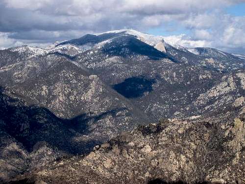
Looking at snowcapped Mt. Lemmon - the highest peak in the Catalinas - from the summit of Mt. Kimball.
Camping
While a climb of Mt. Kimball does not usually necessitate a high camp, camping is permitted in the Catalinas and there are some good sites at the 6850' saddle just south of the peak. Many campsites in the Catalinas have suffered heavy and incosiderate use (ie; the construction of multiple fire rings); please try to make as little impact as possible if you choose to camp here.
Conditions
Mt. Kimball is in the Coronado National Forest: https://www.fs.usda.gov/coronado/
Warning
Around a quarter-mile from the summit of Mt. Kimball, the Pima Canyon trail and Finger Rock trail intersect at the short spur trail that heads to Kimball's summit and its overlook. This intersection has (or had, in 2024) a newer sign which simply says "Mt. Kimball," and underneath that, Pima Canyon trail to the left (southwest) and Finger Rock trail to the right (southeast). Neither one of these will take you to Mt. Kimball. Some helpful soul has carved an arrow pointing north, and this is the way you want to go - onto the spur trail which leads in short order to the summit.
Miscellaneous Info
In 1931 Mt. Kimball was named after Frederick E. Kimball, a land developer who went on to serve in the Arizona State Senate. Kimball pushed for a road up Mt. Lemmon (the highest of the Catalina summits), and promoted the building of Summerhaven, the community just below the top of Lemmon. It is not known whether Kimball ever stood on the summit of his namesake peak.