

|
|
Mountain/Rock |
|---|---|
|
|
33.28200°N / 110.821°W |
|
|
Mountaineering |
|
|
Fall |
|
|
7848 ft / 2392 m |
|
|
Overview
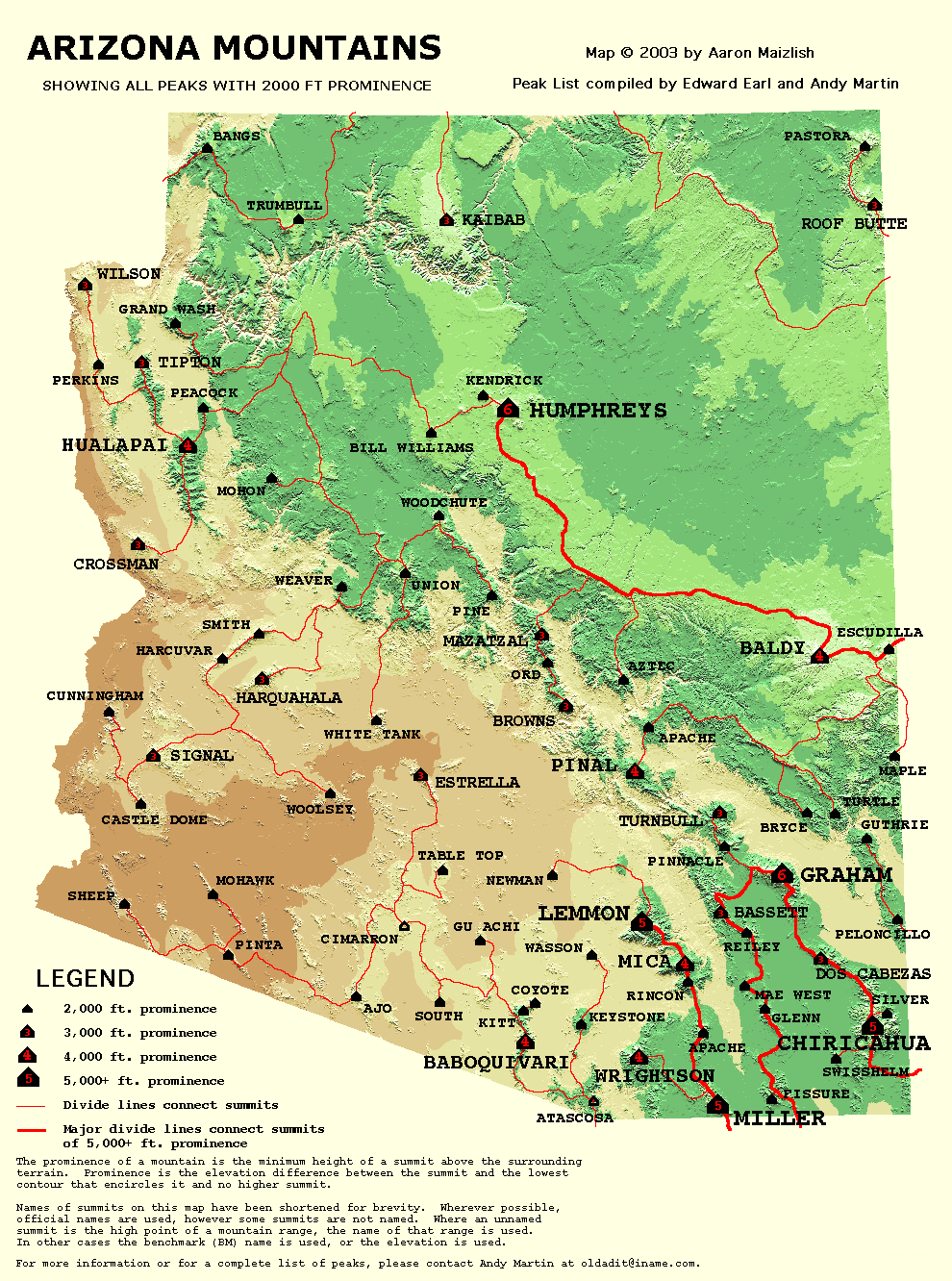
Pinal Peak is the highpoint of the Pinal Mountains. This large mountain is located in the Tonto National Forest about nine miles south of Globe, and is a prominent landmark in the area. A good road goes all the way to the summit of Pinal Peak, which is crowded with radio towers. Pinal Peak has several good trails on it, and a campground is located near the top. With an elevation of 7,848', Pinal Peak ranks way down on the Arizona elevation list. But the new field of Prominence has made Pinal Peak an important mountain. With a prominence of 4,090', Pinal Peak makes an impressive appearance on the Arizona Prominence Map.
Getting There
From US 70 in the city of Globe, turn off the highway when you see a sign that says, "Pinal Mountain Recreation Area". This sign is located on the east side of a large bridge on US 70. Start driving towards Icehouse Canyon. At some point, you will reach a sign that points to Icehouse Canyon (right) and Sixshooter Canyon (left). Turn right towards Icehouse Canyon and follow Forest Road 112 as it heads for Pinal Peak. A short while later, you will reach another road junction between Forest Roads 112 and 55. Turn left onto Forest Road 112. The road will turn to dirt at some point. Continue up the road another mile or two until you reach the Icehouse CCC Picnic Site sign. Continue up the road another half mile or so until you see a small turnoff on the right side of the road. This is the start of Forest Trail 192, also known as the Telephone Trail. There is only enough parking for one or two vehicles. It's easy to miss the parking spot, but there is a trail sign about 30' from the parking spot. You can also drive all the way to the top using a different road.
Mountain Conditions
Contact the Tonto National Forest, Globe Ranger District, at 928-402-6200 for the latest conditions.
Forest Service Map: Tonto National Forest.
Topo Map: Pinal Peak.
Camping
The Forest Service maintains several developed campgrounds in the Pinal Mountains.