
|
|
Mountain/Rock |
|---|---|
|
|
39.27500°N / 105.3672°W |
|
|
11589 ft / 3532 m |
|
|
Buffalo Peak Overview
Buffalo Peak (11,589-ft) is located 4.4 miles southeast of Windy Peak, both reside within the Kenosha Range just a few miles from the popular Wellington Lake. Buffalo Peak is a very large mountain, it’s tree covered mass is apparent from many places from the east. Buffalo is also a county highpoint (Jefferson), and also has the unique distinction of having two official names, “Buffalo Peak” and “Freeman Peak.”
Attaining Buffalo’s craggy summit is not for the faint hearted. An accidental route finding glitch can easily introduce you to a really long day in the trees. The potential for getting “lost” is real; especially if you’re not comfortable going hours without seeing anything but densely packed pine trees. Locating landmarks within this trail-less and featureless terrain is difficult, to say the least. The actual summit has a reputation for being hard to locate as well. Thus, I wouldn’t recommend this peak for an LCW first ascent. Buffalo Peak is for die-hard LCW lovers, and you know who you are.
Lost Creek Wilderness Overview
First, the mountains of the Lost Creek Wilderness submitted here on Summitpost are exclusive to this site. Locating information or any route beta for this area is difficult. Thanks to Jennifer and Gerry Roach's LCW book all of us can view photos and visit these remote summits here on SP.
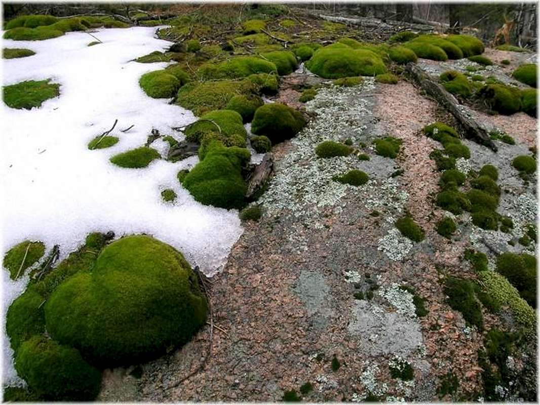
The Lost Creek Wilderness Area protects nearly 120,000 acres in the Tarryall, Platte River and Kenosha mountain ranges in central Colorado. This relatively new wilderness (designated in 1980) is loaded with hiking, backpacking and climbing possibilities. Typical LCW landscape will consist of mixed and very dense forests, open meadows, small streams; somewhat the norm for Colorado’s high country. Upon first sight, it’s possible the casual climber or mountaineer may not be too impressed with the typical LCW mountain configuration. Dense, tree- laden slopes that frequently lead to tree-covered summits could easily rekindle a forgotten bad memory, a memory that includes your most frightening bushwhacking experience.
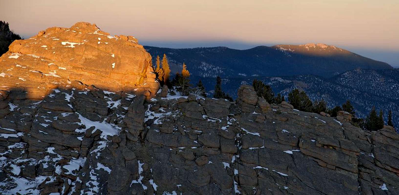
However, despite lacking the grand alpine scenery of other Colorado wilderness areas, one can argue that LCW may be one of the most unique Wildernesses in Colorado. Upon closer inspection the LCW has its own character that no other place in Colorado can match. Character that includes some of the most bizarre rock formations you will ever see. A lot of the LCW is dominated by these incredible rock formations, including massive polished granite domes and towering spires. With elevations ranging from 8,000 to 12,400 feet, many of the mountains here sport huge, wide-open plateaus providing easy hiking and excellent views. Getting to those plateaus is another story.
South Slope Loop Route
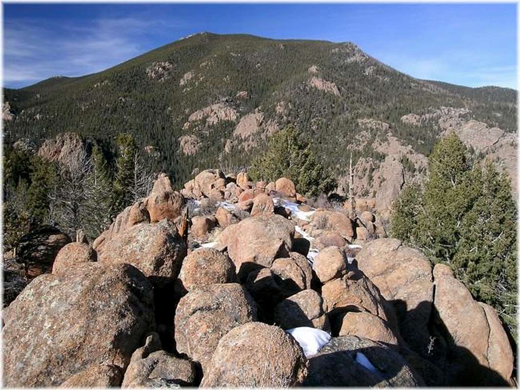
Buffalo, really doesn’t have a standard route. The Roach’s describe three routes in their excellent LCW book, and I will describe the fourth route, one that flirts with Buffalo’s most intricate and complex slope, the extremely rugged, and cliffed-out south slope. This slope towers over UN 9,500 or “The Wigwam,” an obvious cone-shaped peak that represents itself well at the Wigwam Creek Trailhead at 8,160-ft. The south slope is Buffalo’s most impressive face, and it’s probably the steepest as well. Loaded with rock outcroppings, the South Slope Route is steep enough to warrant being called the South Face Route. The routes redeeming quality is its short length at 3 miles to the summit, but the first mile only requires 400-ft of vertical gain leaving 3,000-ft for the last two miles, that’s steep! The route does get southern exposure, but dense tree cover prevents the snow from consolidating very quickly. For a safe winter ascent, expect snow for the last 1,500 vertical, bring snowshoes and expect a nice steep, post holing bushwhack…. yikes. The reward in all of this misery is a tree less summit loaded with character, a fine summit indeed where views will make it all worth the effort.
"The Wigwam" or UN 9,500
The Wigwam” or UN 9,500 is a worthy side trip from Buffalo Peak, especially on the descent. It is the typical LCW, cone shaped mountain and the summit affords excellent views of the craggy south slope on Buffalo Peak. It’s from this summit where I gained my inspiration to climb Buffalo Peak’s south slopes. The summit is craggy and requires a little class 3 scrambling to attain. There is a summit register on the summit, placed by LCW pioneer Mike Garret in 2002. It does not get climbed very often.Wigwam Creek Trailhead
First, this TH is assessable year round and is on a good dirt road. The road gets very muddy in winter/spring. As of March of 2005, the Stoney Pass Road is gated and closed at the junction of FR545 and FR560, about a mile south of Dream Valley Ranch. But FR545 remains open to get to the Wigwam Creek TH.From Hwy 285 at Pine Junction, turn south onto County Road #126 towards Pine. Drive for 21.8 miles. Turn right (south) onto Forest Road #211. Be careful not to miss this turnoff, it’s easy to miss. The turnoff is just passed a big paved parking area for popular hiking trail called “Cheeseman” something a rather. Take FR211 for 2 miles, turn right on FR560, there will be a sign here for “Flying G Ranch.” Take FR560 1 mile to another junction, go right on the Stoney Pass Road and take it about 4 miles to another junction. Take the left fork and get on FR545, this road will terminate at the Wigwam Creek Trailhead at 8,160-ft.
Point Forecast-Buffalo Peak
Click here for current weather conditions for Buffalo Peak and immediate area 10,860-ftClick image to enlarge

