
-
 22741 Hits
-
 82.94% Score
-
 16 Votes
|
|
Mountain/Rock |
|---|---|
|
|
45.28221°N / 109.7679°W |
|
|
Hiking, Mountaineering, Skiing |
|
|
Spring, Summer, Fall, Winter |
|
|
12119 ft / 3694 m |
|
|
Overview
From the foothills to the north of the Beartooth Mountains, Pyramid Mountain appears as a high, prominent, pointed peak with fairly low angle sides. The easiest route is Class 2, but because of its positioning and the lack of nearby trails, it likely sees probably less that ten people a year, likely much less. The most challenging part about this mountain is that it begins with a 3000 foot climb out of the West Rosebud drainage, then continued on to gain another 2,600 feet above treeline on huge boulders. The total gain is nearly 6000 vertical feet.
Being one of the 27 12,000 foot peaks in Montana, it is a worthy objective for anyone looking to thoroughly explore the Beartooth Mountans. The summit register, like the one on Mount Hague, is currently 30 years old, and was placed in 1985 by members of the Sierra Club. There are years where no one signed it and I was the second person to sign in in 2015. Enjoy the solitude this peak offers!
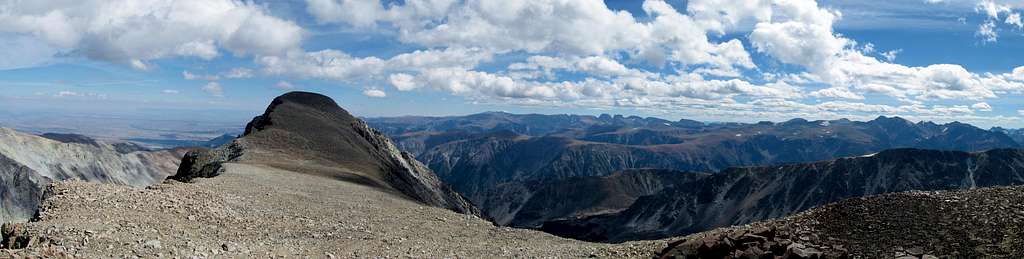
Pyramid Mountain Panorama from Point 12,022
Getting There - Trailhead Options
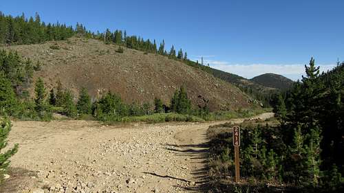
West Rosebud - The West Rosebud Trailhead is located approximately 80 miles southwest of Billings. To reach the trailhead, take the Columbus exit from Interstate 90, and take Montana Highway 78 through Absaroka and turn west (right) toward Fishtail (approximately 17 miles from Columbus). From Fishtail, drive west and south for 1 mile and turn south (left) on West Rosebud Road. Follow this paved road for 6.3 miles until reaching a fork in the road and a large brown Forest Service sign. The sign will indicate West Rosebud Lake Road #2072. Turn left here and follow the dirt road for 14.4 miles until reaching the trailhead. The trailhead has toilet facilities, and a large parking area. Please obey the posted private property signs and do not drive beyond the trailhead parking area.
Sunrise from the West Rosebud TH
Benbow Mine (Golf Course) - The Benbow Mine (aka Golf Course) trailhead is the normal starting point for people wishing to access the north side of Pyramid Mountain. This trailhead is unmarked and difficult to get to. A tough passenger car can make to the Benbow Mine but a high clearance 4WD vehicle is advised, and certainly required if you plan to drive beyond Benbow Mine. Note that in the "Hiking the Absaroka-Beartooth Wilderness" Falcon Guide book, this trailhead is called the Lake Wilderness trailhead. Information about getting here can be found on page 97 of this book.
In short, if coming from Red Lodge, start from the MT 308 and US 212 junction at the south end of town and drive north on US 212 for 1.5 miles and turn left onto MT 78. Continue on this road west for 30 miles and turn left on CO Road 419 (also called Nye Road) and continue on this road for 14 miles passing through the small town of Fishtail on the way. Just past the Montana Jacks Bar and Grill in the tiny town of Dean, turn left (south) onto Benbow Road (FS 1414). Drive this very windy road as it switchbacks up to the Benbow Mine head frame after 11.4 miles at an elevation of 8,480 feet. Park passenger cars here. 4WD vehicles can continue driving up a series of switchbacks, which were likely used when the mine was active, for an additional 2 miles to a large open meadow land known as the Golf Course (apparently some miner thought it looked like a golf course). The road continues down a short ways to the trailhead at the south end of the meadow at an elevation of 9,100 feet. A sign marks the end of the road.
Route Options
Chicken Creek to SE Ridge Standard Route (Class 2+)
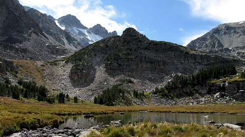
This is the standard route up Pyramid Mountain and involves some bushwhacking, loads of huge talus and some steeper scrambling. Start this route just a few hundred feet east of the West Rosebud Trailhead (end of the road just before the private property). You should just park at the trailhead and walk back down the road for a few minutes, then veer north ascending grassy slopes through somewhat sparse trees early on, but the forest gets thicker after the first 500 feet. Be sure to stay well off to the left (west) of Chicken Creek itself. After 1200 feet of gain, you'll reach a small flat bench at 7,700 feet. The next 300 feet to the next, larger bench has the worst bushwhacking but it isn't too long. At 8,100 feet there is a long flat bench that offers decent passage. You can simply walk north along this, and descend a little bit (maybe 40 feet) and reach Chicken Creek at the base of a series of small waterfalls. Follow the left fork and hike westward up along the creek for nearly 700 feet until you reach the small unnamed lake at 8,680 feet, below Ram Lake. This part of the route has more manageable bushwhacking.
 Pyramid Mountain view from Chicken Creek |  Lake at 8,680 feet, just below Ram Lake | 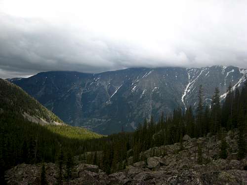 View down Chicken Creek valley |
From this small lake, which has great views and lots of solitude, make an ascending traverse towards the northwest up talus and aim for the obvious ridge coming down and terminating just above the lake. Veer to the right (east) around the small cliffs at the base of the ridge and ascend talus just along the north side of the ridge to where the slope mellows at about 10,300 feet. If you're looking for a little more third class scrambling, simply stay on the ridge crest, otherwise, stay just north of the crest where the north fork of Chicken Creek is visible. The boulders are exceptionally huge from just above the small lake at 8,680 all the way to about 9,400 feet. Even the best rock hoppers will require extra time for this section.
Once on the broad ridge at 10,300 feet, take a break here and observe the weather. From this point it's an exposed ascent on a broad ridge above treeline. If weather still looks good, continue up the ridge. Between 10,800 and 11,000 feet it steepens into more Class 2+ scrambling but above that it's easy, and fairly mellow hiking on talus all the way to the summit. The boulders don't get much smaller so allow plenty of time to safely navigate the terrain. Even though most of this peak is just a walk up, the danger for a fall/injury is still present. In spring, when many of the boulders are snow covered, but after the worst of the winter storms have ended, the ascent can be done much faster.
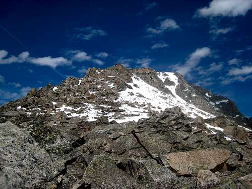 Broad SE Ridge on Pyramid Mountain | 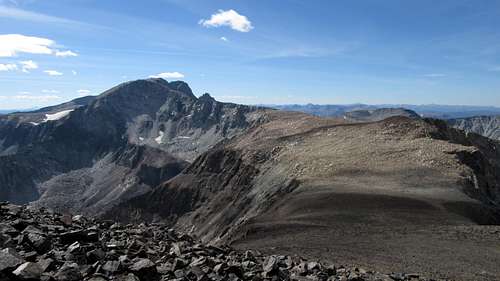 Mount Wood from Pyramid Mountain | 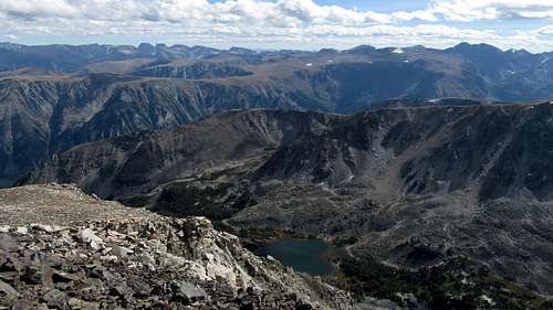 Ram Lake from Pyramid Mountain |
West Ridge via West Fishtail Lakes (Class 2)
This route begins near the Golf Course Trailhead (see above), and utilizes the approach to West Fishtail Lakes. This approach isn't particularly fun, but is guarantees solitude and offers a sense of adventure above and beyond many other areas of the Beartooths. I wasn't able to get much beta for this approach from Red Lodge locals since hardly anyone ever goes up there. This is one route where 90% of the effort really is done in the approach. Rather than starting at the Benbow Mine (end of rough 2wd road), take the spur road which heads left at the second to last switchback before reaching the mine. This road passes by some old mine tailings below, and gently gains elevation for a half mile until it reaches a large open area with many junctions and a small creek crossing. Do not take the left road, which will head over the small hill, pass to the north of Chrome Lake and begin descending steeply down the valley to the east. Instead, continue straight and follow the road that traverses south of Chrome Lake. It's best to park cars here, but 4wd vehicles can continue the final .7 mile to where the road makes a sharp U-turn to the left. Park here where the elevation is 8,500 feet (the road ends just a few feet further) and begin bushwhacking through dense trees heading due south. You'll gain about 150 feet over a painful quarter mile at which point you will reach a large area of blow down. Crossing this area of downed trees is one of the cruxes of the approach. It's a large maze of pick-up sticks that are ready to stab you if you aren't careful! Once past this obstacle though, you will reach an open meadow at 8,750 feet where the valley above flattens out.
Road junction to West Fishtail Creek Approach - Head straight
Hike SW to the opposite end of this meadow, then continue bushwhacking due south again, over a small rib and across the stream draining the small lake above. Once across this stream, it's an additional steep 300 feet up to the large ridge separating the valley you're in with the West Fishtail Creek Valley. This is the same ridge you can see from the road near where you parked. Once on top of it at around 9,050 feet, descend due south (this will be a descending traverse rightward...do not descend directly down the slope) to a small pond at 8,550 feet. This slope down has less trees and more talus making travel slightly easier. You are now 50 feet above your car, but the worst of the approach is over. From this pond, hike up the gentle valley staying to the right of the main creek. There will be some marshy areas without trees so if you don't mind some wet feet, you can avoid the bush this way.
 Small meadow in valley NW of West Fishtail Creek | 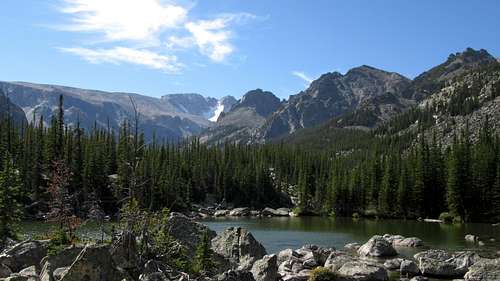 Small tarn in lower West Fishtail Creek valley | 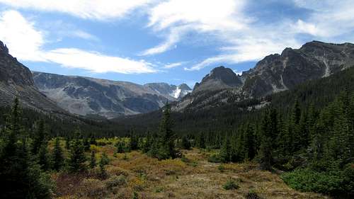 Mount Wood from meadows in West Fishtail Creek valley |
You will reach a huge open meadow a though which makes a big part of the valley go much quicker. Here, you should find a small trail that can be followed for 1.5 miles all the way to about 9,100 feet where the valley begins to steepen. From this point the trees are thin enough that you can easily continue SW up the hill to the first lake at 9,600 feet. Great camping can be found here, or you can continue south to the largest lake 100 feet higher which also has excellent camping. The highest lake at 10,000 feet doesn't have any good camp spots for a tent, as it's mostly surrounded by large talus, but you could probably find the bivy spot I made under a large boulder just before the lake.
 First lake in upper West Fishtail Creek | 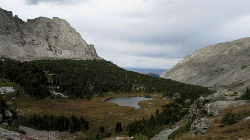 Looking down on the first lake in West Fishtail Creek valley | 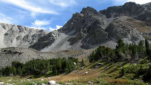 Views in the Upper West Fishtail Creek |
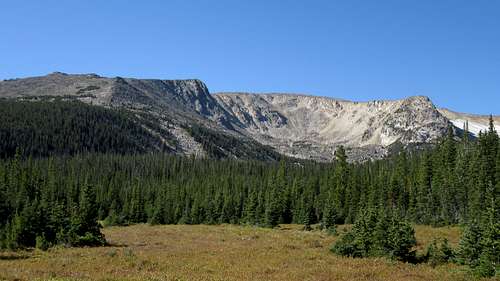
From the highest lake at 10,000 feet the ascent up Pyramid is simply more talus. Ascend the steep slopes just to the southeast of the upper lake at a weakness in the cliffs. This talus slope would be more fun if snow covered. At 11,000 feet the terrain opens up as you emerge onto the very large West Fishtail Plateau. Pyramid Mountain is technically just the high point of this plateau and is located nearly 2 more miles east from where you reach the plateau. You will have to hike over Point 12,022 along the way. Have a map, compass and maybe a GPS as it would be easy to get lost up here and be unable to find the way you came. Do not venture onto the summit plateau if storms are brewing. Once on the summit the views are great. The summit register is ancient and goes back to 1992 (See photo below)!!
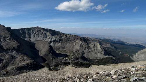 Looking down on West Fishtail Valley from the route up Pyramid | 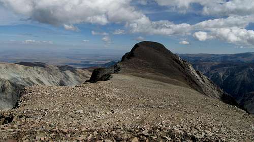 Pyramid Mountain from Point 12,022 to the west |
Camping/Red Tape
As with the other Beartooth Peaks, there are no permits or fees, and the West Rosebud road is open all year. If you try the Benbow Mine/West Fishtail approach, deep snow will probably block the road from late fall through mid-June. There are two campgrounds in the West Rosebud drainage, and one of them, called the Emerald Lake Campground, is right at the base of the climb. There are fees to camp, however you can pull off at any reasonable pull-out along the road once you enter the National Forest and camp free of charge. You can also camp on the mountain, with Ram Lake likely providing the best spot. It is recommended that you do this climb as a long day hike after staying the night at or near the trailhead or the Emerald Lake campground. If you do the West Fishtail Creek approach, either the first or second lake offer great camping with the upper most lake offering good bivy sites.
When To Climb
The easiest time of the year to climb Pyramid mountain is from about mid-July to mid-September. With considerable snow on the ground, this could turn into quite an arduous journey, especially once you gain treeline where the wind and spin drift will certainly carry you away. However, if you climb in good weather, snow cover should make the ascent much easier and more fun. Just be sure to have an ice axe and good boots.
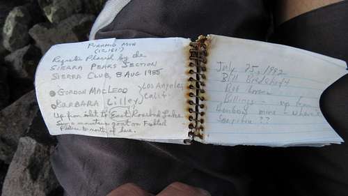
Pyramid Mountain summit register
Map
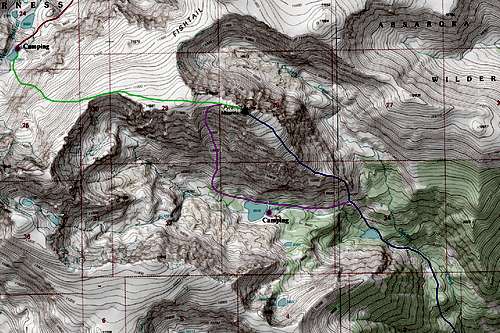
Pyramid Mountain Map
BLUE: SE Ridge via Chicken Creek Standard Route - Class 2+
GREEN: West Ridge via West Fishtail Creek - Class 2
PURPLE: South Face (Variation of Standard Route) - Class 2+