
|
|
Mountain/Rock |
|---|---|
|
|
42.30890°N / 113.6594°W |
|
|
9265 ft / 2824 m |
|
|
Overview
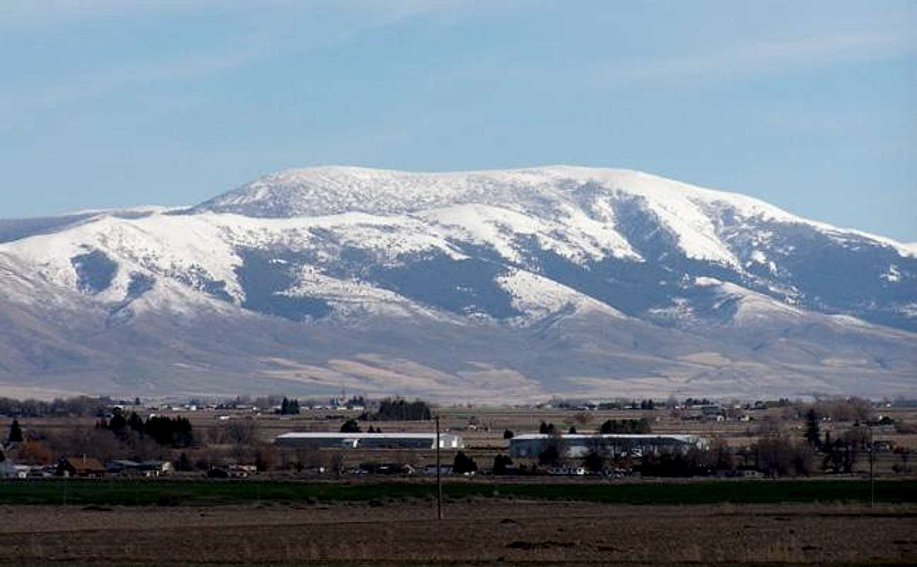
Mount Harrison is the northernmost major mountain in the compact Albion Range. Cache Peak, the highest in the range, lies 8.5 miles to the south. Mount Harrison holds an alpine lake and glacial cirque, rare for this region.
The location of the mountain dominates the central Snake River Plain and is visible for miles around. As the northern end of the range juts north into the Snake River Plain, the mountain is a snow catcher. Pomerelle Ski Resort is to the east of the summit. (On the day this page was created, March 29, 2005, there were 99 inches at the top of the resort and 68 inches at the base.)
Read about the Albion range in an article published in Summit Magazine and written by Tom Lopez.
 |  |  |  |
Getting There
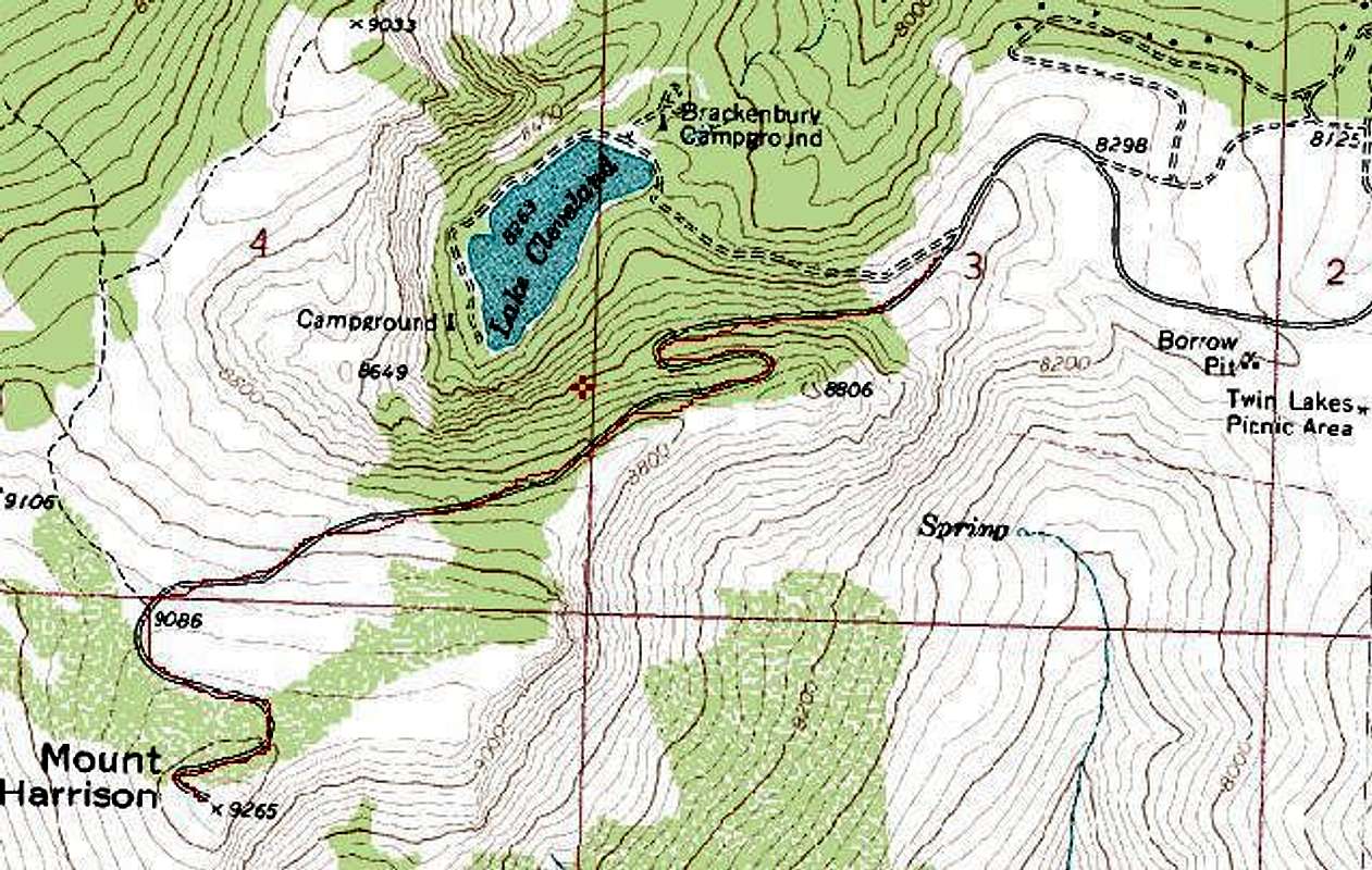
From I-84, head south from the Declo / Albion exit number 216. Head past the historic town of Albion until the the sign indicating the route to Pomerelle Ski Resort. As one is about to arrive at the entrance to the ski area, a signed road heads off to the right to Thompson Flat, the Twin Lake picnic area, and Lake Cleveland. |  |  |  |
Route Information
There is a road from Lake Cleveland (see "Getting There") to the summit (view topozone map) which makes route finding and summiting a more casual hike. One might also be able to scramble directly from Lake Cleveland, which is also a short trip. On top you will find a Forest Service lookout. When I visited in the early '90s the lookout was still manned.Other routes to the summit may come from the valley floor, but those will probably be an all day endeavor.
View the area map provided by Dean.
If you have any route and summit photos, please contribute.
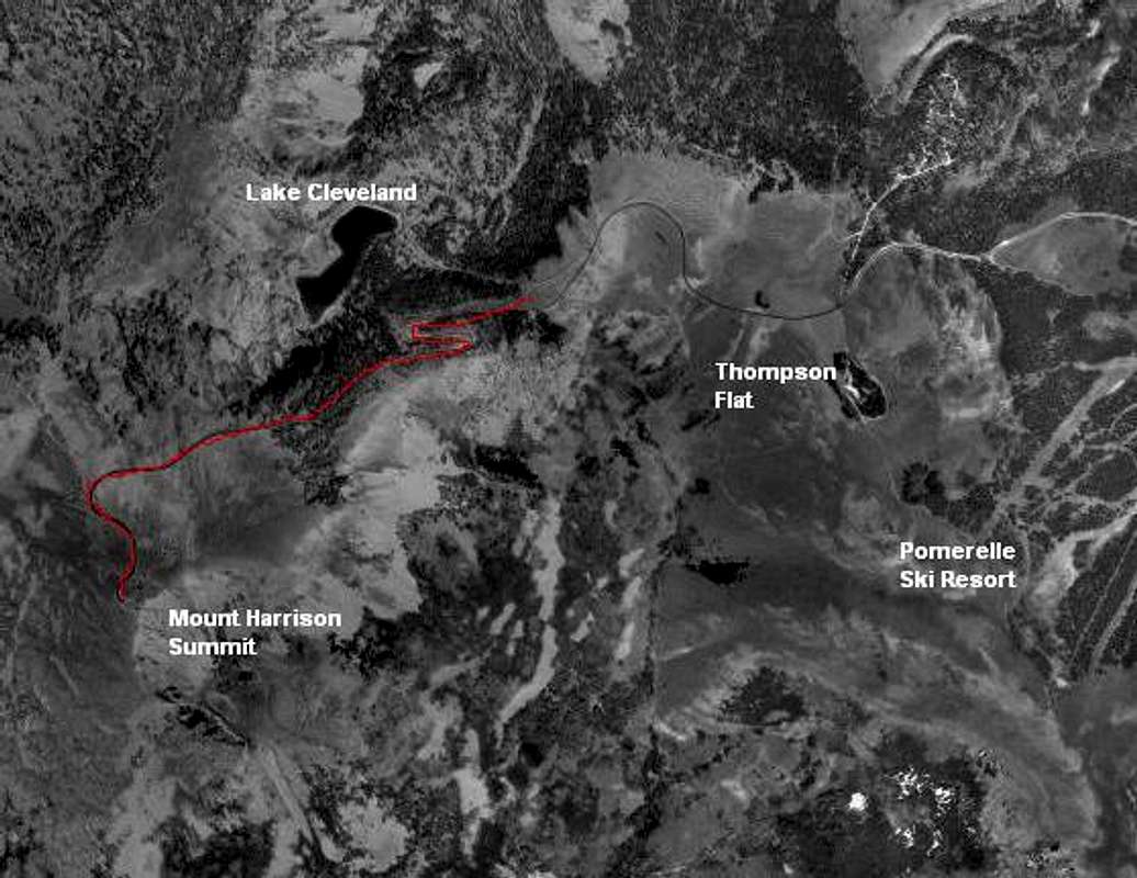
USGS Aerial Photo
Red Tape and Camping
The mountain is administered by the Sawtooth National Forest, Minidoka Ranger District. Check here for more recreation information.Current News Releases from SNF
Sawtooth National Forest
2647 Kimberly Rd. E.
Twin Falls, ID. 83301
Phone: (208) 737-3200
There are many camping areas in the Sawtooth National Forest. Click here for a complete list of camping areas.
- Thompson Flat - Elevation: 8400 ft.
- 20 Individual Units
- Drinking water available
- Toilets
- Group Reservation Area
- Lake Cleveland -West End - Elevation: 8200 ft.
- 9 Individual Units
- Capacity - 40 people
- Drinking water available
- 3-2 unit toilets
- Wheelchair access trail to lake
- Fee Area
- No motor boats on lake
- Lake Cleveland - East End - Elevation: 8200 ft.
- 20 Individual Units
- Capacity - 100 people
- Drinking Water available
- Toilets
- Some Accessible Units
- Fee Area
 |
When To Climb
All year long as long as the weather is good (or bad, if you're into that kind of stuff). Cross-country ski and snowshoe during the winter months (or snowmobile) and hike during the summer (or drive).Mountain Conditions
Pomerelle Ski Resort, located on the eastern ridges of the Mount Harrison area, has constant updates of snow and mountain conditions. This is also a popular snowmobiling area during the winter. Pomerelle Mountain ResortMagic Valley Weather webcam.