
|
|
Mountain/Rock |
|---|---|
|
|
39.37890°N / 104.856°W |
|
|
6586 ft / 2007 m |
|
|
Castle Rock Overview
Though this peak is small it is the first in my effort to post information on some lesser known peaks of the Front Range that offer options for those who want to continue climbing in winter, but don't want to head up to higher, snowier elevations.
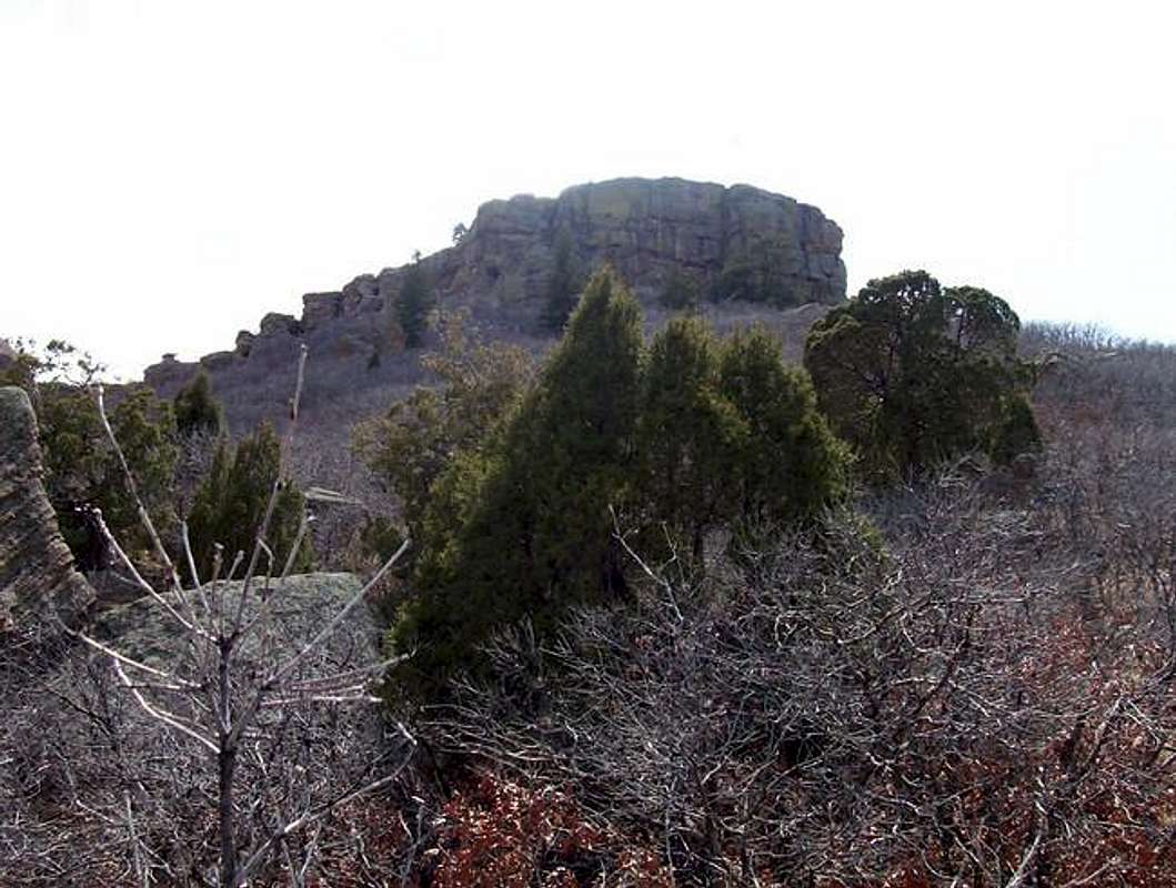
Towering more than 400 ft. over the Crowfoot valley, Castle Rock's namesake peak greets travellers as they hurry down I-25. Despite it relatively small size, the aptly named peak is still an impressive peak, especially with its eighty foot vertical rock walls capping the summit.
White settlers were first drawn to this part of the state by the same thing that fueled much of the western expansion: gold. The settlement of what was then Castle Rock started out as just a few prospectors shacks located at the foot of "The Rock". In 1874 the town of Castle Rock officially earned that name, and the town was officialy chartered in 1881. Castle Rock is now the seat of Douglas County, one of the fastest growing counties in the country.
As the city of Castle Rock has expanded it has completely surrounded this small mountain. The summit block and 60 acres of the land surrounding it are now protected as part of Rock Park, a division of Castle Rock parks and recreation. This makes this mountain kind of what I would call a family mountain. On any given day there are several families with small children exploring this natural oasis right in their backyard. Unfortunately because this is in the middle of a city, there are also some pretty suspicious looking people lurking around, and people often don't hesitate to leave their garbage on the ground.
Of the millions of people who gaze at this mountain as they drive under it on the highway, very few of them probably ever stop to climb to the top. Indeed, from this vantage point the mountain does look imposing: vertical rock walls rising nearly eighty above a thirty foot overhang. Even among the people who stop to hike in the park very few ever make it to the actual rocky summit, most are content to walk around it and stare up at the imposing walls.
The few who are willing to scramble up to the gently sloping summit plateau are usually rewarded with solitude and almost always with exceptional views of the Front Range. Indeed more than a hundred miles of mountains are visible spanning from the massive mountain that is Pikes Peak to the distant Longs Peak. Indeed, while the easiest route to the summit is an easy scramble, there a number of short routes that could be top roped, or free-climbed as a nice easy way to practice rock climbing.
 |  |
Getting There
The parking lot for the park is located along Front St. This street serves as the frontage road on the eastern side of the highway and can be accessed from any of the Castle Rock exits. The easiest way to get there is to take the Founders Parkway exit (the northernmost Castle Rock exit) and go east on on Founders parkway. Turn right on Front St. after about a third of a mile, and follow Front St. south to the parking area on the left side of the road. Another option for those coming from the south is to take the Wilcox St. exit, and go north on Wilcox to Fifth St. Turn right onto Fifth St. and take the second left onto Perry St (Front St. changes names here). The parking area will be shortly on your right. From the parking you can get on the trail that switchbacks up the side of the mountain to access the south side of the mountain.The easiest way to the summit is up the system of ledges on the north side of the mountain. Walk around to the north side and the best way to the summit will be fairly visible. Look for the remanants of an old stairwell, and climb up the easy system of ledges to the summit plateau. From there it's a short easy stroll to the actual located near the star formation at the western edge of the mountain. The total distance to the summit is about a half mile though longer options are possible.
 |  |
bigwilly - Aug 7, 2005 3:53 pm - Hasn't voted
Untitled CommentThanks for the info, I will make the change.
Doug Shaw - Aug 1, 2005 12:12 pm - Hasn't voted
Untitled CommentRock Park is closed from dark to dawn, so there is no legal camping within the Park or on the Rock.
bigwilly - Aug 7, 2005 3:53 pm - Hasn't voted
Untitled CommentThanks for the info, I will make the change.